more stats
2.2 miles
Distance
1,353 ft
Climb
-51 ft
Descent
00:40:13
Avg time
1,302 ft
Altitude change
154 ft
Altitude min
1,457 ft
Altitude max
155 ft
Altitude start
1,457 ft
Altitude end
11.3%
Grade
-13.5%
Grade max
60.3%
Grade min
2 miles
Distance climb
1,814 ft
Distance down
177 ft
Distance flat
00:40:13
Avg time

Tip Track Details

  • Activities
    • Mountain Bike
    • Gravel Bike
    • Adaptive Bike
    • Horse
    • Hike
    • Trail Running
  • Riding Area
    Te Kopahou Reserve
    Wellington
  • Difficulty Rating
  • Voted Difficulty
    Advanced (1 vote)
  • Local Popularity
    55 in Mountain Biking [+]
    • 95 in Trail Running
    • 80 in Hiking
    • 5 in Horseback
  • Global Ranking
    #72177 in Mountain Biking [+]
    • #368 in Trail Running
    • #3107 in Hiking
    • #1152 in Horseback
  • Trail Type
    Dirt/Gravel Road
  • Bike Type
    XC, Adaptive MTB, Gravel
  • Climb Difficulty
    Black Diamond
  • Physical Rating
    Extreme
  • Trail Visibility
    Always easy to follow
  • Dogs Allowed
    Yes
  • Ride in Rain
    Yes

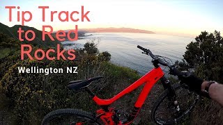
The nastiest (and shortest) route to the top of Hawkins Hill. It's steep Really steep, but not technically challenging, but an Advanced level ride. Doing hill reps of the Tip Track makes great Karapoti Classic training.

Recent Activity on Trail

Past Week
  • 1 rides
  • 47 miles average
6 Months
  • 15 rides
  • 22 miles avg distance
All
  • 122 rides
  • Last: Jun 28, 2026
c1c2c3c4
January
February
March
April
May
June
July
August
September
October
November
December
update trails status or condition

Tip Track Trail Reports

statusdatedescription
Nov 25, 2025 @ 7:09pm (Pacific/Auckland)
Nov 24, 2025
Going up Tip Track is mainly rocky ground, and it can be run in almost any weather conditions. The descent towards Red Rocks gives you beautiful...
Jul 19, 2025 @ 12:55pm
Jul 19, 2025
Riding well.A few rocks starting to break through the graded line, but OK on an ebike. Would be as bad on a muscle bike as it was 30 years ago...
Apr 25, 2025 @ 8:44am
Apr 25, 2025
Rides good an e-bike - but could never get up on an analogue as too steep and long.
Aug 12, 2024 @ 8:44pm
Aug 12, 2024
Looks like it’s been recently graded with a machine. So surface is in as good condition as you can expect. Still steep AF though
Sep 28, 2023 @ 7:22am
Sep 28, 2023
Is in the best condition I can remember.
more »
Status:
on Nov 25, 2025
Dry
Avg: 3.76 (3 votes)
Your vote: 0

view (2,426)
close
3D
Trail Conditions
  • Unknown
  • Snow Groomed
  • Snow Packed
  • Snow Covered
  • Snow Cover Partial
  • Freeze/thaw Cycle
  • Icy
  • Prevalent Mud
  • Wet
  • Variable
  • Ideal
  • Dry
  • Very Dry
Trail Flow (Ridden Direction)
Trailforks scans users ridelogs to determine the most popular direction each trail is ridden. A good flowing trail network will have most trails flowing in a single direction according to their intension.
The colour categories are based on what percentage of riders are riding a trail in its intended direction.
  • > 96%
  • > 90%
  • > 80%
  • > 70%
  • > 50%
  • < 50%
  • bi-directional trail
  • no data
Trail Last Ridden
Trailforks scans ridelogs to determine the last time a trail was ridden.
  • < 2 days
  • < 1 week
  • < 2 weeks
  • < 1 month
  • < 6 months
  • > 6 months
Trail Ridden Direction
The intended direction a trail should be ridden.
  • Downhill Only
  • Downhill Primary
  • Both Directions
  • Uphill Primary
  • Uphill Only
  • One Direction
Contribute Details
Colors indicate trail is missing specified detail.
  • Description
  • Photos
  • Description & Photos
  • Videos
Trail Popularity ?
Trailforks scans ridelogs to determine which trails are ridden the most in the last 9 months. Trails are compared with nearby trails in the same city region with a possible 25 colour shades. Think of this as a heatmap, more rides = more kinetic energy = warmer colors.
  • most popular
  • popular
  • less popular
  • not popular
ATV/ORV/OHV Filter
Max Vehicle Width
inches
US Cell Coverage
Legend
cell carrier legend

Radar Time
Activity Recordings
Trailforks uses anonymized public activity data. ?
Activity Recordings
Trailforks uses anonymized public activity data. ?
Personal Heatmap
Activity Types
all / none
Options
2
Date range month
Winter Trails
Warning A routing network for winter maps does not exist. Selecting trails using the winter trails layer has been disabled.
Missing Trails
Most Popular
Least Popular
Trails are colored based on popularity. The more popular a trail is, the more red. Less popular trails trend towards green.
Jump Magnitude Heatmap
Heatmap of where riders jump on trails. Zoom in to see individual jumps, click circles to view jump details.
BC Backroad Status

Service Road Atlas is a free to use, community-driven service for viewing and creating reports on the numerous back-country service roads around B.C. and Alberta.

map legend
Slope Aspect
Direction the slope faces
Flat N NE E SE S SW W NW
Trails Deemphasized
Trails are shown in grey.
disable
Only show trails with no bike usage.
Enable
Suggested Layers
Based on selected activity type

    Save the current map location and zoom level as your default home location whenever this page is loaded.

    Save
        Directions to tip-track trailhead (-41.331770, 174.757120)

        Photos

        7 more »
        87 |
        Apr 5, 2023 @ 8:01pm
        Apr 5, 2023
        374 |
        Sep 18, 2016 @ 6:26pm
        Sep 18, 2016
        269 |
        Sep 18, 2016 @ 6:26pm
        Sep 18, 2016
        288 |
        May 1, 2015 @ 4:02am
        May 1, 2015

        Videos

        1 more »
        Wellington MTB - Tip Track to Red Rocks
        6:45 | 1345 | Feb 4, 2019 , Wellington

        Routes with this trail

        2.0 13 miles 2,910 ft 15 Out & Back
        Great taste of technical singletrack from the middle of the city.
        39 miles 11,222 ft 8 Point to Point
        This route was used by the Wuu2k but makes for a good bike ride too - http://www.wuu2k.co.nz/course.html

        Reviews / Comments

        No reviews yet, be the first to write a review or ask a question.
        Use trail reports to comment on trail conditions.


        We hope you've been enjoying Trailforks!

        Create a FREE account to view trail comments and much more.

        • By arje WTT & contributors
        • #18246 - 17,936 views

        Frequently Asked Questions About Tip Track

        Where is Tip Track located?
        Tip Track is located in Te Kopahou Reserve, Wellington, New Zealand. It is part of the Te Kopahou Reserve trail network. The trailhead is located at coordinates -41.33177, 174.75712.
        How hard is Tip Track?
        Tip Track is rated as Advanced difficulty. The physical rating is Extreme. The average grade is 11.3%. The climb difficulty is rated Black Diamond.
        What is the elevation gain for Tip Track?
        Tip Track has 1,353 ft of elevation gain. The trail has 51 ft of elevation descent. The elevation ranges from 154 ft to 1,457 ft.
        How long is Tip Track?
        Tip Track is 2.2 miles long. The trail type is dirt/gravel road.

        Hit the Trail

        Open in App

        Get this trail on your phone instantly.
        open trail in app

        Download Trail

        Save to wishlist, Garmin & download.
        save the trail

        Find Related Routes

        Find routes and users activities that include this trail.
        find routes for this trail

        You must enter a description before submitting.