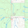
more stats
5.9 miles
Distance
243 ft
Climb
-3,104 ft
Descent
7,572 ft
High Point
-2,861 ft
Altitude change
4,708 ft
Altitude min
7,572 ft
Altitude start
4,711 ft
Altitude end
-9.2%
Grade
-70.9%
Grade max
23.4%
Grade min
4,774 ft
Distance climb
5 miles
Distance down
1,194 ft
Distance flat

Tolan Ridge Details

  • Activities
    • Mountain Bike
    • Horse
    • Hike
    • Trail Running
  • Riding Area
  • Difficulty Rating
  • Local Popularity
    5 in Mountain Biking heatmap [+]
    • 5 in Trail Running
    • 5 in Hiking
    • 5 in Horseback
  • Global Ranking
    #344085 in Mountain Biking [+]
    • #380163 in Trail Running
    • #292709 in Hiking
    • #30040 in Horseback
  • State Ranking
    #2,796 in Mountain Biking · Montana [+]
    • #4,085 in Trail Running
    • #3,496 in Hiking
    • #1,335 in Horseback
  • Trail Type
    Singletrack
  • Bike Type
    AM
  • Direction
    Downhill Primary
  • Climb Difficulty
    Black Diamond
  • Physical Rating
    Hard
  • Season
    June - October
  • Dogs Allowed
    Yes
  • Land Owner
    Bitterroot National Forest

A rarely ridden trail only recently reclaimed from neglect. The trail still needs plenty of love and there are plenty of obstacles to keep you on your toes or off your pedals, but there is plenty of vertical and grade to get your downhill jollies.

Tags
Ridgeline

Trail Supporters

Local Trail Association

Recent Activity on Trail

Past Week
  • 0 rides
  •  
6 Months
  • 0 rides
  •  
All
  • 0 rides
  • Last: Aug 26, 2022
update trails status or condition

Tolan Ridge Trail Reports

statusdatedescription
Jul 27, 2026 @ 6:21am (America/Denver)
Jul 27, 2026
Cleared by BBC contractor on 7/19/26
Jul 31, 2025 @ 2:38pm
Jul 31, 2025
Cleared by BBC contractor on July 21st, 2025.
Aug 24, 2023 @ 9:05am
Aug 24, 2023
All cleared on August 9th.
May 14, 2022 @ 5:42pm
May 14, 2022
Trail was dry up to 6700’. I rode up from the bottom about 4 miles before hitting snow. Only a couple trees down.
May 14, 2022 @ 5:42pm
May 14, 2022
Dry up to 6700’. You can go really fast and two wheel drift through the pine needles.
more »
Status:
on Jul 27, 2026
Ideal
no votes yet
Your vote: 0

view (2)
close
      Directions to tolan-ridge trailhead (45.786660, -113.871260)

      Photos

      No photos have been added for Tolan Ridge yet, add a photo.

      Videos

      no videos have been added for Tolan Ridge yet, add a video.

      2 Reviews & Comments

      jkernmt
      This trail is definitely a much less technical option than the Reimel Creek trail. It's more blue than double black.
      loamwhisperer420 loamwhisperer420
      Not a bad climb up 4 miles from the bottom; smooth, not at all technical, and a few steep walk-ups. Trail is on an old, fading double track, but feels like singletrack. If the top 2 miles are similar, then I would rate this as a blue/intermediate descent, not double black.

      We hope you've been enjoying Trailforks!

      Create a FREE account to view all trail reviews and much more.

      • By BitterrootBumTF Pro BBC & contributors
      • #101433 - 1,257 views

      Frequently Asked Questions

      ▼ Where is Tolan Ridge located?
      Tolan Ridge is located in Warm Springs / Lost Trail Pass, Sula, Montana, United States. It is part of the Warm Springs / Lost Trail Pass trail network. The trailhead is located at coordinates 45.78666, -113.87126.
      ▼ How hard is Tolan Ridge?
      Tolan Ridge is rated as Blue difficulty. The physical rating is Hard. The average grade is 9.2%. The climb difficulty is rated Black Diamond.
      ▼ What is the elevation gain for Tolan Ridge?
      Tolan Ridge has 243 ft of elevation gain. The trail has 3,104 ft of elevation descent. The elevation ranges from 4,708 ft to 7,572 ft.
      ▼ Is Tolan Ridge a point to point trail?
      Tolan Ridge is not a point to point trail. The direction is Downhill Primary. The trail type is singletrack.
      ▼ How long is Tolan Ridge?
      Tolan Ridge is 5.9 miles long. The trail type is singletrack.
      ▼ Are dogs allowed on Tolan Ridge?
      Yes, dogs are allowed on Tolan Ridge. Please keep dogs on a leash where required and clean up after them.
      ▼ When is the best time of year to ride Tolan Ridge?
      Tolan Ridge is best visited during: June - October.
      ▼ How do I access Tolan Ridge? Where is the closest parking trailhead?
      The closest parking and trailhead locations to Tolan Ridge are: View all parking locations in the area.
      ▼ How busy is Tolan Ridge?
      Tolan Ridge is a less popular trail with lighter traffic. There have been 4 recorded activities on this trail. The trail has received 2 check-ins. View recent activity on this trail.

      Hit the Trail

      Open in App

      Get this trail on your phone instantly.

      open trail in app

      Download Trail

      Save to wishlist, Garmin & download.
      save the trail

      Find Related Routes

      Find routes and users activities that include this trail.
      find routes for this trail

      You must enter a description before submitting.