1.5 miles
Distance
3 ft
Climb
-1,027 ft
Descent
00:17:04
Avg time

Top Chief Details

  • Activities
    • Mountain Bike
    • E-Bike
  • Riding Area
    Nevis Range
    Fort William
  • AKA
    Red Giant
  • Difficulty Rating
  • Voted Difficulty
    Black (3 votes)
  • Trail Type
    Singletrack
  • Bike Type
    DH, AM
  • Direction
    Downhill Primary
    Popular direction shown
  • Physical Rating
    Hard
  • Season
    May-Sept
  • Dogs Allowed
    Yes
  • eBike Allowed
    Yes up to Class 1
  • TTFs on Trail
    Bridge, Drop, Jump, Rock Face, Skinny
  • Ride in Rain
    Yes
  • Global Ranking
    #3397 in Mountain Biking [+]
    • #3086 in E-Biking
  • Local Popularity
    95 in Mountain Biking [+]
    • 70 in E-Biking
  • Year Opened
    2009

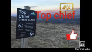
Board walk top section with fast sections and tight corners. Mid section along the ridge contains some board walk and natural bed rock with small features. Lower ridge line involves steep technical sections and an optional drop some technical bed rock sections that are both steep and rough. Bottom of the track opens up into fast flowy corners with loose surface and some jumps and features.

Was called the Red Giant, has now been renamed and regraded black as of the 2018 season

Access Info

Trail is assessed from Gondola Uplift and trail head can be found next to the Quad Chair Uplift

Bike Park

More Stats for Top Chief mountain bike trail trail
  • Altitude change
    -1,025 ft
  • Altitude min
    596 ft
  • Altitude max
    1,622 ft
  • Altitude start
    1,622 ft
  • Altitude end
    597 ft
  • Grade
    -13%
  • Grade max
    -70%
  • Grade min
    12.7%
  • Distance climb
    138 ft
  • Distance down
    1 mile
  • Distance flat
    200 ft
  • Avg time
    00:17:04
  • Avg reverse time
    00:40:22
  • view trail stats
Status:
on Aug 14, 2024
Very Dry
Avg: 4.17 (30 votes)
Your vote: 0

view (3,967)
close
3D
Trail Conditions
  • Unknown
  • Snow Groomed
  • Snow Packed
  • Snow Covered
  • Snow Cover Partial
  • Freeze/thaw Cycle
  • Icy
  • Prevalent Mud
  • Wet
  • Variable
  • Ideal
  • Dry
  • Very Dry
Trail Flow (Ridden Direction)
Trailforks scans users ridelogs to determine the most popular direction each trail is ridden. A good flowing trail network will have most trails flowing in a single direction according to their intension.
The colour categories are based on what percentage of riders are riding a trail in its intended direction.
  • > 96%
  • > 90%
  • > 80%
  • > 70%
  • > 50%
  • < 50%
  • bi-directional trail
  • no data
Trail Last Ridden
Trailforks scans ridelogs to determine the last time a trail was ridden.
  • < 2 days
  • < 1 week
  • < 2 weeks
  • < 1 month
  • < 6 months
  • > 6 months
Trail Ridden Direction
The intended direction a trail should be ridden.
  • Downhill Only
  • Downhill Primary
  • Both Directions
  • Uphill Primary
  • Uphill Only
  • One Direction
Contribute Details
Colors indicate trail is missing specified detail.
  • Description
  • Photos
  • Description & Photos
  • Videos
Trail Popularity ?
Trailforks scans ridelogs to determine which trails are ridden the most in the last 9 months. Trails are compared with nearby trails in the same city region with a possible 25 colour shades. Think of this as a heatmap, more rides = more kinetic energy = warmer colors.
  • most popular
  • popular
  • less popular
  • not popular
ATV/ORV/OHV Filter
Max Vehicle Width
inches
US Cell Coverage
Legend
cell carrier legend

Radar Time
x Activity Recordings
Trailforks users anonymized public ridelogs from the past 6 months.
  • mountain biking recent
  • mountain biking (>6 month)
  • hiking (1 year)
  • moto (1 year)
Activity Recordings
Trailforks users anonymized public skilogs from the past 12 months.
  • Downhill Ski
  • Backcountry Ski
  • Nordic Ski
  • Snowmobile
Winter Trails
Warning A routing network for winter maps does not exist. Selecting trails using the winter trails layer has been disabled.
x Missing Trails
Most Popular
Least Popular
Trails are colored based on popularity. The more popular a trail is, the more red. Less popular trails trend towards green.
Jump Magnitude Heatmap
Heatmap of where riders jump on trails. Zoom in to see individual jumps, click circles to view jump details.
Trails Deemphasized
Trails are shown in grey.
disable
Only show trails with NO bikes.
enable

Save the current map location and zoom level as your default home location whenever this page is loaded.

Save
      Directions to top-chief trailhead (56.836180, -4.993560)
      update trails status or condition

      Top Chief Trail Reports

      statusdatedescription
      Aug 14, 2024 @ 10:48am
      Aug 14, 2024
      Jun 5, 2023 @ 3:28am
      Jun 5, 2023
      could do with a shower to tighten up the loose sections
      Jun 2, 2023 @ 4:13am
      Jun 2, 2023
      Sep 1, 2022 @ 12:56am
      Sep 1, 2022
      Aug 31, 2022 @ 6:51am
      Aug 31, 2022
      Mostly dry, some wet spots. No mud.
      view all reports »

      Recent Ridelog Activity on Trail

      Past Week
      • 0 rides
      •  
      6 Months
      • 7 rides
      • 16 miles avg distance
      All
      • 124 rides
      • Last: Jul 22, 2024

      Photos

      more »
      98 |
      Sep 4, 2023 @ 3:16am
      Sep 4, 2023
      104 |
      Jul 30, 2022 @ 1:30pm
      Jul 30, 2022
      124 |
      Jul 30, 2022 @ 1:29pm
      Jul 30, 2022
      108 |
      Jul 30, 2022 @ 1:29pm
      Jul 30, 2022

      Routes with this trail

      titledistance
      Nevis Exploration19 miles
      Fort William SES 2016 Route race17 miles

      Reviews / Comments

      No reviews yet, be the first to write a review or ask a question.
      Use trail reports to comment on trail conditions.


      We hope you've been enjoying Trailforks!

      Create a FREE account to view trail comments and much more.

      Videos

      more »
      Fort William (Nevis Range) - Top Chief
      15:39 | 481 | Aug 11, 2022 , Fort William
      Can I manage Top chief from top to bottom...
      17:43 | 201 | Jul 12, 2022 , Fort William
      youtuber Fort William Downhill is scary! | Top Chief...
      17:26 | 353 | Oct 13, 2021 , Fort William
      Top Chief, Fort William - October 2021
      218 | Oct 10, 2021 , Fort William

      Nearby Trails

      • By OwenL67 & contributors
      • #18708 - 26,253 views

      You must enter a description before submitting.