Trail Details
-
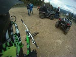
Activities
- Mountain Bike
- Hike
- Trail Running
-
Riding AreaSelkirk College
Castlegar, British Columbia -
Difficulty Rating
-
Trail TypeDoubletrack
-
Bike TypeAM, XC, Gravel, Adaptive MTB
-
DirectionBoth Directions
-
Climb DifficultyGreen
-
Physical RatingEasy
-
Dogs AllowedYes
-
Ride in RainYes
-
Global Ranking#88766 in Mountain Biking
-
Local Popularity50 in Mountain Biking [+]
- 40 in Trail Running
- 5 in Hiking
No description for Trail trail has been added yet!
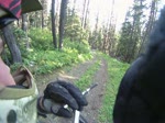
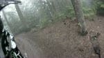
Trail is a 456 m moderately popular green doubletrack trail located near Castlegar British Columbia. This mountain bike primary trail can be used both directions and has a easy overall physical rating with a 21 m green climb. On average it takes 5 minutes to complete this trail.
Local Trail Association
-
-

-
Please consider joining or donating to the local trail association to supportdonate to earn trail karma!
trail development & maintenance.
Traditionally Indigenous Territory
More Stats for Trail mountain bike trail trail
-
Altitude change53 ft
-
Altitude min1,442 ft
-
Altitude max1,494 ft
-
Altitude start1,442 ft
-
Altitude end1,494 ft
-
Grade3.519%
-
Grade max-4.431%
-
Grade min38.514%
-
Distance climb878 ft
-
Distance down620 ft
-
Avg time00:05:40
-
Avg reverse time00:02:57
- view trail stats
-
Layers w
- Map Content
- More Layers
- Pro
- Pro
- Pro
- Pro
- Pro
- Pro
- Pro
- Pro
-
Upgrade to

- Unknown
- Snow Groomed
- Snow Packed
- Snow Covered
- Snow Cover Partial
- Freeze/thaw Cycle
- Icy
- Prevalent Mud
- Wet
- Variable
- Ideal
- Dry
- Very Dry
The colour categories are based on what percentage of riders are riding a trail in its intended direction.
- > 96%
- > 90%
- > 80%
- > 70%
- > 50%
- < 50%
- bi-directional trail
- no data
- < 2 days
- < 1 week
- < 2 weeks
- < 1 month
- < 6 months
- > 6 months
- Downhill Only
- Downhill Primary
- Both Directions
- Uphill Primary
- Uphill Only
- One Direction
- Description
- Photos
- Description & Photos
- Videos
- most popular
- popular
- less popular
- not popular

- mountain biking recent
- mountain biking (>6 month)
- hiking (1 year)
- moto (1 year)
- Downhill Ski
- Backcountry Ski
- Nordic Ski
- Snowmobile
Save the current map location and zoom level as your default home location whenever this page is loaded.
SaveTrail Trail Reports
Recent Ridelog Activity on Trail
- 1 rides
- 10 miles avg distance
- 3 rides
- 11 miles avg distance
- 30 rides
- Last: May 12, 2024
Photos
Reviews / Comments
No reviews yet, be the first to write a review or ask a question.
Use trail reports to comment on trail conditions.
We hope you've been enjoying Trailforks!
Create a FREE account to view trail comments and much more.
Videos
Nearby Trails
- Unnamed 682 ft
- Trail 1,158 ft
- Loop 1,257 ft
- Road Connector 1,407 ft
- Road Access 1,568 ft
- By barry-mclane
 & contributors
 - #27768 - 1,527 views
- follow/subscribe
- login to download gpx or kml files.
You must enter a description before submitting.