
more stats
2.3 miles
Distance
606 ft
Climb
-39 ft
Descent
00:26:19
Avg time
567 ft
Altitude change
481 ft
Altitude min
1,048 ft
Altitude max
481 ft
Altitude start
1,050 ft
Altitude end
4.8%
Grade
-10.1%
Grade max
26.8%
Grade min
2 miles
Distance climb
1,529 ft
Distance down
1,234 ft
Distance flat
00:26:19
Avg time

Trunkline Details

  • Activities
    • Mountain Bike
    • E-Bike
    • Gravel Bike
    • Hike
    • Trail Running
  • Riding Area
    Wallula Scablands
    Wallula, Washington
  • Difficulty Rating
  • Local Popularity
    85 in Mountain Biking heatmap [+]
    • 90 in E-Biking
    • 5 in Trail Running
    • 5 in Hiking
    • 5 in Gravel Biking
  • Global Ranking
    #3561 in Mountain Biking [+]
    • #37883 in E-Biking
    • #377323 in Trail Running
    • #369884 in Hiking
    • #18779 in Gravel Biking
  • State Ranking
    #114 in Mountain Biking · Washington [+]
    • #606 in E-Biking
    • #8,396 in Trail Running
    • #8,378 in Hiking
    • #362 in Gravel Biking
  • Hiking SAC Scale
    T1 Hiking
  • Trail Type
    Singletrack
  • Bike Type
    AM, XC, Gravel
  • Direction
    Both Directions
  • Climb Difficulty
    Green
  • Physical Rating
    Moderate
  • Trail Visibility
    Always easy to follow
  • Season
    year-round
  • eBike Allowed
    Yes up to Class 1
  • Ride in Rain
    Yes
  • Land Owner
    Whitman College
  • OSM Way

Trunkline is the central trail in the Wallula scablands trail network, which lies on land owned by Whitman College. It consists of a single track trail that follows an old jeep road.

Access Info

To access, ride and push the approach trail up the canyon from the History of Wallula parking area on Hwy 730

Disclaimer

on private land, use at own risk

Tags

Traditionally Indigenous Territory

Recent Activity on Trail

Past Week
  • 0 rides
  •  
6 Months
  • 0 rides
  •  
All
  • 38 rides
  • Last: Apr 26, 2026
c1c2c3c4
January
February
March
April
May
June
July
August
September
October
November
December
update trails status or condition

Trunkline Trail Reports

statusdatedescription
Sep 3, 2026 @ 7:04am (America/Los_Angeles)
Sep 3, 2026
Trail has been cleared of weeds. The first half mile was utilized by fire fighting vehicles, so is now more of a double track in places.
Mar 15, 2026 @ 8:09pm (America/Los_Angeles)
Mar 15, 2026
Aug 13, 2025 @ 6:37pm
Aug 13, 2025
Cleared of summer weed growth and ready to ride. Hard and dry.
Sep 28, 2024 @ 7:33am
Sep 28, 2024
Trail has been weed-whacked and is now in great shape for the cool weather (Oct-Apr) riding season.
Aug 16, 2023 @ 12:53pm
Aug 16, 2023
Trail has been weed-whacked and is cleared of brush
more »
Status:
on Sep 3, 2026
Very Dry
Avg: 4.24 (2 votes)
Your vote: 0

view (117)
close
      Directions to trunkline-388039 trailhead (46.050230, -118.930980)

      Photos

      13 more »
      mtb
      0 |
      Nov 13, 2026 @ 6:56am
      20 hours
      mtb
      96 |
      Mar 15, 2026 @ 8:10pm
      Mar 15, 2026
      mtb
      74 |
      Feb 9, 2026 @ 8:39am
      Feb 9, 2026
      mtb
      154 |
      Nov 3, 2022 @ 12:07am
      Nov 3, 2022

      Videos

      4 more »
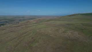
      360° overview of Wallula Scablands terrain
      mtb
      0:41 | 303 | May 18, 2024 , Wallula
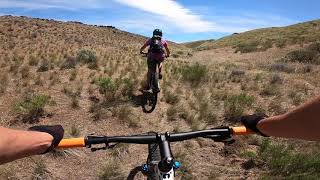
      Wallula Half Pipe
      mtb
      6:14 | 192 | Jul 21, 2023 , Wallula
      Wallula High Side
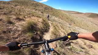
      mtb
      6:06 | 231 | Jul 21, 2023 , Wallula
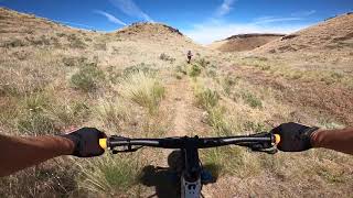
      Wallula Runout
      mtb
      0:47 | 94 | Jul 21, 2023 , Wallula

      Routes with this trail

      more »
      ★ 4.0 • 11 miles • 1,940 ft • 17 • Loop •
      This tour links some of Wallula's greatest hits into a single-cross country style route with plenty of...
      5 miles • 784 ft • 4 •
      The quickest route to the Lonesome Juniper from the Car.
      5.0 ★★★★★
      2 Ratings
      5 ★ 100%
      4 ★
      3 ★
      2 ★
      1 ★

      4 Reviews & Comments

      kpinwalla2
      The previous comments refer to an older version of this trail ("Rd. 664") that has since (thankfully) been removed from Trailforks. The Trunkline trail is approached by parking at the "History of Wallula" parking lot and riding (and pushing) your bike up the canyon to the prominent gap. The trail starts at a ladder over a fence line. The land the trail is on is owned by Whitman College. Please be respectful of the property so that we can can continue to use the trail.
      sonofjohn
      I have heard this before that the man in question BELIEVES it is his private property but that local law enforcement has repeatedly been involved and informed him it is not.
      kpinwalla2
      The lower part of this "trail" as it is currently (5/4/22) depicted, is the driveway of a very cranky older man who will threaten you if you ride onto his property. It is NOT a public road or trail and is NOT open for riding. I have submitted a revision of this "trail" that only includes the part that is on land owned by Whitman College. It can be approached by starting at the "History of Wallula" parking area.

      We hope you've been enjoying Trailforks!

      Create a FREE account to view all trail reviews and much more.

      Nearby Trails

      This trails GPS track was originally sourced from OpenStreetMap and will always be available for download in OSM Format.

      Frequently Asked Questions

      ▼ Where is Trunkline located?
      Trunkline is located in Wallula Scablands, Wallula, Washington, United States. It is part of the Wallula Scablands trail network. The trailhead is located at coordinates 46.05023, -118.93098.
      ▼ How hard is Trunkline?
      Trunkline is rated as Green difficulty. The physical rating is Moderate. The average grade is 4.8%. The climb difficulty is rated Green.
      ▼ What is the elevation gain for Trunkline?
      Trunkline has 606 ft of elevation gain. The trail has 39 ft of elevation descent. The elevation ranges from 481 ft to 1,048 ft.
      ▼ Is Trunkline a point to point trail?
      Trunkline is not a point to point trail. The direction is Both Directions. The trail type is singletrack.
      ▼ How long is Trunkline?
      Trunkline is 2.3 miles long. The trail type is singletrack.
      ▼ Are dogs allowed on Trunkline?
      There is no information about dogs being allowed on Trunkline. Check with local trail managers or the trail page for the latest access rules.
      ▼ When is the best time of year to ride Trunkline?
      Based on activity log data, the most popular months to ride Trunkline are:
      • March (7 activities)
      • April (5 activities)
      • February (3 activities)
      Check the reports page for current trail conditions.
      ▼ How do I access Trunkline? Where is the closest parking trailhead?
      The closest parking and trailhead locations to Trunkline are: View all parking locations in the area.
      ▼ How long does it take to ride Trunkline?
      Based on recorded activities, it takes an average of 26 minutes to ride Trunkline. The trail is 2.3 miles long. Actual times will vary based on fitness level, conditions, and pace. View recent activity logs for more details.
      ▼ How busy is Trunkline?
      Trunkline is a very popular trail. There have been 109 recorded activities on this trail. The trail has received 117 check-ins. View recent activity on this trail.

      Hit the Trail

      Open in App

      Get this trail on your phone instantly.

      open trail in app

      Download Trail

      Save to wishlist, Garmin & download.
      save the trail

      Find Related Routes

      Find routes and users activities that include this trail.
      find routes for this trail

      You must enter a description before submitting.

