more stats
889 ft
Distance
-164 ft
Descent
00:04:06
Avg time
-166 ft
Altitude change
272 ft
Altitude min
439 ft
Altitude max
439 ft
Altitude start
272 ft
Altitude end
-18.7%
Grade
-45.5%
Grade max
0.6%
Grade min
837 ft
Distance down
52 ft
Distance flat
00:04:06
Avg time

TTS Details

  • Activities
    • Mountain Bike
    • Hike
    • Trail Running
  • Riding Area
    Mt Vic
    Wellington
  • Difficulty Rating
  • Voted Difficulty
    Black Diamond (4 votes)
  • Local Popularity
    85 in Mountain Biking [+]
    • 20 in Trail Running
    • 60 in Hiking
  • Global Ranking
    #2222 in Mountain Biking [+]
    • #127115 in Trail Running
    • #89334 in Hiking
  • Trail Type
    Singletrack
  • Bike Type
    AM, XC
  • Direction
    Downhill Only
    Popular Direction Shown
  • Physical Rating
    Moderate
  • Season
    All Season
  • Dogs Allowed
    Yes

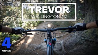
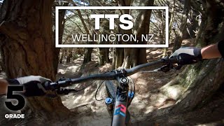
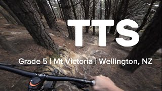
Turn right into TTS off the Super D track. Take the right turn into TTS off the Super D track - which is just after Super D leaves running alongside Alexandra Road. TTS is not overly technical ("Advanced" is a better description than "Very Difficult". There is a track junction about 100 m into TTS, and go left about 20 m, before dropping right into the track again (sign posted).

Trail Supporters
  • Sponsor
Local Trail Association

Recent Activity on Trail

Past Week
  • 0 rides
  •  
6 Months
  • 59 rides
  • 17.5 km avg distance
All
  • 717 rides
  • Last: Jul 1, 2026
c1c2c3c4
January
February
March
April
May
June
July
August
September
October
November
December
update trails status or condition

TTS Trail Reports

statusdatedescription
Jan 15, 2024 @ 10:20am
Jan 15, 2024
Sep 29, 2023 @ 6:21pm
Sep 29, 2023
Sep 7, 2023 @ 9:14pm
Sep 7, 2023
Aug 22, 2023 @ 7:21pm
Aug 22, 2023
dry in the important bits. The loamy S bend is wet and showing damage however
Aug 6, 2023 @ 6:02am
Aug 6, 2023
more »
Status:
on Jan 15, 2024
Dry
Avg: 4.27 (13 votes)
Your vote: 0

view (18,851)
close
3D
Trail Conditions
  • Unknown
  • Snow Groomed
  • Snow Packed
  • Snow Covered
  • Snow Cover Partial
  • Freeze/thaw Cycle
  • Icy
  • Prevalent Mud
  • Wet
  • Variable
  • Ideal
  • Dry
  • Very Dry
Trail Flow (Ridden Direction)
Trailforks scans users ridelogs to determine the most popular direction each trail is ridden. A good flowing trail network will have most trails flowing in a single direction according to their intension.
The colour categories are based on what percentage of riders are riding a trail in its intended direction.
  • > 96%
  • > 90%
  • > 80%
  • > 70%
  • > 50%
  • < 50%
  • bi-directional trail
  • no data
Trail Last Ridden
Trailforks scans ridelogs to determine the last time a trail was ridden.
  • < 2 days
  • < 1 week
  • < 2 weeks
  • < 1 month
  • < 6 months
  • > 6 months
Trail Ridden Direction
The intended direction a trail should be ridden.
  • Downhill Only
  • Downhill Primary
  • Both Directions
  • Uphill Primary
  • Uphill Only
  • One Direction
Contribute Details
Colors indicate trail is missing specified detail.
  • Description
  • Photos
  • Description & Photos
  • Videos
Trail Popularity ?
Trailforks scans ridelogs to determine which trails are ridden the most in the last 9 months. Trails are compared with nearby trails in the same city region with a possible 25 colour shades. Think of this as a heatmap, more rides = more kinetic energy = warmer colors.
  • most popular
  • popular
  • less popular
  • not popular
ATV/ORV/OHV Filter
Max Vehicle Width
inches
US Cell Coverage
Legend
cell carrier legend

Radar Time
Activity Recordings
Trailforks uses anonymized public activity data. ?
Activity Recordings
Trailforks uses anonymized public activity data. ?
Personal Heatmap
Activity Types
all / none
Options
2
Date range month
Winter Trails
Warning A routing network for winter maps does not exist. Selecting trails using the winter trails layer has been disabled.
Missing Trails
Most Popular
Least Popular
Trails are colored based on popularity. The more popular a trail is, the more red. Less popular trails trend towards green.
Jump Magnitude Heatmap
Heatmap of where riders jump on trails. Zoom in to see individual jumps, click circles to view jump details.
BC Backroad Status

Service Road Atlas is a free to use, community-driven service for viewing and creating reports on the numerous back-country service roads around B.C. and Alberta.

map legend
Slope Aspect
Direction the slope faces
Flat N NE E SE S SW W NW
Trails Deemphasized
Trails are shown in grey.
disable
Only show trails with no bike usage.
Enable
Suggested Layers
Based on selected activity type

    Save the current map location and zoom level as your default home location whenever this page is loaded.

    Save
        Directions to tts trailhead (-41.300120, 174.790920)

        Photos

        5 more »
        75 |
        Jul 20, 2025 @ 5:47pm
        Jul 20, 2025
        250 |
        Apr 7, 2020 @ 12:00am
        Apr 7, 2020
        191 |
        Jun 26, 2019 @ 6:28pm
        Jun 26, 2019
        165 |
        Jun 26, 2019 @ 6:28pm
        Jun 26, 2019

        Videos

        12 more »
        youtuber CHUNKY ROOTS - Trevor Mountain Bike Trail...
        0:37 | 498 | Sep 26, 2020 , Wellington
        youtuber CHUTES AND ROOTS - 'TTS' Mountain Bike Trail...
        0:24 | 1124 | Sep 26, 2020 , Wellington
        TTS - Matairangi / Mt Victoria
        2:10 | 48 | Jan 5, 2026 , Wellington
        POV Trailview - TTS @ Mt Victoria - Grade 5...
        0:07 | 175 | May 18, 2024 , Wellington

        Routes with this trail

        4 miles 915 ft 16 Loop
        Pirie Street - south e st - summit - - Pirie St
        3 miles 551 ft 6 Loop Race
        E sy option for 2015, PNP Spring series

        3 Reviews & Comments


        We hope you've been enjoying Trailforks!

        Create a FREE account to view trail comments and much more.

        • By arje WTT & contributors
        • #18882 - 9,185 views

        Frequently Asked Questions About TTS

        Where is TTS located?
        TTS is located in Mt Vic, Wellington, New Zealand. It is part of the Mt Vic trail network. The trailhead is located at coordinates -41.30012, 174.79092.
        How hard is TTS?
        TTS is rated as Black Diamond difficulty. The physical rating is Moderate. The average grade is 18.7%.
        What is the elevation gain for TTS?
        The trail has 164 ft of elevation descent. The elevation ranges from 272 ft to 439 ft.
        Is TTS a point to point trail?
        Yes, TTS is a point to point trail. The direction is Downhill Only. The trail type is singletrack.

        Hit the Trail

        Open in App

        Get this trail on your phone instantly.
        open trail in app

        Download Trail

        Save to wishlist, Garmin & download.
        save the trail

        Find Related Routes

        Find routes and users activities that include this trail.
        find routes for this trail

        You must enter a description before submitting.