1.6 miles
Distance
180 ft
Climb
-226 ft
Descent
00:16:37
Avg time
Supporters, Builders, Maintainers & Land Managers of Undisclosed Trail
  • BLM
    BLM
    Land Manager

Undisclosed Details

  • Activities
    • Mountain Bike
    • Hike
    • Trail Running
  • Riding Area
    Grafton Mesa
    Hurricane, Utah
  • Difficulty Rating
  • Trail Type
    Singletrack
  • Direction
    Both Directions
  • Climb Difficulty
    Blue
  • Physical Rating
    Hard
  • Dogs Allowed
    Yes
  • Global Ranking
    #75361 in Mountain Biking [+]
    • #37356 in Trail Running
  • Local Popularity
    40 in Mountain Biking [+]
    • 5 in Trail Running
    • 45 in Hiking

A bit of a bushwack in places, but provides a nice little connector to the other Grafton Mesa trail to by pass the the road.

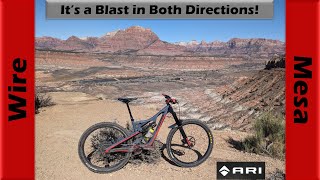
Upper Undisclosed is not an officially sanctioned trail by the BLM, it is open to riding though. It is the upper part of the trail leading from Grafton to Wire Mesa or visa versa.

Traditionally Indigenous Territory
More Stats for Undisclosed mountain bike trail trail
  • Altitude change
    -46 ft
  • Altitude min
    4,536 ft
  • Altitude max
    4,729 ft
  • Altitude start
    4,729 ft
  • Altitude end
    4,683 ft
  • Grade
    -0.562%
  • Grade max
    -13.662%
  • Grade min
    16.66%
  • Distance climb
    2,896 ft
  • Distance down
    4,231 ft
  • Distance flat
    1,063 ft
  • Avg time
    00:16:37
  • Avg reverse time
    00:18:50
  • view trail stats
Status:
on Apr 15, 2023
Dry
Avg: 3.74 (10 votes)
Your vote: 0

view (226)
close
3D
Trail Conditions
  • Unknown
  • Snow Groomed
  • Snow Packed
  • Snow Covered
  • Snow Cover Partial
  • Freeze/thaw Cycle
  • Icy
  • Prevalent Mud
  • Wet
  • Variable
  • Ideal
  • Dry
  • Very Dry
Trail Flow (Ridden Direction)
Trailforks scans users ridelogs to determine the most popular direction each trail is ridden. A good flowing trail network will have most trails flowing in a single direction according to their intension.
The colour categories are based on what percentage of riders are riding a trail in its intended direction.
  • > 96%
  • > 90%
  • > 80%
  • > 70%
  • > 50%
  • < 50%
  • bi-directional trail
  • no data
Trail Last Ridden
Trailforks scans ridelogs to determine the last time a trail was ridden.
  • < 2 days
  • < 1 week
  • < 2 weeks
  • < 1 month
  • < 6 months
  • > 6 months
Trail Ridden Direction
The intended direction a trail should be ridden.
  • Downhill Only
  • Downhill Primary
  • Both Directions
  • Uphill Primary
  • Uphill Only
  • One Direction
Contribute Details
Colors indicate trail is missing specified detail.
  • Description
  • Photos
  • Description & Photos
  • Videos
Trail Popularity ?
Trailforks scans ridelogs to determine which trails are ridden the most in the last 9 months. Trails are compared with nearby trails in the same city region with a possible 25 colour shades. Think of this as a heatmap, more rides = more kinetic energy = warmer colors.
  • most popular
  • popular
  • less popular
  • not popular
ATV/ORV/OHV Filter
Max Vehicle Width
inches
US Cell Coverage
Legend
cell carrier legend

Radar Time
x Activity Recordings
Trailforks users anonymized public ridelogs from the past 6 months.
  • mountain biking recent
  • mountain biking (>6 month)
  • hiking (1 year)
  • moto (1 year)
Activity Recordings
Trailforks users anonymized public skilogs from the past 12 months.
  • Downhill Ski
  • Backcountry Ski
  • Nordic Ski
  • Snowmobile
Winter Trails
Warning A routing network for winter maps does not exist. Selecting trails using the winter trails layer has been disabled.
x Missing Trails
Most Popular
Least Popular
Trails are colored based on popularity. The more popular a trail is, the more red. Less popular trails trend towards green.
Jump Magnitude Heatmap
Heatmap of where riders jump on trails. Zoom in to see individual jumps, click circles to view jump details.
Trails Deemphasized
Trails are shown in grey.
disable
Only show trails with NO bikes.
enable

Save the current map location and zoom level as your default home location whenever this page is loaded.

Save
      Directions to undisclosed trailhead (37.133532, -113.097178)
      update trails status or condition

      Undisclosed Trail Reports

      statusdatedescription
      Apr 15, 2023 @ 12:30pm
      Apr 15, 2023
      Perfect condition
      Mar 9, 2023 @ 7:54am
      Mar 9, 2023
      Major Water drainage issue, large mud holes
      Jan 9, 2022 @ 6:00pm
      Jan 9, 2022
      Very muddy
      Apr 2, 2021 @ 8:33am
      Apr 2, 2021
      No signs. Trail fairly easy to follow. Tight in some spots. Good ride.
      Jan 2, 2021 @ 6:37pm
      Jan 2, 2021
      Several thin skiffs of snow, but very dry due to cold temps.
      view all reports »

      Recent Ridelog Activity on Trail

      Past Week
      • 0 rides
      •  
      6 Months
      • 6 rides
      • 19 miles avg distance
      All
      • 46 rides
      • Last: Apr 17, 2025

      Photos

      more »
      27 |
      May 20, 2023 @ 10:19am
      May 20, 2023
      48 |
      Sep 28, 2022 @ 1:55pm
      Sep 28, 2022
      47 |
      Sep 28, 2022 @ 1:55pm
      Sep 28, 2022
      48 |
      Sep 28, 2022 @ 1:54pm
      Sep 28, 2022

      9 Reviews & Comments


      We hope you've been enjoying Trailforks!

      Create a FREE account to view trail comments and much more.

      Videos

      more »
      youtuber Why have I never ridden Wire Mesa...
      22:53 | 45 | Mar 29, 2024 , Hurricane
      • By toddTF Pro Trailforks & contributors
      • #106956 - 1,827 views

      You must enter a description before submitting.