more stats
5,157 ft
Distance
86 ft
Climb
-128 ft
Descent
00:16:28
Avg time
-43 ft
Altitude change
1,986 ft
Altitude min
2,063 ft
Altitude max
2,063 ft
Altitude start
2,021 ft
Altitude end
-0.8%
Grade
-18.1%
Grade max
12.9%
Grade min
2,831 ft
Distance climb
2,326 ft
Distance down
00:16:28
Avg time

Upper Baughman Details

  • Activities
    • Mountain Bike
    • Hike
    • Trail Running
  • Riding Area
    Ohiopyle State Park
    Ohiopyle, Pennsylvania
  • Difficulty Rating
  • Voted Difficulty
    Black Diamond (1 vote)
  • Local Popularity
    55 in Mountain Biking heatmap [+]
    • 65 in Trail Running
    • 5 in Hiking
  • Global Ranking
    #136987 in Mountain Biking [+]
    • #341603 in Trail Running
    • #323037 in Hiking
  • State Ranking
    #2,002 in Mountain Biking · Pennsylvania [+]
    • #5,345 in Trail Running
    • #5,532 in Hiking
  • Hiking SAC Scale
    T1 Hiking
  • Trail Type
    Singletrack
  • Direction
    Both Directions
  • Climb Difficulty
    Blue
  • Physical Rating
    Moderate
  • Trail Visibility
    Always easy to follow
  • Dogs Allowed
    Yes

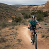
Upper Baughman trail connects Sugarloaf Trail to the Baughman overlook. It has a good mix of fast downhill and technical climbs. It can be ridden both ways. It has some very technical and steep sections, but well worth the challenge.

Tags

Local Trail Association

Traditionally Indigenous Territory

Recent Activity on Trail

Past Week
  • 0 rides
  •  
6 Months
  • 15 rides
  • 12 miles avg distance
All
  • 188 rides
  • Last: Oct 31, 2026
update trails status or condition

Upper Baughman Trail Reports

statusdatedescription
Jun 13, 2026 @ 1:06pm (America/New_York)
Jun 13, 2026
3 major blown downs have blocked upper baughman, right before Baughman Rocks. One is a large tree crown that result is a large blockage. Another...
Jun 8, 2024 @ 5:46am
Jun 8, 2024
May 6, 2023 @ 7:44am
May 6, 2023
Aug 1, 2022 @ 7:09pm
Aug 1, 2022
reporter All clear as of Aug 1, 2022. Grip it and rip it.
Oct 1, 2020 @ 6:56pm
Oct 1, 2020
Tree down right after jump on long descent.
more »
Status:
on Jun 13, 2026
Avg: 3.33 (6 votes)
Your vote: 0

view (568)
close
      Directions to upper-baughman trailhead (39.833400, -79.474110)

      Photos

      4 more »
      mtb
      25 |
      Sep 26, 2026 @ 11:30am
      Sep 26, 2026
      mtb
      22 |
      Sep 26, 2026 @ 11:30am
      Sep 26, 2026
      mtb
      104 |
      Jun 4, 2023 @ 5:09pm
      Jun 4, 2023
      report
      mtb
      118 |
      Oct 1, 2020 @ 6:56pm
      Oct 1, 2020

      Videos

      no videos have been added for Upper Baughman yet, add a video.

      Routes with this trail

      more »
      11 miles • 672 ft • 5 •
      Leave a car in town and shuttle up to Firetower Road. Take the road until the gate on your left and follow...
      ★ 2.0 • 13 miles • 988 ft • 6 • Shuttled •
      Grip it and rip it. This shuttle ride is a great way to experience the Ohiopyle goods. You can cut out Kim...
      9 miles • 532 ft • 5 • Shuttled •
      Fun shuttle ride with some climes, but more down than up. Some trails have a lot of rocky tech, others are...
      2.7 ★★★★★
      6 Ratings
      5 ★ 17%
      4 ★ 17%
      3 ★ 17%
      2 ★ 17%
      1 ★ 33%

      3 Reviews & Comments

      MontanaMiller
      Tight, rocky PA ridge line riding. One of my favorite trails in the park, but if you don't like herky jerky trials-lite type riding, you might not dig it.
      Bennnnnn Bennnnnn
      Not overgrown now, but this is primarily a hiking trail. Yeah, you can ride most of it just fine, but there are stairs you will have to climb and two trees growing in the trail. If you have great trials skills, maybe you can ride the whole trail. Also, some wet spots with drainage problems.
      Momberj Momberj
      Very over grown and basically unmaintained.

      We hope you've been enjoying Trailforks!

      Create a FREE account to view all trail reviews and much more.

      • By toddTF Pro Trailforks & contributors
      • #85249 - 1,750 views

      Frequently Asked Questions

      ▼ Where is Upper Baughman located?
      Upper Baughman is located in Ohiopyle State Park, Ohiopyle, Pennsylvania, United States. It is part of the Ohiopyle State Park trail network. The trailhead is located at coordinates 39.8334, -79.47411.
      ▼ How hard is Upper Baughman?
      Upper Baughman is rated as Black Diamond difficulty. The physical rating is Moderate. The average grade is 0.8%. The climb difficulty is rated Blue.
      ▼ What is the elevation gain for Upper Baughman?
      Upper Baughman has 86 ft of elevation gain. The trail has 128 ft of elevation descent. The elevation ranges from 1,986 ft to 2,063 ft.
      ▼ Is Upper Baughman a point to point trail?
      Upper Baughman is not a point to point trail. The direction is Both Directions. The trail type is singletrack.
      ▼ How long is Upper Baughman?
      Upper Baughman is 5,157 ft long. The trail type is singletrack.
      ▼ Are dogs allowed on Upper Baughman?
      Yes, dogs are allowed on Upper Baughman. Please keep dogs on a leash where required and clean up after them.
      ▼ How do I access Upper Baughman? Where is the closest parking trailhead?
      The closest parking and trailhead locations to Upper Baughman are: View all parking locations in the area.
      ▼ How long does it take to ride Upper Baughman?
      Based on recorded activities, it takes an average of 16 minutes to ride Upper Baughman. The trail is 5,157 ft long. Actual times will vary based on fitness level, conditions, and pace. View recent activity logs for more details.
      ▼ How busy is Upper Baughman?
      Upper Baughman is a moderately popular trail. There have been 563 recorded activities on this trail. The trail has received 568 check-ins. View recent activity on this trail.

      Hit the Trail

      Open in App

      Get this trail on your phone instantly.

      open trail in app

      Download Trail

      Save to wishlist, Garmin & download.
      save the trail

      Find Related Routes

      Find routes and users activities that include this trail.
      find routes for this trail

      You must enter a description before submitting.