1.3 miles
Distance
34 ft
Climb
-527 ft
Descent
00:15:57
Avg time
Supporters, Builders, Maintainers & Land Managers of Upper Moto Trail
Coconino Trail RidersSponsor
Flagstaff Biking OrganizationSponsor
USFSLand Manager
Upper Moto Details
-
Activities
- Mountain Bike
- E-Bike
- Hike
- Trail Running
- Horse
- Dirtbike/Moto
-
Riding AreaFort Valley Trail System
Flagstaff, Arizona -
Ref Number#430
-
AKAMoto
-
Difficulty Rating
-
Hiking SAC ScaleT2 Mountain Hiking
-
Trail TypeSingletrack
-
Bike TypeAM
-
DirectionDownhill PrimaryPopular direction shown
-
Climb DifficultyDouble Black Diamond
-
Physical RatingHard
-
Trail VisibilityAlways easy to follow
-
SeasonLate April-Mid November
-
eBike AllowedYes up to Class 1
-
TTFs on TrailRock Face, Rock Garden
-
Global Ranking#43763 in Mountain Biking [+]
- #11944 in E-Biking
- #17330 in Trail Running
- #37155 in Hiking
- #1191 in Dirtbiking
-
Local Popularity70 in Mountain Biking [+]
- 80 in E-Biking
- 70 in Trail Running
- 65 in Hiking
- 5 in Dirtbiking
- 5 in Horseback
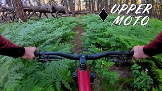
Chunky enough Located at the top of Fort Valley Trail System in Flagstaff, there are several sections with car sized boulders, and narrow passages between them! This alone makes it a worthy excursion - just don't kid yourself that you'll be shredding this trail at mach-chicken (!)...it's not gonna happen. But, if you like the challenge of descending through epic boulder fields in the forest - then this trail's for you! In order to access this trail I had to ride Newham Trail, a black, and it had some steep and chunderous sections, as well as a cool overlook and big rock outcropping/overhang on West Secret.
Access Info
To access ride Freidlein Prairie Road, Secret, or Newham from Secret
Local Trail Association
-
Please consider joining or donating to the local trail association to supportdonate to earn trail karma!
trail development & maintenance.
Traditionally Indigenous Territory
More Stats for Upper Moto bike trail trail
-
Altitude change-493 ft
-
Altitude min7,874 ft
-
Altitude max8,367 ft
-
Altitude start8,367 ft
-
Altitude end7,874 ft
-
Grade-7%
-
Grade max-24.5%
-
Grade min12.9%
-
Distance climb522 ft
-
Distance down1 mile
-
Distance flat860 ft
-
Avg time00:15:57
-
Avg reverse time00:31:34
- view trail stats
close
Trail Conditions
- Unknown
- Snow Groomed
- Snow Packed
- Snow Covered
- Snow Cover Inadequate
- Freeze/thaw Cycle
- Icy
- Prevalent Mud
- Wet
- Variable
- Ideal
- Dry
- Very Dry
Trail Flow (Ridden Direction)
Trailforks scans users ridelogs to determine the most popular direction each trail is ridden. A good flowing trail network will have most trails flowing in a single direction according to their intension.
The colour categories are based on what percentage of riders are riding a trail in its intended direction.
- > 96%
- > 90%
- > 80%
- > 70%
- > 50%
- < 50%
- bi-directional trail
- no data
Trail Last Ridden
Trailforks scans ridelogs to determine the last time a trail was ridden.
- < 2 days
- < 1 week
- < 2 weeks
- < 1 month
- < 6 months
- > 6 months
Trail Ridden Direction
The intended direction a trail should be ridden.
- Downhill Only
- Downhill Primary
- Both Directions
- Uphill Primary
- Uphill Only
- One Direction
Contribute Details
Colors indicate trail is missing specified detail.
- Description
- Photos
- Description & Photos
- Videos
Trail Popularity ?
Trailforks scans ridelogs to determine which trails are ridden the most in the last 9 months.
Trails are compared with nearby trails in the same city region with a possible 25 colour shades.
Think of this as a heatmap, more rides = more kinetic energy = warmer colors.
- most popular
- popular
- less popular
- not popular
ATV/ORV/OHV Filter
Max Vehicle Width
inches
Radar Time
x
Activity Recordings
Trailforks users anonymized public ridelogs from the past 6 months.
- mountain biking recent
- mountain biking (>6 month)
- hiking (1 year)
- moto (1 year)
Activity Recordings
Trailforks users anonymized public skilogs from the past 12 months.
- Downhill Ski
- Backcountry Ski
- Nordic Ski
Jump Magnitude Heatmap
Heatmap of where riders jump on trails. Zoom in to see individual jumps, click circles to view jump details.
Trails Deemphasized
Trails are shown in grey.
Only show trails with NO bikes.
Directions to upper-moto trailhead
(35.287510, -111.662530)
update trails status or condition
Upper Moto Trail Reports
view all reports »
Recent Ridelog Activity on Trail
Past Week
- 4 rides
- 13 miles avg distance
6 Months
- 24 rides
- 16 miles avg distance
All
- 334 rides
Photos
more »
Routes with this trail
-
+ 0
Streetdoctor
(Nov 10, 2017 at 14:17)
Stats are misleading. It’s a moto trail. No flow at any speed, lots of pedaling. Much better gnar trails in the area unless slow speed bouncing over round rocks is your thing.
[Reply]
atfarley
(Apr 7, 2018 at 20:04)

Some parts of this tech descent are good, mostly it's just awkward.
[Reply]
raisingarizona
(Jul 4, 2018 at 23:44)

Old school rock tech jank. It’s rad if that’s your thing. I love it and if you give it a chance, give it some time to figure it out it sort of flows in that old school jank sort of way but it’s not easy!
[Reply]
Ob1matt
(May 11, 2020 at 19:09)

If you can not handle the tech,ride another trail.This Trail is awesome
[Reply]
jrobo
(Sep 19, 2020 at 22:49)

Great ride if you like fun, rocky tech that never gets too steep and has good flow.
[Reply]
Nikwho
(Oct 5, 2020 at 7:27)

Awesome moto trail. Fun, technical chunky trail that is super fun to ride up, if thats your thing. I wouldn't ride this on my mountain bike. More of a motorcycle trail, for sure. Bring a skid plate and solid clutch control or a Rekluse! Its a pretty technical trail! Lots of rock hopping!
[Reply]


Actually really enjoyed this trail! Chunk party all the way down....but very doable.
[Reply]
Ktobin23
(Jun 24, 2021 at 17:06)

This trail runs very slow. Even on my 29er the rocks force you to go about 7mph. There are better tech trails around this area imo. The trail was challenging but I cleaned it first try and have no desire to ride it again. If you like slow tech this trail is great but for everyone else ride other trails.
[Reply]
gnarflow13
(Sep 26, 2021 at 16:46)

I rode this on my XC 100-100 bike and it was a blast. You can go as fast as you want, you just have to pedal and pump and work for it. Really fun if you like tech trails with moves that require good bike handling.
[Reply]
Nearby Trails
- Twisted Sister 7 ft
- Newham 2,641 ft
- Secret Access 1 mile
- Lower Moto 1 mile
- Rocky Moto 1 mile
Fort Valley Trail System
- embed Upper Moto trail on your website
- By todd
Trailforks & contributors
- #16335 - 2,277 views
- subscribe
- login to download gpx or kml files.
Open trail in mobile app