

more stats
2.6 miles
Distance
-628 ft
Descent
00:16:13
Avg time
-628 ft
Altitude change
7,224 ft
Altitude min
7,852 ft
Altitude max
7,852 ft
Altitude start
7,224 ft
Altitude end
-4.6%
Grade
-16.2%
Grade max
0.6%
Grade min
2 miles
Distance down
889 ft
Distance flat
00:16:13
Avg time

Lower Moto Details

  • Activities
    • Mountain Bike
    • E-Bike
    • Horse
    • Hike
    • Trail Running
    • Dirtbike/Moto
  • Riding Area
    Fort Valley Trail System
    Flagstaff, Arizona
  • Ref Number
    #430
  • Difficulty Rating
  • Local Popularity
    40 in Mountain Biking [+]
    • 65 in E-Biking
    • 40 in Trail Running
    • 45 in Hiking
    • 100 in Dirtbiking
    • 5 in Horseback
  • Global Ranking
    #128852 in Mountain Biking [+]
    • #116031 in E-Biking
    • #151177 in Trail Running
    • #148087 in Hiking
    • #4569 in Dirtbiking
    • #3615 in Horseback
  • State Ranking
    #1,996 in Mountain Biking · Arizona [+]
    • #729 in E-Biking
    • #2,731 in Trail Running
    • #3,079 in Hiking
    • #64 in Dirtbiking
    • #229 in Horseback
  • Hiking SAC Scale
    T1 Hiking
  • Trail Type
    Singletrack
  • Bike Type
    AM, XC
  • Direction
    Downhill Primary
    Popular Direction Shown
  • Climb Difficulty
    Green
  • Physical Rating
    Easy
  • Dogs Allowed
    Yes
  • eBike Allowed
    Yes up to Class 1

A dirtbike trail that is flowy and offers a twisty decent and easy climb.

Tags
FlowyTight and twisty

Trail Supporters

Local Trail Association

Recent Activity on Trail

Past Week
  • 0 rides
  •  
6 Months
  • 4 rides
  • 23.8 km avg distance
All
  • 58 rides
  • Last: Oct 20, 2026
c1c2c3c4
January
February
March
April
May
June
July
August
September
October
November
December
update trails status or condition

Lower Moto Trail Reports

statusdatedescription
Jul 10, 2026 @ 8:59am (America/Phoenix)
Jul 10, 2026
Dec 27, 2025 @ 7:25am (America/Phoenix)
Dec 27, 2025
Aug 4, 2024 @ 9:54pm
Aug 4, 2024
Oct 10, 2020 @ 1:29pm
Oct 10, 2020
Very dry and dusty, easy to lose the front if you're not paying attention
Sep 30, 2019 @ 7:02pm
Sep 30, 2019
one tree down, can avoid it by taking Easter Island
more »
Status:
on Jul 10, 2026
Ideal
Avg: 3.64 (20 votes)
Your vote: 0

view (640)
close
      Directions to lower-moto trailhead (35.277140, -111.662060)

      Photos

      19 more »
      mtb
      71 |
      May 25, 2023 @ 9:49am
      May 25, 2023
      mtb
      74 |
      May 25, 2023 @ 9:49am
      May 25, 2023
      mtb
      73 |
      May 25, 2023 @ 9:49am
      May 25, 2023
      mtb
      63 |
      May 25, 2023 @ 9:49am
      May 25, 2023

      Videos

      3 more »
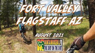
      XC Cruisin the Fort Valley Trails in Flagstaff
      mtb
      6:09 | 256 | Nov 13, 2021 , Flagstaff
      We took an unofficial trail - Part I //...
      mtb
      4:27 | 383 | Jul 16, 2020 , Flagstaff
      3 Miles Down - MOTO trail Flagstaff
      mtb
      688 | Jan 20, 2019 , Flagstaff

      Routes with this trail

      ★ 4.5 • 19 miles • 2,297 ft • 37 • Loop •
      Great loop with plenty of climbing to earn your downhill fun. Some techie but rideable bits on Secret and...
      ★ 2.0 • 12 miles • 1,043 ft • 15 • Loop •
      This ride can start in the lower parking lot or the one about a half mile (or less) up schultz pass rd. I...
      21 miles • 2,034 ft • 17 •
      A challenging, yet fun mix of rocky singletrack, techy climbs, and fast flowy descents sure to put a smile...
      3.6 ★★★★★
      20 Ratings
      5 ★ 15%
      4 ★ 40%
      3 ★ 35%
      2 ★ 5%
      1 ★ 5%

      7 Reviews & Comments

      DoneyParker DoneyParker
      Nice easy climb to AZ trail to Sunset Parking.
      Ktobin23
      This trail should be rated a green. It is generally flat and does not have any features like other flow trails in the area. This trail is meant for dirt bikes that generate speed via motor. On a non motorized bike this trail runs slow. This flat and featureless trail would be great for a beginner learning how to ride single track, but if you are an intermediate-advanced rider you will hate this trail.
      bensgig bensgig
      Mostly the intermediate trail good gradual little climb upwards coming back is a lot of fun though.

      We hope you've been enjoying Trailforks!

      Create a FREE account to view all trail reviews and much more.

      • By toddTF Pro Trailforks & contributors
      • #16324 - 4,291 views

      Frequently Asked Questions

      ▼ Where is Lower Moto located?
      Lower Moto is located in Fort Valley Trail System, Flagstaff, Arizona, United States. It is part of the Fort Valley Trail System trail network. The trailhead is located at coordinates 35.27714, -111.66206.
      ▼ How hard is Lower Moto?
      Lower Moto is rated as Green difficulty. The physical rating is Easy. The average grade is 4.6%. The climb difficulty is rated Green.
      ▼ What is the elevation gain for Lower Moto?
      The trail has 628 ft of elevation descent. The elevation ranges from 7,224 ft to 7,852 ft.
      ▼ Is Lower Moto a point to point trail?
      Lower Moto is not a point to point trail. The direction is Downhill Primary. The trail type is singletrack.
      ▼ How long is Lower Moto?
      Lower Moto is 2.6 miles long. The trail type is singletrack.
      ▼ Are dogs allowed on Lower Moto?
      Yes, dogs are allowed on Lower Moto. Please keep dogs on a leash where required and clean up after them.
      ▼ When is the best time of year to ride Lower Moto?
      Based on activity log data, the most popular months to ride Lower Moto are:
      • July (3 activities)
      • August (3 activities)
      • March (2 activities)
      Check the reports page for current trail conditions.
      ▼ How do I access Lower Moto? Where is the closest parking trailhead?
      The closest parking and trailhead locations to Lower Moto are: View all parking locations in the area.
      ▼ How long does it take to ride Lower Moto?
      Based on recorded activities, it takes an average of 16 minutes to ride Lower Moto. The trail is 2.6 miles long. Actual times will vary based on fitness level, conditions, and pace. View recent activity logs for more details.
      ▼ How busy is Lower Moto?
      Lower Moto is a moderately popular trail. There have been 612 recorded activities on this trail. The trail has received 640 check-ins. View recent activity on this trail.

      Hit the Trail

      Open in App

      Get this trail on your phone instantly.

      open trail in app

      Download Trail

      Save to wishlist, Garmin & download.
      save the trail

      Find Related Routes

      Find routes and users activities that include this trail.
      find routes for this trail

      You must enter a description before submitting.