
Open in App
Get this trail on your phone instantly.

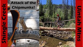
This is primarily a hike trail used to connect to some High Uinta Trails, and is a nice hike with only a few steep sections.
On a bike, this is a difficult and rocky climb, but challenging and fun to some. This is the preferred way to get to the Shingle Creek trail for some wild expert downhill fun. You can climb it all with some skill, though a couple creek crossings are rocky and difficult. This is one of the few trails that you can ride in the High Uintaa
| c1 | c2 | c3 | c4 |
|---|---|---|---|
January | February | March | April |
May | June | July | August |
September | October | November | December |

Service Road Atlas is a free to use, community-driven service for viewing and creating reports on the numerous back-country service roads around B.C. and Alberta.
Save the current map location and zoom level as your default home location whenever this page is loaded.
Save
No reviews yet, be the first to write a review or ask a question.
Use trail reports to comment on trail conditions.
We hope you've been enjoying Trailforks!
Create a FREE account to view trail comments and much more.
You must enter a description before submitting.

