
Open in App
Get this trail on your phone instantly.

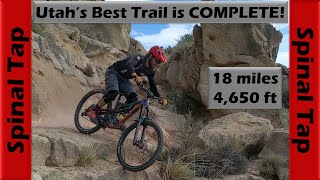
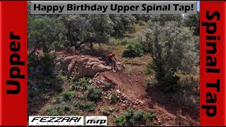
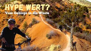
Upper Spinal Tap starts gradual but picks up quickly with fast berms, rollers, and jumps. It winds through the aspen and pine trees for about 2.5 miles before crossing the shuttle road. The trail continues with fast berms, rollers, and jumps for another 3 miles through Mahogany and Pinion trees where you will find a cattle guard crossing followed by an ATV trail crossing. The trail gets a little more challenging with 4 technical drop features that will get your blood pumping. A few short gradual climbs will then send you flying down the rest of the trail through sweeping berms and jumps and right into Middle Spinal Tap.
Generally this trail rates intermediate in difficulty and has very few mandatory challenging features.
The trail is located in open grazing lands and there are cattle in the area. You may encounter cattle on the trail. Please be respectful to the cattle and wildlife should you encounter them.
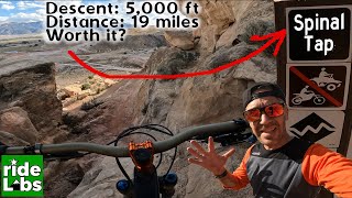
Trail is accessed from the CCC road to FR 096. Park near the pit toilet and then head north over the cattle guard. The trail starts just after passing over the cattle guard on the right hand side.
Trail is generally well benched with 42”+ width, however there are a lot of built pinches (apparently intended to restrict quad / motorized use) that narrow the trail to 26” or less. There are a few significant narrow/ off camber sections near the bottom.
There is a single MANDATORY TECHNICAL FEATURE approx 2/3 of the way down which consists of a 6’ techy DH roll into a hard left hand turn on flat. Significant Endo potential. Other B line option is a 26” wide line with poor spotting potential and significant exposure to rolling. Do not ride this trail without advanced skills and appropriate support.
| c1 | c2 | c3 | c4 |
|---|---|---|---|
January | February | March | April |
May | June | July | August |
September | October | November | December |

Service Road Atlas is a free to use, community-driven service for viewing and creating reports on the numerous back-country service roads around B.C. and Alberta.
Save the current map location and zoom level as your default home location whenever this page is loaded.
Save
 Rock Garden Rock Garden Drop Drop
We hope you've been enjoying Trailforks!
Create a FREE account to view trail comments and much more.
You must enter a description before submitting.

