
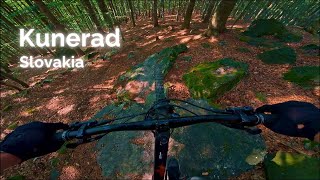

more stats
3,678 ft
Distance
5 ft
Climb
-742 ft
Descent
00:13:26
Avg time
-737 ft
Altitude change
2,179 ft
Altitude min
2,922 ft
Altitude max
2,917 ft
Altitude start
2,178 ft
Altitude end
-20%
Grade
-70.2%
Grade max
6.9%
Grade min
256 ft
Distance climb
3,307 ft
Distance down
115 ft
Distance flat
00:13:26
Avg time

Valibuk Details

  • Activities
    • Mountain Bike
    • E-Bike
  • Riding Area
    Kunerad
    Žilina
  • Difficulty Rating
  • Voted Difficulty
    Double Black Diamond (3 votes)
  • Local Popularity
    70 in Mountain Biking [+]
    • 70 in E-Biking
  • Global Ranking
    #1522 in Mountain Biking [+]
    • #33845 in E-Biking
  • National Ranking
    #20 in Mountain Biking · Slovakia [+]
    • #179 in E-Biking
  • Trail Type
    Singletrack
  • Bike Type
    DH, AM
  • Direction
    Downhill Only
    Popular Direction Shown
  • Physical Rating
    Hard
  • Trail Visibility
    Always easy to follow
  • Dogs Allowed
    Yes
  • eBike Allowed
    Yes up to Class 1
  • TTFs on Trail
    Drop, Rock Garden, Other
  • Year Opened
    2021

Umelo vytvorený/vyhrabaný enduro trail. Dva rockgardeny, skalný drop, nordshore a veľa zábavy pomedzi stromy. Údajne najťažší trail široko ďaleko.

Tags
DropsRock gardens

Trail Supporters

Recent Activity on Trail

Past Week
  • 0 rides
  •  
6 Months
  • 3 rides
  • 20 miles avg distance
All
  • 30 rides
  • Last: Nov 9, 2026
c1c2c3c4
January
February
March
April
May
June
July
August
September
October
November
December
update trails status or condition

Valibuk Trail Reports

statusdatedescription
Nov 9, 2026 @ 12:19pm (Europe/Bratislava)
23 hours
dosť zapadaný lístim
Oct 1, 2026 @ 2:36pm (Europe/Bratislava)
Oct 1, 2026
prečistený plne prejazdný
Sep 10, 2026 @ 4:05pm (Europe/Bratislava)
Sep 10, 2026
v strede trailu zasa prebieha preriezka, asi 20 metrov treba obísť.
Aug 31, 2026 @ 4:18pm (Europe/Bratislava)
Aug 31, 2026
Aug 18, 2026 @ 4:42pm (Europe/Bratislava)
Aug 18, 2026
ťažba skončila trail je čistý akurát v pár miestach nieje dobre vidieť stopu
more »
Status:
on Nov 9, 2026
Dry
Avg: 4.58 (11 votes)
Your vote: 0

view (441)
close
      Directions to valibuk trailhead (49.067180, 18.736130)

      Photos

      21 more »
      mtb
      240 |
      Oct 7, 2021 @ 9:56am
      Oct 7, 2021
      mtb
      228 |
      Oct 7, 2021 @ 9:54am
      Oct 7, 2021
      mtb
      210 |
      Oct 7, 2021 @ 9:50am
      Oct 7, 2021
      mtb
      231 |
      Oct 7, 2021 @ 9:49am
      Oct 7, 2021

      Videos

      2 more »
      Valibuk
      mtb
      19:34 | 122 | Nov 6, 2024 , Žilina
      MTB Kunerad - Valibuk
      mtb
      12:10 | 138 | Mar 7, 2024 , Žilina

      Routes with this trail

      28 miles • 5,957 ft • 12 •
      Najlepšie a najjazdenejšie Kuneradské traily momentálne. The best and most ridden Kunerad trails at...
      4.9 ★★★★★
      11 Ratings
      5 ★ 91%
      4 ★ 9%
      3 ★
      2 ★
      1 ★

      5 Reviews & Comments

      bobris01
      perfektne! koniec by si zasluzil bezpecnejsi mostik
      jurrasic jurrasic
      Valibuk mam rad, kludne by som tych kamenistych pasazi uvital viac. Ovela viac Wink
      jxxw jxxw
      Novy oblubeny trail, s podtitulom "Kanadsky sen". Rockgardeny, fajnovy drop a opat rockgardeny. A medzi tym tona namotanej zabavy pomedzi stromy!

      We hope you've been enjoying Trailforks!

      Create a FREE account to view all trail reviews and much more.

      • By jurosik & contributors
      • #435936 - 1,974 views

      Frequently Asked Questions

      ▼ Where is Valibuk located?
      Valibuk is located in Kunerad, Žilina, Slovakia. It is part of the Kunerad trail network. The trailhead is located at coordinates 49.06718, 18.73613.
      ▼ How hard is Valibuk?
      Valibuk is rated as Double Black Diamond difficulty. The physical rating is Hard. The average grade is 20%.
      ▼ What is the elevation gain for Valibuk?
      Valibuk has 5 ft of elevation gain. The trail has 742 ft of elevation descent. The elevation ranges from 2,179 ft to 2,922 ft.
      ▼ Is Valibuk a point to point trail?
      Yes, Valibuk is a point to point trail. The direction is Downhill Only. The trail type is singletrack.
      ▼ How long is Valibuk?
      Valibuk is 3,678 ft long. The trail type is singletrack.
      ▼ Are dogs allowed on Valibuk?
      Yes, dogs are allowed on Valibuk. Please keep dogs on a leash where required and clean up after them.
      ▼ When is the best time of year to ride Valibuk?
      Based on activity log data, the most popular months to ride Valibuk are:
      • August (5 activities)
      • May (3 activities)
      • October (3 activities)
      Check the reports page for current trail conditions.
      ▼ How do I access Valibuk? Where is the closest parking trailhead?
      The closest parking and trailhead locations to Valibuk are: View all parking locations in the area.
      ▼ How long does it take to ride Valibuk?
      Based on recorded activities, it takes an average of 13 minutes to ride Valibuk. The trail is 3,678 ft long. Actual times will vary based on fitness level, conditions, and pace. View recent activity logs for more details.
      ▼ How busy is Valibuk?
      Valibuk is a very popular trail. There have been 413 recorded activities on this trail. The trail has received 441 check-ins. View recent activity on this trail.

      Hit the Trail

      Open in App

      Get this trail on your phone instantly.

      open trail in app

      Download Trail

      Save to wishlist, Garmin & download.
      save the trail

      Find Related Routes

      Find routes and users activities that include this trail.
      find routes for this trail

      You must enter a description before submitting.

