
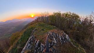


more stats
1.2 miles
Distance
137 ft
Climb
-1,463 ft
Descent
00:17:52
Avg time
-1,325 ft
Altitude change
1,598 ft
Altitude min
2,926 ft
Altitude max
2,923 ft
Altitude start
1,598 ft
Altitude end
-20.64%
Grade
-62.989%
Grade max
61.575%
Grade min
1,000 ft
Distance climb
1 mile
Distance down
00:17:52
Avg time

Vigolone 3 Details

  • Activities
    • Mountain Bike
    • E-Bike
    • Hike
    • Trail Running
  • Riding Area
  • Difficulty Rating
  • Voted Difficulty
    Black (2 votes)
  • Local Popularity
    100 in Mountain Biking heatmap [+]
    • 95 in E-Biking
    • 5 in Trail Running
    • 5 in Hiking
  • Global Ranking
    #34858 in Mountain Biking [+]
    • #11494 in E-Biking
    • #297958 in Trail Running
    • #290211 in Hiking
  • National Ranking
    #3,371 in Mountain Biking · Italy [+]
    • #1,398 in E-Biking
    • #9,974 in Trail Running
    • #9,887 in Hiking
  • Trail Type
    Singletrack
  • Bike Type
    DH, AM
  • Direction
    Downhill Only
    Popular Direction Shown
  • Physical Rating
    Hard
  • Dogs Allowed
    Yes
  • eBike Allowed
    Yes up to Class 1
  • Year Opened
    2015

Single track ripido e stretto e pericoloso col bagnato, soprattutto la parte alta. Anche in condizione di asciutto è consigliato solo per esperti. Attenzione all'uscita sulla strada provinciale.

Access Info

Da Parma seguire la strada provinciale per Calestano. Dal parcheggio pedalare in direzione di Berceto e prendere la deviazione per Vigolone

Tags

Trail Supporters

  • Mangusta Bike Team
    Builder

Recent Activity on Trail

Past Week
  • 0 rides
  •  
6 Months
  • 7 rides
  • 17 miles avg distance
All
  • 60 rides
  • Last: Oct 23, 2026
c1c2c3c4
January
February
March
April
May
June
July
August
September
October
November
December
update trails status or condition

Vigolone 3 Trail Reports

statusdatedescription
May 4, 2026 @ 5:16am (Pacific/Midway)
May 4, 2026
Attenzione ai ripidoni, molto asciutti e polverosi!
Apr 19, 2026 @ 10:45am (Europe/Rome)
Apr 19, 2026
Oct 18, 2025 @ 10:01am (Europe/San_Marino)
Oct 18, 2025
rimosso l'albero ora è al top. Attenzione cmq al ponte a non saltare nel buco
Sep 14, 2025 @ 4:14pm (Europe/Rome)
Sep 14, 2025
Attenzione pianta caduta in fondo prima dei ponticelli di legno
Aug 27, 2025 @ 6:45am
Aug 27, 2025
Very nice trail! Really worth it. perfect work of the trail builders and shuttle service!!
more »
Status:
on May 4, 2026
Dry
Avg: 4.07 (6 votes)
Your vote: 0

view (351)
close
      Directions to vigolone-3 trailhead (44.581779, 10.109562)

      Photos

      4 more »
      mtb
      73 |
      May 4, 2026 @ 5:36pm
      May 4, 2026
      mtb
      158 |
      Jun 12, 2017 @ 2:18pm
      Jun 12, 2017
      mtb
      266 |
      Jan 26, 2017 @ 11:31am
      Jan 26, 2017
      report
      mtb
      68 |
      Sep 10, 2022 @ 1:39am
      Sep 10, 2022

      Videos

      5 more »
      Calestano / Vigolone - Vigo3 2026 - MTB POV
      mtb
      6:07 | 305 | Apr 13, 2026 , Parma
      Calestano / Vigolone - Vigo3 - MTB POV
      mtb
      6:24 | 274 | Apr 28, 2025 , Parma
      Vigo 3,Calestano
      mtb
      8:07 | 151 | Dec 15, 2022 , Parma
      Val Baganza Terra di Bikers - River Gap
      mtb
      709 | Jan 24, 2016 , Parma
      4.2 ★★★★★
      6 Ratings
      5 ★ 17%
      4 ★ 83%
      3 ★
      2 ★
      1 ★

      3 Reviews & Comments

      camikakushi camikakushi
      Sentiero sistemato in occasione della SenatorsEnduroCup di aprile. Nuova partenza dalla cima del monte (con vista panoramica sulla vallata) tenendo la sinistra nella parte terminale della risalita. Nuova variante che taglia sulla destra il passaggio in cresta più ostico + divertente toboga finale in un canalone sulla sinistra nella parte finale. Ripido e tecnico, fastidioso con bagnato e asciutto. Bello!
      ArteBici ArteBici
      Trail che inizia livello S3 con alcuni passaggi in cresta non semplici, poi il livello di difficoltà cala a S2 ma nel complesso la si può correttamente definire una nera
      alesvizzero
      Prima parte in cresta abbastanza esposta e con qualche ripido, poi sezione guidata nel bosco. Mai estremo, però non adatto ai principianti. Molto divertente.

      We hope you've been enjoying Trailforks!

      Create a FREE account to view all trail reviews and much more.

      • By CapatazTF Pro & contributors
      • #46842 - 3,577 views

      Frequently Asked Questions

      ▼ Where is Vigolone 3 located?
      Vigolone 3 is located in Calestano Bike Park, Parma, Italy. It is part of the Calestano Bike Park trail network. The trailhead is located at coordinates 44.58178, 10.10956.
      ▼ How hard is Vigolone 3?
      Vigolone 3 is rated as Black difficulty. The physical rating is Hard. The average grade is 20.64%.
      ▼ What is the elevation gain for Vigolone 3?
      Vigolone 3 has 137 ft of elevation gain. The trail has 1,463 ft of elevation descent. The elevation ranges from 1,598 ft to 2,926 ft.
      ▼ Is Vigolone 3 a point to point trail?
      Yes, Vigolone 3 is a point to point trail. The direction is Downhill Only. The trail type is singletrack.
      ▼ How long is Vigolone 3?
      Vigolone 3 is 1.2 miles long. The trail type is singletrack.
      ▼ Are dogs allowed on Vigolone 3?
      Yes, dogs are allowed on Vigolone 3. Please keep dogs on a leash where required and clean up after them.
      ▼ How do I access Vigolone 3? Where is the closest parking trailhead?
      The closest parking and trailhead locations to Vigolone 3 are: View all parking locations in the area.
      ▼ How long does it take to ride Vigolone 3?
      Based on recorded activities, it takes an average of 18 minutes to ride Vigolone 3. The trail is 1.2 miles long. Actual times will vary based on fitness level, conditions, and pace. View recent activity logs for more details.
      ▼ How busy is Vigolone 3?
      Vigolone 3 is a very popular trail. There have been 329 recorded activities on this trail. The trail has received 351 check-ins. View recent activity on this trail.

      Hit the Trail

      Open in App

      Get this trail on your phone instantly.

      open trail in app

      Download Trail

      Save to wishlist, Garmin & download.
      save the trail

      Find Related Routes

      Find routes and users activities that include this trail.
      find routes for this trail

      You must enter a description before submitting.

