

more stats
1.7 miles
Distance
54 ft
Climb
-2,043 ft
Descent
00:25:35
Avg time
-1,989 ft
Altitude change
314 ft
Altitude min
2,303 ft
Altitude max
2,303 ft
Altitude start
315 ft
Altitude end
-21.9%
Grade
-112.5%
Grade max
18.5%
Grade min
1,063 ft
Distance climb
1 mile
Distance down
171 ft
Distance flat
00:25:35
Avg time

Whaimana Details

  • Activities
    • Mountain Bike
  • Riding Area
  • Difficulty Rating
  • Voted Difficulty
    Double Black Diamond (3 votes)
  • Local Popularity
    65 in Mountain Biking
  • Global Ranking
    #41665 in Mountain Biking
  • National Ranking
    #936 in Mountain Biking · New Zealand
  • Trail Type
    Singletrack
  • Direction
    Downhill Only
    Popular Direction Shown
  • eBike Allowed
    Yes up to Class 1

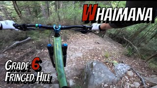
A super-fun trail, steep, lots of loamy corners, some off-camber and a few dusty chutes (but with great catch berms). Easier than 629 & Peaking Ridge, if you can ride Aorere you should be sweet with this one.

Take it easy right at bottom, the trail drops into a fence you won't get your handlebars through (which I assume is to stop you riding out onto the road). New trail grade in 2021.

Access Info

A few different ways to get there:
- Head up Fringed Hill Rd > Black Diamond > Sunrise Ridge (the entrance is about half way down on the left)
- Ride up to the top of 629 Firebreak, then follow Sunrise Ridge to about the half way point (it's about 100m past the turn off to Maitai Caves).
- Ride up to Third House, then push up Black Diamond Third House Link, then head down Sunrise Ridge.

All routes are quite a mission, take a snack

Tags
BermsLoamy

Recent Activity on Trail

Past Week
  • 1 rides
  • 9 miles average
6 Months
  • 13 rides
  • 16 miles avg distance
All
  • 72 rides
  • Last: Oct 25, 2026
c1c2c3c4
January
February
March
April
May
June
July
August
September
October
November
December
update trails status or condition

Whaimana Trail Reports

statusdatedescription
Oct 25, 2026 @ 8:58am (Pacific/Auckland)
Oct 24, 2026
Sep 30, 2026 @ 11:53am (Pacific/Auckland)
Sep 29, 2026
Pig rooting fixed and few branches cleared with silky
Aug 21, 2026 @ 9:00am (Pacific/Auckland)
Aug 20, 2026
Lots of pig rooting
Jun 19, 2026 @ 1:43pm (Pacific/Auckland)
Jun 18, 2026
Tree cleared
Jun 12, 2026 @ 8:15am (Pacific/Auckland)
Jun 11, 2026
large trunk fully blocking track. chain saw required and multiple cuts through trunk. can walk+push around
more »
Status:
on Oct 25, 2026
Ideal
Avg: 4.58 (13 votes)
Your vote: 0

view (650)
close
      Directions to whaimana trailhead (-41.315050, 173.342050)

      Photos

      31 more »
      mtb
      46 |
      Apr 11, 2026 @ 4:15pm
      Apr 11, 2026
      mtb
      51 |
      Mar 6, 2026 @ 12:18am
      Mar 6, 2026
      mtb
      88 |
      Nov 4, 2025 @ 12:20am
      Nov 4, 2025
      mtb
      90 |
      Oct 9, 2023 @ 10:00pm
      Oct 9, 2023

      Videos

      2 more »
      youtuber Whaimana | Nelson's Most Epic Descent?
      mtb
      14:45 | 721 | Feb 26, 2022 , Nelson
      Whaimana you beauty! Join me on an epic blind...
      mtb
      11:35 | 285 | Feb 14, 2024 , Nelson

      Routes with this trail

      33 miles • 10,816 ft • 12 •
      A visitors route to show some of the best that's available on Fringed Hill. Catch a shuttle for the first...
      27 miles • 8,036 ft • 5 •
      Mammoth Enduro 2025 Presented By Santa Cruz
      50 miles • 14,596 ft • 29 •
      This is a true experience of Nelson and its trails
      4.9 ★★★★★
      13 Ratings
      5 ★ 92%
      4 ★
      3 ★ 8%
      2 ★
      1 ★

      8 Reviews & Comments

      fuzzzzywuzzzzy
      This trail is worth a look for a non-expert rider if you're comfortable on a trail as steep as Koata Park's 'Smasher'. On this ride, I much appreciated the recent track work on the steeper lower half of the trail. The three new 'Steep' signs were a great heads up that it was time for me to be paying a bit more attention!
      jamesreidrides jamesreidrides
      Once you get past the climbing along the ridge at the start this is one of the best trails around!
      Shanc
      One tree down at the very top (big silky job) and unfortunately pig rooting at the bottom on the rebuilt sections

      We hope you've been enjoying Trailforks!

      Create a FREE account to view all trail reviews and much more.

      • By NMTBCTF Pro NMTBC & contributors
      • #320774 - 8,324 views

      Frequently Asked Questions

      ▼ Where is Whaimana located?
      Whaimana is located in Fringed Hill Nelson, Nelson, New Zealand. It is part of the Fringed Hill Nelson trail network. The trailhead is located at coordinates -41.31505, 173.34205.
      ▼ How hard is Whaimana?
      Whaimana is rated as Black Diamond difficulty. The average grade is 21.9%.
      ▼ What is the elevation gain for Whaimana?
      Whaimana has 54 ft of elevation gain. The trail has 2,043 ft of elevation descent. The elevation ranges from 314 ft to 2,303 ft.
      ▼ Is Whaimana a point to point trail?
      Yes, Whaimana is a point to point trail. The direction is Downhill Only. The trail type is singletrack.
      ▼ How long is Whaimana?
      Whaimana is 1.7 miles long. The trail type is singletrack.
      ▼ Are dogs allowed on Whaimana?
      There is no information about dogs being allowed on Whaimana. Check with local trail managers or the trail page for the latest access rules.
      ▼ How do I access Whaimana? Where is the closest parking trailhead?
      The closest parking and trailhead locations to Whaimana are: View all parking locations in the area.
      ▼ How long does it take to ride Whaimana?
      Based on recorded activities, it takes an average of 26 minutes to ride Whaimana. The trail is 1.7 miles long. Actual times will vary based on fitness level, conditions, and pace. View recent activity logs for more details.
      ▼ How busy is Whaimana?
      Whaimana is a moderately popular trail. There have been 668 recorded activities on this trail. The trail has received 650 check-ins. View recent activity on this trail.

      Hit the Trail

      Open in App

      Get this trail on your phone instantly.

      open trail in app

      Download Trail

      Save to wishlist, Garmin & download.
      save the trail

      Find Related Routes

      Find routes and users activities that include this trail.
      find routes for this trail

      You must enter a description before submitting.

