

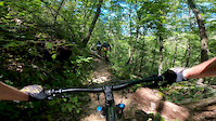
more stats
2.6 miles
Distance
896 ft
Climb
-326 ft
Descent
00:46:05
Avg time
569 ft
Altitude change
1,956 ft
Altitude min
2,603 ft
Altitude max
1,991 ft
Altitude start
2,560 ft
Altitude end
4.185%
Grade
-31.833%
Grade max
33.343%
Grade min
2 miles
Distance climb
4,053 ft
Distance down
76 ft
Distance flat
00:46:05
Avg time

Whiterock Gap Details

  • Activities
    • Mountain Bike
    • Hike
    • Trail Running
  • Riding Area
    Sherando Lake Area
    Sherando, Virginia
  • Difficulty Rating
  • Local Popularity
    100 in Mountain Biking [+]
    • 95 in Trail Running
    • 65 in Hiking
  • Global Ranking
    #29277 in Mountain Biking [+]
    • #89825 in Trail Running
    • #104504 in Hiking
  • State Ranking
    #181 in Mountain Biking · Virginia [+]
    • #757 in Trail Running
    • #1,024 in Hiking
  • Trail Type
    Singletrack
  • Direction
    Both Directions
    Popular Direction Shown
  • Climb Difficulty
    Blue
  • Physical Rating
    Hard
  • Dogs Allowed
    Yes

A long not too challenging climb from the lake to Whiterock Gap, or a very nice descent that isn't as technical as some of the other trails in the area.

Tags
Jumps

Trail Supporters

Local Trail Association

Traditionally Indigenous Territory

Recent Activity on Trail

Past Week
  • 0 rides
  •  
6 Months
  • 2 rides
  • 9 miles avg distance
All
  • 79 rides
  • Last: Oct 25, 2026
update trails status or condition

Whiterock Gap Trail Reports

statusdatedescription
Apr 7, 2026 @ 10:07pm (America/New_York)
Apr 7, 2026
Three trees down
Jan 11, 2026 @ 5:02pm (America/New_York)
Jan 11, 2026
The creek crossing near the bottom is pretty washed out.
Jun 27, 2025 @ 9:48am
Jun 27, 2025
A little bit grown over and a few small trees to hop but in good shape for the summer.
Mar 4, 2024 @ 2:16am
Mar 4, 2024
Feb 15, 2024 @ 7:01am
Feb 15, 2024
more »
Status:
on Apr 7, 2026
Ideal
Avg: 4.26 (10 votes)
Your vote: 0

view (547)
close
      Directions to whiterock-gap trailhead (37.918049, -79.018178)

      Photos

      3 more »
      report
      mtb
      47 |
      Apr 7, 2026 @ 7:07pm
      Apr 7, 2026
      report
      mtb
      44 |
      Apr 7, 2026 @ 7:07pm
      Apr 7, 2026
      report
      mtb
      37 |
      Apr 7, 2026 @ 7:07pm
      Apr 7, 2026

      Videos

      4 more »
      youtuber SHE'S NOT AFRAID TO GO FAST | Mountain Biking...
      mtb
      13:11 | 290 | Jan 10, 2022 , Sherando
      Biking down Whiterock Gap Trail at Sherando...
      mtb
      6:33 | 505 | Sep 27, 2020 , Sherando
      Torry Ridge Sherando - MTB Trail Peek - White...
      mtb
      18:38 | 248 | May 26, 2020 , Sherando
      Whiterock Gap
      mtb
      6:32 | 66 | Sep 6, 2020 , Sherando

      Routes with this trail

      12 miles • 1,885 ft • 2 • Loop •
      Birthday loop above Sherando Lake
      10 miles • 1,734 ft • 3 •
      8 miles • 1,759 ft • 1 • Point to Point •
      This is the easiest way to climb to the top of Bald Mtn where all the Sherando descents start.
      4.5 ★★★★★
      10 Ratings
      5 ★ 80%
      4 ★ 10%
      3 ★
      2 ★
      1 ★ 10%

      1 Review & Comments

      kdoggest
      There’s a tree down before getting to the slacks intersection.

      We hope you've been enjoying Trailforks!

      Create a FREE account to view all trail reviews and much more.

      • By brettn13TF Pro CAMBC & contributors
      • #84324 - 2,298 views

      Frequently Asked Questions

      ▼ Where is Whiterock Gap located?
      Whiterock Gap is located in Sherando Lake Area, Sherando, Virginia, United States. It is part of the Sherando Lake Area trail network. The trailhead is located at coordinates 37.91805, -79.01818.
      ▼ How hard is Whiterock Gap?
      Whiterock Gap is rated as Blue difficulty. The physical rating is Hard. The average grade is 4.185%. The climb difficulty is rated Blue.
      ▼ What is the elevation gain for Whiterock Gap?
      Whiterock Gap has 896 ft of elevation gain. The trail has 326 ft of elevation descent. The elevation ranges from 1,956 ft to 2,603 ft.
      ▼ Is Whiterock Gap a point to point trail?
      Whiterock Gap is not a point to point trail. The direction is Both Directions. The trail type is singletrack.
      ▼ How long is Whiterock Gap?
      Whiterock Gap is 2.6 miles long. The trail type is singletrack.
      ▼ Are dogs allowed on Whiterock Gap?
      Yes, dogs are allowed on Whiterock Gap. Please keep dogs on a leash where required and clean up after them.
      ▼ How do I access Whiterock Gap? Where is the closest parking trailhead?
      The closest parking and trailhead locations to Whiterock Gap are: View all parking locations in the area.
      ▼ How long does it take to ride Whiterock Gap?
      Based on recorded activities, it takes an average of 46 minutes to ride Whiterock Gap. The trail is 2.6 miles long. Actual times will vary based on fitness level, conditions, and pace. View recent activity logs for more details.
      ▼ How busy is Whiterock Gap?
      Whiterock Gap is a very popular trail. There have been 534 recorded activities on this trail. The trail has received 547 check-ins. View recent activity on this trail.

      Hit the Trail

      Open in App

      Get this trail on your phone instantly.

      open trail in app

      Download Trail

      Save to wishlist, Garmin & download.
      save the trail

      Find Related Routes

      Find routes and users activities that include this trail.
      find routes for this trail

      You must enter a description before submitting.


