

more stats
2,572 ft
Distance
5 ft
Climb
-295 ft
Descent
00:07:05
Avg time
-290 ft
Altitude change
464 ft
Altitude min
754 ft
Altitude max
754 ft
Altitude start
463 ft
Altitude end
-11.3%
Grade
-46.2%
Grade max
10.6%
Grade min
39 ft
Distance climb
2,411 ft
Distance down
66 ft
Distance flat
00:07:05
Avg time

Windies Right Details

  • Activities
    • Mountain Bike
    • E-Bike
    • Hike
    • Trail Running
  • Riding Area
    Randell Reserve
    Adelaide
  • Difficulty Rating
  • Voted Difficulty
    Black Diamond (2 votes)
  • Local Popularity
    75 in Mountain Biking [+]
    • 70 in E-Biking
    • 45 in Trail Running
    • 65 in Hiking
  • Global Ranking
    #53232 in Mountain Biking [+]
    • #33599 in E-Biking
    • #152130 in Trail Running
    • #137879 in Hiking
  • National Ranking
    #2,557 in Mountain Biking · Australia [+]
    • #2,344 in E-Biking
    • #5,103 in Trail Running
    • #4,429 in Hiking
  • Trail Type
    Singletrack
  • Bike Type
    DH
  • Direction
    Downhill Only
    Popular Direction Shown
  • Trail Visibility
    Always easy to follow
  • Dogs Allowed
    Yes
  • eBike Allowed
  • TTFs on Trail
    Berm, Drop, Jump, Gap Jump

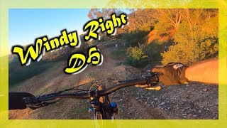
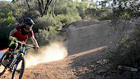
Technical Steep rock gardens in to burns collecting speed in to a choice of 4 jumps slowing down in to rock drop and switch backs.

Tags
BermsDropsJumpsRock gardens

Local Trail Association

Traditionally Indigenous Territory

Recent Activity on Trail

Past Week
  • 0 rides
  •  
6 Months
  • 5 rides
  • 8.2 km avg distance
All
  • 91 rides
  • Last: Oct 21, 2026
c1c2c3c4
January
February
March
April
May
June
July
August
September
October
November
December
update trails status or condition

Windies Right Trail Reports

statusdatedescription
Jan 10, 2026 @ 9:04am (Australia/Adelaide)
Jan 9, 2026
rock garden is super sandy and loose. everything else is as well
Dec 8, 2025 @ 8:42am (Australia/Adelaide)
Dec 7, 2025
Major erosion (major ruts or slumping, large boulders and roots exposed due to erosion)
Sep 20, 2025 @ 8:26am (Australia/Adelaide)
Sep 19, 2025
Feb 22, 2024 @ 8:36pm
Feb 22, 2024
running sweet
Jan 5, 2023 @ 5:19pm
Jan 5, 2023
more »
Status:
on Jan 10, 2026
Very Dry
Avg: 4.21 (8 votes)
Your vote: 0

view (953)
close
      Directions to windies-right trailhead (-35.000600, 138.608170)

      Photos

      10 more »
      mtb
      88 |
      Dec 5, 2025 @ 1:27pm
      Dec 5, 2025
      mtb
      120 |
      Dec 5, 2025 @ 1:27pm
      Dec 5, 2025
      mtb
      100 |
      Dec 5, 2025 @ 1:27pm
      Dec 5, 2025
      mtb
      151 |
      Nov 5, 2022 @ 4:40am
      Nov 5, 2022

      Videos

      4 more »
      Purples - Ando&s - Sleeps 1 - Windy Right...
      mtb
      8:12 | 1151 | Dec 4, 2019 , Adelaide
      Windy Right DH -  Adelaide MTB -
      mtb
      2:59 | 1047 | Jul 20, 2019 , Adelaide
      Jack Skewes - Windies DH
      mtb
      0:05 | 528 | Jul 1, 2017 , Adelaide
      WINDY'S | DAMIEN LORNIE
      mtb
      2:21 | 1012 | Feb 15, 2016 , Adelaide

      Routes with this trail

      44 miles • 7,397 ft • 36 • Point to Point •
      Start at Lofty and get in as many black runs as we can down to Flinders. Lunch at Belair finishing...
      1 mile • 28 ft • 10 • Shuttled •
      A route from the windy's trails to 4X.
      4.4 ★★★★★
      8 Ratings
      5 ★ 50%
      4 ★ 38%
      3 ★ 13%
      2 ★
      1 ★

      3 Reviews & Comments

      SQUIDY-1000
      Mostly pretty easy, other reviews exaggerate a bit. There is a random double black section about 30 seconds into the trail. The rest is super fun mellow tech.
      LucaswZK8Sw
      Top half is not for the faint hearted as the trail can go from easy going to double black rock chutes and with rocks all over the trail it makes it very hard to hard and the bottom is less rocky and more jumps that require some commitment to clear and gnarly rock gardens that will catch you off guard
      Aaronjohns7
      The top is steep, loose and rocky, then the lower section is a lot of fun with jumps, wall ride and rock drops.

      We hope you've been enjoying Trailforks!

      Create a FREE account to view all trail reviews and much more.

      • By toddTF Pro Trailforks & contributors
      • #15955 - 4,115 views

      Frequently Asked Questions

      ▼ Where is Windies Right located?
      Windies Right is located in Randell Reserve, Adelaide, Australia. It is part of the Randell Reserve trail network. The trailhead is located at coordinates -35.0006, 138.60817.
      ▼ How hard is Windies Right?
      Windies Right is rated as Black Diamond difficulty. The average grade is 11.3%.
      ▼ What is the elevation gain for Windies Right?
      Windies Right has 5 ft of elevation gain. The trail has 295 ft of elevation descent. The elevation ranges from 464 ft to 754 ft.
      ▼ Is Windies Right a point to point trail?
      Yes, Windies Right is a point to point trail. The direction is Downhill Only. The trail type is singletrack.
      ▼ How long is Windies Right?
      Windies Right is 2,572 ft long. The trail type is singletrack.
      ▼ Are dogs allowed on Windies Right?
      Yes, dogs are allowed on Windies Right. Please keep dogs on a leash where required and clean up after them.
      ▼ How do I access Windies Right? Where is the closest parking trailhead?
      The closest parking and trailhead locations to Windies Right are: View all parking locations in the area.
      ▼ How long does it take to ride Windies Right?
      Based on recorded activities, it takes an average of 7 minutes to ride Windies Right. The trail is 2,572 ft long. Actual times will vary based on fitness level, conditions, and pace. View recent activity logs for more details.
      ▼ How busy is Windies Right?
      Windies Right is a very popular trail. There have been 859 recorded activities on this trail. The trail has received 953 check-ins. View recent activity on this trail.

      Hit the Trail

      Open in App

      Get this trail on your phone instantly.

      open trail in app

      Download Trail

      Save to wishlist, Garmin & download.
      save the trail

      Find Related Routes

      Find routes and users activities that include this trail.
      find routes for this trail

      You must enter a description before submitting.