
more stats
4,321 ft
Distance
3 ft
Climb
-374 ft
Descent
00:06:46
Avg time
-371 ft
Altitude change
3,620 ft
Altitude min
3,992 ft
Altitude max
3,992 ft
Altitude start
3,622 ft
Altitude end
-8.6%
Grade
-29.8%
Grade max
7.7%
Grade min
56 ft
Distance climb
4,012 ft
Distance down
253 ft
Distance flat
00:06:46
Avg time

Wizard DH Details

  • Activities
    • Mountain Bike
    • E-Bike
    • Gravel Bike
    • Hike
    • Trail Running
  • Riding Area
    Cranbrook Community Forest
    Cranbrook, British Columbia
  • Ref Number
    #121
  • Difficulty Rating
  • Voted Difficulty
    Blue (1 vote)
  • Local Popularity
    70 in Mountain Biking [+]
    • 60 in E-Biking
    • 35 in Trail Running
    • 5 in Hiking
    • 5 in Gravel Biking
  • Global Ranking
    #85357 in Mountain Biking [+]
    • #37685 in E-Biking
    • #156911 in Trail Running
    • #326008 in Hiking
    • #23456 in Gravel Biking
  • Provincial Ranking
    #4,246 in Mountain Biking · British Columbia [+]
    • #2,565 in E-Biking
    • #9,691 in Trail Running
    • #13,330 in Hiking
    • #1,270 in Gravel Biking
  • Trail Type
    Singletrack
  • Bike Type
    AM, XC, Gravel
  • Direction
    Downhill Primary
    Popular Direction Shown
  • Climb Difficulty
    Blue
  • Physical Rating
    Moderate
  • Trail Visibility
    Always easy to follow
  • Dogs Allowed
    Yes
  • eBike Allowed
    Yes up to Class 1
  • TTFs on Trail
    Berm, Jump
  • Land Owner
    FLNROD

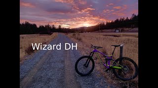
A narrow section of single track through dense trees, with lots of twists and turns. When paired with The Wizard or Pole 62 this trail becomes one of the longest descents in the Community forest.

Access Info

Access trail by one of three ways, directly from Wizard Connector; by riding Hobgoblin till the road then follow this road to the right till you hit the power lines, by riding directly up the power lines from Going up.

Tags
BermsJumpsTight and twisty

Local Trail Association

Traditionally Indigenous Territory

Recent Activity on Trail

Past Week
  • 0 rides
  •  
6 Months
  • 28 rides
  • 12 miles avg distance
All
  • 162 rides
  • Last: Oct 9, 2026
update trails status or condition

Wizard DH Trail Reports

statusdatedescription
Sep 27, 2026 @ 2:53pm (America/Edmonton)
Sep 27, 2026
Jun 13, 2026 @ 10:52am (America/Creston)
Jun 13, 2026
May 17, 2026 @ 11:33am (America/Creston)
May 17, 2026
Apr 19, 2026 @ 11:01am (America/Creston)
Apr 19, 2026
Apr 7, 2026 @ 5:01pm (America/Edmonton)
Apr 7, 2026
reporter CRANBROOK COMMUNITY FOREST OFFICIAL: We are now fully open. Beware of early season hazards as our trail crew continues to remove winter debris.
more »
Status:
on Sep 27, 2026
Ideal
Avg: 3.99 (3 votes)
Your vote: 0

view (399)
close
      Directions to wizard-dh trailhead (49.506830, -115.693790)

      Photos

      No photos have been added for Wizard DH yet, add a photo.

      Videos

      3 more »
      Wizard DH - Cranbrook Community Forest
      mtb
      0:48 | 293 | Nov 10, 2020 , Cranbrook
      mtb
      2:23 | 68 | May 7, 2022 , Cranbrook
      mtb
      0:26 | 24 | May 7, 2022 , Cranbrook
      4.0 ★★★★★
      3 Ratings
      5 ★
      4 ★ 100%
      3 ★
      2 ★
      1 ★

      1 Review & Comments

      lukelikesbikesandbeers lukelikesbikesandbeers
      Wicked fun descent. Would be even better with a both of a refresh/modernization and some bermed out corners, rollers etc! If that was to happen if come and lend a shovel Wink

      We hope you've been enjoying Trailforks!

      Create a FREE account to view all trail reviews and much more.

      • By canadakaTF Pro Trailforks & contributors
      • #105767 - 1,257 views

      Frequently Asked Questions

      ▼ Where is Wizard DH located?
      Wizard DH is located in Cranbrook Community Forest, Cranbrook, British Columbia, Canada. It is part of the Cranbrook Community Forest trail network. The trailhead is located at coordinates 49.50683, -115.69379.
      ▼ How hard is Wizard DH?
      Wizard DH is rated as Blue difficulty. The physical rating is Moderate. The average grade is 8.6%. The climb difficulty is rated Blue.
      ▼ What is the elevation gain for Wizard DH?
      Wizard DH has 3 ft of elevation gain. The trail has 374 ft of elevation descent. The elevation ranges from 3,620 ft to 3,992 ft.
      ▼ Is Wizard DH a point to point trail?
      Wizard DH is not a point to point trail. The direction is Downhill Primary. The trail type is singletrack.
      ▼ How long is Wizard DH?
      Wizard DH is 4,321 ft long. The trail type is singletrack.
      ▼ Are dogs allowed on Wizard DH?
      Yes, dogs are allowed on Wizard DH. Please keep dogs on a leash where required and clean up after them.
      ▼ How do I access Wizard DH? Where is the closest parking trailhead?
      The closest parking and trailhead locations to Wizard DH are: View all parking locations in the area.
      ▼ How long does it take to ride Wizard DH?
      Based on recorded activities, it takes an average of 7 minutes to ride Wizard DH. The trail is 4,321 ft long. Actual times will vary based on fitness level, conditions, and pace. View recent activity logs for more details.
      ▼ How busy is Wizard DH?
      Wizard DH is a very popular trail. There have been 392 recorded activities on this trail. The trail has received 399 check-ins. View recent activity on this trail.

      Hit the Trail

      Open in App

      Get this trail on your phone instantly.

      open trail in app

      Download Trail

      Save to wishlist, Garmin & download.
      save the trail

      Find Related Routes

      Find routes and users activities that include this trail.
      find routes for this trail

      You must enter a description before submitting.