more stats
1,186 ft
Distance
18 ft
Climb
-169 ft
Descent
660 ft
High Point
-151 ft
Altitude change
509 ft
Altitude min
660 ft
Altitude start
509 ft
Altitude end
-12.731%
Grade
-22.511%
Grade max
12.22%
Grade min
125 ft
Distance climb
1,031 ft
Distance down
30 ft
Distance flat

Zig Details

  • Activities
    • Mountain Bike
    • Hike
    • Trail Running
  • Riding Area
    Coedwig Dyfi Forest
    Machynlleth
  • Difficulty Rating
  • Local Popularity
    5 in Mountain Biking [+]
    • 5 in Trail Running
    • 5 in Hiking
  • Global Ranking
    #267565 in Mountain Biking [+]
    • #139536 in Trail Running
    • #133666 in Hiking
  • Trail Type
    Singletrack
  • Direction
    Downhill Primary
  • Physical Rating
    Moderate
  • Dogs Allowed
    Yes

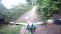
Links with Zig Zags, fast slippery down hill with roots, after initially passing a boggy section.

Status:
no votes yet
Your vote: 0

view (0)

This trail is missing GPS data, you can help by uploading a GPS track of Zig here.

update trails status or condition

Zig Trail Reports

no reports have been added for Zig yet, add a trail report.
Trail reports are used to indicate a trails current condition and inform builders and other riders about any issues on a trail.

Photos

14 more »
267 |
Jul 20, 2015 @ 2:37pm
Jul 20, 2015
357 |
Jul 21, 2015 @ 10:41am
Jul 21, 2015
216 |
Dec 20, 2009 @ 2:16pm
Dec 20, 2009
195 |
Apr 16, 2010 @ 12:03pm
Apr 16, 2010

Videos

4 more »
commentary from blue turtle crew
0:28 | 60 | Sep 8, 2015 , Machynlleth
A couple of runs at PORC
3:59 | 217 | May 18, 2015 , Machynlleth
Zig Zags
0:59 | 234 | Jun 21, 2015 , Machynlleth
PORC zig zag line
0:15 | 89 | Nov 1, 2014 , Machynlleth

Reviews / Comments

No reviews yet, be the first to write a review or ask a question.
Use trail reports to comment on trail conditions.


We hope you've been enjoying Trailforks!

Create a FREE account to view trail comments and much more.

  • By shem & contributors
  • #45990 - 1,702 views

Frequently Asked Questions About Zig

Where is Zig located?
Zig is located in Coedwig Dyfi Forest, Machynlleth, United Kingdom. It is part of the Coedwig Dyfi Forest trail network.
How hard is Zig?
Zig is rated as Black Diamond difficulty. The physical rating is Moderate. The average grade is 12.731%.
What is the elevation gain for Zig?
Zig has 18 ft of elevation gain. The trail has 169 ft of elevation descent. The elevation ranges from 509 ft to 660 ft.
Is Zig a point to point trail?
Zig is not a point to point trail. The direction is Downhill Primary. The trail type is singletrack.

Hit the Trail

Open in App

Get this trail on your phone instantly.
open trail in app

Download Trail

Save to wishlist, Garmin & download.
save the trail

Find Related Routes

Find routes and users activities that include this trail.
find routes for this trail

You must enter a description before submitting.