
close
3D
Trail Conditions
- Unknown
- Snow Groomed
- Snow Packed
- Snow Covered
- Snow Cover Partial
- Freeze/thaw Cycle
- Icy
- Prevalent Mud
- Wet
- Variable
- Ideal
- Dry
- Very Dry
Trail Flow (Ridden Direction)
Trailforks scans users activity logs to determine the most popular direction each trail is ridden. A good flowing trail network will have most trails flowing in a single direction according to their intension.
The colour categories are based on what percentage of users are riding a trail in its intended direction.
The colour categories are based on what percentage of users are riding a trail in its intended direction.
- > 96%
- > 90%
- > 80%
- > 70%
- > 50%
- < 50%
- bi-directional trail
- no data
Trail Last Used
Trailforks scans activity logs to determine the last time a trail was ridden.
- < 2 days
- < 1 week
- < 2 weeks
- < 1 month
- < 6 months
- > 6 months
Trail Ridden Direction
The intended direction a trail should be ridden.
- Downhill Only
- Downhill Primary
- Both Directions
- Uphill Primary
- Uphill Only
- One Direction
Contribute Details
Colors indicate trail is missing specified detail.
- Description
- Photos
- Description & Photos
- Videos
Trail Popularity ?
Trailforks scans activity logs to determine which trails are ridden the most in the last 9 months.
Trails are compared with nearby trails in the same city region with a possible 25 colour shades.
Think of this as a heatmap, more activities = more kinetic energy = warmer colors.
- most popular
- popular
- less popular
- not popular
ATV/ORV/OHV Filter
Max Vehicle Width
inches
US Cell Coverage
Legend

Radar Time
Activity Recordings
Trailforks uses anonymized public activity data.
?
Activity Recordings
Trailforks uses anonymized public activity data.
?
Winter Trails
Warning
A routing network for winter maps does not exist. Selecting trails using the winter trails layer has been disabled.
Missing Trails
Most Popular
Least Popular
Trails are colored based on popularity. The more popular a trail is, the more red. Less popular trails trend towards green.
Jump Magnitude Heatmap
Heatmap of where users jump on trails. Zoom in to see individual jumps, click circles to view jump details.
BC Backroad Status
![map legend]()
Service Road Atlas is a free to use, community-driven service for viewing and creating reports on the numerous back-country service roads around B.C. and Alberta.

Slope Aspect
Direction the slope faces
Trails Deemphasized
Trails are shown in grey.
Only show trails with no bike usage.
Suggested Layers
Based on selected activity type
Save the current map location and zoom level as your default home location whenever this page is loaded.
SaveMachynlleth trails and routes are listed on Trailforks with interactive trail maps, difficulty ratings, photos, and user-reported trail conditions. The Trailforks community has mapped hundreds of trails and shared hundreds of photos in this region. Supported activity types include Mountain Biking, Hiking, Trail Running, E-Biking, Gravel Biking, Horseback, Adaptive Biking and Winter Fat Biking. Trails here are often rooty, faint trail and rocky. Scenery includes views and ridgelines. Common trail features include berms, drops and rock gardens. Many trails are family friendly. Popular destinations include Coedwig Dyfi Forest, Rhiwlwyfen and Abercegir Caban and Beudy Banc.
This is an auto-generated description of Machynlleth.
Login or register to submit a custom description.
This region uses the Uk/Euro style trail grading system.
Trail info last updated
Activities Click to view
- Mountain Bike
133 trails
- E-Bike
91 trails
- Gravel Bike
65 trails
- Adaptive Bike
30 trails
- Winter Fat Bike
22 trails
- Horse
42 trails
- Hike
99 trails
- Trail Running
99 trails
Region Details
- 42
- 4
- 12
- 35
- 33
- 4
Region Status
Caution as of Nov 13, 2026Stats
- Avg Trail Rating
- Trails (view details)
- 143
- Trails Mountain Bike
- 133
- Trails E-Bike
- 91
- Trails Gravel Bike
- 65
- Trails Adaptive Bike
- 30
- Trails Winter Fat Bike
- 22
- Trails Horse
- 42
- Trails Hike
- 99
- Trails Trail Running
- 99
- Trails Dirtbike/Moto
- 1
- Total Distance
- 146 miles
- Total Descent
- 42,438 ft
- Total Vertical
- 2,802 ft
- Highest Trailhead
- 2,851 ft
- Reports
- 466
- Photos
- 213
- Completed Counter
- 25,601
Articles
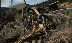
Must Watch: Gee Atherton Turns Storm-Shattered Dyfi Hillside Into A Wild New Line in ‘Windfell’
Nov 27, 2025 from pinkbike.com
Gee is a certified freak on the bike.

Video: Jim Monro Tears Up a Freshly Groomed Dyfi Bikepark
Jul 7, 2025 from pinkbike.com
Jim Monro, fresh turns, packed lips, and an empty Dyfi Bikepark. That's some good watching.
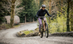
Video: Becci Skelton Everesting at Dyfi Bike Park For A Good Cause.
Jul 2, 2025 from pinkbike.com
25 laps up and down the gruelling trails of Dyfi. This is a rad effort.
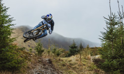
Video: Dan and Gee Atherton Test the S.200 on Home Soil
Mar 5, 2025 from pinkbike.com
It’s always rad to see the Atherton brothers swinging a leg over their own machines and shredding together.
Sub Regions
-
Abercegir Caban and Beudy Banc
- 1
-
Coedwig Dyfi Forest
- 3
- 9
- 34
- 29
- 3
-
Rhiwlwyfen
- 1
Popular Machynlleth Mountain Biking Trails
• 100 ★ 4.7 • 2 miles • 0 ft • 1,084 •
Rail the berms & enjoy that flowing feeling then launch yourself into some small but perfectly formed jumps before finishing with more berms and the flat-out exhilaration of riding the shred road!
• 100 ★ 4.0 • 1,847 ft • 0 ft • 971 •
Popular red difficulty mixed. This mountain bike primary trail can be used downhill only. It features berm, drop and jump. On average it takes 3 minutes to complete this trail.
• 100 ★ 4.7 • 509 ft • 0 ft • 904 •
Steep and natural berms which join onto the race track lower
• 100 ★ 5.0 • 3,566 ft • 31 ft • 777 •
Original DH starts out technical with rocky, rooty drops and berms then gets fast and fun, spitting you out into three big table tops before sending you over the iconic bridges. Try the Road Gap, then step up onto the largest roundwood...
• 100 ★ 4.6 • 2 miles • 20 ft • 774 •
50 Hits starts in the path of the RAF Low Fly Zone, with over 8 mins of flowing table tops this track is best suited to Enduro bikes.
• 95 ★ 4.8 • 2 miles • 27 ft • 749 •
Fast rocky sections lead into 3 table tops before dropping into tight corners that shoot you into more tight corners. Bermed and rutted, with natural senders and flat out bus stops, this track races down hill at a perfect gradient and...
• 95 ★ 4.9 • 2 miles • 39 ft • 718 •
Section 8 of Climachx. One of the longest purpose built, unbroken downhill descents in the UK with a tricky rock garden climb to earn your reward.
Machynlleth Mountain Bike Routes
★ 4.0 • 9 miles • 1,911 ft • 10 • Loop •
The cli-machx was built in 2005 and is sited in the Dyfi forest; now looked after by Beicio Mynydd Dyfi...
★ 4.0 • 8 miles • 1,452 ft • 3 •
This route takes in the start of the Mach 1 trail and adds in 2 slightly off-piste red runs: Star Wars and...
★ 4.0 • 24 miles • 4,226 ft • 10 • Loop •
The Best of Dyfi's official unofficial trails! A fantastic day on the bike!
121 miles • 12,571 ft • 7 • Point to Point •
From enticing lost lanes meandering through valleys to forest tracks or moorland trails climbing up to...
★ 4.0 • 13 miles • 1,329 ft • 0 • Loop •
This is a fast rather than technical trail, taking you steeply upwards and fast downwards with some epic...
★ 3.7 • 14 miles • 1,785 ft • 0 • Loop •
The classic cross country mountain biking trail: This trail offers a perfect mix of XC riding, the taxing...
Photos of Machynlleth Mountain Bike
Videos of Machynlleth Mountain Bike
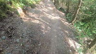
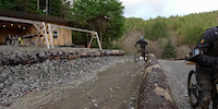
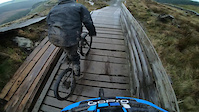
Recent Trail Reports
| status | trail | date | condition | info | user |
|---|---|---|---|---|---|
| Cadair Idris | Nov 13, 2026 @ 11:38am (Europe/Isle_of_Man) Nov 13, 2026 | Variable | RadBikeBro NCTC | ||
| Deck the Halls | Sep 16, 2026 @ 12:05pm (Europe/London) Sep 16, 2026 | Wet | Malcgreen | ||
| Forest Road | Aug 26, 2026 @ 7:55am (Europe/London) Aug 25, 2026 | Wet | Vimto-North | ||
| Forest Road | Aug 26, 2026 @ 7:55am (Europe/London) Aug 25, 2026 | Wet | Vimto-North | ||
| Forest Road | Aug 26, 2026 @ 7:55am (Europe/London) Aug 25, 2026 | Wet | Vimto-North | ||
| Forest trail to top | Aug 26, 2026 @ 7:55am (Europe/London) Aug 25, 2026 | Wet | Vimto-North | ||
| Final Forest Rd | Aug 26, 2026 @ 7:55am (Europe/London) Aug 25, 2026 | Wet | Vimto-North | ||
| Tony the Tiger | Aug 26, 2026 @ 7:55am (Europe/London) Aug 25, 2026 | Wet | Vimto-North | ||
| Where's My Ball | Aug 26, 2026 @ 7:55am (Europe/London) Aug 25, 2026 | Wet | Vimto-North | ||
| Better Late Than Never | Aug 26, 2026 @ 7:55am (Europe/London) Aug 25, 2026 | Wet | Vimto-North |
Activity Feed
| username | action | type | title | date |
|---|---|---|---|---|
| tomparker13 | add | photo | activity #107797431 and 4 more | Nov 14, 2026 @ 3:42pm 3 days |
| aag87 | difficultyvote | trail | activity #107740541 | Nov 13, 2026 @ 11:13pm Nov 13, 2026 |
| aag87 | ridden | trail | activity #107740522 | Nov 13, 2026 @ 11:11pm Nov 13, 2026 |
| aag87 | ridden | trail | activity #107740506 and 2 more | Nov 13, 2026 @ 11:10pm Nov 13, 2026 |
| RadBikeBro | add | report | activity #107708742 | Nov 13, 2026 @ 8:23am Nov 13, 2026 |
Recent Comments
| username | type | title | comment | date |
|---|---|---|---|---|
| trail | no longer passable, completely overgrown with... | Aug 9, 2026 @ 8:28am Aug 9, 2026 | ||
| trail | Shit trail! Scree all over the place! No fun... | Jul 29, 2026 @ 10:07am Jul 29, 2026 | ||
| trail | Blue Trail (couple of light red spots)... | Jul 26, 2026 @ 1:54am Jul 26, 2026 | ||
| report | Quite a few trees down100m from top… not... | Jul 13, 2025 @ 2:23am Jul 13, 2025 | ||
| trail | Totally unrideable. | Jul 6, 2025 @ 7:09am Jul 6, 2025 |
Local Badges
-

10 Black Trails22 awarded -

Epic Ride Climb 2k1,748 awarded -

Climbing 10k Badge219 awarded -

Climbing 100k Badge4 awarded -

Epic Ride Descent 2k2,041 awarded -

Descent 10k Badge261 awarded

Activity Type Stats
| activitytype | trails | distance | descent | descent distance | total vertical | rating | global rank | state rank | photos | reports | routes | activity logs |
|---|---|---|---|---|---|---|---|---|---|---|---|---|
| Mountain Bike | 133 | 132 miles | 41,280 ft | 78 miles | 2,802 ft | #782 | #32 | 210 | 466 | 12 | 11,758 | |
| E-Bike | 91 | 98 miles | 28,691 ft | 57 miles | 2,802 ft | #1,275 | #54 | 373 | 2 | 1,633 | ||
| Gravel Bike | 65 | 89 miles | 14,419 ft | 40 miles | 2,684 ft | #615 | #28 | 99 | 2 | 97 | ||
| Adaptive Bike | 30 | 56 miles | 7,343 ft | 23 miles | 1,086 ft | #1,121 | #26 | 48 | 1 | |||
| Winter Fat Bike | 22 | 40 miles | 6,952 ft | 20 miles | 1,230 ft | #965 | #30 | 89 | ||||
| Horse | 42 | 56 miles | 10,230 ft | 27 miles | 1,289 ft | #584 | #23 | 85 | ||||
| Hike | 99 | 120 miles | 27,333 ft | 60 miles | 2,802 ft | #1,759 | #37 | 3 | 414 | 861 | ||
| Trail Running | 99 | 120 miles | 27,333 ft | 60 miles | 2,802 ft | #1,377 | #31 | 414 | 149 | |||
| Dirtbike/Moto | 1 | 4,364 ft | 89 ft | 2,913 ft | 89 ft | 82 |
Frequently Asked Questions
▼
What are the best places to ride in Machynlleth?
Machynlleth has 3 areas to explore for mountain biking. The top rated areas are:
▼
What are the highest rated mountain biking trails in Machynlleth?
The highest rated mountain biking trails in Machynlleth are:
- Tony the Tiger (4.6/5)
- Whiterocks (4.4/5)
- Gravity Elephant (4.4/5)
- World Cup (4.4/5)
- Star Wars (4.4/5)
▼
What is the best time of the year to ride in Machynlleth?
Based on activity log data, the most popular months to ride in Machynlleth are:
- May (131 activities)
- August (115 activities)
- July (99 activities)
▼
Where can I park to ride in Machynlleth?
There are 10 parking locations listed in Machynlleth. The most popular parking spots are: View all parking and trailhead locations on the map to plan your visit.
▼
What is the longest trail in Machynlleth?
The longest trail in Machynlleth is Over Tarren to Rhyd yr Onen at 5.5 miles. View all trails sorted by distance.
▼
What are the best & highest rated hiking trails in Machynlleth?
The best hiking trails in Machynlleth are:
- Cadair Idris
- Minfford Path
- Llanfihangel
- Tarren Hendre to tarren Gessail ridge
- The Old Rectory Bridleway
▼
What are the best & highest rated trail running trails in Machynlleth?
The best trail running trails in Machynlleth are:
- Gorse Gorse Go Away!
- Foel Lwyd Travers
- Mach 1 First Bridleways
- Deadmans / Caecenau Bridleway
- Steep Bridleway
▼
How many trails are in Machynlleth?
Machynlleth has a total of 143 trails. Of those, 133 are designated for mountain biking. Browse top mountain biking trails in Machynlleth to find detailed information including difficulty ratings, distances, and trail conditions.
▼
Which trail has the most elevation gain in Machynlleth?
The trail with the most elevation gain in Machynlleth is Over Tarren to Rhyd yr Onen with 1,168 ft of elevation gain. View all trails sorted by elevation gain.
▼
Which trail has the most elevation descent in Machynlleth?
The trail with the most elevation descent in Machynlleth is Cadair Idris with 1,795 ft of elevation descent. View all trails sorted by elevation descent.
▼
What activities are most popular in Machynlleth?
Machynlleth supports the following activities: Mountain Biking, E-Biking, Gravel Biking, Adaptive Biking, Winter Fat Biking, Horseback, Hiking, Trail Running.
▼
What are the steepest mountain biking trails in Machynlleth?
The steepest mountain biking trail in Machynlleth is Pentre Climb / Bridleway with an average grade of 13.9%. View all trails sorted by grade.
▼
What trails have the biggest jumps in Machynlleth?
The trails with the biggest jumps in Machynlleth are: Browse all mountain bike trails to find trails with jumps and technical features.
▼
Are the trails open in Machynlleth?
The overall region status for Machynlleth is Minor Issue / Yellow. Out of 77 trails:
- Clear / Green: 59
- Minor Issue / Yellow: 11
- Significant Issue / Amber: 6
- Closed: 1
▼
What are the trail conditions in Machynlleth?
Based on trail reports from the past week in Machynlleth:
- Variable: 1 trail
▼
Can I ride an ebike in Machynlleth?
Yes, Machynlleth supports e-bike riding. There are 85 trails in Machynlleth that allow e-bikes. Check the e-bike trails listing for specific trail access details and any local regulations.
▼
What are the most popular mountain biking routes in Machynlleth?
The most popular mountain biking routes in Machynlleth are: View all mountain biking routes in Machynlleth.
▼
What type of bike is most common in Machynlleth?
Based on activity log data, the most common bike types used in Machynlleth are:
- AM (41 activities)
- DH (1 activities)
▼
What is the highest summit in Machynlleth?
The highest summit in Machynlleth is Cadair Idris at 2,874 ft elevation.
▼
What are the most popular Strava Segments in Machynlleth?
The most popular Strava segments in Machynlleth are:
- Climax Descent - north shore to end (7,171 athletes)
- Tony the Tiger.. I think. (7,098 athletes)
- Clmachx Final Descent Singletrack (6,984 athletes)
▼
What trails are closed in Machynlleth?
There are currently 1 closed trails in Machynlleth. The breakdown of all trail statuses is:
- Clear / Green: 59
- Minor Issue / Yellow: 11
- Significant Issue / Amber: 6
- Closed: 1
▼
Are there accessible or adaptive trails in Machynlleth?
Yes, there are 31 accessible/adaptive trails in Machynlleth. View all adaptive trails in Machynlleth for specific accessibility information.
▼
What are the most popular mountain biking trails in Machynlleth?
The most popular mountain biking trails in Machynlleth are: View all mountain biking trails sorted by popularity.
▼
What are the best beginner ride trails in Machynlleth?
The best beginner mountain biking trails in Machynlleth are:
- The Old Rectory Bridleway (0/5)
- Straight Shooter (0/5)
- Foel Lwyd Travers (0/5)
Activities
Trails
- By brenthillier
 NSMBA TRAILFORKS & contributors
- Admins: apply
- #7082 - 11,410 views
- machynlleth activity log | embed map of Machynlleth mountain bike trails | machynlleth mountain biking points of interest
Downloading of trail gps tracks in kml & gpx formats is enabled for Machynlleth.
You must login to download files.
