Listed from Green to Pro Line
- Mountain Bike
Login to see your progress towards riding all the trails and routes in this list.
Trails
| title | riding area | rating | distance | completed | |||
|---|---|---|---|---|---|---|---|
| 1 | Skyline | 3,770 ft | |||||
| 2 | Pandani | 3,619 ft | |||||
| 3 | Clifftop | 817 ft | |||||
| 4 | Green Room | 1 mile | |||||
| 5 | Midline | 2 miles | |||||
| 6 | Scandinavia | 2,037 ft | |||||
| 7 | Showtime | 974 ft | |||||
| 8 | Tyenna | 1,283 ft | |||||
| 9 | Evergreen | 4,505 ft | |||||
| 10 | Wattle Grove | 1,637 ft | |||||
| 11 | Dirt Surfer | 2 miles | |||||
| 12 | Spirit Quest | 1,102 ft | |||||
| 13 | Marriotts | 4,747 ft | |||||
| 14 | Tea Trees | 2,566 ft | |||||
| 15 | Beach Babe | 2,874 ft | |||||
| 16 | Vista | 1 mile | |||||
| 17 | Waratah | 3,967 ft | |||||
| 18 | Outer Limits | 2 miles | |||||
| 19 | Creekside | 1,371 ft | |||||
| 20 | Beef Chief | 1,778 ft | |||||
| 21 | Dial It Down | 2,566 ft | |||||
| 22 | Moss Boss | 2,477 ft | |||||
| 23 | Eastside | 1,670 ft | |||||
| 24 | Flight School | 1,417 ft | |||||
| 25 | MIA | 1,539 ft | |||||
| 26 | Wedgetail | 1,417 ft | |||||
| 27 | Super Funk | 2,444 ft | |||||
| 28 | Colour Blind | 1,181 ft | |||||
| 29 | Handi Scandi | 892 ft | |||||
| 30 | South Crescent | 1,565 ft | |||||
| 31 | Keep It Natural | 1,683 ft | |||||
| 32 | Drop Zone | 469 ft | |||||
| 33 | Even Flow | 1,460 ft | |||||
| 34 | Moss Def | 2,487 ft | |||||
| 35 | Sideshow Bob | 1,988 ft | |||||
| 36 | Styx & Stones | 1,467 ft | |||||
| 37 | King Brown | 1,654 ft | |||||
| 38 | Wicked Styx | 1,096 ft | |||||
| 39 | Supercross | 2,014 ft | |||||
| 40 | Billy Bob | 1,939 ft | |||||
| 41 | Old Mate Cobba | 1,293 ft | |||||
| 42 | Funky Cold Maydena | 1,378 ft | |||||
| 43 | Pamela | 883 ft | |||||
| 44 | The Local | 5,125 ft | |||||
| 45 | Handi Link | 190 ft | |||||
| 46 | Blow In | 443 ft | |||||
| 47 | Upper Cut | 492 ft | |||||
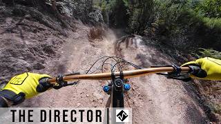
| 48 | The Director | 906 ft | |||||
| 49 | Exit Strategy | 246 ft | |||||
| 50 | Natures Nectar | 1,119 ft | |||||
| 51 | Inferno | 564 ft | |||||
| 52 | Orbit | 627 ft | |||||
| 53 | Yeah Gnar | 1,555 ft | |||||
| 54 | OTT | 2,067 ft | |||||
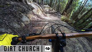
| 55 | Dirt Church | 1,365 ft | |||||
| 56 | Thrash Horse | 1,726 ft | |||||
| 57 | Top Gun | 1,007 ft | |||||
| 58 | The Nunnery | 863 ft | |||||
| 59 | Gnar Yeah | 1,841 ft | |||||
| 60 | Maxed Out | 331 ft | |||||
| 61 | Zen Garden | 1,115 ft | |||||
| 62 | Maydena Hits | 787 ft | |||||
| 63 | Big Hips | 1,014 ft |
Displaying 63
Videos

2:41 |
19 |
Apr 24, 2026 , Maydena
0:31 |
20 |
Apr 24, 2026 , Maydena
0:27 |
52 |
Apr 24, 2026 , Maydena
Recent Trail Reports
| status | trail | date | condition | |
|---|---|---|---|---|
| Flight School | Apr 2, 2026 @ 4:36pm (Australia/Hobart) Apr 1, 2026 | view | ||
| Marriotts | Mar 23, 2026 @ 6:41pm (Australia/Hobart) Mar 23, 2026 | view | ||
| Waratah | Mar 23, 2026 @ 6:39pm (Australia/Hobart) Mar 23, 2026 | view | ||
| Pandani | Mar 23, 2026 @ 6:36pm (Australia/Hobart) Mar 23, 2026 | view | ||
| Moss Boss | Mar 9, 2025 @ 4:09pm Mar 9, 2025 | view |
Total Trails
63
Total Distance
26 miles
Total Descent
-18,824 ft
Total Climb
1,369 ft
close
-
Layers w
- Weather Layers
- Pro
- Pro
- Pro
- Pro
- Pro
- Pro
- More Layers
- Pro
- Pro
- Pro
- Pro
-
Upgrade to

3D
Trail Conditions
- Unknown
- Snow Groomed
- Snow Packed
- Snow Covered
- Snow Cover Partial
- Freeze/thaw Cycle
- Icy
- Prevalent Mud
- Wet
- Variable
- Ideal
- Dry
- Very Dry
Trail Flow (Ridden Direction)
Trailforks scans users ridelogs to determine the most popular direction each trail is ridden. A good flowing trail network will have most trails flowing in a single direction according to their intension.
The colour categories are based on what percentage of riders are riding a trail in its intended direction.
The colour categories are based on what percentage of riders are riding a trail in its intended direction.
- > 96%
- > 90%
- > 80%
- > 70%
- > 50%
- < 50%
- bi-directional trail
- no data
Trail Last Ridden
Trailforks scans ridelogs to determine the last time a trail was ridden.
- < 2 days
- < 1 week
- < 2 weeks
- < 1 month
- < 6 months
- > 6 months
Trail Ridden Direction
The intended direction a trail should be ridden.
- Downhill Only
- Downhill Primary
- Both Directions
- Uphill Primary
- Uphill Only
- One Direction
Contribute Details
Colors indicate trail is missing specified detail.
- Description
- Photos
- Description & Photos
- Videos
Trail Popularity ?
Trailforks scans ridelogs to determine which trails are ridden the most in the last 9 months.
Trails are compared with nearby trails in the same city region with a possible 25 colour shades.
Think of this as a heatmap, more rides = more kinetic energy = warmer colors.
- most popular
- popular
- less popular
- not popular
ATV/ORV/OHV Filter
Max Vehicle Width
inches
US Cell Coverage
Legend

Radar Time
Activity Recordings
Trailforks uses anonymized public activity data.
?
Activity Recordings
Trailforks uses anonymized public activity data.
?
Personal Heatmap
▶
Activity Types
all
/
none
▶
Options
2
Date range
month
–
Winter Trails
Warning
A routing network for winter maps does not exist. Selecting trails using the winter trails layer has been disabled.
Missing Trails
Most Popular
Least Popular
Trails are colored based on popularity. The more popular a trail is, the more red. Less popular trails trend towards green.
Jump Magnitude Heatmap
Heatmap of where riders jump on trails. Zoom in to see individual jumps, click circles to view jump details.
BC Backroad Status
![map legend]()
Service Road Atlas is a free to use, community-driven service for viewing and creating reports on the numerous back-country service roads around B.C. and Alberta.

Slope Aspect
Direction the slope faces
Trails Deemphasized
Trails are shown in grey.
Only show trails with no bike usage.
Suggested Layers
Based on selected activity type
Save the current map location and zoom level as your default home location whenever this page is loaded.
Save
Trail transparency
Average difficulty
Trails and Routes in List - Distance by Difficulty
Trails and Routes in List - Difficulty Totals
- By kyleluvsdh

- #424 - 1,272 views