close
-
Layers w
- Weather Layers
- Pro
- Pro
- Pro
- Pro
- Pro
- Pro
- More Layers
- Pro
- Pro
- Pro
- Pro
-
Upgrade to

3D
Trail Conditions
- Unknown
- Snow Groomed
- Snow Packed
- Snow Covered
- Snow Cover Partial
- Freeze/thaw Cycle
- Icy
- Prevalent Mud
- Wet
- Variable
- Ideal
- Dry
- Very Dry
Trail Flow (Ridden Direction)
Trailforks scans users ridelogs to determine the most popular direction each trail is ridden. A good flowing trail network will have most trails flowing in a single direction according to their intension.
The colour categories are based on what percentage of riders are riding a trail in its intended direction.
The colour categories are based on what percentage of riders are riding a trail in its intended direction.
- > 96%
- > 90%
- > 80%
- > 70%
- > 50%
- < 50%
- bi-directional trail
- no data
Trail Last Ridden
Trailforks scans ridelogs to determine the last time a trail was ridden.
- < 2 days
- < 1 week
- < 2 weeks
- < 1 month
- < 6 months
- > 6 months
Trail Ridden Direction
The intended direction a trail should be ridden.
- Downhill Only
- Downhill Primary
- Both Directions
- Uphill Primary
- Uphill Only
- One Direction
Contribute Details
Colors indicate trail is missing specified detail.
- Description
- Photos
- Description & Photos
- Videos
Trail Popularity ?
Trailforks scans ridelogs to determine which trails are ridden the most in the last 9 months.
Trails are compared with nearby trails in the same city region with a possible 25 colour shades.
Think of this as a heatmap, more rides = more kinetic energy = warmer colors.
- most popular
- popular
- less popular
- not popular
ATV/ORV/OHV Filter
Max Vehicle Width
inches
US Cell Coverage
Legend

Radar Time
Activity Recordings
Trailforks uses anonymized public activity data.
?
Activity Recordings
Trailforks uses anonymized public activity data.
?
Personal Heatmap
▶
Activity Types
all
/
none
▶
Options
2
Date range
month
–
Winter Trails
Warning
A routing network for winter maps does not exist. Selecting trails using the winter trails layer has been disabled.
Missing Trails
Most Popular
Least Popular
Trails are colored based on popularity. The more popular a trail is, the more red. Less popular trails trend towards green.
Jump Magnitude Heatmap
Heatmap of where riders jump on trails. Zoom in to see individual jumps, click circles to view jump details.
BC Backroad Status
![map legend]()
Service Road Atlas is a free to use, community-driven service for viewing and creating reports on the numerous back-country service roads around B.C. and Alberta.

Slope Aspect
Direction the slope faces
Trails Deemphasized
Trails are shown in grey.
Only show trails with no bike usage.
Suggested Layers
Based on selected activity type
Save the current map location and zoom level as your default home location whenever this page is loaded.
Save
No description for Alpine has been added yet!
Login or register to submit one.
Links
Activities Click to view
- Mountain Bike
81 trails
- E-Bike
71 trails
- Gravel Bike
0 trails
- Adaptive Bike
0 trails
- Horse
11 trails
- Hike
89 trails
- Trail Running
91 trails
- Snowshoe
2 trails
Region Details
- 5
- 8
- 17
- 32
- 4
- 1
Region Status
Open as of Jun 16, 2026Stats
- Avg Trail Rating
- Trails (view details)
- 89
- Trails Mountain Bike
- 84
- Trails E-Bike
- 71
- Trails Horse
- 11
- Trails Hike
- 90
- Trails Trail Running
- 91
- Trails Snowshoe
- 2
- Trails Nordic Ski
- 1
- Total Distance
- 78 miles
- Total Descent
- 18,819 ft
- Total Vertical
- 6,371 ft
- Highest Trailhead
- 11,079 ft
- Reports
- 2,364
- Photos
- 381
- Ridden Counter
- 44,978
Sub Regions
-
Lambert Park
- 1
- 17
- 33
- 3
- 1
Popular Alpine Mountain Biking Trails
• 100 ★ 4.5 • 3,924 ft • 5 ft • 1,487 •
The jewel of Lambert Park, a blast from top to bottom. Fast flowing, banked turns, bridge crossings, a few little jumps. Recommend starting at the top of . To start from the Rodeo, you are cutting the sweetness in half.
• 100 ★ 3.3 • 2,674 ft • 165 ft • 1,406 •
As implied, great way to get up to Rodeo, though is probably just as good or better. Easier spin up this way though.
• 85 ★ 4.5 • 3 miles • 837 ft • 1,316 •
New Trail in Corner Canyon, may not be officially open yet, and terminates near the sliding rock because of a missing bridge. Hopefully this trail will punch through to Alpine soon. Update: The bridge is in place and open as of 4/10/2018
• 85 ★ 3.4 • 1,250 ft • 0 ft • 1,088 •
Great flowy trail to use to access from the sourth.
• 90 ★ 2.8 • 272 ft • 0 ft • 1,030 •
Popular blue difficulty singletrack. This mountain bike primary trail can be used both directions. On average it takes minutes to complete this trail.
• 55 ★ 2.5 • 2,224 ft • 203 ft • 892 •
If you're looking for a non-technical, quick, and boring way to the top of Rodeo this is your trail.
• 65 ★ 3.8 • 3,061 ft • 31 ft • 857 •
This nice option off of provides you with a bunch of twists and turns many of which are a bit technical to maneuver. Be careful and watch out for folks bombing down Rodeo or take the rest of Rodeo when the trails cross.
Alpine Mountain Bike Routes
Ruin the Rodeo Featured
★ 3.5 • 5 miles • 586 ft • 23 • Loop •
So technically you do Rodeo first and finish off with . This route includes many small trails, but the 2...
★ 4.0 • 6 miles • 861 ft • 1 • Loop •
One of my typical rides. Nice loop with some downhill.
22 miles • 3,756 ft • 10 • Point to Point •
This route is a cross-country tour across the Corner Canyon riding area from Alpine to Traverse Mountain...
24 miles • 4,312 ft • 18 • Loop •
Connect the South side of Canyon Canyon with the North side of Corner Canyon and Traverse Mountain, one...
40 miles • 5,156 ft • 28 • Loop •
40 mile route through the Corner Canyon and Lambert Park Trail Systems. All blue and green trails with...
5 miles • 589 ft • 23 • Loop •
So technically you do Rodeo first and finish off with . This route includes many small trails, but the 2...
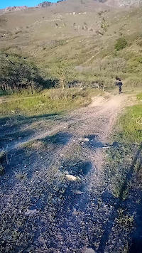
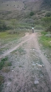
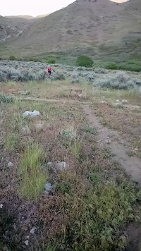
Photos of Alpine Mountain Bike
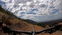
Videos of Alpine Mountain Bike
trail: Lambert Access
0:05 |
80 |
Jan 22, 2023
trail: Lambert Access
0:05 |
46 |
Jan 22, 2023
trail: Lambert Access
0:08 |
105 |
Jan 16, 2023
trail: Fort Canyon
2:23 |
108 |
Aug 23, 2019
trail: Ruin
0:48 |
138 |
May 2, 2019
trail: Alpine City Trail
3:27 |
171 |
Mar 17, 2015
trail: Redford Run
2:45 |
93 |
Mar 17, 2015
trail: Ziggy
0:38 |
188 |
Mar 14, 2015
Recent Trail Reports
| status | trail | date | condition | info | user |
|---|---|---|---|---|---|
| Lone Peak Wilderness | May 25, 2026 @ 7:24pm (America/Denver) May 25, 2026 | Dry | BTGfam | ||
| Three Falls | May 25, 2026 @ 4:19pm (America/Denver) May 25, 2026 | Very Dry | LainaDoll | ||
| Easy Breezy (Deadhead) | May 14, 2026 @ 10:39pm (America/Denver) May 14, 2026 | Unknown | mawiro57 | ||
| Ziggy | May 6, 2026 @ 5:58pm (America/Denver) May 6, 2026 | Dry | jeshbarlow | ||
| Ruin | May 6, 2026 @ 5:58pm (America/Denver) May 6, 2026 | Dry | jeshbarlow | ||
| Rodeo Down | May 6, 2026 @ 5:58pm (America/Denver) May 6, 2026 | Ideal | jeshbarlow | ||
| Rodeo Trailhead | May 6, 2026 @ 5:58pm (America/Denver) May 6, 2026 | Ideal | jeshbarlow | ||
| Rodeo Up | May 6, 2026 @ 5:58pm (America/Denver) May 6, 2026 | Dry | jeshbarlow | ||
| High Bench | May 6, 2026 @ 5:58pm (America/Denver) May 6, 2026 | Ideal | jeshbarlow | ||
| Shell Shocked | May 6, 2026 @ 5:58pm (America/Denver) May 6, 2026 | Dry | jeshbarlow |
National Scenic Trails & Official Routes
-
Bonneville Shoreline Trail
- Mountain Bike
- E-Bike
- Horse
- Hike
- Trail Running
- Snowshoe
- Nordic Ski

Activity Feed
| username | action | type | title | date |
|---|---|---|---|---|
| IVQ51Oh1 | ridden | trail | activity #97270071 and 1 more | Jun 18, 2026 @ 12:33pm 2 days |
| JasonFarns | add | report | activity #97158138 | Jun 16, 2026 @ 7:50pm Jun 16, 2026 |
| Gavinb9buC1 | wishlist | trail | activity #96983686 | Jun 14, 2026 @ 10:25am Jun 14, 2026 |
| goldsaman | ridden | trail | activity #96891603 | Jun 13, 2026 @ 10:08am Jun 13, 2026 |
| rustyjoe25 | wishlist | route | activity #96471073 | Jun 7, 2026 @ 9:35am Jun 7, 2026 |
Recent Comments
| username | type | title | comment | date |
|---|---|---|---|---|
| trail | Slightly overgrown and difficult to follow.... | May 25, 2026 @ 6:23pm May 25, 2026 | ||
| trail | This trail is no longer downhill-only. It’s... | May 14, 2026 @ 9:38pm May 14, 2026 | ||
| trail | NOT A BLUE! At least the stretch north of... | May 12, 2026 @ 2:54pm May 12, 2026 | ||
| trail | Trail is accessible. Park off the road before... | Apr 10, 2026 @ 8:59am Apr 10, 2026 | ||
| trail | Can’t understand why this is marked as a... | Nov 9, 2025 @ 11:40am Nov 9, 2025 |
Local Badges
-

10 Blue Trails809 awarded -

Epic Ride Climb 2k234 awarded -

Climbing 10k Badge204 awarded -

Climbing 100k Badge10 awarded -

Epic Ride Descent 2k237 awarded -

Descent 10k Badge206 awarded
Activity Type Stats
| activitytype | trails | distance | descent | descent distance | total vertical | rating | global rank | state rank | photos | reports | routes | ridelogs |
|---|---|---|---|---|---|---|---|---|---|---|---|---|
| Mountain Bike | 81 | 39 miles | 7,320 ft | 19 miles | 2,201 ft | #664 | #248 | 337 | 2,411 | 26 | 28,095 | |
| E-Bike | 71 | 34 miles | 5,643 ft | 16 miles | 2,034 ft | #2,544 | #1,020 | 1 | 2,303 | 3 | 1,525 | |
| Horse | 11 | 17 miles | 4,469 ft | 6 miles | 6,073 ft | #1,750 | #990 | 798 | 7 | |||
| Hike | 89 | 74 miles | 17,566 ft | 31 miles | 6,371 ft | #824 | #377 | 40 | 2,337 | 3 | 1,561 | |
| Trail Running | 91 | 71 miles | 17,402 ft | 30 miles | 6,371 ft | #2,342 | #717 | 3 | 2,336 | 5 | 1,706 | |
| Snowshoe | 2 | 1 mile | 33 ft | 1,102 ft | 217 ft | #1,559 | #883 | 2 | 27 | |||
| Nordic Ski | 1 | 4,692 ft | 7 ft | 505 ft | 141 ft | #303 | #95 | 550 |
Frequently Asked Questions About Alpine
▼
What are the best places to ride in Alpine?
Alpine has 1 areas to explore for mountain biking. The top rated areas are:
▼
What are the highest rated mountain biking trails in Alpine?
The highest rated mountain biking trails in Alpine are:
- Crew's Folly (4.4/5)
- Rodeo Down (4.4/5)
- Three Falls (4.4/5)
- Invincible (4.3/5)
- Dr. Pepper (4.1/5)
▼
What is the best time of the year to ride in Alpine?
Based on ride log data, the most popular months to ride in Alpine are:
- July (282 activities)
- May (246 activities)
- June (236 activities)
▼
Where can I park to ride in Alpine?
There are 6 parking locations listed in Alpine. The most popular parking spots are: View all parking and trailhead locations on the map to plan your visit.
Activities
Trails
- By ChadF
 & contributors
 - Admins: jkwilliamz, UtahJohn, jpmcghee, jasonmalczyk, URMB, UVTA
- #7841 - 11,665 views
- alpine activity log | embed map of Alpine mountain bike trails | alpine mountain biking points of interest
Downloading of trail gps tracks in kml & gpx formats is enabled for Alpine.
You must login to download files.