close
-
Layers w
- Weather Layers
- Pro
- Pro
- Pro
- Pro
- Pro
- Pro
- More Layers
- Pro
- Pro
- Pro
- Pro
-
Upgrade to

3D
Trail Conditions
- Unknown
- Snow Groomed
- Snow Packed
- Snow Covered
- Snow Cover Partial
- Freeze/thaw Cycle
- Icy
- Prevalent Mud
- Wet
- Variable
- Ideal
- Dry
- Very Dry
Trail Flow (Ridden Direction)
Trailforks scans users ridelogs to determine the most popular direction each trail is ridden. A good flowing trail network will have most trails flowing in a single direction according to their intension.
The colour categories are based on what percentage of riders are riding a trail in its intended direction.
The colour categories are based on what percentage of riders are riding a trail in its intended direction.
- > 96%
- > 90%
- > 80%
- > 70%
- > 50%
- < 50%
- bi-directional trail
- no data
Trail Last Ridden
Trailforks scans ridelogs to determine the last time a trail was ridden.
- < 2 days
- < 1 week
- < 2 weeks
- < 1 month
- < 6 months
- > 6 months
Trail Ridden Direction
The intended direction a trail should be ridden.
- Downhill Only
- Downhill Primary
- Both Directions
- Uphill Primary
- Uphill Only
- One Direction
Contribute Details
Colors indicate trail is missing specified detail.
- Description
- Photos
- Description & Photos
- Videos
Trail Popularity ?
Trailforks scans ridelogs to determine which trails are ridden the most in the last 9 months.
Trails are compared with nearby trails in the same city region with a possible 25 colour shades.
Think of this as a heatmap, more rides = more kinetic energy = warmer colors.
- most popular
- popular
- less popular
- not popular
ATV/ORV/OHV Filter
Max Vehicle Width
inches
US Cell Coverage
Legend

Radar Time
Activity Recordings
Trailforks uses anonymized public activity data.
?
Activity Recordings
Trailforks uses anonymized public activity data.
?
Personal Heatmap
▶
Activity Types
all
/
none
▶
Options
2
Date range
month
–
Winter Trails
Warning
A routing network for winter maps does not exist. Selecting trails using the winter trails layer has been disabled.
Missing Trails
Most Popular
Least Popular
Trails are colored based on popularity. The more popular a trail is, the more red. Less popular trails trend towards green.
Jump Magnitude Heatmap
Heatmap of where riders jump on trails. Zoom in to see individual jumps, click circles to view jump details.
BC Backroad Status
![map legend]()
Service Road Atlas is a free to use, community-driven service for viewing and creating reports on the numerous back-country service roads around B.C. and Alberta.

Slope Aspect
Direction the slope faces
Trails Deemphasized
Trails are shown in grey.
Only show trails with no bike usage.
Suggested Layers
Based on selected activity type
Save the current map location and zoom level as your default home location whenever this page is loaded.
Save
No description for Camas has been added yet!
Login or register to submit one.
Activities Click to view
- Mountain Bike
122 trails
- Gravel Bike
0 trails
- Adaptive Bike
0 trails
- Winter Fat Bike
0 trails
- Horse
14 trails
- Hike
123 trails
- Trail Running
123 trails
- Dirtbike/Moto
39 trails
- ATV/ORV/OHV
36 trails
Region Details
- 13
- 1
- 36
- 54
- 1
Region Status
Caution as of Jun 12, 2026Stats
- Avg Trail Rating
- Trails (view details)
- 109
- Trails Mountain Bike
- 122
- Trails E-Bike
- 1
- Trails Horse
- 14
- Trails Hike
- 123
- Trails Trail Running
- 123
- Trails Dirtbike/Moto
- 39
- Trails ATV/ORV/OHV
- 36
- Total Distance
- 22 miles
- Total Descent
- 3,369 ft
- Total Vertical
- 762 ft
- Highest Trailhead
- 806 ft
- Reports
- 1,999
- Photos
- 158
- Ridden Counter
- 23,832
Sub Regions
-
44N/Lower Leadbetter
- 11
-
Fallen Leaf Park
- 2
- 14
-
Green Mountain
- 8
- 6
-
Lacamas Park
- 1
- 24
- 24
- 1
Popular Camas Mountain Biking Trails
• 100 ★ 4.4 • 3,488 ft • 27 ft • 845 •
is the only BIKE ONLY, trail in Lacamas Park. It is also a one way direction only trail. PLEASE avoid riding it when conditions get bad due to wet weather.
• 95 ★ 1.8 • 2,313 ft • 111 ft • 582 •
Popular green difficulty singletrack. This mountain bike primary trail can be used both directions and has a easy overall physical rating with a 111 ft green climb. On average it takes 4 minutes to complete this trail.
• 100 ★ 4.0 • 1,007 ft • 0 ft • 514 •
Popular green difficulty singletrack. This mountain bike primary trail can be used both directions and has a easy overall physical rating with a 0 ft green climb. On average it takes 1 minutes to complete this trail.
• 95 ★ 3.7 • 2,244 ft • 13 ft • 503 •
Popular blue difficulty singletrack. This mountain bike primary trail can be used both directions and has a moderate overall physical rating with a 13 ft blue climb. On average it takes 3 minutes to complete this trail.
• 90 ★ 4.0 • 1,083 ft • 20 ft • 483 •
Popular blue difficulty singletrack. This mountain bike primary trail can be used both directions and has a moderate overall physical rating with a 20 ft blue climb. On average it takes 2 minutes to complete this trail.
• 90 ★ 3.4 • 2,064 ft • 0 ft • 464 •
Popular green difficulty doubletrack. This mountain bike primary trail can be used both directions and has a moderate overall physical rating with a 0 ft blue climb. Trail visibility is always easy to follow. On average it takes 2 minutes to complete this trail.
• 95 ★ 3.4 • 1,089 ft • 30 ft • 462 •
Popular green difficulty singletrack. This mountain bike primary trail can be used both directions and has a easy overall physical rating with a 30 ft green climb. On average it takes 1 minutes to complete this trail.
• 85 ★ 0.0 • 476 ft • 0 ft • 460 •
Popular green difficulty doubletrack. This mountain bike primary trail can be used both directions and has a easy overall physical rating with a 0 ft green climb. On average it takes minutes to complete this trail.
Camas Mountain Bike Routes
★ 5.0 • 7 miles • 890 ft • 18 • Loop •
This loop is recommended for anyone new to Lacamas Park. It incorporates the most popular and fun single...
★ 1.7 • 5 miles • 466 ft • 8 • Loop •
Quick loop for a good training ride. Includes some technical sections and challenges to keep the ride...
3,852 ft • 56 ft • 3 •
Main start down to to to back to main road finish.
5 miles • 536 ft • 5 •
Beginner Mountain Bike Loop around Round Lake in the Lacamas Lake Park area. Fifty percent gravel, fifty...
3 miles • 499 ft • 9 • Loop •
A good introduction to Lacamas Park. Starts on a fireroad, but quickly moves to a fun, relatively flat...
4,180 ft • 110 ft • 1 •
Hill Intervals Start at wood bridge. Up to the gate. Oil1. . Repeat
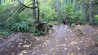
Photos of Camas Mountain Bike
Videos of Camas Mountain Bike
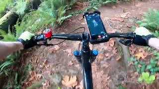
trail: Boneyard
8:09 |
380 |
Apr 1, 2015
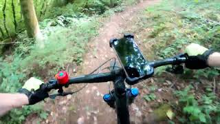
trail: Rock Garden
8:12 |
1065 |
Jul 9, 2013
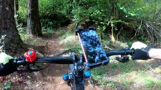
trail: Drop In
0:08 |
349 |
Nov 7, 2011
trail: Drop In
0:12 |
661 |
Nov 7, 2011
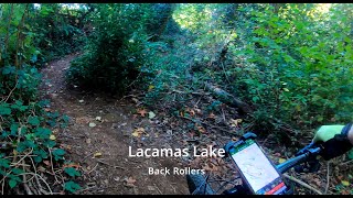
trail: Back Rollers
0:40 |
119 |
Sep 29, 2024 , Camas
trail: Tiki
0:35 |
148 |
Sep 23, 2024 , Camas
trail: Scratchy
0:59 |
95 |
Sep 23, 2024 , Camas
trail: The Vine
0:47 |
98 |
Sep 23, 2024 , Camas
Recent Trail Reports
| status | trail | date | condition | info | user |
|---|---|---|---|---|---|
| Parking Lot Corner Entrance | May 2, 2026 @ 6:03pm (America/Vancouver) May 2, 2026 | Ideal | RichardDavies | ||
| Disgruntled | May 2, 2026 @ 6:03pm (America/Vancouver) May 2, 2026 | Ideal | RichardDavies | ||
| Short Cut | May 2, 2026 @ 6:03pm (America/Vancouver) May 2, 2026 | Ideal | RichardDavies | ||
| Nasty Stench | May 2, 2026 @ 6:03pm (America/Vancouver) May 2, 2026 | Ideal | RichardDavies | ||
| Eavesdrop | May 2, 2026 @ 6:03pm (America/Vancouver) May 2, 2026 | Ideal | RichardDavies | ||
| Skinny Man | May 2, 2026 @ 6:03pm (America/Vancouver) May 2, 2026 | Variable | RichardDavies | ||
| Baseball Field to Picnic Shelter | May 2, 2026 @ 6:03pm (America/Vancouver) May 2, 2026 | Wet | RichardDavies | ||
| Red Tape - Directional trail. BIKE ONLY. | Apr 20, 2026 @ 6:20pm (America/Vancouver) Apr 20, 2026 | Variable | Sbnickmo | ||
| Scratchy | Feb 14, 2026 @ 9:39am (America/Los_Angeles) Feb 14, 2026 | Variable | RichardDavies | ||
| The Vine | Feb 14, 2026 @ 9:39am (America/Los_Angeles) Feb 14, 2026 | Variable | RichardDavies |
Activity Feed
| username | action | type | title | date |
|---|---|---|---|---|
| Thigu | vote | trail | activity #97104704 | Jun 16, 2026 @ 6:20am 9 hours |
| booshie | wishlist | region | activity #96651846 | Jun 9, 2026 @ 8:55pm Jun 9, 2026 |
| jpcrockett | wishlist | route | activity #96336431 | Jun 5, 2026 @ 6:48pm Jun 5, 2026 |
| Shortmem | wishlist | trail | activity #96300036 | Jun 5, 2026 @ 8:54am Jun 5, 2026 |
| bLjBFR | wishlist | region | activity #95349684 | May 23, 2026 @ 1:19pm May 23, 2026 |
Recent Comments
| username | type | title | comment | date |
|---|---|---|---|---|
| report | Actually I'm still riding with that helmet.... | Oct 13, 2025 @ 9:53am Oct 13, 2025 | ||
| report | Better as of 9/3! Thanks to whoever trimmed... | Sep 5, 2025 @ 7:30pm Sep 5, 2025 | ||
| report | Witnessed the consequences when buddy crashed.... | Sep 1, 2025 @ 1:33pm Sep 1, 2025 | ||
| trail | Super overgrown with blackberries | Aug 30, 2025 @ 10:41am Aug 30, 2025 | ||
| trail | One of the two double black trails at... | Aug 28, 2025 @ 9:34am Aug 28, 2025 |
Local Badges
-

10 Green Trails245 awarded -

10 Blue Trails258 awarded -

Epic Ride Climb 2k12 awarded -

Climbing 10k Badge86 awarded -

Climbing 100k Badge3 awarded -

Epic Ride Descent 2k14 awarded
Activity Type Stats
| activitytype | trails | distance | descent | descent distance | total vertical | rating | global rank | state rank | photos | reports | routes | ridelogs |
|---|---|---|---|---|---|---|---|---|---|---|---|---|
| Mountain Bike | 122 | 21 miles | 3,330 ft | 8 miles | 761 ft | #796 | #308 | 137 | 1,974 | 8 | 18,767 | |
| E-Bike | 1 | 3,812 ft | 338 ft | 30 ft | 1,741 | 504 | ||||||
| Horse | 14 | #3,019 | #1,707 | 285 | ||||||||
| Hike | 123 | 21 miles | 2,989 ft | 7 miles | 761 ft | #2,517 | #992 | 20 | 1,909 | 3 | 1,162 | |
| Trail Running | 123 | 21 miles | 2,989 ft | 7 miles | 761 ft | #2,886 | #830 | 1 | 1,909 | 3,184 | ||
| Dirtbike/Moto | 39 | #1,035 | #401 | 281 | 21 | |||||||
| ATV/ORV/OHV | 36 | #771 | #331 | 281 | 1 |
Frequently Asked Questions About Camas
▼
What are the best places to ride in Camas?
Camas has 5 areas to explore for mountain biking. The top rated areas are:
▼
What are the highest rated mountain biking trails in Camas?
The highest rated mountain biking trails in Camas are:
- Red Tape - Directional trail. BIKE ONLY. (4.4/5)
- Gnarzebo (4.1/5)
- Lilly Fields Loop - East (4.1/5)
- Back Rollers (4.1/5)
- Late For Dinner (4.1/5)
▼
What is the best time of the year to ride in Camas?
Based on ride log data, the most popular months to ride in Camas are:
- July (392 activities)
- August (208 activities)
- September (157 activities)
▼
Where can I park to ride in Camas?
There are 9 parking locations listed in Camas. The most popular parking spots are: View all parking and trailhead locations on the map to plan your visit.
Activities
Trails
- By brenthillier
 NSMBA TRAILFORKS & contributors
 - Admins: EMBA-SW
- #8279 - 12,979 views
- camas activity log | embed map of Camas mountain bike trails | camas mountain biking points of interest
Downloading of trail gps tracks in kml & gpx formats is enabled for Camas.
You must login to download files.