close
-
Layers w
- Weather Layers
- Pro
- Pro
- Pro
- Pro
- Pro
- Pro
- More Layers
- Pro
- Pro
- Pro
- Pro
-
Upgrade to

3D
Trail Conditions
- Unknown
- Snow Groomed
- Snow Packed
- Snow Covered
- Snow Cover Partial
- Freeze/thaw Cycle
- Icy
- Prevalent Mud
- Wet
- Variable
- Ideal
- Dry
- Very Dry
Trail Flow (Ridden Direction)
Trailforks scans users activity logs to determine the most popular direction each trail is ridden. A good flowing trail network will have most trails flowing in a single direction according to their intension.
The colour categories are based on what percentage of users are riding a trail in its intended direction.
The colour categories are based on what percentage of users are riding a trail in its intended direction.
- > 96%
- > 90%
- > 80%
- > 70%
- > 50%
- < 50%
- bi-directional trail
- no data
Trail Last Ridden
Trailforks scans activity logs to determine the last time a trail was ridden.
- < 2 days
- < 1 week
- < 2 weeks
- < 1 month
- < 6 months
- > 6 months
Trail Ridden Direction
The intended direction a trail should be ridden.
- Downhill Only
- Downhill Primary
- Both Directions
- Uphill Primary
- Uphill Only
- One Direction
Contribute Details
Colors indicate trail is missing specified detail.
- Description
- Photos
- Description & Photos
- Videos
Trail Popularity ?
Trailforks scans activity logs to determine which trails are ridden the most in the last 9 months.
Trails are compared with nearby trails in the same city region with a possible 25 colour shades.
Think of this as a heatmap, more activities = more kinetic energy = warmer colors.
- most popular
- popular
- less popular
- not popular
ATV/ORV/OHV Filter
Max Vehicle Width
inches
US Cell Coverage
Legend

Radar Time
Activity Recordings
Trailforks uses anonymized public activity data.
?
Activity Recordings
Trailforks uses anonymized public activity data.
?
Personal Heatmap
▶
Activity Types
all
/
none
▶
Options
2
Date range
month
–
Winter Trails
Warning
A routing network for winter maps does not exist. Selecting trails using the winter trails layer has been disabled.
Missing Trails
Most Popular
Least Popular
Trails are colored based on popularity. The more popular a trail is, the more red. Less popular trails trend towards green.
Jump Magnitude Heatmap
Heatmap of where users jump on trails. Zoom in to see individual jumps, click circles to view jump details.
BC Backroad Status
![map legend]()
Service Road Atlas is a free to use, community-driven service for viewing and creating reports on the numerous back-country service roads around B.C. and Alberta.

Slope Aspect
Direction the slope faces
Trails Deemphasized
Trails are shown in grey.
Only show trails with no bike usage.
Suggested Layers
Based on selected activity type
Save the current map location and zoom level as your default home location whenever this page is loaded.
Save
No description for Challis has been added yet!
Login or register to submit one.
Activities Click to view
- Mountain Bike
80 trails
- E-Bike
56 trails
- Gravel Bike
12 trails
- Adaptive Bike
8 trails
- Winter Fat Bike
17 trails
- Horse
49 trails
- Hike
90 trails
- Trail Running
91 trails
- Dirtbike/Moto
55 trails
- ATV/ORV/OHV
25 trails
- Downhill Ski
2 trails
- Nordic Ski
9 trails
Region Details
- 14
- 7
- 33
- 21
- 3
- 1
Region Status
Open as of Jul 22, 2026Local Trail Association
Stats
- Avg Trail Rating
- Trails (view details)
- 117
- Trails Mountain Bike
- 80
- Trails E-Bike
- 56
- Trails Gravel Bike
- 12
- Trails Adaptive Bike
- 8
- Trails Winter Fat Bike
- 17
- Trails Horse
- 49
- Trails Hike
- 90
- Trails Trail Running
- 91
- Trails Dirtbike/Moto
- 56
- Trails Observed Trials
- 1
- Trails ATV/ORV/OHV
- 25
- Trails Snowmobile
- 2
- Trails Snowshoe
- 1
- Trails Downhill Ski
- 2
- Trails Backcountry Ski
- 1
- Trails Nordic Ski
- 9
- Total Distance
- 228 miles
- Total Descent
- 50,286 ft
- Total Vertical
- 7,781 ft
- Highest Trailhead
- 12,641 ft
- Reports
- 556
- Photos
- 252
- Completed Counter
- 1,412
Sub Regions
-
Bayhorse Area
- 3
-
Challis Foothills
- 6
- 21
- 9
- 2
- 1
-
Lost River Range
- 2
-
Morgan Creek
- 6
- 11
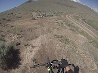
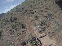
Popular Challis Mountain Biking Trails
• 90 ★ 3.0 • 1,112 ft • 2 ft • 153 •
Trail is a short gentle return from Dave's Wave back to the and to Upper Dump Road parking lot. Route can be ridden either direction, but preference is uphill.
• 95 ★ 4.8 • 1,821 ft • 2 ft • 131 •
Dave's Wave is a fun trail that begins slowly and then culminates with a series of sharp bermed turns as you pick up speed toward the lower end. It is open in both directions but is typically ridden from top to bottom.
• 100 ★ 4.7 • 633 ft • 0 ft • 72 •
is a multi directional trail that was created to bypass one short steep section of with a gentler grade.
• 100 ★ 5.0 • 1,424 ft • 72 ft • 63 •
This singletrack provides access to the main and the trail system to the north and west of the parking area located on the Dump Road.
• 100 ★ 4.8 • 5,207 ft • 6 ft • 50 •
Best traveled downhill due to steepness. Great flow. Connects between the trail and the Blue Mtn singletrack trail. It provides a great alternative to going down to trail.
• 95 ★ 4.0 • 1,424 ft • 37 ft • 47 •
SharksTooth is a short connector from the to the , , Skull and Trails.
• 80 ★ 3.0 • 3,301 ft • 16 ft • 44 •
Skull is offers a lower gradient climb (4%) as opposed to the . It also provides a fun and flowy descent. It provides connections to Shark Tooth, and Trails.
• 95 ★ 3.8 • 971 ft • 17 ft • 42 •
A short section of singletrack that provides a low gradient climb and descent for riders seeking an alternative to a portion of the .
Photos of Challis Mountain Bike
Videos of Challis Mountain Bike
trail: Foothills Trail
5:53 |
40 |
Jun 19, 2020
trail: Mahogany
2:32 |
47 |
Jun 19, 2020
trail: French Creek Trail
4:26 |
213 |
Aug 11, 2022 , Challis
Recent Trail Reports
| status | trail | date | condition | info | user |
|---|---|---|---|---|---|
| Round Valley View Trail | Jul 22, 2026 @ 10:30am (America/Boise) Jul 22, 2026 | Dry | IDMTBCruiser | ||
| Foothills Trail | Jul 22, 2026 @ 10:30am (America/Boise) Jul 22, 2026 | Dry | IDMTBCruiser | ||
| John Henry | Jul 22, 2026 @ 10:30am (America/Boise) Jul 22, 2026 | Dry | IDMTBCruiser | ||
| RR Connector | Jul 22, 2026 @ 10:30am (America/Boise) Jul 22, 2026 | Dry | IDMTBCruiser | ||
| Blue Mountain Connector | Jul 22, 2026 @ 10:30am (America/Boise) Jul 22, 2026 | Dry | IDMTBCruiser | ||
| Playground | Jul 22, 2026 @ 10:30am (America/Boise) Jul 22, 2026 | Dry | IDMTBCruiser | ||
| Ebb And Flow | Jul 22, 2026 @ 10:30am (America/Boise) Jul 22, 2026 | Dry | IDMTBCruiser | ||
| Sharks Tooth | Jul 22, 2026 @ 10:30am (America/Boise) Jul 22, 2026 | Very Dry | IDMTBCruiser | ||
| Lower Foothills Trail | Jul 22, 2026 @ 10:30am (America/Boise) Jul 22, 2026 | Very Dry | IDMTBCruiser | ||
| Zoomies | Jul 17, 2026 @ 1:48pm (Pacific/Midway) Jul 17, 2026 | Dry | swanybikes16 |
Activity Feed
| username | action | type | title | date |
|---|---|---|---|---|
| swanybikes16 | add | photo | activity #99970624 and 2 more | Jul 25, 2026 @ 8:27am 7 hours |
| IDMTBCruiser | add | report | activity #99765456 and 8 more | Jul 22, 2026 @ 11:44am Jul 22, 2026 |
| swanybikes16 | add | report | activity #99529416 and 2 more | Jul 19, 2026 @ 7:25am Jul 19, 2026 |
| chatownd | add | trail | activity #99182993 | Jul 14, 2026 @ 11:04am Jul 14, 2026 |
| msmcfate | update | trail | activity #99090215 and 2 more | Jul 13, 2026 @ 5:04am Jul 13, 2026 |
Recent Comments
| username | type | title | comment | date |
|---|---|---|---|---|
| trail | Combine with Blue Mountain Trail, Grand Prize,... | Nov 5, 2025 @ 11:03am Nov 5, 2025 | ||
| trail | Agree with the previous comment. | Oct 29, 2022 @ 3:09pm Oct 29, 2022 | ||
| trail | Trail is now double track to the base of Quake... | Sep 2, 2022 @ 5:59pm Sep 2, 2022 | ||
| trail | This trail is a nice adder if you ride pat’s... | Aug 27, 2022 @ 5:37pm Aug 27, 2022 | ||
| trail | A fun loop is to ride up pat’s creek trail... | Aug 27, 2022 @ 5:36pm Aug 27, 2022 |
Local Badges
-

10 Blue Trails12 awarded -

10 Black Trails9 awarded -

Epic Ride Climb 2k4 awarded -

Climbing 10k Badge9 awarded -

Climbing 100k Badge3 awarded -

Epic Ride Descent 2k4 awarded
Activity Type Stats
| activitytype | trails | distance | descent | descent distance | total vertical | rating | global rank | state rank | photos | reports | routes | activity logs |
|---|---|---|---|---|---|---|---|---|---|---|---|---|
| Mountain Bike | 80 | 163 miles | 40,072 ft | 83 miles | 4,268 ft | #1,211 | #471 | 246 | 539 | 4,568 | ||
| E-Bike | 56 | 100 miles | 24,337 ft | 54 miles | 4,268 ft | #1,691 | #890 | 5 | 486 | 511 | ||
| Gravel Bike | 12 | 16 miles | 1,762 ft | 5 miles | 2,766 ft | #559 | #1,022 | 23 | 1 | |||
| Adaptive Bike | 8 | 12 miles | 1,667 ft | 4 miles | 2,493 ft | #605 | #1,776 | 14 | ||||
| Winter Fat Bike | 17 | 16 miles | 5,430 ft | 11 miles | 3,615 ft | #348 | #1,057 | 170 | 5 | |||
| Horse | 49 | 135 miles | 33,038 ft | 70 miles | 7,782 ft | #278 | #451 | 90 | 2 | |||
| Hike | 90 | 194 miles | 40,860 ft | 84 miles | 7,782 ft | #1,125 | #521 | 1 | 539 | 754 | ||
| Trail Running | 91 | 199 miles | 42,303 ft | 87 miles | 7,782 ft | #815 | #306 | 539 | 357 | |||
| Dirtbike/Moto | 55 | 134 miles | 33,819 ft | 70 miles | 5,016 ft | #211 | #118 | 67 | 4 | |||
| Observed Trials | 1 | 2 miles | 505 ft | |||||||||
| ATV/ORV/OHV | 25 | 60 miles | 12,900 ft | 28 miles | 5,016 ft | #431 | #138 | 21 | ||||
| Snowmobile | 2 | 5 miles | 7 ft | 574 ft | 1,283 ft | 13 | 1 | |||||
| Snowshoe | 1 | 2 miles | 505 ft | 13 | 22 | |||||||
| Downhill Ski | 2 | 3,409 ft | 545 ft | 3,409 ft | 289 ft | #755 | #376 | 13 | 5 | |||
| Backcountry Ski | 1 | 2 miles | 505 ft | 13 | 23 | |||||||
| Nordic Ski | 9 | 5 miles | 1,033 ft | 3 miles | 551 ft | #1,299 | #584 | 16 | 139 |
Frequently Asked Questions About Challis
▼
What are the best places to ride in Challis?
Challis has 6 areas to explore for mountain biking. The top rated areas are:
▼
What are the highest rated mountain biking trails in Challis?
The highest rated mountain biking trails in Challis are:
- Rattlesnake Alley (4.4/5)
- Daves Wave (4.3/5)
- Foothills Trail (4.2/5)
- Rocky Road (4.2/5)
- Playground (4.2/5)
▼
What is the best time of the year to ride in Challis?
Based on activity log data, the most popular months to ride in Challis are:
- July (34 activities)
- August (17 activities)
- October (6 activities)
▼
Where can I park to ride in Challis?
There are 14 parking locations listed in Challis. The most popular parking spots are: View all parking and trailhead locations on the map to plan your visit.
Activities
- Challis Mountain Biking Trails
- Challis E-Biking Trails
- Challis Gravel Biking Trails
- Challis Adaptive Biking Trails
- Challis Winter Fat Biking Trails
- Challis Horseback Trails
- Challis Hiking Trails
- Challis Trail Running Trails
- Challis Dirtbiking Trails
- Challis ATVing/Offroading Trails
- Challis Nordic Skiing Trails
Trails
Points of Interest
- Leatherman Pass Summit
- Tickets Lodge
- Rock Staircase TTF
- Rock Jump/drop TTF
- Alt Steep Rock Slab TTF
- Lost River Mountain Summit
- Mount Breitenbach Summit
- Donaldson Peak Summit
- Mount Church Summit
- Yankee Fork State Park Information
- Borah Peak (12,657 ft)
- Leatherman Peak (12,221 ft)
- Mount Church (12,211 ft)
- By sidehiller1
 TRAILFORKS & contributors
 - Admins: CCTA, SAwSoc, SAWCO, WRTC
- #6894 - 7,109 views
- challis activity log | embed map of Challis mountain bike trails | challis mountain biking points of interest
Downloading of trail gps tracks in kml & gpx formats is enabled for Challis.
You must login to download files.