close
-
Layers w
- Weather Layers
- Pro
- Pro
- Pro
- Pro
- Pro
- Pro
- More Layers
- Pro
- Pro
- Pro
- Pro
-
Upgrade to

3D
Trail Conditions
- Unknown
- Snow Groomed
- Snow Packed
- Snow Covered
- Snow Cover Partial
- Freeze/thaw Cycle
- Icy
- Prevalent Mud
- Wet
- Variable
- Ideal
- Dry
- Very Dry
Trail Flow (Ridden Direction)
Trailforks scans users ridelogs to determine the most popular direction each trail is ridden. A good flowing trail network will have most trails flowing in a single direction according to their intension.
The colour categories are based on what percentage of riders are riding a trail in its intended direction.
The colour categories are based on what percentage of riders are riding a trail in its intended direction.
- > 96%
- > 90%
- > 80%
- > 70%
- > 50%
- < 50%
- bi-directional trail
- no data
Trail Last Ridden
Trailforks scans ridelogs to determine the last time a trail was ridden.
- < 2 days
- < 1 week
- < 2 weeks
- < 1 month
- < 6 months
- > 6 months
Trail Ridden Direction
The intended direction a trail should be ridden.
- Downhill Only
- Downhill Primary
- Both Directions
- Uphill Primary
- Uphill Only
- One Direction
Contribute Details
Colors indicate trail is missing specified detail.
- Description
- Photos
- Description & Photos
- Videos
Trail Popularity ?
Trailforks scans ridelogs to determine which trails are ridden the most in the last 9 months.
Trails are compared with nearby trails in the same city region with a possible 25 colour shades.
Think of this as a heatmap, more rides = more kinetic energy = warmer colors.
- most popular
- popular
- less popular
- not popular
ATV/ORV/OHV Filter
Max Vehicle Width
inches
US Cell Coverage
Legend

Radar Time
Activity Recordings
Trailforks uses anonymized public activity data.
?
Activity Recordings
Trailforks uses anonymized public activity data.
?
Personal Heatmap
▶
Activity Types
all
/
none
▶
Options
2
Date range
month
–
Winter Trails
Warning
A routing network for winter maps does not exist. Selecting trails using the winter trails layer has been disabled.
Missing Trails
Most Popular
Least Popular
Trails are colored based on popularity. The more popular a trail is, the more red. Less popular trails trend towards green.
Jump Magnitude Heatmap
Heatmap of where riders jump on trails. Zoom in to see individual jumps, click circles to view jump details.
BC Backroad Status
![map legend]()
Service Road Atlas is a free to use, community-driven service for viewing and creating reports on the numerous back-country service roads around B.C. and Alberta.

Slope Aspect
Direction the slope faces
Trails Deemphasized
Trails are shown in grey.
Only show trails with no bike usage.
Suggested Layers
Based on selected activity type
Save the current map location and zoom level as your default home location whenever this page is loaded.
Save
No description for Comox has been added yet!
Login or register to submit one.
Activities Click to view
- Mountain Bike
48 trails
- Gravel Bike
0 trails
- Adaptive Bike
0 trails
- Winter Fat Bike
0 trails
- Hike
109 trails
- Trail Running
110 trails
Region Details
- 17
- 5
- 19
- 5
- 2
Region Status
Open as of May 31, 2026Local Trail Association
Stats
- Avg Trail Rating
- Trails (view details)
- 107
- Trails Mountain Bike
- 48
- Trails E-Bike
- 2
- Trails Hike
- 111
- Trails Trail Running
- 110
- Trails Snowshoe
- 2
- Total Distance
- 166 miles
- Total Descent
- 22,745 ft
- Total Vertical
- 7,109 ft
- Highest Trailhead
- 7,126 ft
- Reports
- 265
- Photos
- 137
- Ridden Counter
- 12,176
Sub Regions
-
Northeast Woods
- 5
- 16
- 5
- 2
Popular Comox Mountain Biking Trails
• 100 ★ 2.4 • 676 ft • 0 ft • 310 •
Fun jump line that is easliy accessed.
• 100 ★ 4.2 • 1,673 ft • 0 ft • 285 •
Fairly easy down hill trail with some jumps, drops, and a log ride just beside the main trail.
• 75 ★ 1.5 • 255 ft • 1 ft • 268 •
Nice small trail mostly for getting to the parking lot or for getting to a trail head.
• 60 ★ 2.4 • 272 ft • 0 ft • 208 •
Small jump line with a few jumps and berms. Fun to sesh!
• 95 ★ 2.0 • 1,907 ft • 28 ft • 189 •
Popular green difficulty singletrack. This mountain bike primary trail can be used both directions. On average it takes 3 minutes to complete this trail.
• 85 ★ 2.4 • 428 ft • 0 ft • 179 •
Fun short flowy small jump line, with a few gaps and berms.
• 50 ★ 3.0 • 390 ft • 0 ft • 146 •
One of the main access points into North East Woods.
• 100 ★ 0.0 • 515 ft • 25 ft • 140 •
Popular green difficulty family friendly singletrack. This mountain bike primary trail can be used both directions. On average it takes minutes to complete this trail.
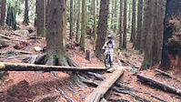
Photos of Comox Mountain Bike
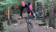
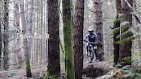
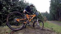
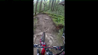
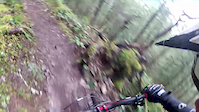
Videos of Comox Mountain Bike

trail: A's
0:00 |
339 |
Apr 11, 2019
trail: Gateway (Jump Trail)
2:07 |
3103 |
Feb 24, 2017
trail: Gateway (Jump Trail)
0:14 |
1378 |
Jan 20, 2017
trail: No Flow
2:16 |
754 |
Feb 7, 2015

trail: Lone Pine
0:46 |
|
Oct 7, 2014
trail: Trillium
2:50 |
136 |
May 8, 2014
trail: Pipeline
0:08 |
406 |
Apr 7, 2014
trail: Trillium
2:37 |
50 |
Mar 15, 2014
Recent Trail Reports
| status | trail | date | condition | info | user |
|---|---|---|---|---|---|
| A's | Apr 14, 2026 @ 3:31pm (America/Vancouver) Apr 14, 2026 | Ideal | ColbyBergen | ||
| No Flow | Apr 14, 2026 @ 3:31pm (America/Vancouver) Apr 14, 2026 | Ideal | ColbyBergen | ||
| Access Road | Apr 14, 2026 @ 3:31pm (America/Vancouver) Apr 14, 2026 | Dry | ColbyBergen | ||
| Wet n' Overgrown | Apr 14, 2026 @ 3:31pm (America/Vancouver) Apr 14, 2026 | Variable | ColbyBergen | ||
| Low Pipeline Connector | Apr 14, 2026 @ 3:31pm (America/Vancouver) Apr 14, 2026 | Ideal | ColbyBergen | ||
| Towers | Apr 14, 2026 @ 3:31pm (America/Vancouver) Apr 14, 2026 | Variable | ColbyBergen | ||
| Wagner Trail to Brent Rd Connector | Jan 19, 2026 @ 11:22am (America/Vancouver) Jan 19, 2026 | Wet | rvandrian DIRA | ||
| Curtis Rd to Brent Rd Connector | Jan 19, 2026 @ 11:22am (America/Vancouver) Jan 19, 2026 | Wet | rvandrian DIRA | ||
| Wagner Trail | Jan 19, 2026 @ 11:22am (America/Vancouver) Jan 19, 2026 | Wet | rvandrian DIRA | ||
| Centennial Loop Trail | Oct 13, 2025 @ 8:53am (America/Vancouver) Oct 13, 2025 | Snow Cover Partial | babesbikesbeers |
Activity Feed
| username | action | type | title | date |
|---|---|---|---|---|
| Bigbird427 | add | report | activity #95997887 | May 31, 2026 @ 9:07pm May 31, 2026 |
| Edanberg | wishlist | trail | activity #95280942 | May 22, 2026 @ 5:51pm May 22, 2026 |
| Bigbird427 | add | report | activity #95035181 and 1 more | May 19, 2026 @ 5:59am May 19, 2026 |
| ZERO3 | add | photo | activity #94900168 | May 17, 2026 @ 7:21am May 17, 2026 |
| ZERO3 | add | photo | activity #94755689 | May 15, 2026 @ 9:44am May 15, 2026 |
Recent Comments
| username | type | title | comment | date |
|---|---|---|---|---|
| report | Added photos of the trees that are blocking... | Oct 10, 2025 @ 5:42pm Oct 10, 2025 | ||
| trail | Overgrown and slow. Avoid this trail. | Jul 26, 2023 @ 6:12pm Jul 26, 2023 | ||
| trail | Very overgrown and slow. Avoid this one. | Jul 26, 2023 @ 6:11pm Jul 26, 2023 | ||
| trail | Easy loop, can get a bit confusion and easy to... | Jul 26, 2023 @ 6:09pm Jul 26, 2023 | ||
| trail | Don't bother with this. Not an enjoyable trail... | Jul 26, 2023 @ 6:07pm Jul 26, 2023 |
Local Badges
-

Epic Ride Climb 2k1 awarded -

Climbing 10k Badge31 awarded -

Climbing 100k Badge0 awarded -

Epic Ride Descent 2k0 awarded -

Descent 10k Badge31 awarded -

Descent 100k Badge0 awarded
Local Mountain Biking Directory
-
Comox Bike CompanyBike Shop
-
Black's CycleBike Shop
![Black's Cycle]()
Activity Type Stats
| activitytype | trails | distance | descent | descent distance | total vertical | rating | global rank | state rank | photos | reports | routes | ridelogs |
|---|---|---|---|---|---|---|---|---|---|---|---|---|
| Mountain Bike | 48 | 12 miles | 1,319 ft | 6 miles | 3,583 ft | #5,106 | #112 | 88 | 255 | 13,303 | ||
| E-Bike | 2 | 2,254 ft | 7 ft | 1,004 ft | 112 ft | 216 | 317 | |||||
| Hike | 109 | 165 miles | 22,644 ft | 45 miles | 7,110 ft | #675 | #39 | 47 | 256 | 3,190 | ||
| Trail Running | 110 | 160 miles | 21,962 ft | 43 miles | 7,110 ft | #872 | #39 | 256 | 3,690 | |||
| Snowshoe | 2 | 6 miles | 2,359 ft | 3 miles | 2,923 ft | 5 | 25 |
Frequently Asked Questions About Comox
▼
What are the best places to ride in Comox?
Comox has 2 areas to explore for mountain biking. The top rated areas are:
▼
What are the highest rated mountain biking trails in Comox?
The highest rated mountain biking trails in Comox are:
- Lazo Loop (4.3/5)
- Centennial Trail (4.1/5)
- Lone Pine (4.1/5)
- Worthington (4/5)
- Centennial Loop Trail (4/5)
▼
What is the best time of the year to ride in Comox?
Based on ride log data, the most popular months to ride in Comox are:
- July (121 activities)
- April (74 activities)
- August (74 activities)
▼
Where can I park to ride in Comox?
There are 18 parking locations listed in Comox. The most popular parking spots are: View all parking and trailhead locations on the map to plan your visit.
Trails
- By TrevorHartland123 & contributors
- Admins: apply
- #13519 - 5,953 views
- comox activity log | embed map of Comox mountain bike trails | comox mountain biking points of interest
Downloading of trail gps tracks in kml & gpx formats is enabled for Comox.
You must login to download files.