
close
3D
Trail Conditions
- Unknown
- Snow Groomed
- Snow Packed
- Snow Covered
- Snow Cover Partial
- Freeze/thaw Cycle
- Icy
- Prevalent Mud
- Wet
- Variable
- Ideal
- Dry
- Very Dry
Trail Flow (Ridden Direction)
Trailforks scans users activity logs to determine the most popular direction each trail is ridden. A good flowing trail network will have most trails flowing in a single direction according to their intension.
The colour categories are based on what percentage of users are riding a trail in its intended direction.
The colour categories are based on what percentage of users are riding a trail in its intended direction.
- > 96%
- > 90%
- > 80%
- > 70%
- > 50%
- < 50%
- bi-directional trail
- no data
Trail Last Used
Trailforks scans activity logs to determine the last time a trail was ridden.
- < 2 days
- < 1 week
- < 2 weeks
- < 1 month
- < 6 months
- > 6 months
Trail Ridden Direction
The intended direction a trail should be ridden.
- Downhill Only
- Downhill Primary
- Both Directions
- Uphill Primary
- Uphill Only
- One Direction
Contribute Details
Colors indicate trail is missing specified detail.
- Description
- Photos
- Description & Photos
- Videos
Trail Popularity ?
Trailforks scans activity logs to determine which trails are ridden the most in the last 9 months.
Trails are compared with nearby trails in the same city region with a possible 25 colour shades.
Think of this as a heatmap, more activities = more kinetic energy = warmer colors.
- most popular
- popular
- less popular
- not popular
ATV/ORV/OHV Filter
Max Vehicle Width
inches
US Cell Coverage
Legend

Radar Time
Activity Recordings
Trailforks uses anonymized public activity data.
?
Activity Recordings
Trailforks uses anonymized public activity data.
?
Winter Trails
Warning
A routing network for winter maps does not exist. Selecting trails using the winter trails layer has been disabled.
Missing Trails
Most Popular
Least Popular
Trails are colored based on popularity. The more popular a trail is, the more red. Less popular trails trend towards green.
Jump Magnitude Heatmap
Heatmap of where users jump on trails. Zoom in to see individual jumps, click circles to view jump details.
BC Backroad Status
![map legend]()
Service Road Atlas is a free to use, community-driven service for viewing and creating reports on the numerous back-country service roads around B.C. and Alberta.

Slope Aspect
Direction the slope faces
Trails Deemphasized
Trails are shown in grey.
Only show trails with no bike usage.
Suggested Layers
Based on selected activity type
Save the current map location and zoom level as your default home location whenever this page is loaded.
Save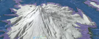
Snow & Rain 3D forecast Pro
See where it will snow, sleet or rain on Courtenay hour by hour, on 3D terrain.
View 3D snow forecast
Courtenay trails and routes are listed on Trailforks with interactive trail maps, difficulty ratings, photos, and user-reported trail conditions. The Trailforks community has mapped hundreds of trails and shared hundreds of photos in this region. Supported activity types include Hiking, Trail Running, Mountain Biking, Skiing, E-Biking, Gravel Biking, Snowshoeing, Nordic Skiing, Horseback, Observed Trials, Dirtbiking, Adaptive Biking, Winter Fat Biking and ATVing/Offroading. Trails here are often tight and twisty, rooty and flowy. Scenery includes views, alpine terrain and creeks. Common trail features include berms, bridges and skinnies. Many trails are family friendly and lit for night riding. Amenities include restrooms. Popular destinations include Mt. Washington Alpine Resort, The Vortex and Seal Bay Regional Nature Park.
This is an auto-generated description of Courtenay.
Login or register to submit a custom description.
Trail info last updated
Activities Click to view
- Mountain Bike
172 trails
- E-Bike
79 trails
- Gravel Bike
52 trails
- Adaptive Bike
4 trails
- Winter Fat Bike
4 trails
- Horse
26 trails
- Hike
174 trails
- Trail Running
173 trails
- Dirtbike/Moto
5 trails
- Observed Trials
6 trails
- ATV/ORV/OHV
4 trails
- Snowshoe
38 trails
- Downhill Ski
93 trails
- Nordic Ski
36 trails
Region Details
- 50
- 44
- 59
- 14
- 5
Region Status
Open as of 3 daysLocal Trail Association

Stats
- Avg Trail Rating
- Trails (view details)
- 337
- Trails Mountain Bike
- 172
- Trails E-Bike
- 79
- Trails Gravel Bike
- 52
- Trails Adaptive Bike
- 4
- Trails Winter Fat Bike
- 4
- Trails Horse
- 26
- Trails Hike
- 174
- Trails Trail Running
- 173
- Trails Dirtbike/Moto
- 5
- Trails Observed Trials
- 6
- Trails ATV/ORV/OHV
- 4
- Trails Snowshoe
- 38
- Trails Downhill Ski
- 93
- Trails Backcountry Ski
- 1
- Trails Nordic Ski
- 36
- Total Distance
- 168 miles
- Total Descent
- 46,671 ft
- Total Vertical
- 5,162 ft
- Highest Trailhead
- 5,166 ft
- Reports
- 1,661
- Photos
- 338
- Completed Counter
- 55,068
Articles
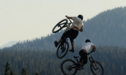
Video: Late Summer Bike Park Laps with Clem Loveless & Nolan Weiss in 'Summer Daze'
Sep 18, 2025 from pinkbike.com
Are they the same person?
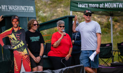
Event Recap: Chainsaw’s Legacy Lives On at the Stevie Smith Memorial DH
Sep 5, 2025 from pinkbike.com
Stevie’s legacy burns bright at Mount Washington with a weekend of top-tier racing and community.

Event Preview: Chainsaw’s Legacy Lives On at the Stevie Smith Memorial DH & VI Bike Fest
Aug 26, 2025 from pinkbike.com
From Canada Cup racing to the crowd favourite Whip Off, Mount Washington celebrates the icon this upcoming Labour Day weekend.
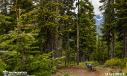
Race Report: Emmy Lan & Jack Menzies Win Canadian Enduro Series Round 4 - Vancouver Island
Jul 13, 2022 from pinkbike.com
The first ever Canadian Enduro Series event on the island.
Sub Regions
-
Mount Washington Bike Park
- 2
- 11
- 6
- 4
-
Puntledge Park
-
Seal Bay Regional Nature Park
- 18
-
The Vortex
- 10
- 42
- 8
-
Wildwood Interpretive Forest
- 7
Popular Courtenay Mountain Biking Trails
• 75 ★ 4.3 • 2 miles • 0 ft • 1,537 •
Highly rated popular blue difficulty family friendly machine groomed. This mountain bike primary trail can be used downhill only and has a moderate overall physical rating. It features berm, bridge, jump and rock garden. Trail visibility is always easy to follow. On average it takes 8 minutes to complete this trail.
• 85 ★ 4.2 • 2,402 ft • 0 ft • 1,508 •
Highly rated popular blue difficulty machine groomed. This mountain bike primary trail can be used downhill only and has a moderate overall physical rating. It features berm, bridge, drop, jump and rock face. Trail visibility is always easy to follow. On average it takes 2 minutes to complete this trail.
• 90 ★ 3.2 • 669 ft • 0 ft • 1,394 •
Popular black diamond difficulty singletrack. This mountain bike primary trail can be used downhill only. It features berm and jump. Trail visibility is always easy to follow. On average it takes minutes to complete this trail.
• 100 ★ 4.3 • 1,660 ft • 0 ft • 1,366 •
Starts with a step down gap into a left turn followed by a right. Another left turn featuring a step down in it. Then a nice hip-style jump to finish ‘er off before pedalling across to merge with Highway 19.
• 75 ★ 3.4 • 1,427 ft • 0 ft • 1,283 •
Inspired by our friends in Cumberland this blue square tech trail features a small waterfall, a creek and great alpine views of Strathcona Park. A great addition for riders to access the hawk chair from the lodge. **3 new berms near the...
• 95 ★ 4.0 • 1 mile • 0 ft • 1,242 •
Slalom style trail, doubles and drops. Not as hard as it once was due to gaps being filled with wood or dirt to decrease the consequences, but still the most difficult trail on Mt Washington. The second drop is the largest (roughly 8...
• 100 ★ 3.8 • 1,322 ft • 0 ft • 1,199 •
Popular black diamond difficulty machine groomed. This mountain bike primary trail can be used downhill only. It features berm, drop, jump, ladder bridge and rock garden. Trail visibility is always easy to follow. On average it takes 1 minutes to complete this trail.
• 80 ★ 3.7 • 2 miles • 33 ft • 1,198 •
Popular green difficulty family friendly machine groomed. This mountain bike primary trail can be used downhill only and has a easy overall physical rating. It features berm. Trail visibility is always easy to follow. On average it takes 11 minutes to complete this trail.
Courtenay Mountain Bike Routes
1 mile • 0 • Point to Point • Race •
7 miles • 2,882 ft • 0 • Point to Point • Race •
Above the treeline at Mt Washington! You’ll be treated to some unbelievable views of the Comox Valley...
• 25 miles • 9,134 ft • 30 •
• 30 miles • 10,212 ft • 38 •
• 27 miles • 2,461 ft • 11 •
• 11 miles • 3,696 ft • 12 •
Photos of Courtenay Mountain Bike
Videos of Courtenay Mountain Bike

Recent Trail Reports
| status | trail | date | condition | info | user |
|---|---|---|---|---|---|
| One Spot Trail | Nov 7, 2026 @ 12:43pm (America/Vancouver) Nov 7, 2026 | Variable | Martha2WGpcy | ||
| Hood Rat | Oct 14, 2026 @ 1:32pm (America/Vancouver) Oct 14, 2026 | Ideal | mudhunny | ||
| Hang Tight | Oct 14, 2026 @ 1:32pm (America/Vancouver) Oct 14, 2026 | Ideal | mudhunny | ||
| Spy vs Spy | Oct 13, 2026 @ 10:56am (America/Vancouver) Oct 13, 2026 | Ideal | mudhunny | ||
| 5th Street | Oct 13, 2026 @ 10:56am (America/Vancouver) Oct 13, 2026 | Ideal | mudhunny | ||
| Stumpquest | Oct 13, 2026 @ 10:56am (America/Vancouver) Oct 13, 2026 | Ideal | mudhunny | ||
| Spruce Trail | Oct 11, 2026 @ 8:34am (America/Vancouver) Oct 11, 2026 | Ideal | G-maMiniWild | ||
| Red Cedar Trail | Oct 7, 2026 @ 6:35pm (America/Vancouver) Oct 7, 2026 | Ideal | mudhunny | ||
| Forest Loop | Oct 7, 2026 @ 6:35pm (America/Vancouver) Oct 7, 2026 | Ideal | mudhunny | ||
| Cottonwood | Oct 7, 2026 @ 6:35pm (America/Vancouver) Oct 7, 2026 | Ideal | mudhunny |
Activity Feed
| username | action | type | title | date |
|---|---|---|---|---|
| mudhunny | add | report | activity #108037403 | Nov 19, 2026 @ 7:25am 2 days |
| kyleluvsdh | vote | trail | activity #107639213 | Nov 11, 2026 @ 7:58pm Nov 11, 2026 |
| Natashapwbgs4 | ridden | trail | activity #107504442 | Nov 9, 2026 @ 12:47pm Nov 9, 2026 |
| Martha2WGpcy | add | report | activity #107382920 | Nov 7, 2026 @ 2:44pm Nov 7, 2026 |
| michaeljstratton | wishlist | region | activity #106524377 | Oct 24, 2026 @ 2:47pm Oct 24, 2026 |
Recent Comments
| username | type | title | comment | date |
|---|---|---|---|---|
| trail | def a blue black, features offer both a blue... | Aug 31, 2026 @ 2:31pm Aug 31, 2026 | ||
| trail | This trail has gotten much better than its... | Aug 6, 2026 @ 9:10am Aug 6, 2026 | ||
| trail | Ideal conditions. Log ride at mid section is... | Jun 5, 2026 @ 12:33pm Jun 5, 2026 | ||
| trail | A challenging tight, twisty trail that... | Jun 5, 2026 @ 12:30pm Jun 5, 2026 | ||
| trail | Horse damage, watch for holes | May 9, 2026 @ 12:45pm May 9, 2026 |
Local Badges
-

Big Ride 30k2,071 awarded -

Descent 100k Badge7 awarded -

Epic Ride 50k950 awarded -

Top 10 Trails0 awarded -

Descent 10k Badge212 awarded -

Completionist0 awarded
Bike & Skill Parks
| name | type | city | rating |
|---|---|---|---|
| Mount Washington Bike Park | bike park | Courtenay | |
| Warm Up Skills Park | skill park | Courtenay | |
| West Skills Area | skill park | Courtenay |


Activity Type Stats
| activitytype | trails | distance | descent | descent distance | total vertical | rating | global rank | state rank | photos | reports | routes | activity logs |
|---|---|---|---|---|---|---|---|---|---|---|---|---|
| Mountain Bike | 172 | 94 miles | 13,297 ft | 44 miles | 5,128 ft | #470 | #41 | 331 | 1,634 | 3 | 30,051 | |
| E-Bike | 79 | 32 miles | 2,116 ft | 15 miles | 3,835 ft | #882 | #45 | 1,140 | 1 | 1,014 | ||
| Gravel Bike | 52 | 38 miles | 1,296 ft | 13 miles | 3,980 ft | #1,202 | #44 | 1 | 76 | 539 | ||
| Adaptive Bike | 4 | 1 mile | 56 ft | 1,719 ft | 3,816 ft | #2,679 | #72 | 48 | ||||
| Winter Fat Bike | 4 | 4 miles | 381 ft | 2 miles | 171 ft | #1,837 | #57 | 53 | 2 | |||
| Horse | 26 | 19 miles | 787 ft | 8 miles | 459 ft | #795 | #22 | 183 | 36 | |||
| Hike | 174 | 89 miles | 4,449 ft | 35 miles | 3,891 ft | #1,471 | #71 | 5 | 1,168 | 3,694 | ||
| Trail Running | 173 | 89 miles | 4,449 ft | 35 miles | 482 ft | #926 | #45 | 1 | 1,165 | 5 | 7,538 | |
| Dirtbike/Moto | 5 | 2 miles | 177 ft | 2 miles | 230 ft | #803 | #57 | 181 | 52 | |||
| Observed Trials | 6 | 3 miles | 180 ft | 2 miles | 230 ft | #203 | #22 | 8 | 4 | |||
| ATV/ORV/OHV | 4 | 2 miles | 177 ft | 2 miles | 230 ft | #611 | #48 | 181 | 16 | |||
| Snowshoe | 38 | 30 miles | 3,461 ft | 14 miles | 1,309 ft | #198 | #20 | 62 | 573 | |||
| Downhill Ski | 93 | 28 miles | 28,770 ft | 24 miles | 1,608 ft | #60 | #7 | 237 | 8,465 | |||
| Backcountry Ski | 1 | 1,050 ft | 20 ft | 892 ft | 23 ft | 76 | 289 | |||||
| Nordic Ski | 36 | 29 miles | 3,340 ft | 14 miles | 1,309 ft | #219 | #17 | 68 | 4,863 |
Frequently Asked Questions
▼
What are the best places to ride in Courtenay?
Courtenay has 6 areas to explore for mountain biking. The top rated areas are:
▼
What are the highest rated mountain biking trails in Courtenay?
The highest rated mountain biking trails in Courtenay are:
- Monster Mile (4.5/5)
- Snatch (4.3/5)
- Upper Monster Mile (4.3/5)
- The Wiz Lower (4.2/5)
- Step Brother (4.2/5)
▼
What is the best time of the year to ride in Courtenay?
Based on activity log data, the most popular months to ride in Courtenay are:
- August (1,005 activities)
- July (905 activities)
- September (554 activities)
▼
Where can I park to ride in Courtenay?
There are 24 parking locations listed in Courtenay. The most popular parking spots are: View all parking and trailhead locations on the map to plan your visit.
▼
What is the longest trail in Courtenay?
The longest trail in Courtenay is Forest Loop at 6.7 km. View all trails sorted by distance.
▼
What are the best & highest rated hiking trails in Courtenay?
The best hiking trails in Courtenay are: View all hiking trails sorted by popularity score.
▼
What are the best & highest rated trail running trails in Courtenay?
The best trail running trails in Courtenay are: View all trail running trails sorted by popularity score.
▼
What are the best & highest rated dirtbiking trails in Courtenay?
The best dirtbiking trails in Courtenay are: View all dirtbiking trails sorted by popularity score.
▼
How many trails are in Courtenay?
Courtenay has a total of 337 trails. Of those, 172 are designated for mountain biking. Browse top mountain biking trails in Courtenay to find detailed information including difficulty ratings, distances, and trail conditions.
▼
Which trail has the most elevation gain in Courtenay?
The trail with the most elevation gain in Courtenay is Sunrise Road with 140 m of elevation gain. View all trails sorted by elevation gain.
▼
Which trail has the most elevation descent in Courtenay?
The trail with the most elevation descent in Courtenay is Greenline with 319 m of elevation descent. View all trails sorted by elevation descent.
▼
What activities are most popular in Courtenay?
Courtenay supports the following activities: Mountain Biking, E-Biking, Gravel Biking, Adaptive Biking, Winter Fat Biking, Horseback, Hiking, Trail Running, Dirtbiking, Observed Trials, ATVing/Offroading, Snowshoeing, Skiing, Nordic Skiing.
▼
What bike services are there in Courtenay?
The following bike services are available in Courtenay:
- Bike Shop (2)
- Other (2)
- Race/Event Organizer (1)
▼
What are the steepest mountain biking trails in Courtenay?
The steepest mountain biking trail in Courtenay is Sunrise Road with an average grade of 9.2%. View all trails sorted by grade.
▼
Are there any trails with scenic viewpoints in Courtenay?
Yes, there are 4 scenic viewpoints marked along trails in Courtenay. Some popular viewpoints include: Explore more points of interest to find trails with the best views.
▼
Are the trails open in Courtenay?
The overall region status for Courtenay is Clear / Green. Out of 147 trails:
- Clear / Green: 123
- Minor Issue / Yellow: 19
- Significant Issue / Amber: 2
- Closed: 3
▼
What are the trail conditions in Courtenay?
Based on trail reports from the past week in Courtenay:
- Ideal: 1 trail
▼
Can I ride an ebike in Courtenay?
Yes, Courtenay supports e-bike riding. There are 73 trails in Courtenay that allow e-bikes. Check the e-bike trails listing for specific trail access details and any local regulations.
▼
What type of bike is most common in Courtenay?
Based on activity log data, the most common bike types used in Courtenay are:
- AM (500 activities)
- XC (98 activities)
- DH (58 activities)
- Fat (5 activities)
- RD (2 activities)
▼
What is the highest summit in Courtenay?
The highest summit in Courtenay is Mount Septimus at 1,928 m elevation.
▼
What are the most popular Strava Segments in Courtenay?
The most popular Strava segments in Courtenay are:
- North Courtenay Connector (2,063 athletes)
- Thin Whizzie (1,833 athletes)
- North Courtenay Connector the other way (1,703 athletes)
▼
What are some popular technical trail features in Courtenay?
There are 3 technical trail features (TTFs) in Courtenay. Some popular features include: View all technical trail features in Courtenay.
▼
What trails are closed in Courtenay?
There are currently 3 closed trails in Courtenay. The breakdown of all trail statuses is:
- Clear / Green: 123
- Minor Issue / Yellow: 19
- Significant Issue / Amber: 2
- Closed: 3
▼
Are there accessible or adaptive trails in Courtenay?
Yes, there are 4 accessible/adaptive trails in Courtenay. View all adaptive trails in Courtenay for specific accessibility information.
▼
Are there local clubs or events in Courtenay?
There are 1 local clubs or associations listed in the Courtenay directory. Browse the local directory for details.
▼
What are the most popular mountain biking trails in Courtenay?
The most popular mountain biking trails in Courtenay are: View all mountain biking trails sorted by popularity.
▼
What are the best beginner ride trails in Courtenay?
The best beginner mountain biking trails in Courtenay are:
- Bear's Den Connector (3/5)
- Dude's (2.5/5)
- Bear's Den Connector (3/5)
Activities
- Courtenay Mountain Biking Trails
- Courtenay E-Biking Trails
- Courtenay Gravel Biking Trails
- Courtenay Horseback Trails
- Courtenay Hiking Trails
- Courtenay Trail Running Trails
- Courtenay Dirtbiking Trails
- Courtenay Observed Trials Trails
- Courtenay Snowshoeing Trails
- Courtenay Skiing Trails
- Courtenay Nordic Skiing Trails
Trails
- By canadaka
 Trailforks & contributors
- Admins: Dubnyk
- #5171 - 20,707 views
- courtenay activity log | embed map of Courtenay mountain bike trails | courtenay mountain biking points of interest
Downloading of trail gps tracks in kml & gpx formats is enabled for Courtenay.
You must login to download files.
