close
-
Layers w
- Weather Layers
- Pro
- Pro
- Pro
- Pro
- Pro
- Pro
- More Layers
- Pro
- Pro
- Pro
- Pro
-
Upgrade to

3D
Trail Conditions
- Unknown
- Snow Groomed
- Snow Packed
- Snow Covered
- Snow Cover Partial
- Freeze/thaw Cycle
- Icy
- Prevalent Mud
- Wet
- Variable
- Ideal
- Dry
- Very Dry
Trail Flow (Ridden Direction)
Trailforks scans users ridelogs to determine the most popular direction each trail is ridden. A good flowing trail network will have most trails flowing in a single direction according to their intension.
The colour categories are based on what percentage of riders are riding a trail in its intended direction.
The colour categories are based on what percentage of riders are riding a trail in its intended direction.
- > 96%
- > 90%
- > 80%
- > 70%
- > 50%
- < 50%
- bi-directional trail
- no data
Trail Last Ridden
Trailforks scans ridelogs to determine the last time a trail was ridden.
- < 2 days
- < 1 week
- < 2 weeks
- < 1 month
- < 6 months
- > 6 months
Trail Ridden Direction
The intended direction a trail should be ridden.
- Downhill Only
- Downhill Primary
- Both Directions
- Uphill Primary
- Uphill Only
- One Direction
Contribute Details
Colors indicate trail is missing specified detail.
- Description
- Photos
- Description & Photos
- Videos
Trail Popularity ?
Trailforks scans ridelogs to determine which trails are ridden the most in the last 9 months.
Trails are compared with nearby trails in the same city region with a possible 25 colour shades.
Think of this as a heatmap, more rides = more kinetic energy = warmer colors.
- most popular
- popular
- less popular
- not popular
ATV/ORV/OHV Filter
Max Vehicle Width
inches
US Cell Coverage
Legend

Radar Time
Activity Recordings
Trailforks uses anonymized public activity data.
?
Activity Recordings
Trailforks uses anonymized public activity data.
?
Personal Heatmap
▶
Activity Types
all
/
none
▶
Options
2
Date range
month
–
Winter Trails
Warning
A routing network for winter maps does not exist. Selecting trails using the winter trails layer has been disabled.
Missing Trails
Most Popular
Least Popular
Trails are colored based on popularity. The more popular a trail is, the more red. Less popular trails trend towards green.
Jump Magnitude Heatmap
Heatmap of where riders jump on trails. Zoom in to see individual jumps, click circles to view jump details.
BC Backroad Status
![map legend]()
Service Road Atlas is a free to use, community-driven service for viewing and creating reports on the numerous back-country service roads around B.C. and Alberta.

Slope Aspect
Direction the slope faces
Trails Deemphasized
Trails are shown in grey.
Only show trails with no bike usage.
Suggested Layers
Based on selected activity type
Save the current map location and zoom level as your default home location whenever this page is loaded.
Save
No description for Devon has been added yet!
Login or register to submit one.
Activities Click to view
- Mountain Bike
46 trails
- E-Bike
33 trails
- Gravel Bike
0 trails
- Adaptive Bike
0 trails
- Winter Fat Bike
0 trails
- Hike
54 trails
- Trail Running
53 trails
- Snowshoe
17 trails
- Nordic Ski
5 trails
Region Details
- 11
- 15
- 17
- 3
Region Status
Caution as of May 14, 2026Horse Stats
- Trails (view details)
- 3
- Trails Mountain Bike
- 46
- Trails E-Bike
- 33
- Trails Horse
- 3
- Trails Hike
- 54
- Trails Trail Running
- 53
- Trails Snowshoe
- 17
- Trails Nordic Ski
- 5
- Total Distance
- 3 miles
- Total Descent Distance
- 2,717 ft
- Total Descent
- 43 ft
- Total Vertical
- 226 ft
- Reports
- 76
Popular Devon Horseback Trails
• 5 ★ 0.0 • 3,058 ft • 0 ft •
Mainline to Evergreen cuts straight across the north region of Tucker's Field. Tucker's Field features a network of pastoral trails that weave through a peaceful forested reserve north of the North Saskatchewan River. The trails rise...
• 5 ★ 3.0 • 3,120 ft • 5 ft •
The Southern Escape starts at one of the highest, open points in Tucker's field and serves as the southern-most exit to the Devonian Trail. Tucker's Field features a network of pastoral trails that weave through a peaceful forested...
• 5 ★ 5.0 • 1 mile • 55 ft •
Out and back single track trail to a spectacular viewpoint. Lands beyond the viewpoint are private.
Recent Ride Log Activity in Region
Today
- 0 horseback ridings
Yesterday
- 0 horseback ridings
Past Week
- 0 horseback ridings
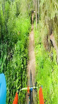
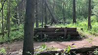
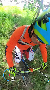
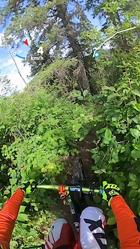
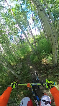
Photos of Devon
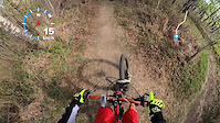
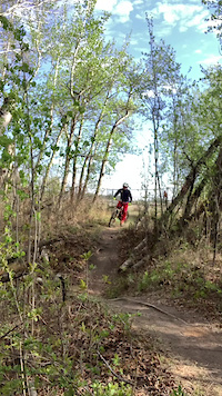
Videos of Devon
trail: Devon DH
0:12 |
54 |
Oct 29, 2024
trail: Disciple 13
0:02 |
252 |
Aug 22, 2023
trail: Devon DH
2:58 |
127 |
May 9, 2023
trail: Devon Golf Course Trail
2:18 |
31 |
May 9, 2023
trail: Voyageur Park Loop
0:51 |
60 |
Jul 17, 2022
trail: Holy Shift
0:14 |
68 |
Jul 17, 2022

trail: Disciple 13
0:10 |
153 |
Jul 17, 2022
trail: Disciple 13
0:42 |
104 |
Jul 17, 2022
Recent Trail Reports
| status | trail | date | condition | info | user |
|---|---|---|---|---|---|
| Tucker's Field: Mainline to Evergreen | Sep 10, 2022 @ 10:29am Sep 10, 2022 | Ideal | BrettMJ | ||
| River View, With a View | Aug 15, 2022 @ 3:42pm Aug 15, 2022 | Dry | BrettMJ | ||
| Tucker's Field: The Southern Escape | Sep 3, 2021 @ 11:06am Sep 3, 2021 | Ideal | Bcharanduk |
Activity Feed
| username | action | type | title | date |
|---|---|---|---|---|
| CameroneE3puD | comment | trail | activity #95150158 | May 20, 2026 @ 7:15pm May 20, 2026 |
| Mcawesom | wishlist | trail | activity #94178878 | May 6, 2026 @ 2:49pm May 6, 2026 |
| snowcruiser | ridden | trail | activity #42713237 and 3 more | Aug 8, 2023 @ 8:49am Aug 8, 2023 |
| snowcruiser | checkin | trail | activity #39637350 | May 3, 2023 @ 9:10pm May 3, 2023 |
| BrettMJ | comment | trail | activity #32543468 | Aug 15, 2022 @ 7:21pm Aug 15, 2022 |
Recent Comments
| username | type | title | comment | date |
|---|---|---|---|---|
| trail | A lady we met on this trail claims this trail... | May 20, 2026 @ 7:15pm May 20, 2026 | ||
| trail | If you’re like me your looking for something... | Aug 15, 2022 @ 7:21pm Aug 15, 2022 | ||
| trail | This trail passes by/through a nudist area.... | May 30, 2022 @ 12:10pm May 30, 2022 | ||
| report | 3 | May 5, 2021 @ 5:18pm May 5, 2021 | ||
| report | Open but very tight, Long pants and Shirt... | May 30, 2019 @ 11:08pm May 30, 2019 |
Activity Type Stats
| activitytype | trails | distance | descent | descent distance | total vertical | rating | global rank | state rank | photos | reports | routes | ridelogs |
|---|---|---|---|---|---|---|---|---|---|---|---|---|
| Mountain Bike | 46 | 31 miles | 2,562 ft | 11 miles | 233 ft | #2,448 | #25 | 185 | 615 | 4 | 8,152 | |
| E-Bike | 33 | 22 miles | 1,601 ft | 8 miles | 233 ft | #3,262 | #28 | 482 | 2 | 308 | ||
| Horse | 3 | 3 miles | 43 ft | 2,717 ft | 226 ft | 76 | ||||||
| Hike | 54 | 38 miles | 2,543 ft | 12 miles | 240 ft | #4,081 | #27 | 602 | 1 | 514 | ||
| Trail Running | 53 | 38 miles | 2,516 ft | 12 miles | 240 ft | #3,575 | #25 | 600 | 7 | 771 | ||
| Snowshoe | 17 | 15 miles | 551 ft | 4 miles | 240 ft | #576 | #19 | 42 | 31 | |||
| Nordic Ski | 5 | 4 miles | 397 ft | 2 miles | 223 ft | #799 | #21 | 13 | 202 |
Frequently Asked Questions About Devon
▼
What are the best places to ride in Devon?
Devon has 4 areas to explore for horseback.
▼
What are the highest rated horseback trails in Devon?
The highest rated horseback trails in Devon are:
- Tucker's Field: The Southern Escape (0/5)
- Tucker's Field: Mainline to Evergreen (0/5)
- River View, With a View (0/5)
▼
Where can I park to ride in Devon?
There are 6 parking locations listed in Devon. The most popular parking spots are: View all parking and trailhead locations on the map to plan your visit.
▼
What is the longest trail in Devon?
The longest trail in Devon is River View, With a View at 1.5 miles. View all trails sorted by distance.
Activities
Trails
Points of Interest
- By brenthillier
 NSMBA TRAILFORKS & contributors
 - Admins: DBA, EMBA
- #3336 - 29,749 views
- devon activity log | embed map of Devon mountain bike trails | devon mountain biking points of interest
Downloading of trail gps tracks in kml & gpx formats is enabled for Devon.
You must login to download files.