
close
3D
Trail Conditions
- Unknown
- Snow Groomed
- Snow Packed
- Snow Covered
- Snow Cover Partial
- Freeze/thaw Cycle
- Icy
- Prevalent Mud
- Wet
- Variable
- Ideal
- Dry
- Very Dry
Trail Flow (Ridden Direction)
Trailforks scans users activity logs to determine the most popular direction each trail is ridden. A good flowing trail network will have most trails flowing in a single direction according to their intension.
The colour categories are based on what percentage of users are riding a trail in its intended direction.
The colour categories are based on what percentage of users are riding a trail in its intended direction.
- > 96%
- > 90%
- > 80%
- > 70%
- > 50%
- < 50%
- bi-directional trail
- no data
Trail Last Used
Trailforks scans activity logs to determine the last time a trail was ridden.
- < 2 days
- < 1 week
- < 2 weeks
- < 1 month
- < 6 months
- > 6 months
Trail Ridden Direction
The intended direction a trail should be ridden.
- Downhill Only
- Downhill Primary
- Both Directions
- Uphill Primary
- Uphill Only
- One Direction
Contribute Details
Colors indicate trail is missing specified detail.
- Description
- Photos
- Description & Photos
- Videos
Trail Popularity ?
Trailforks scans activity logs to determine which trails are ridden the most in the last 9 months.
Trails are compared with nearby trails in the same city region with a possible 25 colour shades.
Think of this as a heatmap, more activities = more kinetic energy = warmer colors.
- most popular
- popular
- less popular
- not popular
ATV/ORV/OHV Filter
Max Vehicle Width
inches
US Cell Coverage
Legend

Radar Time
Activity Recordings
Trailforks uses anonymized public activity data.
?
Activity Recordings
Trailforks uses anonymized public activity data.
?
Winter Trails
Warning
A routing network for winter maps does not exist. Selecting trails using the winter trails layer has been disabled.
Missing Trails
Most Popular
Least Popular
Trails are colored based on popularity. The more popular a trail is, the more red. Less popular trails trend towards green.
Jump Magnitude Heatmap
Heatmap of where users jump on trails. Zoom in to see individual jumps, click circles to view jump details.
BC Backroad Status
![map legend]()
Service Road Atlas is a free to use, community-driven service for viewing and creating reports on the numerous back-country service roads around B.C. and Alberta.

Slope Aspect
Direction the slope faces
Trails Deemphasized
Trails are shown in grey.
Only show trails with no bike usage.
Suggested Layers
Based on selected activity type
Save the current map location and zoom level as your default home location whenever this page is loaded.
SaveThis area has a ton to offer for all types of recreation. Home to Great Basin National Park and Wheeler Peak (13,062′) along with some amazing mountain ranges, tons of public land, great access, and trails right from downtown Ely, you can really spend some time in this area and still not see a fraction of it.
Located about 4 hours North of Vegas, 5 hours East of Reno, and 4 hours West of Salt Lake this area is in the middle of everywhere and makes for a great stopping over point for longer journeys. It also makes for a great summer destination when the asphalt is melting your shoes down South or when you can no longer handle the crowds in the Sierras.
Located about 4 hours North of Vegas, 5 hours East of Reno, and 4 hours West of Salt Lake this area is in the middle of everywhere and makes for a great stopping over point for longer journeys. It also makes for a great summer destination when the asphalt is melting your shoes down South or when you can no longer handle the crowds in the Sierras.
source: Great Basin Trails Alliance
Trail info last updated
Activities Click to view
- Mountain Bike
97 trails
- E-Bike
60 trails
- Gravel Bike
25 trails
- Adaptive Bike
10 trails
- Winter Fat Bike
21 trails
- Horse
22 trails
- Hike
106 trails
- Trail Running
106 trails
- Dirtbike/Moto
5 trails
- ATV/ORV/OHV
7 trails
- Snowshoe
13 trails
Region Details
- 22
- 1
- 35
- 39
- 8
- 1
Region Status
Open as of Nov 4, 2026Trail Running Stats
- Global Ranking
- #1,172
- State Ranking
- #7
- Trails (view details)
- 106
- Trails Mountain Bike
- 97
- Trails E-Bike
- 60
- Trails Gravel Bike
- 25
- Trails Adaptive Bike
- 10
- Trails Winter Fat Bike
- 20
- Trails Horse
- 22
- Trails Hike
- 106
- Trails Trail Running
- 106
- Trails Dirtbike/Moto
- 5
- Trails Observed Trials
- 1
- Trails ATV/ORV/OHV
- 7
- Trails Snowmobile
- 1
- Trails Snowshoe
- 13
- Trails Nordic Ski
- 14
- Total Distance
- 157 miles
- Total Descent Distance
- 57 miles
- Total Descent
- 22,113 ft
- Total Vertical
- 4,626 ft
- Reports
- 478
- Completed Counter
- 70
Articles
Mountain Bike News, Photos, Videos & Events | Pinkbike
Apr 13, 2026 from betamtb.com
Pinkbike is the homepage of mountain biking. Stay updated with the latest news, reviews, videos, buyer's guides and racing results. Join the...
Sub Regions
-
Butte Mountains
- 1
- 3
-
Cave Lake State Park
- 3
- 6
-
Dry Mountain
- 7
-
High Schells Wilderness
-
Sacramento Pass
- 3
- 1
-
Squaw Peak
- 2
- 1
-
Ward Charcoal Ovens State Park
- 4
- 3
-
Ward Mountain
- 1
- 26
- 10
- 2
- 1
Popular Ely Trail Running Trails
• 75 ★ 3.3 • 2,661 ft • 46 ft • 3 •
This is a narrow cross trail, often used for a loop option.
• 80 ★ 4.0 • 1 mile • 20 ft • 3 •
This trail was originally built as a specific climb trail to get to the top of Ice Plant canyon, turns out that it’s a fun descent as well but keep your head up as you will likely encounter climbers. This trail is named after the...
• 90 ★ 3.0 • 2,933 ft • 151 ft • 3 •
The last part of Ice Plant is very steep and hard to climb, that’s why we call it “Heart Attack Hill” but with this trail, you really have “No Excuses” to keep climbing to the top!
• 90 ★ 3.8 • 2 miles • 11 ft • 3 •
Very steep sections and tight switchbacks. Moist and rooty bottom section...very different environmental zone.
• 95 ★ 0.0 • 1 mile • 943 ft • 3 •
This is a horse trail and is not recommended to climb or descend!
• 95 ★ 4.8 • 4,961 ft • 0 ft • 2 •
This is a downhill option around the jump section of Ice Plant. It is very fast and flowy, but don't overshoot the whoops!
Ely Routes
2 miles • 243 ft • 2 •
Photos of Ely
Videos of Ely
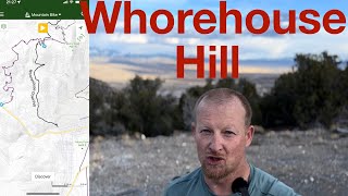
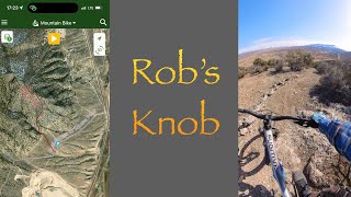

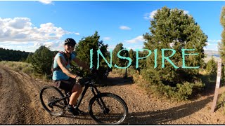
Recent Trail Reports
| status | trail | date | condition | info | user |
|---|---|---|---|---|---|
| Total BS | Nov 4, 2026 @ 4:31pm (America/Los_Angeles) Nov 4, 2026 | Ideal | kelernest GBTS | ||
| High Roller | Nov 4, 2026 @ 4:29pm (America/Los_Angeles) Nov 4, 2026 | Unknown | kelernest GBTS | ||
| Making Pancakes | Sep 13, 2026 @ 4:09pm (America/Los_Angeles) Sep 13, 2026 | Dry | Frankboboutside | ||
| No Excuses | Sep 13, 2026 @ 4:09pm (America/Los_Angeles) Sep 13, 2026 | Dry | Frankboboutside | ||
| Rope Tow | Sep 13, 2026 @ 4:09pm (America/Los_Angeles) Sep 13, 2026 | Ideal | Frankboboutside | ||
| Ward Loop H | Jul 16, 2026 @ 10:43am (America/Los_Angeles) Jul 16, 2026 | Unknown | MarthaJ427aW | ||
| G Loop | Jul 2, 2026 @ 2:21pm (America/Los_Angeles) Jul 2, 2026 | Dry | Rudolf4sFFmV | ||
| Birkebeiner Loop D | Jun 6, 2026 @ 2:38pm (America/Los_Angeles) Jun 6, 2026 | Unknown | tobypalmer1 | ||
| Powderberry Divide | Jun 4, 2026 @ 4:38pm (America/Los_Angeles) Jun 4, 2026 | Dry | aobbard | ||
| FreeWheeler | Jun 4, 2026 @ 4:36pm (America/Los_Angeles) Jun 4, 2026 | Ideal | aobbard |
Activity Feed
| username | action | type | title | date |
|---|---|---|---|---|
| ledgekat | wishlist | region | activity #107972280 | Nov 17, 2026 @ 9:24pm Nov 17, 2026 |
| NickPoirier1976 | wishlist | region | activity #107688203 | Nov 12, 2026 @ 6:47pm Nov 12, 2026 |
| KevinMurray | vote | trail | activity #107611532 | Nov 11, 2026 @ 11:31am Nov 11, 2026 |
| kelernest | add | report | activity #107211457 | Nov 4, 2026 @ 4:31pm Nov 4, 2026 |
| kelernest | add | report | activity #107211373 | Nov 4, 2026 @ 4:29pm Nov 4, 2026 |
Recent Comments
| username | type | title | comment | date |
|---|---|---|---|---|
| trail | Yep counter clockwise. The trail is marked as... | Oct 8, 2026 @ 5:59pm Oct 8, 2026 | ||
| trail | Class 1 e-bikes allowed per Nevada State Park regs | Sep 29, 2026 @ 7:23am Sep 29, 2026 | ||
| trail | Ely is coming up! This trail is classic loose... | Sep 14, 2026 @ 8:19am Sep 14, 2026 | ||
| trail | In addition, this trail is unsustainable as... | Aug 27, 2026 @ 10:45am Aug 27, 2026 | ||
| trail | See comments below!!!! | Jul 16, 2026 @ 10:56am Jul 16, 2026 |
Local Badges
-

10 Green Trails0 awarded -

10 Blue Trails0 awarded -

Epic Trail Running Climb 2k0 awarded -

Climbing 10k Badge0 awarded -

Trail Running 100k Badge0 awarded -

Completionist0 awarded
Local Trail Running Directory
-
Great Basin Trails StewardshipTrail Association
![Great Basin Trails Stewardship]()
Activity Type Stats
| activitytype | trails | distance | descent | descent distance | total vertical | rating | global rank | state rank | photos | reports | routes | activity logs |
|---|---|---|---|---|---|---|---|---|---|---|---|---|
| Mountain Bike | 97 | 129 miles | 19,016 ft | 53 miles | 2,887 ft | #1,468 | #7 | 210 | 478 | 21 | 6,101 | |
| E-Bike | 60 | 74 miles | 10,617 ft | 28 miles | 2,835 ft | #2,451 | #13 | 378 | 2 | 593 | ||
| Gravel Bike | 25 | 48 miles | 1,946 ft | 9 miles | 2,451 ft | #1,682 | #7 | 24 | 1 | 11 | ||
| Adaptive Bike | 10 | 24 miles | 705 ft | 6 miles | 1,923 ft | #2,828 | #10 | 55 | ||||
| Winter Fat Bike | 21 | 26 miles | 3,806 ft | 11 miles | 1,512 ft | #1,658 | #5 | 10 | 1 | |||
| Horse | 22 | 46 miles | 4,452 ft | 9 miles | 4,531 ft | #1,231 | #12 | 3 | 116 | |||
| Hike | 106 | 157 miles | 22,113 ft | 57 miles | 4,626 ft | #703 | #6 | 6 | 478 | 1 | 523 | |
| Trail Running | 106 | 157 miles | 22,113 ft | 57 miles | 4,626 ft | #1,172 | #7 | 478 | 1 | 95 | ||
| Dirtbike/Moto | 5 | 8 miles | 600 ft | 2 miles | 1,509 ft | #1,102 | #8 | 41 | 2 | |||
| Observed Trials | 1 | 4,465 ft | 230 ft | 2,759 ft | 180 ft | |||||||
| ATV/ORV/OHV | 7 | 11 miles | 712 ft | 2 miles | 1,509 ft | #756 | #5 | 41 | 6 | |||
| Snowmobile | 1 | 1 mile | 138 ft | 52 ft | 1 | |||||||
| Snowshoe | 13 | 22 miles | 3,435 ft | 10 miles | 1,535 ft | #767 | #1 | 4 | 24 | |||
| Nordic Ski | 14 | 22 miles | 3,533 ft | 10 miles | 1,463 ft | 3 | 16 |
Frequently Asked Questions
▼
What are the best places to run in Ely?
Ely has 8 areas to explore for trail running. The top rated areas are:
▼
What are the highest rated trail running trails in Ely?
The highest rated trail running trails in Ely are:
- Overlook Trail (0/5)
- Shelter Connector Trail (0/5)
- Connector (0/5)
- Cave Overlook Horse Trail (0/5)
- Steptoe Creek 2 (0/5)
▼
What is the best time of the year to run in Ely?
Based on activity log data, the most popular months to run in Ely are:
- September (3 activities)
- April (1 activities)
- October (1 activities)
▼
Where can I park to run in Ely?
There are 20 parking locations listed in Ely. The most popular parking spots are:
- X-Gate Parking
- Cedar Chips Parking Area
- Ward Mountain Recreation Area Parking
- Steptoe Creek North
- Overlook Trailhead Parking
▼
What is the longest trail in Ely?
The longest trail in Ely is Kolcheck at 6.5 miles. View all trails sorted by distance.
▼
What are the best & highest rated hiking trails in Ely?
The best hiking trails in Ely are: View all hiking trails sorted by popularity score.
▼
How many trails are in Ely?
Ely has a total of 109 trails. Of those, 106 are designated for trail running. Browse top trail running trails in Ely to find detailed information including difficulty ratings, distances, and trail conditions.
▼
Which trail has the most elevation gain in Ely?
The trail with the most elevation gain in Ely is Kolcheck with 3,277 ft of elevation gain. View all trails sorted by elevation gain.
▼
Which trail has the most elevation descent in Ely?
The trail with the most elevation descent in Ely is Powderberry Divide with 1,694 ft of elevation descent. View all trails sorted by elevation descent.
▼
What activities are most popular in Ely?
Ely supports the following activities: Mountain Biking, E-Biking, Gravel Biking, Adaptive Biking, Winter Fat Biking, Horseback, Hiking, Trail Running, Dirtbiking, ATVing/Offroading, Snowshoeing.
▼
What are the steepest trail running trails in Ely?
The steepest trail running trail in Ely is North Fork Timber Creek with an average grade of 15.3%. View all trails sorted by grade.
▼
Are the trails open in Ely?
The overall region status for Ely is Clear / Green. Out of 64 trails:
- Clear / Green: 62
- Minor Issue / Yellow: 1
- Closed: 1
▼
What are the most popular trail running routes in Ely?
The most popular trail running routes in Ely are: View all trail running routes in Ely.
▼
What is the highest summit in Ely?
The highest summit in Ely is Mount Moriah at 12,060 ft elevation.
▼
What trails are closed in Ely?
There are currently 1 closed trails in Ely. The breakdown of all trail statuses is:
- Clear / Green: 62
- Minor Issue / Yellow: 1
- Closed: 1
▼
Are there accessible or adaptive trails in Ely?
Yes, there are 10 accessible/adaptive trails in Ely. View all adaptive trails in Ely for specific accessibility information.
▼
Are there local clubs or events in Ely?
There are 1 local clubs or associations listed in the Ely directory. Browse the local directory for details.
▼
What are the most popular trail running trails in Ely?
The most popular trail running trails in Ely are: View all trail running trails sorted by popularity.
▼
What are the best beginner trail run trails in Ely?
The best beginner trail running trails in Ely are:
- Shelter Connector Trail (0/5)
- Steptoe Creek 2 (0/5)
- FreeWheeler (0/5)
Activities
Trails
Points of Interest
- By natenbake & contributors
- Admins: apply
- #3386 - 20,507 views
- ely activity log | embed map of Ely mountain bike trails | ely mountain biking points of interest
Downloading of trail gps tracks in kml & gpx formats is enabled for Ely.
You must login to download files.
