
close
3D
Trail Conditions
- Unknown
- Snow Groomed
- Snow Packed
- Snow Covered
- Snow Cover Partial
- Freeze/thaw Cycle
- Icy
- Prevalent Mud
- Wet
- Variable
- Ideal
- Dry
- Very Dry
Trail Flow (Ridden Direction)
Trailforks scans users activity logs to determine the most popular direction each trail is ridden. A good flowing trail network will have most trails flowing in a single direction according to their intension.
The colour categories are based on what percentage of users are riding a trail in its intended direction.
The colour categories are based on what percentage of users are riding a trail in its intended direction.
- > 96%
- > 90%
- > 80%
- > 70%
- > 50%
- < 50%
- bi-directional trail
- no data
Trail Last Used
Trailforks scans activity logs to determine the last time a trail was ridden.
- < 2 days
- < 1 week
- < 2 weeks
- < 1 month
- < 6 months
- > 6 months
Trail Ridden Direction
The intended direction a trail should be ridden.
- Downhill Only
- Downhill Primary
- Both Directions
- Uphill Primary
- Uphill Only
- One Direction
Contribute Details
Colors indicate trail is missing specified detail.
- Description
- Photos
- Description & Photos
- Videos
Trail Popularity ?
Trailforks scans activity logs to determine which trails are ridden the most in the last 9 months.
Trails are compared with nearby trails in the same city region with a possible 25 colour shades.
Think of this as a heatmap, more activities = more kinetic energy = warmer colors.
- most popular
- popular
- less popular
- not popular
ATV/ORV/OHV Filter
Max Vehicle Width
inches
US Cell Coverage
Legend

Radar Time
Activity Recordings
Trailforks uses anonymized public activity data.
?
Activity Recordings
Trailforks uses anonymized public activity data.
?
Winter Trails
Warning
A routing network for winter maps does not exist. Selecting trails using the winter trails layer has been disabled.
Missing Trails
Most Popular
Least Popular
Trails are colored based on popularity. The more popular a trail is, the more red. Less popular trails trend towards green.
Jump Magnitude Heatmap
Heatmap of where users jump on trails. Zoom in to see individual jumps, click circles to view jump details.
BC Backroad Status
![map legend]()
Service Road Atlas is a free to use, community-driven service for viewing and creating reports on the numerous back-country service roads around B.C. and Alberta.

Slope Aspect
Direction the slope faces
Trails Deemphasized
Trails are shown in grey.
Only show trails with no bike usage.
Suggested Layers
Based on selected activity type
Save the current map location and zoom level as your default home location whenever this page is loaded.
SaveForest Park is a 5100-acre park in NW Portland with around 70 miles of trails and fire roads. Of those 70, only 29 miles are open to bikes, and only one mile of that is singletrack (Firelane 5). Forest Park is a great spot for a non-technical cross country ride or a gravel ride. The fire roads and trails are often wet from November until June, so fenders are your friend.
Up until the 1980s, most trails in the park were open to cyclists. That changed starting in the late 1980s with the adoption of the Forest Park Natural Resource management plan, which severely restricted bike access. NWTA’s predecessor group, Portland United Mountain Pedalers (PUMP) was formed in part to respond to these proposed new restrictions. Since that time, many efforts continue to try and expand access to singletrack. In 2006 PUMP, in collaboration with Friends of Forest Park (now Forest Park Conservancy) and Portland Parks & Recreation, constructed a short section of singletrack on Firelane 5. It remains the only section of singletrack in the park open to cyclists.
In 2020 NWTA signed an agreement with Portland Parks to become the steward of soft-surface multi-use trails in Portland Parks including Forest Park. Initially, this will just involve the maintenance of these trails. NWTA continues to advocate for expanding trail access within the published Portland Off-Road Cycling Master Plan.
Primary Trail Type: Cross-Country
Land Status: City Managed
 google parking directions plan a road trip here
Access Info:
Open 5:00 a.m. – 10:00 p.m. The park can be accessed from a number of points including NW Thurman, Germantown Road, Skyline, Road, Highway 30, and Saltzman Road. Parking is free at trailheads, although for many Portlanders it is easier to just ride to the trails.
Trail info last updated
Activities Click to view
- Mountain Bike
17 trails
- E-Bike
1 trails
- Horse
8 trails
- Hike
57 trails
- Trail Running
57 trails
Region Details
- 9
- 6
- 2
Region Status
Open as of Oct 3, 2026
Stats
- Avg Trail Rating
- Trails (view details)
- 57
- Trails Mountain Bike
- 17
- Trails E-Bike
- 1
- Trails Gravel Bike
- 12
- Trails Adaptive Bike
- 19
- Trails Winter Fat Bike
- 3
- Trails Horse
- 8
- Trails Hike
- 57
- Trails Trail Running
- 57
- Total Distance
- 82 miles
- Total Descent
- 15,430 ft
- Total Vertical
- 1,090 ft
- Highest Trailhead
- 1,132 ft
- Reports
- 458
- Photos
- 44
- Completed Counter
- 12,371
Popular Forest Park Mountain Biking Trails
• 85 ★ 3.5 • 1 mile • 23 ft • 689 •
Popular green difficulty singletrack. This multi-use trail can be used downhill primary. On average it takes 5 minutes to complete this trail.
• 70 ★ 3.8 • 4,623 ft • 0 ft • 289 •
FL 3 is a nice fast (when dry) mostly single track downhill. It's relatively short and drops you onto Lief Erikson Rd. Should only be ridden downhill. Watch for hikers. Will be muddy if recently rained
• 55 ★ 1.6 • 1 mile • 473 ft • 210 •
Moderately popular blue difficulty singletrack. This multi-use trail can be used both directions. On average it takes 17 minutes to complete this trail.
• 45 ★ 1.9 • 1 mile • 134 ft • 136 •
A steep gravel/dirt doubletrack. The section below Leif Erikson is in disrepair and often muddy and rutted/off-camber. Not currently worth riding the lower bit.
• 60 ★ 4.0 • 4,383 ft • 27 ft • 119 •
Moderately popular green difficulty doubletrack. This multi-use trail can be used downhill primary and has a easy overall physical rating with a 27 ft blue climb. Trail visibility is always easy to follow. On average it takes 4 minutes to complete this trail.
• 35 ★ 2.4 • 1 mile • 191 ft • 117 •
Less popular green difficulty singletrack. This multi-use trail can be used both directions and has a easy overall physical rating with a 191 ft green climb. Trail visibility is always easy to follow. On average it takes 9 minutes to complete this trail.
Forest Park Mountain Bike Routes
★ 3.0 • 15 miles • 1,833 ft • 4 • Loop •
Loop that goes up Holman Lane then comes back down through Forest Park.
• 24 miles • 2,701 ft • 6 •
• 13 miles • 2,224 ft • 8 •
• 3 miles • 15 ft • 0 •
• 10 miles • 1,979 ft • 6 •
• 9 miles • 1,790 ft • 4 •
Photos of Forest Park Mountain Bike
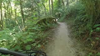
Videos of Forest Park Mountain Bike
Recent Trail Reports
| status | trail | date | condition | info | user |
|---|---|---|---|---|---|
| NW Leif Erikson Drive | Oct 3, 2026 @ 9:42am (America/Los_Angeles) Oct 3, 2026 | Dry | ckohlmeier | ||
| Springville Road | Oct 3, 2026 @ 9:42am (America/Los_Angeles) Oct 3, 2026 | Dry | ckohlmeier | ||
| Firelane 10 | Oct 3, 2026 @ 9:42am (America/Los_Angeles) Oct 3, 2026 | Dry | ckohlmeier | ||
| Firelane 3 | Oct 3, 2026 @ 9:42am (America/Los_Angeles) Oct 3, 2026 | Dry | ckohlmeier | ||
| Holman Lane | Oct 3, 2026 @ 9:42am (America/Los_Angeles) Oct 3, 2026 | Dry | ckohlmeier | ||
| Newton Road | Sep 30, 2026 @ 11:41am (America/Los_Angeles) Sep 30, 2026 | Dry | underscorefool | ||
| Upper NW Saltzman | Sep 1, 2026 @ 12:58pm (America/Vancouver) Sep 1, 2026 | Ideal | Mdeniston | ||
| Firelane 1 | Aug 17, 2026 @ 12:38pm (America/Vancouver) Aug 17, 2026 | Dry | Mdeniston | ||
| Firelane 5 | Aug 17, 2026 @ 12:38pm (America/Vancouver) Aug 17, 2026 | Dry | Mdeniston | ||
| NW Firelane 15 Road | Aug 7, 2026 @ 10:07am (America/Vancouver) Aug 7, 2026 | Ideal | Mdeniston |
Activity Feed
| username | action | type | title | date |
|---|---|---|---|---|
| monaf | wishlist | trail | activity #105883931 | Oct 14, 2026 @ 12:06pm Oct 14, 2026 |
| ckohlmeier | add | report | activity #105252984 and 5 more | Oct 4, 2026 @ 8:03pm Oct 4, 2026 |
| underscorefool | add | report | activity #104944288 and 1 more | Sep 30, 2026 @ 4:37pm Sep 30, 2026 |
| ToddxpbDHJ | wishlist | trail | activity #103658278 and 2 more | Sep 12, 2026 @ 2:39pm Sep 12, 2026 |
| Mdeniston | add | report | activity #102871817 and 1 more | Sep 1, 2026 @ 9:41pm Sep 1, 2026 |
Recent Comments
| username | type | title | comment | date |
|---|---|---|---|---|
| trail | Bikes are permitted. Nice, serene trail.... | Jul 1, 2026 @ 8:03am Jul 1, 2026 | ||
| report | Dry and getting a little dusty. There were a... | Jun 16, 2026 @ 1:32pm Jun 16, 2026 | ||
| trail | Super fun and right in our backyard. Very short. | May 27, 2025 @ 6:20pm May 27, 2025 | ||
| trail | Firelane 10 is bike legal. Ignore above comment | Oct 17, 2024 @ 11:20am Oct 17, 2024 | ||
| trail | Great gravel ride! All grades are pretty... | Sep 13, 2024 @ 8:19pm Sep 13, 2024 |
Nearby Areas
| name | distance | ||||
|---|---|---|---|---|---|
| Kaiser Woods Park | 1 | 2.9 km | |||
| Eichler Park | 2 | 1 | 1 | 8 km | |
| Vancouver Lake Park | 2 | 8.2 km | |||
| River View Natural Area | 9.3 km | ||||
| Sauvie Island | 9 | 9.7 km |


Activity Type Stats
| activitytype | trails | distance | descent | descent distance | total vertical | rating | global rank | state rank | photos | reports | routes | activity logs |
|---|---|---|---|---|---|---|---|---|---|---|---|---|
| Mountain Bike | 17 | 31 miles | 6,102 ft | 12 miles | 1,073 ft | #3,840 | #42 | 31 | 455 | 1 | 24,539 | |
| E-Bike | 1 | 1 mile | 397 ft | #8,911 | #77 | 418 | 684 | |||||
| Gravel Bike | 12 | 23 miles | 3,907 ft | 8 miles | 1,073 ft | #5,565 | #2,402 | 8 | 234 | 1 | 731 | |
| Adaptive Bike | 19 | 15 miles | 4,547 ft | 7 miles | 1,056 ft | #5,574 | #2,402 | 38 | ||||
| Winter Fat Bike | 3 | 2 miles | 26 ft | 764 ft | 397 ft | #5,565 | #2,402 | |||||
| Horse | 8 | 11 miles | 4,186 ft | 7 miles | 1,024 ft | #2,189 | #46 | 39 | ||||
| Hike | 57 | 82 miles | 15,430 ft | 32 miles | 1,089 ft | #2,203 | #31 | 4 | 457 | 3,188 | ||
| Trail Running | 57 | 82 miles | 15,430 ft | 32 miles | 1,089 ft | #877 | #12 | 1 | 457 | 8,807 |
Frequently Asked Questions
▼
What are the highest rated mountain biking trails in Forest Park?
The highest rated mountain biking trails in Forest Park are:
- Firelane 1 (4/5)
- Firelane 3 (3.9/5)
- Firelane 5 (3.6/5)
- Firelane 15 (3.6/5)
- NW Firelane 15 Road (3.3/5)
▼
What is the best time of the year to ride in Forest Park?
Based on activity log data, the most popular months to ride in Forest Park are:
- August (169 activities)
- July (167 activities)
- June (161 activities)
▼
Where can I park to ride in Forest Park?
There are 19 parking locations listed in Forest Park. The most popular parking spots are: View all parking and trailhead locations on the map to plan your visit.
▼
What is the longest trail in Forest Park?
The longest trail in Forest Park is Firelane 15 at 2.2 miles. View all trails sorted by distance.
▼
What are the best & highest rated hiking trails in Forest Park?
The best hiking trails in Forest Park are: View all hiking trails sorted by popularity score.
▼
What are the best & highest rated trail running trails in Forest Park?
The best trail running trails in Forest Park are: View all trail running trails sorted by popularity score.
▼
How many trails are in Forest Park?
Forest Park has a total of 57 trails. Of those, 17 are designated for mountain biking. Browse top mountain biking trails in Forest Park to find detailed information including difficulty ratings, distances, and trail conditions.
▼
Which trail has the most elevation gain in Forest Park?
The trail with the most elevation gain in Forest Park is Firelane 12 with 669 ft of elevation gain. View all trails sorted by elevation gain.
▼
Which trail has the most elevation descent in Forest Park?
The trail with the most elevation descent in Forest Park is Firelane 15 with 830 ft of elevation descent. View all trails sorted by elevation descent.
▼
What activities are most popular in Forest Park?
Forest Park supports the following activities: Mountain Biking, E-Biking, Horseback, Hiking, Trail Running.
▼
What are the steepest mountain biking trails in Forest Park?
The steepest mountain biking trail in Forest Park is Firelane 12 with an average grade of 8%. View all trails sorted by grade.
▼
Are there any trails with scenic viewpoints in Forest Park?
Yes, there are 1 scenic viewpoints marked along trails in Forest Park. Some popular viewpoints include: Explore more points of interest to find trails with the best views.
▼
Are the trails open in Forest Park?
The overall region status for Forest Park is Clear / Green. Out of 38 trails:
- Clear / Green: 33
- Minor Issue / Yellow: 5
▼
Can I ride an ebike in Forest Park?
Yes, Forest Park supports e-bike riding. There are 1 trails in Forest Park that allow e-bikes. Check the e-bike trails listing for specific trail access details and any local regulations.
▼
What are the most popular mountain biking routes in Forest Park?
The most popular mountain biking routes in Forest Park are: View all mountain biking routes in Forest Park.
▼
What type of bike is most common in Forest Park?
Based on activity log data, the most common bike types used in Forest Park are:
- AM (64 activities)
- XC (17 activities)
- Gravel (1 activities)
▼
What are the most popular Strava Segments in Forest Park?
The most popular Strava segments in Forest Park are:
- Last riser before Saltzman (12,264 athletes)
- Four Dog Night (11,177 athletes)
- Wild-Salz-Wood-Man (10,305 athletes)
▼
What are the most popular mountain biking trails in Forest Park?
The most popular mountain biking trails in Forest Park are: View all mountain biking trails sorted by popularity.
▼
What are the best beginner ride trails in Forest Park?
The best beginner mountain biking trails in Forest Park are:
- Firelane 1 (4/5)
- Firelane 5 (3.5/5)
- Firelane 15 (1/5)
Activities
- By mattsavage & contributors
- Admins: spokesmanmtb
- #7092 - 25,372 views
- forest park activity log | embed map of Forest Park mountain bike trails | forest park mountain biking points of interest
Downloading of trail gps tracks in kml & gpx formats is enabled for Forest Park.
You must login to download files.
