close
-
Layers w
- Weather Layers
- Pro
- Pro
- Pro
- Pro
- Pro
- Pro
- More Layers
- Pro
- Pro
- Pro
- Pro
-
Upgrade to

3D
Trail Conditions
- Unknown
- Snow Groomed
- Snow Packed
- Snow Covered
- Snow Cover Partial
- Freeze/thaw Cycle
- Icy
- Prevalent Mud
- Wet
- Variable
- Ideal
- Dry
- Very Dry
Trail Flow (Ridden Direction)
Trailforks scans users ridelogs to determine the most popular direction each trail is ridden. A good flowing trail network will have most trails flowing in a single direction according to their intension.
The colour categories are based on what percentage of riders are riding a trail in its intended direction.
The colour categories are based on what percentage of riders are riding a trail in its intended direction.
- > 96%
- > 90%
- > 80%
- > 70%
- > 50%
- < 50%
- bi-directional trail
- no data
Trail Last Ridden
Trailforks scans ridelogs to determine the last time a trail was ridden.
- < 2 days
- < 1 week
- < 2 weeks
- < 1 month
- < 6 months
- > 6 months
Trail Ridden Direction
The intended direction a trail should be ridden.
- Downhill Only
- Downhill Primary
- Both Directions
- Uphill Primary
- Uphill Only
- One Direction
Contribute Details
Colors indicate trail is missing specified detail.
- Description
- Photos
- Description & Photos
- Videos
Trail Popularity ?
Trailforks scans ridelogs to determine which trails are ridden the most in the last 9 months.
Trails are compared with nearby trails in the same city region with a possible 25 colour shades.
Think of this as a heatmap, more rides = more kinetic energy = warmer colors.
- most popular
- popular
- less popular
- not popular
ATV/ORV/OHV Filter
Max Vehicle Width
inches
US Cell Coverage
Legend

Radar Time
Activity Recordings
Trailforks uses anonymized public activity data.
?
Activity Recordings
Trailforks uses anonymized public activity data.
?
Personal Heatmap
▶
Activity Types
all
/
none
▶
Options
2
Date range
month
–
Winter Trails
Warning
A routing network for winter maps does not exist. Selecting trails using the winter trails layer has been disabled.
Missing Trails
Most Popular
Least Popular
Trails are colored based on popularity. The more popular a trail is, the more red. Less popular trails trend towards green.
Jump Magnitude Heatmap
Heatmap of where riders jump on trails. Zoom in to see individual jumps, click circles to view jump details.
BC Backroad Status
![map legend]()
Service Road Atlas is a free to use, community-driven service for viewing and creating reports on the numerous back-country service roads around B.C. and Alberta.

Slope Aspect
Direction the slope faces
Trails Deemphasized
Trails are shown in grey.
Only show trails with no bike usage.
Suggested Layers
Based on selected activity type
Save the current map location and zoom level as your default home location whenever this page is loaded.
Save
No description for Gotland has been added yet!
Login or register to submit one.
This region uses the Uk/Euro style trail grading system.
Region Details
- 138
- 73
- 140
- 22
- 2
Stats
- Avg Trail Rating
- Trails (view details)
- 375
- Trails Mountain Bike
- 375
- Trails E-Bike
- 9
- Trails Gravel Bike
- 179
- Trails Adaptive Bike
- 112
- Trails Winter Fat Bike
- 11
- Trails Horse
- 19
- Trails Hike
- 360
- Trails Trail Running
- 365
- Trails Dirtbike/Moto
- 1
- Trails ATV/ORV/OHV
- 1
- Trails Snowmobile
- 1
- Trails Snowshoe
- 2
- Trails Nordic Ski
- 9
- Total Distance
- 273 miles
- Total Descent
- 7,889 ft
- Total Vertical
- 274 ft
- Highest Trailhead
- 274 ft
- Reports
- 1,112
- Photos
- 211
- Ridden Counter
- 11,862
Sub Regions
- Region Gotland (375)
- Fårö (4)
- Gotland Bike Park (213)
- Klintehamn (27)
- Ljugarn (12)
- Stenkumla (24)
- Visby (31)
- Visby MTB Park (9)
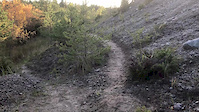
Popular Gotland Mountain Biking Trails
• 100 ★ 4.0 • 750 ft • 2 ft • 204 •
Hängbron is an easy dualtrack that takes you to hängbron and
• 100 ★ 3.5 • 1,181 ft • 2 ft • 200 •
Popular blue difficulty machine groomed. This mountain bike primary trail can be used both directions and has a easy overall physical rating with a 2 ft green climb. It features berm and jump. On average it takes 1 minutes to complete this trail.
• 50 ★ 0.0 • 827 ft • 3 ft • 190 •
parallellstig till 147:an över gräset från Preem till , körs för att slippa bilarna
• 95 ★ 4.5 • 2,216 ft • 23 ft • 168 •
is a easy singletrack that serpentines it´s way through the woods, passing over spillingsån halfway on a wo bridge.
• 100 ★ 4.2 • 438 ft • 5 ft • 164 •
Highly rated popular black difficulty singletrack. This mountain bike primary trail can be used one direction and has a hard overall physical rating with a 5 ft green climb. It features a-frame, pump track and skinny. On average it takes minutes to complete this trail.
• 100 ★ 4.0 • 522 ft • 5 ft • 159 •
Draknästet is an alternative trail for those who not dare to ride but still like a challange.
Gotland Mountain Bike Routes
★ 4.5 • 3 miles • 58 ft • 3 •
Singletrack som varvas med 2km spång i naturskön gotlandsmyr, på sina håll teknisk med en del rötter...
★ 5.0 • 2 miles • 128 ft • 11 • Loop •
Klintrundan startar efter hängbron utför på Tvättbrädan, en ca tre km lång teknisk slinga med...
11 miles • 599 ft • 11 • Point to Point •
Vacker stig längs kusten med fantastisk utsikt vid klinten. Vid Lummelundagrottan går det antagligen att...
★ 5.0 • 11 miles • 276 ft • 9 • Out & Back •
Ta en tur ut på vackra ! På vägen passerar du gårdsbutiker och Barläst Kalkbruksområde som har anor...
1 mile • 43 ft • 7 • Loop •
Arenasprinten Startar på toppen av och består av två lika långa sammankopplade slingor. den första...
9 miles • 345 ft • 15 • Out & Back •
En trevlig cykeltur genom skogarna och naturreservaten runt burg och Hejnum. Målet med turen är Graute...
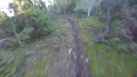
Photos of Gotland Mountain Bike
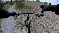
Videos of Gotland Mountain Bike
trail: Över Döden
0:22 |
271 |
Feb 2, 2020
trail: Flowride
0:52 |
148 |
Feb 1, 2020
trail: Asunden Stora Varvet
0:45 |
88 |
Feb 1, 2020
trail: Lännaberget
0:05 |
77 |
Sep 7, 2018
trail: Över Döden
0:15 |
334 |
Feb 13, 2018
trail: Döden
0:09 |
340 |
Feb 13, 2018
trail: Draknästet
0:22 |
261 |
Feb 13, 2018

0:42 |
150 |
Oct 31, 2017
Recent Trail Reports
| status | trail | date | condition | info | user |
|---|---|---|---|---|---|
| MTB-Banan Röda Slingan Visby MTB Park | Jul 7, 2026 @ 8:08pm (Europe/Stockholm) 3 days | Ideal | enduropeter NOTV | ||
| Gothemhammar Gotland Bike Park | Jul 29, 2025 @ 2:53pm Jul 29, 2025 | Dry | KerstinsjciE3 | ||
| Gothems Strandbadsväg Gotland Bike Park | Jul 29, 2025 @ 2:53pm Jul 29, 2025 | Dry | KerstinsjciE3 | ||
| Kuststigen Visby | Jul 20, 2025 @ 7:33pm Jul 20, 2025 | Ideal | Lillkick | ||
| Haid Ride Gotland Bike Park | Jul 10, 2025 @ 4:26am Jul 10, 2025 | Ideal | Hermelinen | ||
| TerraNova 2 Visby | Jun 27, 2025 @ 5:54pm Jun 27, 2025 | Dry | LarsAn5Omx | ||
| Graute Genväg Gotland Bike Park | Mar 2, 2025 @ 1:06pm Mar 2, 2025 | Ideal | Lillkick | ||
| Visby Motionsspår 1 Visby MTB Park | Feb 9, 2025 @ 1:20pm Feb 9, 2025 | Variable | LarsAn5Omx | ||
| Draknästet Gotland Bike Park | Jul 28, 2024 @ 3:09am Jul 28, 2024 | Variable | mrkyhahn | ||
| Drakfoten Gotland Bike Park | Jul 28, 2024 @ 3:09am Jul 28, 2024 | Variable | mrkyhahn |
Activity Feed
| username | action | type | title | date |
|---|---|---|---|---|
| OrjanX | like | report | activity #98796501 | Jul 9, 2026 @ 10:29am 14 hours |
| OrjanX | comment | trail | activity #98796435 | Jul 9, 2026 @ 10:28am 14 hours |
| OrjanX | update | trail | activity #98796416 | Jul 9, 2026 @ 10:28am 14 hours |
| Kolifej | comment | trail | activity #98792863 | Jul 9, 2026 @ 9:38am 15 hours |
| Kolifej | vote | trail | activity #98792767 | Jul 9, 2026 @ 9:36am 15 hours |
Recent Comments
| username | type | title | comment | date |
|---|---|---|---|---|
| trail | Nu uppdaterad plot, namn och aktuell Strava. | Jul 9, 2026 @ 10:28am 14 hours | ||
| trail | Körde rött spår. Trevlig runda. Bra skyltat... | Jul 9, 2026 @ 9:38am 15 hours | ||
| trail | Svårhittad där skogen öppnar upp med högt... | Jul 2, 2025 @ 2:33am Jul 2, 2025 | ||
| trail | Lätt och smidigt första hälften sedan... | Jun 8, 2025 @ 6:55am Jun 8, 2025 | ||
| trail | Gör en stigrapport (Trail Report) istället. | Jun 30, 2024 @ 12:35pm Jun 30, 2024 |
Local Badges
-

Epic Ride Climb 2k0 awarded -

Climbing 10k Badge22 awarded -

Climbing 100k Badge1 awarded -

Epic Ride Descent 2k0 awarded -

Descent 10k Badge22 awarded -

Descent 100k Badge1 awarded
Bike & Skill Parks
| name | type | city | rating |
|---|---|---|---|
| Gotland Bike Park Pumptrack | skill park | Region Gotland | |
| cementa arena | skill park | Region Gotland | |
| Lännaberget Rauk n Roll | skill park | Region Gotland | |
| Sudersand Dirt Track | skill park | Region Gotland |
Activity Type Stats
| activitytype | trails | distance | descent | descent distance | total vertical | rating | global rank | state rank | photos | reports | routes | ridelogs |
|---|---|---|---|---|---|---|---|---|---|---|---|---|
| Mountain Bike | 375 | 273 miles | 7,890 ft | 102 miles | 272 ft | 205 | 1,112 | 18 | 10,826 | |||
| E-Bike | 9 | 4 miles | 141 ft | 1 mile | 197 ft | 795 | 2 | 152 | ||||
| Gravel Bike | 179 | 137 miles | 3,255 ft | 51 miles | 269 ft | 356 | 1 | 29 | ||||
| Adaptive Bike | 112 | 80 miles | 1,588 ft | 31 miles | 230 ft | 527 | 1 | |||||
| Winter Fat Bike | 11 | 14 miles | 466 ft | 5 miles | 184 ft | 19 | ||||||
| Horse | 19 | 16 miles | 702 ft | 8 miles | 184 ft | 581 | ||||||
| Hike | 360 | 261 miles | 7,579 ft | 98 miles | 272 ft | 1,112 | 5 | 372 | ||||
| Trail Running | 365 | 265 miles | 7,697 ft | 99 miles | 272 ft | 5 | 1,112 | 5 | 1,066 | |||
| Dirtbike/Moto | 1 | 545 ft | 3 ft | 220 ft | 581 | 2 | ||||||
| ATV/ORV/OHV | 1 | 545 ft | 3 ft | 220 ft | 581 | 1 | ||||||
| Snowmobile | 1 | 545 ft | 3 ft | 220 ft | 1 | |||||||
| Snowshoe | 2 | 2 miles | 108 ft | 3,419 ft | 69 ft | |||||||
| Nordic Ski | 9 | 6 miles | 348 ft | 2 miles | 233 ft | 180 |
Activities
Trails
Points of Interest
- Tiselhagen naturreservat Sight
- Dagghagen naturreservat Sight
- Hideviken naturreservat Sight
- Bruten naturreservat Sight
- Storhagen naturreservat Sight
- Kallgatburg naturreservat Sight
- Bojsvätar naturreservat Sight
- Bälsalvret naturreservat Sight
- Blautmörskogen naturreservat Sight
- Mojner naturreservat Sight
- By brenthillier
 NSMBA TRAILFORKS & contributors
 - Admins: ollesvenskonthetrail, JALLE, OrjanX, martinlindstr, pyjamas, Jonashenning
- #9830 - 9,102 views
- gotland activity log | embed map of Gotland mountain bike trails | gotland mountain biking points of interest
Downloading of trail gps tracks in kml & gpx formats is enabled for Gotland.
You must login to download files.