close
-
Layers w
- Weather Layers
- Pro
- Pro
- Pro
- Pro
- Pro
- Pro
- More Layers
- Pro
- Pro
- Pro
- Pro
-
Upgrade to

3D
Trail Conditions
- Unknown
- Snow Groomed
- Snow Packed
- Snow Covered
- Snow Cover Partial
- Freeze/thaw Cycle
- Icy
- Prevalent Mud
- Wet
- Variable
- Ideal
- Dry
- Very Dry
Trail Flow (Ridden Direction)
Trailforks scans users ridelogs to determine the most popular direction each trail is ridden. A good flowing trail network will have most trails flowing in a single direction according to their intension.
The colour categories are based on what percentage of riders are riding a trail in its intended direction.
The colour categories are based on what percentage of riders are riding a trail in its intended direction.
- > 96%
- > 90%
- > 80%
- > 70%
- > 50%
- < 50%
- bi-directional trail
- no data
Trail Last Ridden
Trailforks scans ridelogs to determine the last time a trail was ridden.
- < 2 days
- < 1 week
- < 2 weeks
- < 1 month
- < 6 months
- > 6 months
Trail Ridden Direction
The intended direction a trail should be ridden.
- Downhill Only
- Downhill Primary
- Both Directions
- Uphill Primary
- Uphill Only
- One Direction
Contribute Details
Colors indicate trail is missing specified detail.
- Description
- Photos
- Description & Photos
- Videos
Trail Popularity ?
Trailforks scans ridelogs to determine which trails are ridden the most in the last 9 months.
Trails are compared with nearby trails in the same city region with a possible 25 colour shades.
Think of this as a heatmap, more rides = more kinetic energy = warmer colors.
- most popular
- popular
- less popular
- not popular
ATV/ORV/OHV Filter
Max Vehicle Width
inches
US Cell Coverage
Legend

Radar Time
Activity Recordings
Trailforks uses anonymized public activity data.
?
Activity Recordings
Trailforks uses anonymized public activity data.
?
Personal Heatmap
▶
Activity Types
all
/
none
▶
Options
2
Date range
month
–
Winter Trails
Warning
A routing network for winter maps does not exist. Selecting trails using the winter trails layer has been disabled.
Missing Trails
Most Popular
Least Popular
Trails are colored based on popularity. The more popular a trail is, the more red. Less popular trails trend towards green.
Jump Magnitude Heatmap
Heatmap of where riders jump on trails. Zoom in to see individual jumps, click circles to view jump details.
BC Backroad Status
![map legend]()
Service Road Atlas is a free to use, community-driven service for viewing and creating reports on the numerous back-country service roads around B.C. and Alberta.

Slope Aspect
Direction the slope faces
Trails Deemphasized
Trails are shown in grey.
Only show trails with no bike usage.
Suggested Layers
Based on selected activity type
Save the current map location and zoom level as your default home location whenever this page is loaded.
Save
No description for Hamilton has been added yet!
Login or register to submit one.
Activities Click to view
- Mountain Bike
122 trails
- E-Bike
13 trails
- Gravel Bike
28 trails
- Adaptive Bike
0 trails
- Winter Fat Bike
0 trails
- Hike
170 trails
- Trail Running
155 trails
- Snowshoe
58 trails
- Nordic Ski
28 trails
Region Details
- 17
- 36
- 19
- 35
- 12
- 3
Region Status
Open as of May 31, 2026Stats
- Avg Trail Rating
- Trails (view details)
- 172
- Trails Mountain Bike
- 122
- Trails E-Bike
- 13
- Trails Gravel Bike
- 28
- Trails Horse
- 1
- Trails Hike
- 170
- Trails Trail Running
- 155
- Trails Snowshoe
- 58
- Trails Nordic Ski
- 28
- Total Distance
- 78 miles
- Total Descent
- 5,598 ft
- Total Vertical
- 561 ft
- Highest Trailhead
- 802 ft
- Reports
- 695
- Photos
- 567
- Ridden Counter
- 22,484
Sub Regions
-
Eramosa Karst Conservation Area
- 7
- 1
-
Iroquoia Heights
- 3
- 3
- 15
- 2
- 1
-
King's Forest
- 19
- 10
- 15
- 9
- 2
-
Maplewood Park
- 1
-
Mount Albion Conservation Area
- 1
-
Spencer Gorge Conservation Area
- 11
Popular Hamilton Mountain Biking Trails
• 85 ★ 4.0 • 4,459 ft • 4 ft • 416 •
Popular white difficulty gravel path. This mountain bike primary trail can be used both directions with a 4 ft black diamond climb. On average it takes 3 minutes to complete this trail.
• 100 ★ 2.0 • 883 ft • 18 ft • 400 •
Gravel lane connecting Mt. Albion Rd. to Red Hill Valley trails
• 95 ★ 0.0 • 2,530 ft • 89 ft • 377 •
Popular blue difficulty singletrack. This multi-use trail can be used both directions. On average it takes 3 minutes to complete this trail.
• 100 ★ 5.0 • 1,243 ft • 0 ft • 377 •
Popular white difficulty paved path. This multi-use trail can be used both directions and has a hard overall physical rating with a 0 ft black diamond climb. On average it takes 1 minutes to complete this trail.
• 85 ★ 0.0 • 1 mile • 7 ft • 370 •
Popular white difficulty gravel path. This mountain bike primary trail can be used both directions with a 7 ft black diamond climb. On average it takes 8 minutes to complete this trail.
• 80 ★ 0.0 • 3,753 ft • 41 ft • 357 •
Popular white difficulty gravel path. This mountain bike primary trail can be used both directions with a 41 ft blue climb. On average it takes 4 minutes to complete this trail.
• 90 ★ 0.0 • 1 mile • 145 ft • 352 •
Popular white difficulty doubletrack. This multi-use trail can be used both directions with a 145 ft blue climb. On average it takes 9 minutes to complete this trail.
Hamilton Mountain Bike Routes
★ 5.0 • 7 miles • 706 ft • 23 •
This route is all the essential single track in Felker's Falls, Kings Forest and Glendale Falls. There are...
14 miles • 782 ft • 4 •
A beginner friendly ride with a couple of challenging climbs.
★ 3.0 • 18 miles • 657 ft • 13 • Point to Point •
This is a nice rail trail type router with a few steep short climbs. It is all gravel paths with a short...
11 miles • 1,311 ft • 7 • Loop •
Mixture of crushed gravel trails linking some of the best single track trails that Dundas Valley has to offer.
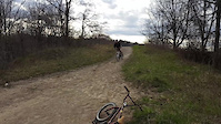
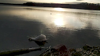
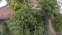
Photos of Hamilton Mountain Bike
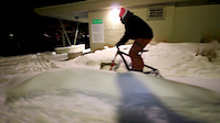
Videos of Hamilton Mountain Bike
0:05 |
206 |
Feb 13, 2021
trail: Hamilton Bayfront Trail
0:35 |
9 |
Apr 26, 2020

trail: Bruce Trail (Redhill Creek)
3:09 |
137 |
May 26, 2018
0:00 |
60 |
May 23, 2018

trail: Bruce Trail (Redhill Creek)
0:57 |
87 |
May 23, 2018

trail: Bruce Trail (Redhill Creek)
3:50 |
107 |
May 23, 2018
3:33 |
223 |
Jun 24, 2016
trail: Blue Trail
2:36 |
324 |
Jul 31, 2012
Recent Trail Reports
| status | trail | date | condition | info | user |
|---|---|---|---|---|---|
| Golf Course | May 31, 2026 @ 12:00pm (America/Toronto) May 31, 2026 | Ideal | Nlewis23 | ||
| Bear Cave | May 31, 2026 @ 11:57am (America/Toronto) May 31, 2026 | Variable | Nlewis23 | ||
| GPS Trail | May 19, 2026 @ 12:11pm (America/Toronto) May 19, 2026 | Variable | GrantNDWYUb | ||
| Hamilton Bayfront Trail | May 17, 2026 @ 6:29am (America/Toronto) May 17, 2026 | Ideal | arfletcher | ||
| Bruce Trail - Iroquois Heights Trail D | May 4, 2026 @ 9:49am (America/Toronto) May 4, 2026 | Variable | atrokz | ||
| Bruce Trail - Iroquois Heights Trail A | May 4, 2026 @ 9:48am (America/Toronto) May 4, 2026 | Ideal | atrokz | ||
| Bruce Trail - Iroquoia Heights | May 4, 2026 @ 9:48am (America/Toronto) May 4, 2026 | Variable | atrokz | ||
| Iroquoia Access Trail | May 4, 2026 @ 9:47am (America/Toronto) May 4, 2026 | Variable | atrokz | ||
| Lineman | Apr 14, 2026 @ 10:33pm (America/Toronto) Apr 14, 2026 | Prevalent Mud | stepoffgeorge | ||
| O-Fence Line | Apr 14, 2026 @ 10:32pm (America/Toronto) Apr 14, 2026 | Prevalent Mud | stepoffgeorge |
Activity Feed
| username | action | type | title | date |
|---|---|---|---|---|
| BEax2qv | wishlist | trail | activity #97289790 | Jun 18, 2026 @ 6:52pm 2 days |
| Nlewis23 | add | report | activity #95945846 and 1 more | May 31, 2026 @ 8:57am May 31, 2026 |
| Nlewis23 | comment | trail | activity #95945749 | May 31, 2026 @ 8:56am May 31, 2026 |
| StephlGv0FC | wishlist | route | activity #95918454 | May 31, 2026 @ 2:35am May 31, 2026 |
| coginthemachine | ridden | trail | activity #95850670 | May 30, 2026 @ 7:39am May 30, 2026 |
Recent Comments
| username | type | title | comment | date |
|---|---|---|---|---|
| trail | Great trail. A little wet, appears blocked... | May 31, 2026 @ 8:56am May 31, 2026 | ||
| trail | Awesome trail. | May 7, 2026 @ 8:02am May 7, 2026 | ||
| trail | Drop in is pretty gnarly. Middle of trail... | Apr 14, 2026 @ 7:27pm Apr 14, 2026 | ||
| trail | This is a fun trail. Quick ups, quick downs.... | Oct 5, 2025 @ 3:05pm Oct 5, 2025 | ||
| trail | Fairly clean, no glass found. | Jun 28, 2025 @ 5:02am Jun 28, 2025 |
Local Badges
-

10 Blue Trails237 awarded -

10 Black Trails97 awarded -

Epic Ride Climb 2k9 awarded -

Climbing 10k Badge72 awarded -

Climbing 100k Badge1 awarded -

Epic Ride Descent 2k8 awarded
Bike & Skill Parks
| name | type | city | rating |
|---|---|---|---|
| Gage Bike Park | skill park | Hamilton |
Local Mountain Biking Directory
-
Velofix Hamilton (Mobile bicycle repair)
-
Hamilton Cycling Club
![Hamilton Cycling Club]()
-
Pieriks CycleBike Shop
-
All The Right GearsBike Shop
-
Main CycleBike Shop
-
New Hope Community BikesBike Shop
Activity Type Stats
| activitytype | trails | distance | descent | descent distance | total vertical | rating | global rank | state rank | photos | reports | routes | ridelogs |
|---|---|---|---|---|---|---|---|---|---|---|---|---|
| Mountain Bike | 122 | 58 miles | 4,026 ft | 20 miles | 561 ft | #972 | #27 | 160 | 689 | 4 | 21,421 | |
| E-Bike | 13 | 5 miles | 184 ft | 1 mile | 335 ft | #4,982 | #85 | 564 | 374 | |||
| Gravel Bike | 28 | 21 miles | 791 ft | 6 miles | 505 ft | #281 | #40 | 151 | 247 | |||
| Horse | 1 | 226 ft | 117 | 1 | ||||||||
| Hike | 170 | 78 miles | 5,538 ft | 27 miles | 561 ft | #434 | #6 | 399 | 694 | 1,573 | ||
| Trail Running | 155 | 75 miles | 5,443 ft | 27 miles | 561 ft | #1,569 | #32 | 8 | 694 | 1,987 | ||
| Snowshoe | 58 | 15 miles | 991 ft | 5 miles | 472 ft | #558 | #60 | 8 | 10 | |||
| Nordic Ski | 28 | 10 miles | 630 ft | 4 miles | 410 ft | #728 | #48 | 4 | 49 |
Frequently Asked Questions About Hamilton
▼
What are the best places to ride in Hamilton?
Hamilton has 7 areas to explore for mountain biking. The top rated areas are:
▼
What are the highest rated mountain biking trails in Hamilton?
The highest rated mountain biking trails in Hamilton are:
- Desperate for some single track (4.2/5)
- CandleStick (4.1/5)
- De-Fence Line (4.1/5)
- Coco (4.1/5)
- GPS Trail (4.1/5)
▼
What is the best time of the year to ride in Hamilton?
Based on ride log data, the most popular months to ride in Hamilton are:
- July (221 activities)
- June (181 activities)
- August (180 activities)
▼
Where can I park to ride in Hamilton?
There are 25 parking locations listed in Hamilton. The most popular parking spots are:
- Bruce Trail/Iroquois Heights Parking Off Scenic
- Parking
- Mud Street Albion Falls Parking
- King's Forest Parking - Pritchard Rd.
- Oak Knoll Park
Activities
Trails
- By masjo & contributors
- Admins: HBMBA
- #5184 - 27,233 views
- hamilton activity log | embed map of Hamilton mountain bike trails | hamilton mountain biking points of interest
Downloading of trail gps tracks in kml & gpx formats is enabled for Hamilton.
You must login to download files.