close
-
Layers w
- Weather Layers
- Pro
- Pro
- Pro
- Pro
- Pro
- Pro
- More Layers
- Pro
- Pro
- Pro
- Pro
-
Upgrade to

3D
Trail Conditions
- Unknown
- Snow Groomed
- Snow Packed
- Snow Covered
- Snow Cover Partial
- Freeze/thaw Cycle
- Icy
- Prevalent Mud
- Wet
- Variable
- Ideal
- Dry
- Very Dry
Trail Flow (Ridden Direction)
Trailforks scans users ridelogs to determine the most popular direction each trail is ridden. A good flowing trail network will have most trails flowing in a single direction according to their intension.
The colour categories are based on what percentage of riders are riding a trail in its intended direction.
The colour categories are based on what percentage of riders are riding a trail in its intended direction.
- > 96%
- > 90%
- > 80%
- > 70%
- > 50%
- < 50%
- bi-directional trail
- no data
Trail Last Ridden
Trailforks scans ridelogs to determine the last time a trail was ridden.
- < 2 days
- < 1 week
- < 2 weeks
- < 1 month
- < 6 months
- > 6 months
Trail Ridden Direction
The intended direction a trail should be ridden.
- Downhill Only
- Downhill Primary
- Both Directions
- Uphill Primary
- Uphill Only
- One Direction
Contribute Details
Colors indicate trail is missing specified detail.
- Description
- Photos
- Description & Photos
- Videos
Trail Popularity ?
Trailforks scans ridelogs to determine which trails are ridden the most in the last 9 months.
Trails are compared with nearby trails in the same city region with a possible 25 colour shades.
Think of this as a heatmap, more rides = more kinetic energy = warmer colors.
- most popular
- popular
- less popular
- not popular
ATV/ORV/OHV Filter
Max Vehicle Width
inches
US Cell Coverage
Legend

Radar Time
Activity Recordings
Trailforks uses anonymized public activity data.
?
Activity Recordings
Trailforks uses anonymized public activity data.
?
Personal Heatmap
▶
Activity Types
all
/
none
▶
Options
2
Date range
month
–
Winter Trails
Warning
A routing network for winter maps does not exist. Selecting trails using the winter trails layer has been disabled.
Missing Trails
Most Popular
Least Popular
Trails are colored based on popularity. The more popular a trail is, the more red. Less popular trails trend towards green.
Jump Magnitude Heatmap
Heatmap of where riders jump on trails. Zoom in to see individual jumps, click circles to view jump details.
BC Backroad Status
![map legend]()
Service Road Atlas is a free to use, community-driven service for viewing and creating reports on the numerous back-country service roads around B.C. and Alberta.

Slope Aspect
Direction the slope faces
Trails Deemphasized
Trails are shown in grey.
Only show trails with no bike usage.
Suggested Layers
Based on selected activity type
Save the current map location and zoom level as your default home location whenever this page is loaded.
Save
No description for Herrick has been added yet!
Login or register to submit one.
Activities Click to view
- Mountain Bike
17 trails
- E-Bike
8 trails
- Adaptive Bike
0 trails
- Winter Fat Bike
0 trails
- Hike
17 trails
- Trail Running
17 trails
- Dirtbike/Moto
38 trails
- ATV/ORV/OHV
14 trails
Region Details
- 5
- 5
- 6
Region Status
Open as of Jul 3, 2026Local Trail Association
Stats
- Avg Trail Rating
- Trails (view details)
- 50
- Trails Mountain Bike
- 17
- Trails E-Bike
- 8
- Trails Horse
- 2
- Trails Hike
- 17
- Trails Trail Running
- 17
- Trails Dirtbike/Moto
- 38
- Trails ATV/ORV/OHV
- 14
- Trails Snowmobile
- 1
- Total Distance
- 162 miles
- Total Descent
- 45,552 ft
- Total Vertical
- 4,034 ft
- Highest Trailhead
- 6,155 ft
- Reports
- 8
- Photos
- 33
- Ridden Counter
- 156
Sub Regions
-
St. Joe River
- 5
- 2
Popular Herrick Mountain Biking Trails
• 5 ★ 4.7 • 12 miles • 5,015 ft • 9 •
The beggining of this climb is a hike a bike climbing roughly 900ft in about a mile. Once up to the ridge your rewarded with views into the canyon before dropping over the backside into the East fork of Big Cr. drainage. Dropping over...
• 5 ★ 5.0 • 4 miles • 1,303 ft • 7 •
The start is a big climb out of the canyon on a steep side hill where you'll eventually drop into the Middle Fork of Big Creek canyon. After you reach the bottom you'll cross the creek several times on the way up to Bronson Meadows....
• 95 ★ 0.0 • 3 miles • 125 ft • 5 •
Mostly used by dirt bikes, this can be a fun and rowdy descent on a bike. Be aware of potential uphill dirt bike traffic, they won't expect mountain bikers out here. It's chunky and rocky in places, has some fun line choices, and can...
• 75 ★ 0.0 • 3 miles • 863 ft • 5 •
Another piece of 16 that provides access to Bad Tom Mountain
• 60 ★ 0.0 • 5 miles • 1,083 ft • 4 •
Sweet alpine ripper with amazing views. Chunky, rocky, and fast, the descents are mega fun. There are some steep climbs, but mostly manageable with one mandatory hike a bike section.
• 55 ★ 0.0 • 2 miles • 690 ft • 3 •
Another piece of Trail 16, or the Saint Joe Divide. Mellow singletrack, nice views.
• 65 ★ 0.0 • 2,044 ft • 87 ft • 3 •
Short but sweet little alpine ridge ripper. Nice viewpoint at the top, and then a fast and rocky singletrack down to the road. Might as well hit this if you're riding Cedar Mountain.
Herrick Mountain Bike Routes
★ 5.0 • 22 miles • 3,915 ft • 0 • Loop •
This area has lots of great options and we will post more as we explore. This particular loop can be done...
Photos of Herrick Mountain Bike
Videos of Herrick Mountain Bike
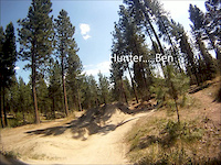
trail: St. Joe Divide #16
3:21 |
406 |
Jul 26, 2012
Recent Trail Reports
| status | trail | date | condition | info | user |
|---|---|---|---|---|---|
| Milwaukee Road | Jul 3, 2026 @ 9:19am (America/Los_Angeles) Jul 3, 2026 | Dry | sngltrx | ||
| Bronson Meadows | Jul 15, 2019 @ 6:47pm Jul 15, 2019 | Variable | imalwaysriding | ||
| Big Creek Drainage Trail | Jul 15, 2019 @ 6:45pm Jul 15, 2019 | Variable | imalwaysriding |
Activity Feed
| username | action | type | title | date |
|---|---|---|---|---|
| sngltrx | add | report | activity #98551269 | Jul 5, 2026 @ 7:06pm Jul 5, 2026 |
| otterpop86 | wishlist | route | activity #96535332 | Jun 8, 2026 @ 6:30am Jun 8, 2026 |
| otterpop86 | wishlist | trail | activity #95490634 | May 25, 2026 @ 8:21am May 25, 2026 |
| Hauserth | wishlist | trail | activity #87989913 | Jan 29, 2026 @ 8:17am Jan 29, 2026 |
| oldermountain | wishlist | region | activity #81862503 | Oct 6, 2025 @ 9:38pm Oct 6, 2025 |
Recent Comments
| username | type | title | comment | date |
|---|---|---|---|---|
| trail | Pretty straight forward ride. Grabbed the... | Jul 1, 2019 @ 12:27pm Jul 1, 2019 |
Local Badges
-

Epic Mountain Bike Climb 2k4 awarded -

Climbing 10k Badge0 awarded -

Mountain Biking 100k Badge0 awarded -

Epic Ride Descent 2k4 awarded -

Descent 10k Badge0 awarded -

Descent 100k Badge0 awarded
Activity Type Stats
| activitytype | trails | distance | descent | descent distance | total vertical | rating | global rank | state rank | photos | reports | routes | ridelogs |
|---|---|---|---|---|---|---|---|---|---|---|---|---|
| Mountain Bike | 17 | 86 miles | 18,635 ft | 41 miles | 4,035 ft | #9,923 | #3,101 | 27 | 8 | 1 | 192 | |
| E-Bike | 8 | 16 miles | 6,781 ft | 10 miles | 3,097 ft | #5,827 | #1,801 | 5 | 15 | |||
| Horse | 2 | 4 miles | 2,313 ft | 3 miles | 2,192 ft | 2 | ||||||
| Hike | 17 | 86 miles | 18,635 ft | 41 miles | 4,035 ft | #3,809 | #1,351 | 8 | 29 | |||
| Trail Running | 17 | 86 miles | 18,635 ft | 41 miles | 4,035 ft | #3,239 | #951 | 8 | ||||
| Dirtbike/Moto | 38 | 82 miles | 29,573 ft | 43 miles | 3,629 ft | #517 | #169 | 8 | 2 | 7 | ||
| ATV/ORV/OHV | 14 | 23 miles | 4,741 ft | 13 miles | 2,516 ft | #751 | #314 | 2 | 1 | |||
| Snowmobile | 1 | 1 mile | 49 ft | 1,775 ft | 213 ft |
Frequently Asked Questions About Herrick
▼
What are the best places to ride in Herrick?
Herrick has 1 areas to explore for mountain biking. The top rated areas are:
▼
What are the highest rated mountain biking trails in Herrick?
The highest rated mountain biking trails in Herrick are:
- Bronson Meadows (4.2/5)
- Big Creek Drainage Trail (4.2/5)
- Red Top (0/5)
- Trail 16 (0/5)
- Big Creek (Upper) (0/5)
▼
What is the best time of the year to ride in Herrick?
Based on ride log data, the most popular months to ride in Herrick are:
- October (5 activities)
- July (4 activities)
- June (4 activities)
▼
Where can I park to ride in Herrick?
Check the Herrick trail map for trailhead and parking information. Community members regularly update access and parking details for trails in the area.
Activities
Trails
Points of Interest
- By wyomont
 & contributors
 - Admins: chuktA, IdahoEnduroSeries, macgyver96
- #21980 - 1,478 views
- herrick activity log | embed map of Herrick mountain bike trails |
Downloading of trail gps tracks in kml & gpx formats is enabled for Herrick.
You must login to download files.