
close
3D
Trail Conditions
- Unknown
- Snow Groomed
- Snow Packed
- Snow Covered
- Snow Cover Partial
- Freeze/thaw Cycle
- Icy
- Prevalent Mud
- Wet
- Variable
- Ideal
- Dry
- Very Dry
Trail Flow (Ridden Direction)
Trailforks scans users activity logs to determine the most popular direction each trail is ridden. A good flowing trail network will have most trails flowing in a single direction according to their intension.
The colour categories are based on what percentage of users are riding a trail in its intended direction.
The colour categories are based on what percentage of users are riding a trail in its intended direction.
- > 96%
- > 90%
- > 80%
- > 70%
- > 50%
- < 50%
- bi-directional trail
- no data
Trail Last Used
Trailforks scans activity logs to determine the last time a trail was ridden.
- < 2 days
- < 1 week
- < 2 weeks
- < 1 month
- < 6 months
- > 6 months
Trail Ridden Direction
The intended direction a trail should be ridden.
- Downhill Only
- Downhill Primary
- Both Directions
- Uphill Primary
- Uphill Only
- One Direction
Contribute Details
Colors indicate trail is missing specified detail.
- Description
- Photos
- Description & Photos
- Videos
Trail Popularity ?
Trailforks scans activity logs to determine which trails are ridden the most in the last 9 months.
Trails are compared with nearby trails in the same city region with a possible 25 colour shades.
Think of this as a heatmap, more activities = more kinetic energy = warmer colors.
- most popular
- popular
- less popular
- not popular
ATV/ORV/OHV Filter
Max Vehicle Width
inches
US Cell Coverage
Legend

Radar Time
Activity Recordings
Trailforks uses anonymized public activity data.
?
Activity Recordings
Trailforks uses anonymized public activity data.
?
Winter Trails
Warning
A routing network for winter maps does not exist. Selecting trails using the winter trails layer has been disabled.
Missing Trails
Most Popular
Least Popular
Trails are colored based on popularity. The more popular a trail is, the more red. Less popular trails trend towards green.
Jump Magnitude Heatmap
Heatmap of where users jump on trails. Zoom in to see individual jumps, click circles to view jump details.
BC Backroad Status
![map legend]()
Service Road Atlas is a free to use, community-driven service for viewing and creating reports on the numerous back-country service roads around B.C. and Alberta.

Slope Aspect
Direction the slope faces
Trails Deemphasized
Trails are shown in grey.
Only show trails with no bike usage.
Suggested Layers
Based on selected activity type
Save the current map location and zoom level as your default home location whenever this page is loaded.
SavePopular Trail Networks
view all areas »
Snow & Rain 3D forecast Pro
See where it will snow, sleet or rain on Interior hour by hour, on 3D terrain.
View 3D snow forecast
Interior trails and routes are listed on Trailforks with interactive trail maps, difficulty ratings, photos, and user-reported trail conditions. The Trailforks community has mapped hundreds of trails and shared hundreds of photos in this region. Supported activity types include Hiking, Trail Running, Mountain Biking, Nordic Skiing, Snowshoeing, E-Biking, Skiing, Gravel Biking, Winter Fat Biking, Snowmobiling, Backcountry Skiing, Horseback, Dirtbiking, ATVing/Offroading, Adaptive Biking and Observed Trials. Trails here are often faint trail, rooty and flowy. Scenery includes creeks, lakes and views. Common trail features include bridges, jumps and berms. Many trails are family friendly. Amenities include huts and restrooms. Popular destinations include Fairbanks, Moose Mountain Ski Area and Mt Aurora Skiland.
This is an auto-generated description of Interior.
Login or register to submit a custom description.
Trail info last updated


Stats
- Avg Trail Rating
- Trails (view details)
- 452
- Trails Mountain Bike
- 238
- Trails E-Bike
- 153
- Trails Gravel Bike
- 147
- Trails Adaptive Bike
- 18
- Trails Winter Fat Bike
- 115
- Trails Horse
- 68
- Trails Hike
- 277
- Trails Trail Running
- 276
- Trails Dirtbike/Moto
- 55
- Trails Observed Trials
- 1
- Trails ATV/ORV/OHV
- 55
- Trails Snowmobile
- 110
- Trails Snowshoe
- 193
- Trails Downhill Ski
- 153
- Trails Backcountry Ski
- 108
- Trails Nordic Ski
- 202
- Total Distance
- 1,166 miles
- Total Descent
- 141,844 ft
- Total Vertical
- 5,620 ft
- Highest Trailhead
- 6,003 ft
- Reports
- 807
- Photos
- 145
- Completed Counter
- 4,891
Sub Regions
- Denali National Park (1)
- Cantwell (1)
- Delta Junction (11)
- Fairbanks (181)
- Alaska Dog Mushers Trails (23)
- Birch Hill Recreation Area (21)
- Ester Dome (3)
- Ester Dome - Happy Valley Trail (16)
- Goldstream Valley (23)
- Skarland Trails (3)
- Skyline Ridge Park (7)
- Tanana Lakes Recreation Area (10)
- Tanana Valley State Forest - Bonanza Creek (4)
- Tanana Valley State Forest - Rosie Creek (19)
- UAF Trails (19)
- White Mountain National Recreation Area (12)
- North Pole (15)
- Chena River State Recreation Area (4)
- Denali National Park And Preserve (3)
- Goldstream Hills North (18)
Popular Interior Mountain Biking Trails
• 100 ★ 4.2 • 6 miles • 847 ft • 109 •
A singletrack flow trail that is very swoopy. Short closure during spring break-up. Dogs: Leashed The Outer Loop is the longest trail of the Ester Dome Singletrack Happy Valley Trail System. Snaking its way around a forested loop on a...
• 100 ★ 4.4 • 3 miles • 478 ft • 93 •
A shorter singletrack flow trail, less swoopy than the Outer Loop. Brief closure during spring break-up. Dogs: Leashed The Inner Loop is a shorter trail of the Ester Dome Singletrack Happy Valley Trail System. Snaking its way around a...
• 100 ★ 0.0 • 557 ft • 106 ft • 75 •
Short connector between the Inner and Outer Loops.
• 100 ★ 4.0 • 1,286 ft • 84 ft • 71 •
Short connector, between St Patrick Rd and Ester Dome Rd. Also used as access for the Ester Dome Singletrack Trails
• 100 ★ 4.5 • 1,819 ft • 149 ft • 55 •
Short drop-in from Henderson Rd to the Outer Loop.
• 95 ★ 0.0 • 160 ft • 0 ft • 50 •
Popular blue difficulty singletrack. This mountain bike primary trail can be used both directions. On average it takes minutes to complete this trail.
Interior Mountain Bike Routes
★ 5.0 • 7 miles • 261 ft • 2 •
The Schloesser Rd Goldstream Creek Ride is a 7 mile less popular blue winter/fatbike loop trail located...
15 miles • 1,462 ft • 6 • Loop •
This route makes most of the climbing at the beginning of the ride and allows for a very long and fun...
11 miles • 1,146 ft • 1 • Loop •
This route follows the iconic Skarland Ski trail, large loop. (There are shorter versions.) It is...
★ 3.0 • 9 miles • 194 ft • 0 • Loop •
The short loop from Goldstream Sports to Ballaine Road and back. Mostly valley riding so it is primarily...
16 miles • 156 ft • 0 •
This trail loop starts at Ivory Jacks. The trail can be picked up at the railroad tracks by Goldstream...
16 miles • 156 ft • 0 • Point to Point •
This mostly-loop is a good way to experience most of what the Goldstream Valley has to offer in winter. It...
Photos of Interior Mountain Bike
Videos of Interior Mountain Bike
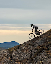
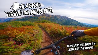
mtb
7:46 |
453 |
Aug 16, 2020
Recent Trail Reports
Activity Feed
| username | action | type | title | date |
|---|---|---|---|---|
| eatroyer | add | report | activity #107887000 | Nov 16, 2026 @ 7:26am 1 day |
| eatroyer | add | report | activity #107709893 and 3 more | Nov 13, 2026 @ 8:45am Nov 13, 2026 |
| eatroyer | add | report | activity #107489238 and 2 more | Nov 9, 2026 @ 7:54am Nov 9, 2026 |
| eatroyer | add | report | activity #107425132 | Nov 8, 2026 @ 7:38am Nov 8, 2026 |
| CaitlinllhDKW | wishlist | trail | activity #106978485 | Oct 31, 2026 @ 8:59pm Oct 31, 2026 |
Recent Comments
| username | type | title | comment | date |
|---|---|---|---|---|
| report | Sorry, I am editing the trail... | Sep 8, 2026 @ 7:59pm Sep 8, 2026 | ||
| trail | Great flow style trail | May 9, 2025 @ 10:07am May 9, 2025 | ||
| trail | It’s really fast and fun now for skate... | Jan 12, 2025 @ 2:43pm Jan 12, 2025 | ||
| report | Trail is a little overgrown and brushy. And... | Jul 14, 2024 @ 9:41pm Jul 14, 2024 | ||
| trail | Super fun MTB trail. Went to the cabin, stayed... | Jul 14, 2024 @ 9:36pm Jul 14, 2024 |
Local Badges
-

Big Ride 30k29 awarded -

Epic Ride 50k13 awarded -
Epic Ride 50k120 awarded -

Top 10 Trails0 awarded -
Big Ride 30k424 awarded -

Descent 100k Badge0 awarded



Activity Type Stats
| activitytype | trails | distance | descent | descent distance | total vertical | rating | global rank | state rank | photos | reports | routes | activity logs |
|---|---|---|---|---|---|---|---|---|---|---|---|---|
| Mountain Bike | 238 | 1,017 miles | 88,583 ft | 445 miles | 5,620 ft | 114 | 630 | 7 | 7,804 | |||
| E-Bike | 153 | 873 miles | 75,784 ft | 385 miles | 5,620 ft | 556 | 4 | 173 | ||||
| Gravel Bike | 147 | 788 miles | 64,154 ft | 354 miles | 3,868 ft | 24 | 145 | |||||
| Adaptive Bike | 18 | 116 miles | 8,356 ft | 56 miles | 3,510 ft | 16 | ||||||
| Winter Fat Bike | 115 | 449 miles | 36,188 ft | 190 miles | 3,061 ft | 90 | 49 | |||||
| Horse | 68 | 487 miles | 51,211 ft | 231 miles | 5,620 ft | 42 | 1 | |||||
| Hike | 277 | 1,086 miles | 102,972 ft | 471 miles | 5,620 ft | 30 | 621 | 3 | 2,117 | |||
| Trail Running | 276 | 1,071 miles | 100,814 ft | 464 miles | 5,620 ft | 619 | 4 | 700 | ||||
| Dirtbike/Moto | 55 | 466 miles | 47,333 ft | 221 miles | 5,620 ft | 37 | 3 | |||||
| Observed Trials | 1 | 31 miles | 2,674 ft | 16 miles | 922 ft | 2 | 1 | |||||
| ATV/ORV/OHV | 55 | 327 miles | 38,871 ft | 154 miles | 3,868 ft | 39 | 12 | |||||
| Snowmobile | 110 | 738 miles | 64,774 ft | 325 miles | 5,620 ft | 189 | 2 | 6 | ||||
| Snowshoe | 193 | 770 miles | 80,341 ft | 325 miles | 5,620 ft | 236 | 3 | 88 | ||||
| Downhill Ski | 153 | 56 miles | 36,398 ft | 44 miles | 2,057 ft | 166 | 326 | |||||
| Backcountry Ski | 108 | 607 miles | 68,310 ft | 263 miles | 5,620 ft | 186 | 2 | 194 | ||||
| Nordic Ski | 202 | 710 miles | 66,601 ft | 301 miles | 5,620 ft | 1 | 227 | 7 | 2,027 |
Activities
- Interior Mountain Biking Trails
- Interior E-Biking Trails
- Interior Gravel Biking Trails
- Interior Adaptive Biking Trails
- Interior Winter Fat Biking Trails
- Interior Horseback Trails
- Interior Hiking Trails
- Interior Trail Running Trails
- Interior Dirtbiking Trails
- Interior ATVing/Offroading Trails
- Interior Snowmobiling Trails
- Interior Snowshoeing Trails
- Interior Skiing Trails
- Interior Backcountry Skiing Trails
- Interior Nordic Skiing Trails
Trails
Points of Interest
- Caribou Bluff Cabin
- Tangle Lake Campground Camping
- Mount Healy Overlook Viewpoint
- Mount Margaret Summit
- Savage Campground Camping
- Savage Patrol Cabin
- Table Mountain Summit
- Summit Trail Shelter Cabin
- Wickersham Creek Trail Shelter Cabin
- Colorado Creek Cabin
- Mount Sanford (16,135 ft)
- Mount Wrangell (14,026 ft)
- Mount Hayes (13,652 ft)
- By gcorth
 & contributors
- Admins: mtnjnkie
- #18916 - 2,690 views
- interior activity log | embed map of Interior mountain bike trails | interior mountain biking points of interest
Downloading of trail gps tracks in kml & gpx formats is enabled for Interior.
You must login to download files.
