close
-
Layers w
- Weather Layers
- Pro
- Pro
- Pro
- Pro
- Pro
- Pro
- More Layers
- Pro
- Pro
- Pro
- Pro
-
Upgrade to

3D
Trail Conditions
- Unknown
- Snow Groomed
- Snow Packed
- Snow Covered
- Snow Cover Partial
- Freeze/thaw Cycle
- Icy
- Prevalent Mud
- Wet
- Variable
- Ideal
- Dry
- Very Dry
Trail Flow (Ridden Direction)
Trailforks scans users ridelogs to determine the most popular direction each trail is ridden. A good flowing trail network will have most trails flowing in a single direction according to their intension.
The colour categories are based on what percentage of riders are riding a trail in its intended direction.
The colour categories are based on what percentage of riders are riding a trail in its intended direction.
- > 96%
- > 90%
- > 80%
- > 70%
- > 50%
- < 50%
- bi-directional trail
- no data
Trail Last Ridden
Trailforks scans ridelogs to determine the last time a trail was ridden.
- < 2 days
- < 1 week
- < 2 weeks
- < 1 month
- < 6 months
- > 6 months
Trail Ridden Direction
The intended direction a trail should be ridden.
- Downhill Only
- Downhill Primary
- Both Directions
- Uphill Primary
- Uphill Only
- One Direction
Contribute Details
Colors indicate trail is missing specified detail.
- Description
- Photos
- Description & Photos
- Videos
Trail Popularity ?
Trailforks scans ridelogs to determine which trails are ridden the most in the last 9 months.
Trails are compared with nearby trails in the same city region with a possible 25 colour shades.
Think of this as a heatmap, more rides = more kinetic energy = warmer colors.
- most popular
- popular
- less popular
- not popular
ATV/ORV/OHV Filter
Max Vehicle Width
inches
US Cell Coverage
Legend

Radar Time
Activity Recordings
Trailforks uses anonymized public activity data.
?
Activity Recordings
Trailforks uses anonymized public activity data.
?
Personal Heatmap
▶
Activity Types
all
/
none
▶
Options
2
Date range
month
–
Winter Trails
Warning
A routing network for winter maps does not exist. Selecting trails using the winter trails layer has been disabled.
Missing Trails
Most Popular
Least Popular
Trails are colored based on popularity. The more popular a trail is, the more red. Less popular trails trend towards green.
Jump Magnitude Heatmap
Heatmap of where riders jump on trails. Zoom in to see individual jumps, click circles to view jump details.
BC Backroad Status
![map legend]()
Service Road Atlas is a free to use, community-driven service for viewing and creating reports on the numerous back-country service roads around B.C. and Alberta.

Slope Aspect
Direction the slope faces
Trails Deemphasized
Trails are shown in grey.
Only show trails with no bike usage.
Suggested Layers
Based on selected activity type
Save the current map location and zoom level as your default home location whenever this page is loaded.
Save
No description for Kaslo has been added yet!
Login or register to submit one.
Activities Click to view
- Mountain Bike
105 trails
- E-Bike
46 trails
- Gravel Bike
0 trails
- Adaptive Bike
0 trails
- Winter Fat Bike
0 trails
- Horse
4 trails
- Hike
99 trails
- Trail Running
99 trails
- Dirtbike/Moto
17 trails
- ATV/ORV/OHV
8 trails
- Snowshoe
18 trails
- Backcountry Ski
5 trails
- Nordic Ski
4 trails
Region Details
- 19
- 4
- 41
- 28
- 11
- 2
Region Status
Open as of 1 dayStats
- Avg Trail Rating
- Trails (view details)
- 121
- Trails Mountain Bike
- 105
- Trails E-Bike
- 46
- Trails Horse
- 4
- Trails Hike
- 99
- Trails Trail Running
- 99
- Trails Dirtbike/Moto
- 17
- Trails Observed Trials
- 2
- Trails ATV/ORV/OHV
- 8
- Trails Snowmobile
- 3
- Trails Snowshoe
- 18
- Trails Downhill Ski
- 3
- Trails Backcountry Ski
- 5
- Trails Nordic Ski
- 4
- Total Distance
- 169 miles
- Total Descent
- 33,422 ft
- Total Vertical
- 7,235 ft
- Highest Trailhead
- 9,011 ft
- Reports
- 802
- Photos
- 323
- Ridden Counter
- 13,727
Sub Regions
-
Branch 7 Trails
- 7
- 2
-
Glacier Creek
-
Kaslo Interpretive Forest Recreation Area
- 2
- 4
- 1
- 1
-
Meadow Creek Area Trails
-
Mount Buchanan (East)
- 1
- 2
- 2
-
True Blue Recreation Area
- 14
- 10
- 2
Popular Kaslo Mountain Biking Trails
• 100 ★ 5.0 • 2 miles • 7 ft • 452 •
is a 3km fun and fast downhill trail accessed via the OR 7 mile spur road, just below the Bucky Cabin. You will find yourself wanting to lap this one as there's a different line every time you ride!
• 90 ★ 4.6 • 2,677 ft • 0 ft • 281 •
Extension to , Still fresh, few berms and jumps. finishes at the airport road
• 100 ★ 4.5 • 5,223 ft • 7 ft • 264 •
This newly constructed trail, , is now open! This bottom section of is considered green/easy Thus is a continuation of the upper blue section of .
• 90 ★ 4.5 • 410 ft • 0 ft • 253 •
Popular green difficulty family friendly doubletrack. This mountain bike primary trail can be used both directions and has a easy overall physical rating. Trail visibility is always easy to follow. On average it takes 1 minutes to complete this trail.
• 95 ★ 5.0 • 11 miles • 583 ft • 249 •
This is a bidirectional trail which means it can be ridden both up and down, be cautious of uphill traffic when sending it downhill! All downhill traffic yield to uphill traffic, bikers yield to hikers. Please don't try and beat your...
• 100 ★ 4.5 • 2,897 ft • 0 ft • 240 •
A newly constructed downhill trail, is now open! This top section of is a considered blue/moderate. Eventually, this trail will connect to the top of .
• 85 ★ 4.8 • 3,665 ft • 87 ft • 226 •
Short climb from the access road to the ridge summit, epic views along the way (I dare you to not stop and take it all in!)
• 100 ★ 0.0 • 597 ft • 16 ft • 197 •
Popular green difficulty doubletrack. This mountain bike primary trail can be used both directions and has a hard overall physical rating with a 16 ft black diamond climb. Trail visibility is always easy to follow. On average it takes 1 minutes to complete this trail.
Kaslo Mountain Bike Routes
13 miles • 2,609 ft • 5 •
Access trail from East to West leads to a variety of options including descent of lower Monster, a climb...
6 miles • 1,095 ft • 15 • Loop •
Shorter/easier route from Arena Ave parking lot, up and down with an exit via . Good for a quick rip!
10 miles • 2,751 ft • 3 •
5 miles • 731 ft • 15 • Loop •
This is a good route for early season, snow free River Trail ride ( , River Moss Climb) to stay on the...
12 miles • 2,683 ft • 5 •
The best way to get from Highway 31A over to the Friendly Giant side of the mountain.
10 miles • 2,515 ft • 7 •
This route is a classic all climb followed by all descent back to town.
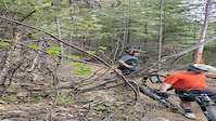
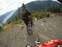
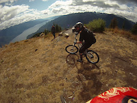
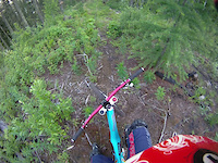
Photos of Kaslo Mountain Bike
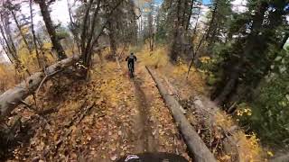
Videos of Kaslo Mountain Bike
trail: High Commander
0:06 |
|
Oct 19, 2024
trail: Angry Dwarf
0:14 |
99 |
Jul 21, 2023
trail: Wagon Road - Kaslo
4:55 |
346 |
Jan 9, 2017
trail: The Monster
11:36 |
1667 |
Nov 5, 2011
trail: The Monster
7:06 |
1718 |
Nov 4, 2011
trail: No Brakes
5:09 |
936 |
Nov 4, 2011
trail: The Monster
14:39 |
940 |
Oct 20, 2023 , Kaslo

trail: Johnny Cash
2:36 |
7475 |
Aug 15, 2010
Recent Trail Reports
| status | trail | date | condition | info | user |
|---|---|---|---|---|---|
| Buckshot | Jul 4, 2026 @ 8:22am (America/Vancouver) 1 day | Ideal | daveg | ||
| Buckshot | Jul 4, 2026 @ 8:20am (America/Vancouver) 1 day | Ideal | daveg | ||
| Upper Songbird | Jul 1, 2026 @ 6:26pm (America/Vancouver) Jul 1, 2026 | Ideal | sdoucet KMBC | ||
| High Commander | Jul 1, 2026 @ 11:45am (America/Vancouver) Jul 1, 2026 | Ideal | mikeabrahamsz | ||
| Friendly Giant | Jul 1, 2026 @ 11:45am (America/Vancouver) Jul 1, 2026 | Ideal | mikeabrahamsz | ||
| The Monster | Jun 29, 2026 @ 3:36pm (America/Vancouver) Jun 29, 2026 | Ideal | sdoucet KMBC | ||
| Chainsmoker | Jun 27, 2026 @ 8:21am (America/Vancouver) Jun 27, 2026 | Unknown | mattruss | ||
| Turnup | Jun 24, 2026 @ 9:54pm (America/Vancouver) Jun 24, 2026 | Unknown | norcochick | ||
| Pandemic | Jun 24, 2026 @ 6:51pm (America/Vancouver) Jun 24, 2026 | Unknown | norcochick | ||
| West Access Trail | Jun 22, 2026 @ 2:32pm (America/Vancouver) Jun 22, 2026 | Ideal | sdoucet KMBC |
Activity Feed
| username | action | type | title | date |
|---|---|---|---|---|
| daveg | add | report | activity #98419671 and 1 more | Jul 4, 2026 @ 8:20am 1 day |
| daveg | ridden | trail | activity #98417387 and 2 more | Jul 4, 2026 @ 7:58am 1 day |
| daveg | comment | trail | activity #98417364 and 2 more | Jul 4, 2026 @ 7:58am 1 day |
| sdoucet | add | report | activity #98240388 | Jul 1, 2026 @ 6:36pm Jul 1, 2026 |
| mikeabrahamsz | add | report | activity #98216022 and 3 more | Jul 1, 2026 @ 11:44am Jul 1, 2026 |
Recent Comments
| username | type | title | comment | date |
|---|---|---|---|---|
| trail | This has to be one of the best climb trails!!... | Jul 4, 2026 @ 8:16am 1 day | ||
| trail | Super fun and fast machine built flow green... | Jul 4, 2026 @ 8:13am 1 day | ||
| trail | So good! Great build! Fast and flowy. | Jul 4, 2026 @ 7:58am 1 day | ||
| report | Saw this on June 25. Near the bottom. | Jun 27, 2026 @ 8:23am Jun 27, 2026 | ||
| report | 🙌 You guys rock! | Jun 24, 2026 @ 9:56pm Jun 24, 2026 |
Local Badges
-

10 Green Trails104 awarded -

10 Blue Trails48 awarded -

Epic Ride Climb 2k50 awarded -

Climbing 10k Badge19 awarded -

Climbing 100k Badge2 awarded -

Epic Ride Descent 2k57 awarded
Bike & Skill Parks
| name | type | city | rating |
|---|---|---|---|
| Kaslo Family Mountain Bike Park | skill park | Kaslo |
Activity Type Stats
| activitytype | trails | distance | descent | descent distance | total vertical | rating | global rank | state rank | photos | reports | routes | ridelogs |
|---|---|---|---|---|---|---|---|---|---|---|---|---|
| Mountain Bike | 105 | 147 miles | 30,833 ft | 54 miles | 5,725 ft | #961 | #50 | 317 | 798 | 29 | 4,840 | |
| E-Bike | 46 | 95 miles | 15,925 ft | 32 miles | 5,725 ft | #1,389 | #45 | 1 | 633 | 3 | 417 | |
| Horse | 4 | 32 miles | 915 ft | 5 miles | 5,456 ft | #991 | #34 | 79 | 7 | |||
| Hike | 99 | 155 miles | 28,963 ft | 52 miles | 7,234 ft | #504 | #30 | 754 | 1,066 | |||
| Trail Running | 99 | 155 miles | 28,963 ft | 52 miles | 7,234 ft | #785 | #37 | 752 | 20 | 1,348 | ||
| Dirtbike/Moto | 17 | 63 miles | 3,458 ft | 12 miles | 5,505 ft | #385 | #37 | 141 | 22 | |||
| Observed Trials | 2 | 21 miles | 456 ft | 2 miles | 5,456 ft | 10 | 5 | |||||
| ATV/ORV/OHV | 8 | 55 miles | 1,683 ft | 9 miles | 5,505 ft | #360 | #28 | 77 | ||||
| Snowmobile | 3 | 16 miles | 840 ft | 4 miles | 2,621 ft | 2 | 2 | |||||
| Snowshoe | 18 | 36 miles | 7,572 ft | 17 miles | 4,249 ft | #462 | #36 | 5 | 94 | 7 | ||
| Downhill Ski | 3 | 9 miles | 246 ft | 4,780 ft | 4,058 ft | 53 | ||||||
| Backcountry Ski | 5 | 14 miles | 253 ft | 4,987 ft | 5,361 ft | #394 | #25 | 1 | 236 | |||
| Nordic Ski | 4 | 16 miles | 843 ft | 4 miles | 2,621 ft | #655 | #38 | 2 | 131 |
Frequently Asked Questions About Kaslo
▼
What are the best places to ride in Kaslo?
Kaslo has 6 areas to explore for mountain biking. The top rated areas are:
▼
What are the highest rated mountain biking trails in Kaslo?
The highest rated mountain biking trails in Kaslo are:
- High Commander (4.7/5)
- Friendly Giant (4.6/5)
- Carlsbad (4.4/5)
- Upper Strawberry Ridge (4.4/5)
- No Brakes (4.3/5)
▼
What is the best time of the year to ride in Kaslo?
Based on ride log data, the most popular months to ride in Kaslo are:
- August (91 activities)
- May (74 activities)
- July (68 activities)
▼
Where can I park to ride in Kaslo?
There are 12 parking locations listed in Kaslo. The most popular parking spots are:
- Parking at Moose Meadows
- Parking Option
- Parking
- Parking to access top portion of Friendly Giant
- Mt. Buchanan Parking
Activities
Trails
Points of Interest
- Unity Bridge Other
- Trailblazers' Bridge Other
- Sight Viewpoint
- Viewpoint N - S Kootenay Lake
- Viewpoint Kaslo & Kootenay Lake
- Moose Meadows Day Use Cabin
- Bucky Day Use Cabin
- Yew Day Use Cabin
- Start and Finish Other
- Ainsworth Historical Cementery Sight
- Mount Cooper (3,077 m)
- Cascade Mountain (2,925 m)
- Mount Marion (2,916 m)
- By barry-mclane & contributors
- Admins: barry-mclane, KCTS, KMBC
- #5796 - 35,780 views
- kaslo activity log | embed map of Kaslo mountain bike trails | kaslo mountain biking points of interest
Downloading of trail gps tracks in kml & gpx formats is enabled for Kaslo.
You must login to download files.