close
-
Layers w
- Weather Layers
- Pro
- Pro
- Pro
- Pro
- Pro
- Pro
- More Layers
- Pro
- Pro
- Pro
- Pro
-
Upgrade to

3D
Trail Conditions
- Unknown
- Snow Groomed
- Snow Packed
- Snow Covered
- Snow Cover Partial
- Freeze/thaw Cycle
- Icy
- Prevalent Mud
- Wet
- Variable
- Ideal
- Dry
- Very Dry
Trail Flow (Ridden Direction)
Trailforks scans users ridelogs to determine the most popular direction each trail is ridden. A good flowing trail network will have most trails flowing in a single direction according to their intension.
The colour categories are based on what percentage of riders are riding a trail in its intended direction.
The colour categories are based on what percentage of riders are riding a trail in its intended direction.
- > 96%
- > 90%
- > 80%
- > 70%
- > 50%
- < 50%
- bi-directional trail
- no data
Trail Last Ridden
Trailforks scans ridelogs to determine the last time a trail was ridden.
- < 2 days
- < 1 week
- < 2 weeks
- < 1 month
- < 6 months
- > 6 months
Trail Ridden Direction
The intended direction a trail should be ridden.
- Downhill Only
- Downhill Primary
- Both Directions
- Uphill Primary
- Uphill Only
- One Direction
Contribute Details
Colors indicate trail is missing specified detail.
- Description
- Photos
- Description & Photos
- Videos
Trail Popularity ?
Trailforks scans ridelogs to determine which trails are ridden the most in the last 9 months.
Trails are compared with nearby trails in the same city region with a possible 25 colour shades.
Think of this as a heatmap, more rides = more kinetic energy = warmer colors.
- most popular
- popular
- less popular
- not popular
ATV/ORV/OHV Filter
Max Vehicle Width
inches
US Cell Coverage
Legend

Radar Time
Activity Recordings
Trailforks uses anonymized public activity data.
?
Activity Recordings
Trailforks uses anonymized public activity data.
?
Personal Heatmap
▶
Activity Types
all
/
none
▶
Options
2
Date range
month
–
Winter Trails
Warning
A routing network for winter maps does not exist. Selecting trails using the winter trails layer has been disabled.
Missing Trails
Most Popular
Least Popular
Trails are colored based on popularity. The more popular a trail is, the more red. Less popular trails trend towards green.
Jump Magnitude Heatmap
Heatmap of where riders jump on trails. Zoom in to see individual jumps, click circles to view jump details.
BC Backroad Status
![map legend]()
Service Road Atlas is a free to use, community-driven service for viewing and creating reports on the numerous back-country service roads around B.C. and Alberta.

Slope Aspect
Direction the slope faces
Trails Deemphasized
Trails are shown in grey.
Only show trails with no bike usage.
Suggested Layers
Based on selected activity type
Save the current map location and zoom level as your default home location whenever this page is loaded.
Save
No description for Keene has been added yet!
Login or register to submit one.
Activities Click to view
- Mountain Bike
262 trails
- E-Bike
89 trails
- Gravel Bike
21 trails
- Adaptive Bike
0 trails
- Hike
256 trails
- Trail Running
256 trails
- Downhill Ski
20 trails
Region Details
- 4
- 1
- 130
- 92
- 22
- 6
Region Status
Open as of Dec 13, 2025Stats
- Avg Trail Rating
- Trails (view details)
- 284
- Trails Mountain Bike
- 262
- Trails E-Bike
- 89
- Trails Gravel Bike
- 21
- Trails Hike
- 256
- Trails Trail Running
- 256
- Trails Downhill Ski
- 21
- Total Distance
- 158 miles
- Total Descent
- 19,703 ft
- Total Vertical
- 1,006 ft
- Highest Trailhead
- 1,243 ft
- Reports
- 334
- Photos
- 85
- Ridden Counter
- 23,963
Sub Regions
-
Beech Hill Preserve
- 6
- 23
- 1
-
Drummer Hill/Goose Pond
- 51
- 40
- 17
- 5
-
Food Network
- 14
- 17
- 3
-
Granite Gorge Mountain Park
- 5
- 1
- 1
-
Robin Hood Park
- 26
- 1
-
Stonewall Farm
- 3
- 3
-
Wildwood Park
- 28
Popular Keene Mountain Biking Trails
• 95 ★ 3.0 • 1,019 ft • 70 ft • 497 •
Popular green difficulty doubletrack. This mountain bike primary trail can be used both directions and has a moderate overall physical rating with a 70 ft green climb. On average it takes 1 minutes to complete this trail.
• 95 ★ 2.5 • 1,713 ft • 93 ft • 396 •
Popular blue difficulty singletrack. This mountain bike primary trail can be used both directions and has a moderate overall physical rating with a 93 ft blue climb. On average it takes 4 minutes to complete this trail.
• 90 ★ 3.5 • 405 ft • 2 ft • 395 •
Popular green difficulty singletrack. This mountain bike primary trail can be used both directions and has a easy overall physical rating with a 2 ft green climb. On average it takes minutes to complete this trail.
• 95 ★ 4.0 • 1,081 ft • 27 ft • 357 •
Popular blue difficulty singletrack. This mountain bike primary trail can be used both directions and has a moderate overall physical rating with a 27 ft blue climb. On average it takes 2 minutes to complete this trail.
• 80 ★ 1.0 • 1,000 ft • 87 ft • 336 •
Popular green difficulty doubletrack. This mountain bike primary trail can be used both directions and has a easy overall physical rating with a 87 ft green climb. On average it takes 2 minutes to complete this trail.
• 85 ★ 4.0 • 4,720 ft • 69 ft • 313 •
Popular blue difficulty singletrack. This mountain bike primary trail can be used both directions and has a moderate overall physical rating with a 69 ft blue climb. On average it takes 11 minutes to complete this trail.
• 80 ★ 0.0 • 1,630 ft • 69 ft • 299 •
Popular blue difficulty singletrack. This mountain bike primary trail can be used both directions and has a moderate overall physical rating with a 69 ft blue climb. On average it takes 4 minutes to complete this trail.
• 75 ★ 4.4 • 4,039 ft • 0 ft • 296 •
Highly rated popular blue difficulty singletrack. This mountain bike primary trail can be used both directions and has a moderate overall physical rating with a 0 ft blue climb. It features bridge and jump. On average it takes 14 minutes to complete this trail.
Keene Mountain Bike Routes
★ 4.0 • 10 miles • 1,104 ft • 24 • Loop •
This loop will take you around 1.5hrs depending on how hard you go. It'll give you a good idea of the...
7 miles • 1,109 ft • 5 • Loop •
Route for 2022 Drummer Hill Trail Races.
★ 1.0 • 14 miles • 1,885 ft • 33 • Loop •
First time out poking around. Not sure this is the way to flow it best but it worked for us.
8 miles • 899 ft • 50 • Loop •
A good introduction to Drummer Hill area and some of the best cross country/trail style trails in the system.
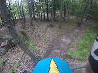
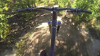
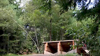
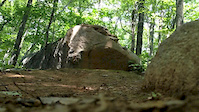
Photos of Keene Mountain Bike
Videos of Keene Mountain Bike

trail: Threader
2:10 |
538 |
Nov 26, 2017

trail: Single Track
2:52 |
126 |
Dec 1, 2016
trail: Bitten
6:31 |
532 |
Sep 5, 2015
trail: Double Drop
2:14 |
1199 |
Sep 29, 2014
trail: Starr
2:56 |
303 |
Sep 24, 2014
trail: Goat
0:41 |
452 |
Jul 18, 2014
trail: Powerline
4:26 |
161 |
May 24, 2014
trail: Step Down
0:08 |
522 |
Nov 21, 2013
Recent Trail Reports
| status | trail | date | condition | info | user |
|---|---|---|---|---|---|
| Ribbon Candy | Dec 13, 2025 @ 10:19am (America/New_York) Dec 13, 2025 | Snow Packed | saychad | ||
| Lemonade | Dec 13, 2025 @ 10:19am (America/New_York) Dec 13, 2025 | Unknown | saychad | ||
| Espresso | Dec 13, 2025 @ 10:19am (America/New_York) Dec 13, 2025 | Snow Cover Partial | saychad | ||
| Beer Run | Dec 13, 2025 @ 10:19am (America/New_York) Dec 13, 2025 | Unknown | saychad | ||
| Biscuits & Gravy | Dec 13, 2025 @ 10:19am (America/New_York) Dec 13, 2025 | Snow Packed | saychad | ||
| Rice Krispie Treat | Dec 13, 2025 @ 10:19am (America/New_York) Dec 13, 2025 | Snow Packed | saychad | ||
| TBD | Dec 13, 2025 @ 10:19am (America/New_York) Dec 13, 2025 | Snow Packed | saychad | ||
| Snack Bar | Dec 13, 2025 @ 10:19am (America/New_York) Dec 13, 2025 | Snow Packed | saychad | ||
| Sushi | Dec 13, 2025 @ 10:19am (America/New_York) Dec 13, 2025 | Snow Packed | saychad | ||
| Smoked Salmon | Dec 13, 2025 @ 10:19am (America/New_York) Dec 13, 2025 | Snow Packed | saychad |
Activity Feed
| username | action | type | title | date |
|---|---|---|---|---|
| dacocca | wishlist | trail | activity #96983483 and 2 more | Jun 14, 2026 @ 10:23am 2 days |
| Vtskiface | wishlist | region | activity #96932610 | Jun 13, 2026 @ 6:48pm 3 days |
| clutch13k | wishlist | region | activity #96571410 | Jun 8, 2026 @ 4:36pm Jun 8, 2026 |
| Mdunkerley | wishlist | trail | activity #96293914 and 19 more | Jun 5, 2026 @ 7:23am Jun 5, 2026 |
| madavern | add | trail | activity #96171240 | Jun 3, 2026 @ 11:47am Jun 3, 2026 |
Recent Comments
| username | type | title | comment | date |
|---|---|---|---|---|
| trail | This is not an easy double track to ride for... | May 18, 2026 @ 8:27pm May 18, 2026 | ||
| trail | Other than 1 "gap" drop at the bottom that... | May 18, 2026 @ 8:26pm May 18, 2026 | ||
| report | Thorns gone all good | Nov 21, 2025 @ 1:58pm Nov 21, 2025 | ||
| report | Thorns gone all clear | Nov 21, 2025 @ 1:57pm Nov 21, 2025 | ||
| report | Nope never done ridden one of them kinda... | Nov 21, 2025 @ 1:54pm Nov 21, 2025 |
Local Badges
-

Completionist0 awarded -

Big Ride 30k504 awarded -

Epic Ride 50k131 awarded -

Top 10 Trails5 awarded -
Completionist0 awarded -
Completionist0 awarded
Bike & Skill Parks
| name | type | city | rating |
|---|---|---|---|
| Granite Gorge Mountain Park | bike park | Keene | |
| Keene Bike Park | skill park | Keene | |
| Skills Park | skill park | Keene |
Activity Type Stats
| activitytype | trails | distance | descent | descent distance | total vertical | rating | global rank | state rank | photos | reports | routes | ridelogs |
|---|---|---|---|---|---|---|---|---|---|---|---|---|
| Mountain Bike | 262 | 152 miles | 17,136 ft | 66 miles | 1,007 ft | #486 | #179 | 77 | 329 | 6 | 14,657 | |
| E-Bike | 89 | 25 miles | 5,079 ft | 12 miles | 689 ft | #2,662 | #1,045 | 299 | 472 | |||
| Gravel Bike | 21 | 10 miles | 2,024 ft | 6 miles | 702 ft | #353 | #959 | 32 | 457 | |||
| Hike | 256 | 152 miles | 16,109 ft | 65 miles | 994 ft | #1,029 | #471 | 2 | 328 | 1 | 691 | |
| Trail Running | 256 | 152 miles | 16,109 ft | 65 miles | 994 ft | #757 | #284 | 328 | 1 | 799 | ||
| Downhill Ski | 20 | 3 miles | 1,952 ft | 3 miles | 423 ft | #526 | #230 | 1 | 6 | 13 |
Frequently Asked Questions About Keene
▼
What are the best places to ride in Keene?
Keene has 7 areas to explore for mountain biking. The top rated areas are:
▼
What are the highest rated mountain biking trails in Keene?
The highest rated mountain biking trails in Keene are:
- Loam Ranger (4.3/5)
- Double Drop (4.2/5)
- Bombs Away (4.2/5)
- Chuck It (4.2/5)
- Jump (4.2/5)
▼
What is the best time of the year to ride in Keene?
Based on ride log data, the most popular months to ride in Keene are:
- August (209 activities)
- July (191 activities)
- September (172 activities)
▼
Where can I park to ride in Keene?
There are 22 parking locations listed in Keene. The most popular parking spots are: View all parking and trailhead locations on the map to plan your visit.
Activities
Trails
Points of Interest
- keene activity log | embed map of Keene mountain bike trails | keene mountain biking points of interest polygons
Downloading of trail gps tracks in kml & gpx formats is enabled for Keene.
You must login to download files.