
close
3D
Trail Conditions
- Unknown
- Snow Groomed
- Snow Packed
- Snow Covered
- Snow Cover Partial
- Freeze/thaw Cycle
- Icy
- Prevalent Mud
- Wet
- Variable
- Ideal
- Dry
- Very Dry
Trail Flow (Ridden Direction)
Trailforks scans users activity logs to determine the most popular direction each trail is ridden. A good flowing trail network will have most trails flowing in a single direction according to their intension.
The colour categories are based on what percentage of users are riding a trail in its intended direction.
The colour categories are based on what percentage of users are riding a trail in its intended direction.
- > 96%
- > 90%
- > 80%
- > 70%
- > 50%
- < 50%
- bi-directional trail
- no data
Trail Last Used
Trailforks scans activity logs to determine the last time a trail was ridden.
- < 2 days
- < 1 week
- < 2 weeks
- < 1 month
- < 6 months
- > 6 months
Trail Ridden Direction
The intended direction a trail should be ridden.
- Downhill Only
- Downhill Primary
- Both Directions
- Uphill Primary
- Uphill Only
- One Direction
Contribute Details
Colors indicate trail is missing specified detail.
- Description
- Photos
- Description & Photos
- Videos
Trail Popularity ?
Trailforks scans activity logs to determine which trails are ridden the most in the last 9 months.
Trails are compared with nearby trails in the same city region with a possible 25 colour shades.
Think of this as a heatmap, more activities = more kinetic energy = warmer colors.
- most popular
- popular
- less popular
- not popular
ATV/ORV/OHV Filter
Max Vehicle Width
inches
US Cell Coverage
Legend

Radar Time
Activity Recordings
Trailforks uses anonymized public activity data.
?
Activity Recordings
Trailforks uses anonymized public activity data.
?
Winter Trails
Warning
A routing network for winter maps does not exist. Selecting trails using the winter trails layer has been disabled.
Missing Trails
Most Popular
Least Popular
Trails are colored based on popularity. The more popular a trail is, the more red. Less popular trails trend towards green.
Jump Magnitude Heatmap
Heatmap of where users jump on trails. Zoom in to see individual jumps, click circles to view jump details.
BC Backroad Status
![map legend]()
Service Road Atlas is a free to use, community-driven service for viewing and creating reports on the numerous back-country service roads around B.C. and Alberta.

Slope Aspect
Direction the slope faces
Trails Deemphasized
Trails are shown in grey.
Only show trails with no bike usage.
Suggested Layers
Based on selected activity type
Save the current map location and zoom level as your default home location whenever this page is loaded.
Save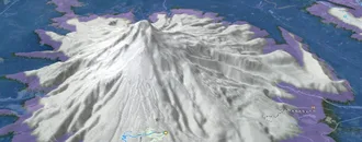
Snow & Rain 3D forecast Pro
See where it will snow, sleet or rain on Kimberley hour by hour, on 3D terrain.
View 3D snow forecast
Set amidst the spectacular Rocky & Purcell mountain ranges, Kimberley offers a great range of mountain bike riding possibilities.
Links
Trail info last updated
Activities Click to view
- Mountain Bike
190 trails
- E-Bike
172 trails
- Gravel Bike
40 trails
- Adaptive Bike
34 trails
- Winter Fat Bike
48 trails
- Horse
2 trails
- Hike
188 trails
- Trail Running
190 trails
- Dirtbike/Moto
1 trails
- ATV/ORV/OHV
1 trails
- Snowmobile
0 trails
- Snowshoe
53 trails
- Downhill Ski
56 trails
- Backcountry Ski
0 trails
- Nordic Ski
66 trails
Region Details
- 13
- 1
- 60
- 96
- 23
Region Status
Open as of Nov 12, 2026

Stats
- Avg Trail Rating
- Trails (view details)
- 296
- Trails Mountain Bike
- 190
- Trails E-Bike
- 172
- Trails Gravel Bike
- 40
- Trails Adaptive Bike
- 34
- Trails Winter Fat Bike
- 48
- Trails Horse
- 2
- Trails Hike
- 188
- Trails Trail Running
- 190
- Trails Dirtbike/Moto
- 1
- Trails ATV/ORV/OHV
- 1
- Trails Snowshoe
- 53
- Trails Downhill Ski
- 56
- Trails Nordic Ski
- 66
- Total Distance
- 246 miles
- Total Descent
- 77,672 ft
- Total Vertical
- 4,897 ft
- Highest Trailhead
- 7,822 ft
- Reports
- 6,159
- Photos
- 1,887
- Completed Counter
- 81,779
Articles

Downtime: Singletrack 6, 2016 - Photo Epic
Aug 10, 2016 from pinkbike.com
Having recovered from her first stage race experience at Singletrack 6 in the East Kootenays, Robin O’Neill shares some images she captured...

Singletrack 6's Portraits from the Back of the Pack
Nov 29, 2017 from pinkbike.com
Going into its fifth year in 2018, Singletrack 6 is starting to attract riders from all around the world. But they’re not the racers you’d...
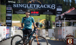
Race Report: The 2018 Singletrack 6
Aug 6, 2018 from pinkbike.com
With 6 days of epic cross-country racing, the Singletrack Six heads across choice locations in British Columbia.
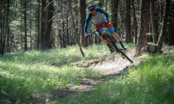
Exploring BC's Lesser Known Riding Destinations on the Bikes & Beers Tour
Sep 14, 2019 from pinkbike.com
Seven days of full-on riding on some of British Columbia's best trail networks.
Sub Regions
-
Bootleg Mountain
- 3
- 7
- 9
-
Kimberley Area Trails
- 9
- 16
- 1
-
Kimberley Nature Park
- 13
- 37
- 7
-
Kimberley Nordic Center and Ski Hill
- 1
- 15
- 23
- 5
-
Lois Creek
- 16
- 12
Popular Kimberley Mountain Biking Trails
• 95 ★ 4.5 • 5,052 ft • 0 ft • 1,604 •
This machine built trail is a 1.5km downhill/ flow/ jump trail. It can be ridden by all riders and has nice smooth dirt with very few rocks. The 44 features include tons of table tops and a gap jump over a big fallen tree, as well as...
• 80 ★ 4.7 • 4,688 ft • 10 ft • 1,112 •
This trail is fast and fluid with giant berms and terrific tabletops for intermediate riders with some bonus optional steep roll lines. A great stepping stone for riders experienced on Nimby who are looking to improve their jumping...
• 90 ★ 4.6 • 2 miles • 24 ft • 1,028 •
The entrance to this trail is located about 150 feet down from the Mr. Toad and Summer Trailheads. Join this up with Shapeshifter and Hoodoo View trail for a great cross country descent (or climb). Recent maintenance work was carried...
• 85 ★ 4.9 • 5 miles • 1,928 ft • 942 •
If you want to see some unicorns you are going to have to get up high. This is the primary climb trail that will bring up to the top of Snow White and the Seven Wasps as well as entry points to Atlas Shrugged, Pinch and Roll, Purple...
• 85 ★ 4.2 • 3,438 ft • 4 ft • 939 •
Highly rated popular blue difficulty singletrack. This multi-use trail can be used both directions and has a moderate overall physical rating with a 4 ft blue climb. On average it takes 4 minutes to complete this trail.
• 90 ★ 3.8 • 407 ft • 0 ft • 893 •
Single track from Atlas to the Purple People Pleaser Trailhead and road access. PPP starts immediately on your right at the exit of this connector.
• 100 ★ 3.7 • 2,510 ft • 87 ft • 863 •
A new way to connect the Levirs trails (Pattersons and Residents Choice) to upper Nature Park without going on the golf course.
Kimberley Mountain Bike Routes
★ 5.0 • 5 miles • 990 ft • 6 • Loop •
A Kimberley classic. This route takes you on the original Magic line route which was also one of the first...
7 miles • 1,126 ft • 9 • Loop •
Just follow the Short Fuse Advanced Loop Signs. This loop must be done in a clockwise direction. This is a...
5 miles • 517 ft • 5 • Loop •
This is the easiest intermediate loop that can be done on the Electrify The Mountains trail network. It...
★ 5.0 • 1 mile • 125 ft • 8 • Out & Back •
Eimer’s Lake is one of the most accessible Special Places and is an excellent short loop for people of...
15 miles • 1,335 ft • 5 • Point to Point •
This is the current route of the Trans Canada Trail through the Kimberley BC Region. The western portion...
Photos of Kimberley Mountain Bike
Videos of Kimberley Mountain Bike



Current Trail Warnings
| status | trail | date | condition | user | info |
|---|---|---|---|---|---|
| Shoodilley-Waddliley-Diddley-Doddley Diddly Waddiley Shoodilley Diddly Hoh-Oh-Ohh (Here I Come) | Oct 23, 2026 @ 4:55pm (America/Edmonton) Oct 23, 2026 | Unknown | adamt | Taped off on Oct 23rd. |
Recent Trail Reports
| status | trail | date | condition | info | user |
|---|---|---|---|---|---|
| Mr. Toad | Nov 12, 2026 @ 1:33pm (America/Creston) Nov 12, 2026 | Ideal | keithridesbikes | ||
| The Prestige - Magic Line 3 Descent | Nov 7, 2026 @ 5:54pm (America/Edmonton) Nov 7, 2026 | Prevalent Mud | Henklaw | ||
| Edge Trail | Oct 24, 2026 @ 12:43pm (America/Edmonton) Oct 24, 2026 | Ideal | TomintheNorth KTRG | ||
| Cutting Edge | Oct 24, 2026 @ 12:42pm (America/Edmonton) Oct 24, 2026 | Ideal | TomintheNorth KTRG | ||
| Duck Pond | Oct 24, 2026 @ 12:42pm (America/Edmonton) Oct 24, 2026 | Ideal | TomintheNorth KTRG | ||
| Skinku¢ / Coyote | Oct 23, 2026 @ 6:31pm (America/Edmonton) Oct 23, 2026 | Ideal | TomintheNorth KTRG | ||
| Unicorn Hunting (Bootleg Climb Trail) | Oct 22, 2026 @ 3:52pm (America/Edmonton) Oct 22, 2026 | Ideal | TomintheNorth KTRG | ||
| Sleight of Hand - Magic Line 1 Climb | Oct 18, 2026 @ 2:19pm (America/Edmonton) Oct 18, 2026 | Dry | Jochen54 | ||
| Ohm My (Short Circuit Cross Country Loop) | Oct 18, 2026 @ 2:19pm (America/Edmonton) Oct 18, 2026 | Ideal | Jochen54 | ||
| The Turn - Magic Line 2 Descent | Oct 18, 2026 @ 2:19pm (America/Edmonton) Oct 18, 2026 | Ideal | Jochen54 |
Activity Feed
| username | action | type | title | date |
|---|---|---|---|---|
| Mckenzieinc | add | trail | activity #107917930 and 2 more | Nov 16, 2026 @ 6:31pm 20 hours |
| alyssaallan | comment | trail | activity #107872103 | Nov 15, 2026 @ 7:50pm 2 days |
| keithridesbikes | add | report | activity #107675239 | Nov 12, 2026 @ 2:09pm Nov 12, 2026 |
| Tristans | wishlist | route | activity #107522047 | Nov 9, 2026 @ 8:17pm Nov 9, 2026 |
| kieranR6w0Q3 | comment | trail | activity #107442680 | Nov 8, 2026 @ 11:13am Nov 8, 2026 |
Recent Comments
| username | type | title | comment | date |
|---|---|---|---|---|
| trail | Trail currently closed! | Nov 15, 2026 @ 7:50pm 2 days | ||
| trail | Trail is wet and muddy with new snow,... | Nov 8, 2026 @ 11:13am Nov 8, 2026 | ||
| report | Four heavy leaners cleared / trail clear. | Oct 23, 2026 @ 5:31pm Oct 23, 2026 | ||
| report | Four heavy leaners cleared / trail clear. | Oct 23, 2026 @ 5:30pm Oct 23, 2026 | ||
| report | Between Borderine and Lower Duck pond | Oct 21, 2026 @ 3:12pm Oct 21, 2026 |
Local Badges
-

Completionist0 awarded -

Epic Ride 50k775 awarded -

Top 10 Trails2 awarded -
Completionist0 awarded -
Completionist0 awarded -

10 Black Trails116 awarded
Bike & Skill Parks
| name | type | city | rating |
|---|---|---|---|
| Kimberley Bike Park | skill park | Kimberley | |
| Velosolutions Pump Track and Dirt Jump Park | skill park | Kimberley |


















Activity Type Stats
| activitytype | trails | distance | descent | descent distance | total vertical | rating | global rank | state rank | photos | reports | routes | activity logs |
|---|---|---|---|---|---|---|---|---|---|---|---|---|
| Mountain Bike | 190 | 175 miles | 29,439 ft | 75 miles | 3,343 ft | #311 | #34 | 1,768 | 6,081 | 35 | 38,329 | |
| E-Bike | 172 | 161 miles | 28,389 ft | 70 miles | 3,343 ft | #373 | #33 | 31 | 4,631 | 15 | 3,622 | |
| Gravel Bike | 40 | 48 miles | 2,451 ft | 14 miles | 3,176 ft | #1,037 | #39 | 2 | 687 | 4 | 199 | |
| Adaptive Bike | 34 | 39 miles | 2,671 ft | 11 miles | 3,104 ft | #602 | #20 | 990 | 3 | 8 | ||
| Winter Fat Bike | 48 | 39 miles | 4,928 ft | 17 miles | 1,483 ft | #170 | #13 | 5 | 472 | 5 | 127 | |
| Horse | 2 | 2 miles | 135 ft | 436 ft | #963 | #29 | 1,473 | 8 | ||||
| Hike | 188 | 179 miles | 28,681 ft | 75 miles | 4,898 ft | #601 | #39 | 44 | 5,709 | 17 | 3,850 | |
| Trail Running | 190 | 182 miles | 28,855 ft | 76 miles | 4,898 ft | #211 | #16 | 21 | 5,715 | 20 | 5,833 | |
| Dirtbike/Moto | 1 | 2 miles | 135 ft | 226 ft | #583 | #41 | 1,471 | 9 | ||||
| ATV/ORV/OHV | 1 | 2 miles | 135 ft | 226 ft | #364 | #25 | 1 | 1,471 | 13 | |||
| Snowshoe | 53 | 45 miles | 4,551 ft | 16 miles | 1,598 ft | #155 | #14 | 4 | 1,062 | 4 | 155 | |
| Downhill Ski | 56 | 33 miles | 42,411 ft | 33 miles | 2,172 ft | #148 | #13 | 8 | 651 | 3,992 | ||
| Nordic Ski | 66 | 57 miles | 4,396 ft | 20 miles | 2,116 ft | #27 | #4 | 3 | 936 | 4 | 4,970 |
Frequently Asked Questions
▼
What are the best places to ride in Kimberley?
Kimberley has 6 areas to explore for mountain biking. The top rated areas are:
▼
What are the highest rated mountain biking trails in Kimberley?
The highest rated mountain biking trails in Kimberley are:
- Snow Mexican (4.6/5)
- The Prestige - Magic Line 3 Descent (4.6/5)
- Unicorn Hunting (Bootleg Climb Trail) (4.5/5)
- Purple People Pleaser (4.5/5)
- Atlas Shrugged (4.5/5)
▼
What is the best time of the year to ride in Kimberley?
Based on activity log data, the most popular months to ride in Kimberley are:
- July (1,166 activities)
- June (1,047 activities)
- August (1,026 activities)
▼
Where can I park to ride in Kimberley?
There are 11 parking locations listed in Kimberley. The most popular parking spots are:
- Swan St Parking Lot - Kimberley Nature Park Access
- Bootleg Trails Parking Lot
- Campground Trail Parking
- Platzl Parking Lot
- Parking Lot - Jimmy Russell Road
▼
What is the longest trail in Kimberley?
The longest trail in Kimberley is Round The Mountain at 11.2 km. View all trails sorted by distance.
▼
What are the best & highest rated hiking trails in Kimberley?
The best hiking trails in Kimberley are: View all hiking trails sorted by popularity score.
▼
What are the best & highest rated trail running trails in Kimberley?
The best trail running trails in Kimberley are: View all trail running trails sorted by popularity score.
▼
How many trails are in Kimberley?
Kimberley has a total of 293 trails. Of those, 190 are designated for mountain biking. Browse top mountain biking trails in Kimberley to find detailed information including difficulty ratings, distances, and trail conditions.
▼
Which trail has the most elevation gain in Kimberley?
The trail with the most elevation gain in Kimberley is Unicorn Hunting (Bootleg Climb Trail) with 588 m of elevation gain. View all trails sorted by elevation gain.
▼
Which trail has the most elevation descent in Kimberley?
The trail with the most elevation descent in Kimberley is Atlas Shrugged with 650 m of elevation descent. View all trails sorted by elevation descent.
▼
What activities are most popular in Kimberley?
Kimberley supports the following activities: Mountain Biking, E-Biking, Gravel Biking, Adaptive Biking, Winter Fat Biking, Horseback, Hiking, Trail Running, Dirtbiking, ATVing/Offroading, Snowmobiling, Snowshoeing, Skiing, Backcountry Skiing, Nordic Skiing.
▼
What bike services are there in Kimberley?
The following bike services are available in Kimberley:
- Trail Association (1)
▼
What are the steepest mountain biking trails in Kimberley?
The steepest mountain biking trail in Kimberley is Richardsons with an average grade of 13.5%. View all trails sorted by grade.
▼
Are there any trails with scenic viewpoints in Kimberley?
Yes, there are 7 scenic viewpoints marked along trails in Kimberley. Some popular viewpoints include: Explore more points of interest to find trails with the best views.
▼
Are the trails open in Kimberley?
The overall region status for Kimberley is Clear / Green. Out of 199 trails:
- Clear / Green: 186
- Minor Issue / Yellow: 6
- Significant Issue / Amber: 6
- Closed: 1
▼
What are the trail conditions in Kimberley?
Based on trail reports from the past week in Kimberley:
- Ideal: 1 trail
▼
Can I ride an ebike in Kimberley?
Yes, Kimberley supports e-bike riding. There are 157 trails in Kimberley that allow e-bikes. Check the e-bike trails listing for specific trail access details and any local regulations.
▼
What are the most popular mountain biking routes in Kimberley?
The most popular mountain biking routes in Kimberley are: View all mountain biking routes in Kimberley.
▼
What type of bike is most common in Kimberley?
Based on activity log data, the most common bike types used in Kimberley are:
- AM (490 activities)
- XC (165 activities)
- Fat (19 activities)
- DJ (11 activities)
- RD (7 activities)
▼
What is the highest summit in Kimberley?
The highest summit in Kimberley is Nowitka Mountain at 2,908 m elevation.
▼
What are the top sights to see in Kimberley?
There are 14 notable sights in Kimberley. Some of the top sights include:
- Site 14 KNP-NH Photo Documentation Project
- Site 9 KNP-NH Photo Documentation Project
- Site 11 KNP-NH Photo Documentation Project
- Site 13 KNP-NH Photo Documentation Project
- Site 8 KNP-NH Photo documentation Project
▼
What are the most popular Strava Segments in Kimberley?
The most popular Strava segments in Kimberley are:
- Nimby (2,518 athletes)
- Magic Line Last DH (2,266 athletes)
- ML 3 First Corner to Bridge (2,235 athletes)
▼
What trails are closed in Kimberley?
There are currently 1 closed trails in Kimberley. The breakdown of all trail statuses is:
- Clear / Green: 186
- Minor Issue / Yellow: 6
- Significant Issue / Amber: 6
- Closed: 1
▼
Are there accessible or adaptive trails in Kimberley?
Yes, there are 33 accessible/adaptive trails in Kimberley. View all adaptive trails in Kimberley for specific accessibility information.
▼
Are there local clubs or events in Kimberley?
There are 1 local clubs or associations listed in the Kimberley directory. Browse the local directory for details.
▼
What are the most popular mountain biking trails in Kimberley?
The most popular mountain biking trails in Kimberley are:
- The Prestige - Magic Line 3 Descent
- Rainbow Rock Rodeo
- Amps Go Marching (Short Circuit Cross Country Loop)
- Electric Avenue
- Yiiikes!
▼
What are the best beginner ride trails in Kimberley?
The best beginner mountain biking trails in Kimberley are:
- Electric Avenue (4.5/5)
- Spicy Kitty (4.2/5)
- Nuts and Volts (Short Circuit Cross Country Loop) (4.2/5)
Activities
Trails
Points of Interest
- Site 9 KNP-NH Photo Documentation Project Sight
- Site 1 KNP-NH Photo Documentation Project Sight
- Site 2 KNP-NH Photo Documentation Project Sight
- Site 3 KNP-NH Photo Documentation Project Sight
- Site 6 KNP-NH Photo Documentation Project Sight
- Site 4 KNP-NH Photo Documentation Project Sight
- Site 5 KNP-NH Photo Documentation Project Sight
- Site 10 KNP-NH Photo Documentation Project Sight
- Site 8 KNP-NH Photo documentation Project Sight
- Site 11 KNP-NH Photo Documentation Project Sight
- Nowitka Mountain (2,908 m)
- Mount St. Mary (2,881 m)
- Mount Alton (2,742 m)
- By canadaka
 Trailforks & contributors
- Admins: barry-mclane, KTS, duck, Mckenzieinc, PColtrane, pascalgrayphoto, Thisguyinkimberley, kimberley-trails-society, STMS, RDEK
- #3023 - 75,470 views
- kimberley activity log | embed map of Kimberley mountain bike trails | kimberley mountain biking points of interest polygons
Downloading of trail gps tracks in kml & gpx formats is enabled for Kimberley.
You must login to download files.
