3.0 miles
Distance
329 ft
Climb
-1,070 ft
Descent
00:35:33
Avg time
Mr. Toad Details
-
Activities
- Mountain Bike
- Hike
- Trail Running
-
Riding AreaKimberley Area Trails
Kimberley, British Columbia -
Difficulty Rating
-
Trail TypeSingletrack
-
Bike TypeAM
-
DirectionDownhill OnlyPopular direction shown
-
Physical RatingHard
-
Dogs AllowedYes
-
Global Ranking
-
Local Popularity70 in Mountain Biking [+]
- 35 in Trail Running
- 50 in Hiking
-
Year Opened2015
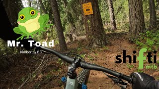
This trail is a downhill technical trail with some climbing in the middle and at the end to join up with Shapeshifter Trail. There are some technical features like rock rolls, ladder bridges and awkward cobbled corners that will test your skills. If you are not comfortable with the log ride at the beginning, it might be best to stick with Thunder Turkey which is also a ton of fun.
Access Info
Access trail from Boulevard trail, about 30 feet south of Summer Trail and 150 south of entrance to Mr. Toad trail.
Local Trail Association
-
Please consider joining or donating to the local trail association to supportdonate to earn trail karma!
trail development & maintenance.
Traditionally Indigenous Territory
More Stats for Mr. Toad mountain bike trail trail
-
Altitude change-741 ft
-
Altitude min3,530 ft
-
Altitude max4,344 ft
-
Altitude start4,344 ft
-
Altitude end3,602 ft
-
Grade-4.7%
-
Grade max-80.7%
-
Grade min26.6%
-
Distance climb4,455 ft
-
Distance down2 miles
-
Distance flat1,539 ft
-
Avg time00:35:33
-
Avg reverse time01:23:11
- view trail stats
close
Trail Conditions
- Unknown
- Snow Groomed
- Snow Packed
- Snow Covered
- Snow Cover Inadequate
- Freeze/thaw Cycle
- Icy
- Prevalent Mud
- Wet
- Variable
- Ideal
- Dry
- Very Dry
Trail Flow (Ridden Direction)
Trailforks scans users ridelogs to determine the most popular direction each trail is ridden. A good flowing trail network will have most trails flowing in a single direction according to their intension.
The colour categories are based on what percentage of riders are riding a trail in its intended direction.
- > 96%
- > 90%
- > 80%
- > 70%
- > 50%
- < 50%
- bi-directional trail
- no data
Trail Last Ridden
Trailforks scans ridelogs to determine the last time a trail was ridden.
- < 2 days
- < 1 week
- < 2 weeks
- < 1 month
- < 6 months
- > 6 months
Trail Ridden Direction
The intended direction a trail should be ridden.
- Downhill Only
- Downhill Primary
- Both Directions
- Uphill Primary
- Uphill Only
- One Direction
Contribute Details
Colors indicate trail is missing specified detail.
- Description
- Photos
- Description & Photos
- Videos
Trail Popularity ?
Trailforks scans ridelogs to determine which trails are ridden the most in the last 9 months.
Trails are compared with nearby trails in the same city region with a possible 25 colour shades.
Think of this as a heatmap, more rides = more kinetic energy = warmer colors.
- most popular
- popular
- less popular
- not popular
ATV/ORV/OHV Filter
Max Vehicle Width
inches
Radar Time
x
Activity Recordings
Trailforks users anonymized public ridelogs from the past 6 months.
- mountain biking recent
- mountain biking (>6 month)
- hiking (1 year)
- moto (1 year)
Activity Recordings
Trailforks users anonymized public skilogs from the past 12 months.
- Downhill Ski
- Backcountry Ski
- Nordic Ski
Jump Magnitude Heatmap
Heatmap of where riders jump on trails. Zoom in to see individual jumps, click circles to view jump details.
Trails Deemphasized
Trails are shown in grey.
Only show trails with NO bikes.
Directions to mr-toad trailhead
(49.654720, -116.047470)
update trails status or condition
Mr. Toad Trail Reports
view all reports »
Recent Ridelog Activity on Trail
Past Week
- 3 rides
- 16 miles avg distance
6 Months
- 6 rides
- 15 miles avg distance
All
- 283 rides
Photos
more »
Routes with this trail
more »
CSharp
(Sep 17, 2019 at 16:01)
It's a pretty good technical and fun first half of the course. Definitely properly rated since a lot of people will walk all the planks and ride around most of the technical features. If it wasn't for the wet boards on the curvy wooden feature, I would've attempted to ride it. Great trail!
[Reply]
tombraumandl
(May 4, 2022 at 16:43)

To hell with flow and consistency! What's wrong with the occasional surprise? brilliant trail
[Reply]
Videos
no videos have been added for Mr. Toad yet, add a video.
Nearby Trails
- Upper Thunder Turkey 249 ft
- Summer 348 ft
- Talus Trail 456 ft
- Dipper Lake 1 mile
- Bullfrog Hill 1 mile
Kimberley Area Trails
- embed Mr. Toad trail on your website
- By k1hickey
KTS KTRG & contributors
- #39985 - 4,069 views
- subscribe
- login to download gpx or kml files.
Open trail in mobile app
Trail isn't very hard but I would recommend riding Turkey Thunder instead.