
close
3D
Trail Conditions
- Unknown
- Snow Groomed
- Snow Packed
- Snow Covered
- Snow Cover Partial
- Freeze/thaw Cycle
- Icy
- Prevalent Mud
- Wet
- Variable
- Ideal
- Dry
- Very Dry
Trail Flow (Ridden Direction)
Trailforks scans users activity logs to determine the most popular direction each trail is ridden. A good flowing trail network will have most trails flowing in a single direction according to their intension.
The colour categories are based on what percentage of users are riding a trail in its intended direction.
The colour categories are based on what percentage of users are riding a trail in its intended direction.
- > 96%
- > 90%
- > 80%
- > 70%
- > 50%
- < 50%
- bi-directional trail
- no data
Trail Last Used
Trailforks scans activity logs to determine the last time a trail was ridden.
- < 2 days
- < 1 week
- < 2 weeks
- < 1 month
- < 6 months
- > 6 months
Trail Ridden Direction
The intended direction a trail should be ridden.
- Downhill Only
- Downhill Primary
- Both Directions
- Uphill Primary
- Uphill Only
- One Direction
Contribute Details
Colors indicate trail is missing specified detail.
- Description
- Photos
- Description & Photos
- Videos
Trail Popularity ?
Trailforks scans activity logs to determine which trails are ridden the most in the last 9 months.
Trails are compared with nearby trails in the same city region with a possible 25 colour shades.
Think of this as a heatmap, more activities = more kinetic energy = warmer colors.
- most popular
- popular
- less popular
- not popular
ATV/ORV/OHV Filter
Max Vehicle Width
inches
US Cell Coverage
Legend

Radar Time
Activity Recordings
Trailforks uses anonymized public activity data.
?
Activity Recordings
Trailforks uses anonymized public activity data.
?
Winter Trails
Warning
A routing network for winter maps does not exist. Selecting trails using the winter trails layer has been disabled.
Missing Trails
Most Popular
Least Popular
Trails are colored based on popularity. The more popular a trail is, the more red. Less popular trails trend towards green.
Jump Magnitude Heatmap
Heatmap of where users jump on trails. Zoom in to see individual jumps, click circles to view jump details.
BC Backroad Status
![map legend]()
Service Road Atlas is a free to use, community-driven service for viewing and creating reports on the numerous back-country service roads around B.C. and Alberta.

Slope Aspect
Direction the slope faces
Trails Deemphasized
Trails are shown in grey.
Only show trails with no bike usage.
Suggested Layers
Based on selected activity type
Save the current map location and zoom level as your default home location whenever this page is loaded.
SaveMap defaulted to winter mode.
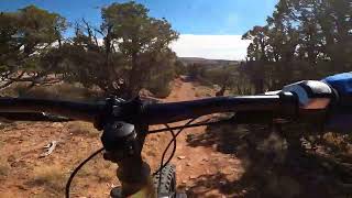
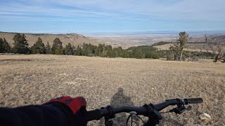
Lander trails and routes are listed on Trailforks with interactive trail maps, difficulty ratings, photos, and user-reported trail conditions. The Trailforks community has mapped hundreds of trails and shared hundreds of photos in this region. Supported activity types include Trail Running, Hiking, Mountain Biking, Gravel Biking, Winter Fat Biking, Horseback, E-Biking, Dirtbiking, ATVing/Offroading, Nordic Skiing, Snowshoeing, Adaptive Biking, Observed Trials and Snowmobiling. Trails here are often faint trail, sandy and rocky. Scenery includes lakes, views and creeks. Common trail features include rock slabs, rock gardens and drops. Many trails are family friendly. Amenities include restrooms and shuttle access. Popular destinations include Sinks Canyon, Bus Loop and Johnny Behind the Rocks.
This is an auto-generated description of Lander.
Login or register to submit a custom description.
Trail info last updated
Activities Click to view
- Mountain Bike
210 trails
- E-Bike
61 trails
- Gravel Bike
79 trails
- Adaptive Bike
29 trails
- Winter Fat Bike
71 trails
- Horse
69 trails
- Hike
224 trails
- Trail Running
226 trails
- Dirtbike/Moto
41 trails
- Observed Trials
16 trails
- ATV/ORV/OHV
40 trails
- Snowmobile
4 trails
- Snowshoe
31 trails
- Nordic Ski
40 trails
Region Details
- 71
- 2
- 28
- 55
- 58
- 12
Region Status
Open as of Nov 9, 2026Local Trail Association

Trail Running Stats
- Global Ranking
- #120
- State Ranking
- #2
- Trails (view details)
- 226
- Trails Mountain Bike
- 210
- Trails E-Bike
- 61
- Trails Gravel Bike
- 79
- Trails Adaptive Bike
- 29
- Trails Winter Fat Bike
- 71
- Trails Horse
- 69
- Trails Hike
- 224
- Trails Trail Running
- 226
- Trails Dirtbike/Moto
- 41
- Trails Observed Trials
- 16
- Trails ATV/ORV/OHV
- 40
- Trails Snowmobile
- 4
- Trails Snowshoe
- 31
- Trails Backcountry Ski
- 5
- Trails Nordic Ski
- 40
- Total Distance
- 659 miles
- Total Descent Distance
- 287 miles
- Total Descent
- 75,253 ft
- Total Vertical
- 11,919 ft
- Reports
- 5,898
- Photos
- 1
- Completed Counter
- 574
Sub Regions
-
Alpine Science Institute
- 1
- 8
- 3
- 3
-
Bus Loop
- 3
- 20
- 10
- 2
-
Commissary ridge
-
Government Draw
- 4
-
Jeffrey City
- 1
-
Johnny Behind the Rocks
- 1
- 2
- 6
- 8
- 1
-
Sinks Canyon
- 8
- 6
- 9
- 8
-
Willow Creek
- 6
- 6
- 5
Popular Lander Trail Running Trails
• 100 ★ 0.0 • 3 miles • 1,386 ft • 38 • • hike
Black diamond difficulty singletrack. This hike primary trail can be used both directions and has a hard overall physical rating. On average it takes 3 hours5 minutes to complete this trail.
• 100 ★ 0.0 • 2 miles • 217 ft • 28 • • hike
Green difficulty singletrack. This hike primary trail can be used both directions. On average it takes 1 hour30 minutes to complete this trail.
• 100 ★ 0.0 • 1,991 ft • 155 ft • 26 • • hike
Trail to the Falls overlook. Great views from high point,
• 95 ★ 5.0 • 3,136 ft • 183 ft • 25 • • hike
Rocky but not as much elevation gain to loop the Arrowhead Lake. Also used to access the south approach to Pingora Peak
• 100 ★ 4.8 • 1 mile • 0 ft • 23 •
Great flowing blue singletrack with lots of optional line choices for more advanced riders. This section is groomed in the winter by the Lander Cycling Club.
• 95 ★ 4.5 • 4 miles • 69 ft • 23 •
From the top, a winding, mostly gentle climb around Fossil Hill takes you to beautiful meadows full of wildflowers, gorgeous views of the high country, many optional dirt and limestone features, and an exciting steep section. Brewers is...
• 95 ★ 5.0 • 2,641 ft • 310 ft • 22 •
Steep somewhat eroded historical road cut now single track. Difficult pedal uphill, fast fun downhill.
Lander Routes
Full Brewers Shuttle Featured
★ 5.0 • 14 miles • 246 ft • 5 • Shuttled •
Top to bottom Brewers Trail Shuttle ride. Upper Brewers is relatively cross country, with lots of whoops...
9 miles • 1,095 ft • 4 •
Beginner friendly super fun route around Johnny Behind the Rocks. Check out the new Flowin' Johnny...
18 miles • 3,162 ft • 0 •
Loop traverse through the Popo Agie trail system via Middle Trails. Passing through the Ice Lakes Trail
• 4 miles • 1,620 ft • 2 •
Photos of Lander
Videos of Lander

Recent Trail Reports
| status | trail | date | condition | info | user |
|---|---|---|---|---|---|
| Petes Lake Single Track | Nov 9, 2026 @ 12:59pm (America/Denver) Nov 9, 2026 | Dry | wes10hoff LCC | ||
| Twin Creek Downhill | Nov 5, 2026 @ 4:14pm (America/Denver) Nov 5, 2026 | Ideal | wes10hoff LCC | ||
| Twin Creek Ascent | Nov 5, 2026 @ 4:14pm (America/Denver) Nov 5, 2026 | Ideal | wes10hoff LCC | ||
| Red Ridge Doubletrack Access | Nov 5, 2026 @ 4:14pm (America/Denver) Nov 5, 2026 | Ideal | wes10hoff LCC | ||
| Red Ridge | Nov 5, 2026 @ 4:14pm (America/Denver) Nov 5, 2026 | Ideal | wes10hoff LCC | ||
| Primary cut off | Nov 5, 2026 @ 4:14pm (America/Denver) Nov 5, 2026 | Ideal | wes10hoff LCC | ||
| Outer Dry Well Road | Nov 5, 2026 @ 4:14pm (America/Denver) Nov 5, 2026 | Ideal | wes10hoff LCC | ||
| Middle Dry Well Road North | Nov 5, 2026 @ 4:14pm (America/Denver) Nov 5, 2026 | Ideal | wes10hoff LCC | ||
| Middle Dry Well Road | Nov 5, 2026 @ 4:14pm (America/Denver) Nov 5, 2026 | Ideal | wes10hoff LCC | ||
| Jolene | Nov 5, 2026 @ 4:14pm (America/Denver) Nov 5, 2026 | Ideal | wes10hoff LCC |
National Scenic Trails & Official Routes
-
Continental Divide Trail
- Mountain Bike
- Hike
- Trail Running
Activity Feed
| username | action | type | title | date |
|---|---|---|---|---|
| WJones008 | vote | trail | activity #107805062 and 1 more | Nov 14, 2026 @ 7:35pm 15 hours |
| WJones008 | vote | trail | activity #107805016 and 4 more | Nov 14, 2026 @ 7:32pm 15 hours |
| mdicken | update | trail | activity #107738912 | Nov 13, 2026 @ 9:12pm 2 days |
| wes10hoff | update | trail | activity #107564050 and 3 more | Nov 10, 2026 @ 3:11pm Nov 10, 2026 |
| wes10hoff | add | report | activity #107501980 | Nov 9, 2026 @ 12:00pm Nov 9, 2026 |
Recent Comments
| username | type | title | comment | date |
|---|---|---|---|---|
| trail | Definitely a trail more suited for hikers that... | Sep 17, 2025 @ 4:42pm Sep 17, 2025 | ||
| trail | A little tight on the switch back starting out... | Sep 17, 2025 @ 4:39pm Sep 17, 2025 | ||
| trail | The entire Brewers and Enchanted forest trails... | Sep 3, 2025 @ 7:40am Sep 3, 2025 | ||
| trail | Rippin' fun! Great green flow trail | Sep 3, 2025 @ 7:35am Sep 3, 2025 | ||
| trail | Loved this! Nice actual hiking trail feel with... | Sep 3, 2025 @ 7:34am Sep 3, 2025 |
Local Badges
-

10 Green Trails4 awarded -

10 Blue Trails4 awarded -

10 Black Trails2 awarded -

Epic Trail Running Climb 2k4 awarded -

Climbing 10k Badge0 awarded -

Trail Running 100k Badge0 awarded






Activity Type Stats
| activitytype | trails | distance | descent | descent distance | total vertical | rating | global rank | state rank | photos | reports | routes | activity logs |
|---|---|---|---|---|---|---|---|---|---|---|---|---|
| Mountain Bike | 210 | 616 miles | 69,583 ft | 274 miles | 10,518 ft | #278 | #1 | 550 | 5,981 | 10 | 8,064 | |
| E-Bike | 61 | 318 miles | 27,602 ft | 131 miles | 5,430 ft | #423 | #5 | 6 | 1,991 | 1 | 510 | |
| Gravel Bike | 79 | 436 miles | 38,596 ft | 185 miles | 5,430 ft | #63 | #1 | 718 | 4 | 237 | ||
| Adaptive Bike | 29 | 163 miles | 15,935 ft | 61 miles | 5,430 ft | #150 | #2 | 753 | 3 | |||
| Winter Fat Bike | 71 | 169 miles | 22,290 ft | 79 miles | 9,701 ft | #80 | #1 | 2 | 1,555 | 2 | 10 | |
| Horse | 69 | 388 miles | 36,083 ft | 169 miles | 6,831 ft | #49 | #5 | 5 | 1,739 | 3 | ||
| Hike | 224 | 650 miles | 72,913 ft | 281 miles | 11,919 ft | #134 | #2 | 71 | 5,956 | 4 | 1,894 | |
| Trail Running | 226 | 659 miles | 75,253 ft | 287 miles | 11,919 ft | #120 | #2 | 1 | 5,898 | 5 | 586 | |
| Dirtbike/Moto | 41 | 266 miles | 19,616 ft | 106 miles | 5,430 ft | #89 | #1 | 517 | 4 | |||
| Observed Trials | 16 | 102 miles | 5,745 ft | 38 miles | 3,763 ft | #34 | #1 | 236 | 3 | |||
| ATV/ORV/OHV | 40 | 274 miles | 20,413 ft | 111 miles | 5,430 ft | #35 | #1 | 516 | 15 | |||
| Snowmobile | 4 | 28 miles | 3,159 ft | 13 miles | 2,392 ft | #195 | #1 | 1 | 272 | 3 | ||
| Snowshoe | 31 | 64 miles | 7,290 ft | 29 miles | 4,400 ft | #346 | #1 | 1 | 885 | 1 | 21 | |
| Backcountry Ski | 5 | 28 miles | 3,143 ft | 13 miles | 3,753 ft | 106 | 97 | |||||
| Nordic Ski | 40 | 54 miles | 5,620 ft | 24 miles | 4,150 ft | #387 | #1 | 1,006 | 1 | 357 |
Frequently Asked Questions
▼
What are the best places to run in Lander?
Lander has 10 areas to explore for trail running. The top rated areas are:
▼
What are the highest rated trail running trails in Lander?
The highest rated trail running trails in Lander are:
- Popo Agie Falls Trail (0/5)
- Popo Agie Nature Trail (0/5)
- North Fork (0/5)
- Big Sandy (Jackass Pass) (0/5)
- Arrowhead Lake (0/5)
▼
What is the best time of the year to run in Lander?
Based on activity log data, the most popular months to run in Lander are:
- May (21 activities)
- June (17 activities)
- July (11 activities)
▼
Where can I park to run in Lander?
There are 21 parking locations listed in Lander. The most popular parking spots are: View all parking and trailhead locations on the map to plan your visit.
▼
What is the longest trail in Lander?
The longest trail in Lander is Bear's Ears at 17.6 miles. View all trails sorted by distance.
▼
What are the best & highest rated hiking trails in Lander?
The best hiking trails in Lander are: View all hiking trails sorted by popularity score.
▼
What are the best & highest rated dirtbiking trails in Lander?
The best dirtbiking trails in Lander are: View all dirtbiking trails sorted by popularity score.
▼
How many trails are in Lander?
Lander has a total of 255 trails. Of those, 226 are designated for trail running. Browse top trail running trails in Lander to find detailed information including difficulty ratings, distances, and trail conditions.
▼
Which trail has the most elevation gain in Lander?
The trail with the most elevation gain in Lander is Bear's Ears with 3,946 ft of elevation gain. View all trails sorted by elevation gain.
▼
Which trail has the most elevation descent in Lander?
The trail with the most elevation descent in Lander is Bear's Ears with 2,766 ft of elevation descent. View all trails sorted by elevation descent.
▼
What activities are most popular in Lander?
Lander supports the following activities: Mountain Biking, E-Biking, Gravel Biking, Adaptive Biking, Winter Fat Biking, Horseback, Hiking, Trail Running, Dirtbiking, Observed Trials, ATVing/Offroading, Snowmobiling, Snowshoeing, Nordic Skiing.
▼
What are the steepest trail running trails in Lander?
The steepest trail running trail in Lander is Addiction Rock Climbing Trail with an average grade of 21.6%. View all trails sorted by grade.
▼
Are there any trails with scenic viewpoints in Lander?
Yes, there are 4 scenic viewpoints marked along trails in Lander. Some popular viewpoints include: Explore more points of interest to find trails with the best views.
▼
Are the trails open in Lander?
The overall region status for Lander is Clear / Green. Out of 220 trails:
- Clear / Green: 220
▼
What are the trail conditions in Lander?
Based on trail reports from the past week in Lander:
- Dry: 1 trail
▼
What are the most popular trail running routes in Lander?
The most popular trail running routes in Lander are: View all trail running routes in Lander.
▼
What is the highest summit in Lander?
The highest summit in Lander is Cony Mountain at 11,099 ft elevation.
▼
Are there accessible or adaptive trails in Lander?
Yes, there are 29 accessible/adaptive trails in Lander. View all adaptive trails in Lander for specific accessibility information.
▼
Are there local clubs or events in Lander?
There are 4 local clubs or associations listed in the Lander directory. Browse the local directory for details.
▼
What are the most popular trail running trails in Lander?
The most popular trail running trails in Lander are: View all trail running trails sorted by popularity.
▼
What are the best beginner trail run trails in Lander?
The best beginner trail running trails in Lander are:
- Popo Agie Nature Trail (0/5)
- Shadow Lake (0/5)
- Sage Draw (0/5)
Activities
- Lander Mountain Biking Trails
- Lander E-Biking Trails
- Lander Gravel Biking Trails
- Lander Adaptive Biking Trails
- Lander Winter Fat Biking Trails
- Lander Horseback Trails
- Lander Hiking Trails
- Lander Trail Running Trails
- Lander Dirtbiking Trails
- Lander Observed Trials Trails
- Lander ATVing/Offroading Trails
- Lander Snowshoeing Trails
- Lander Nordic Skiing Trails
Trails
Points of Interest
- Falls Viewpoint
- Hugh Otte Camping
- Cottonwood Tabletop 1 TTF
- Creek Crossing TTF
- The Sinks Sight
- Drop (go around on left) TTF
- Rock Shop Inn Cabin
- Steep Hill / Difficult Climb/Decent TTF
- Sweetwater Gap Campground Camping
- Dickinson Creek Campground Camping
- Cony Mountain (11,099 ft)
- Mount Arter (11,047 ft)
- Granite Peak (10,400 ft)
- By todd
 Trailforks & contributors
- Admins: LCC
- #6300 - 19,596 views
- lander activity log | embed map of Lander mountain bike trails | lander mountain biking points of interest
Downloading of trail gps tracks in kml & gpx formats is enabled for Lander.
You must login to download files.
