
close
3D
Trail Conditions
- Unknown
- Snow Groomed
- Snow Packed
- Snow Covered
- Snow Cover Partial
- Freeze/thaw Cycle
- Icy
- Prevalent Mud
- Wet
- Variable
- Ideal
- Dry
- Very Dry
Trail Flow (Ridden Direction)
Trailforks scans users activity logs to determine the most popular direction each trail is ridden. A good flowing trail network will have most trails flowing in a single direction according to their intension.
The colour categories are based on what percentage of users are riding a trail in its intended direction.
The colour categories are based on what percentage of users are riding a trail in its intended direction.
- > 96%
- > 90%
- > 80%
- > 70%
- > 50%
- < 50%
- bi-directional trail
- no data
Trail Last Used
Trailforks scans activity logs to determine the last time a trail was ridden.
- < 2 days
- < 1 week
- < 2 weeks
- < 1 month
- < 6 months
- > 6 months
Trail Ridden Direction
The intended direction a trail should be ridden.
- Downhill Only
- Downhill Primary
- Both Directions
- Uphill Primary
- Uphill Only
- One Direction
Contribute Details
Colors indicate trail is missing specified detail.
- Description
- Photos
- Description & Photos
- Videos
Trail Popularity ?
Trailforks scans activity logs to determine which trails are ridden the most in the last 9 months.
Trails are compared with nearby trails in the same city region with a possible 25 colour shades.
Think of this as a heatmap, more activities = more kinetic energy = warmer colors.
- most popular
- popular
- less popular
- not popular
ATV/ORV/OHV Filter
Max Vehicle Width
inches
US Cell Coverage
Legend

Radar Time
Activity Recordings
Trailforks uses anonymized public activity data.
?
Activity Recordings
Trailforks uses anonymized public activity data.
?
Winter Trails
Warning
A routing network for winter maps does not exist. Selecting trails using the winter trails layer has been disabled.
Missing Trails
Most Popular
Least Popular
Trails are colored based on popularity. The more popular a trail is, the more red. Less popular trails trend towards green.
Jump Magnitude Heatmap
Heatmap of where users jump on trails. Zoom in to see individual jumps, click circles to view jump details.
BC Backroad Status
![map legend]()
Service Road Atlas is a free to use, community-driven service for viewing and creating reports on the numerous back-country service roads around B.C. and Alberta.

Slope Aspect
Direction the slope faces
Trails Deemphasized
Trails are shown in grey.
Only show trails with no bike usage.
Suggested Layers
Based on selected activity type
Save the current map location and zoom level as your default home location whenever this page is loaded.
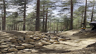
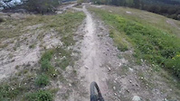
SaveLjusdal trails and routes are listed on Trailforks with interactive trail maps, difficulty ratings, photos, and user-reported trail conditions. The Trailforks community has mapped hundreds of trails and shared hundreds of photos in this region. Supported activity types include Mountain Biking, Trail Running, Hiking, Gravel Biking, Horseback, Adaptive Biking, Nordic Skiing, Winter Fat Biking, E-Biking and Snowmobiling. Trails here are often faint trail and flowy. Scenery includes views and creeks. Common trail features include rock gardens, rock slabs and berms. Many trails are family friendly and lit for night riding. Amenities include picnic spots. Popular destinations include Järvsö, Färila and Los.
This is an auto-generated description of Ljusdal.
Login or register to submit a custom description.
This region uses the Uk/Euro style trail grading system.
Trail info last updated
Activities Click to view
- Mountain Bike
392 trails
- E-Bike
19 trails
- Gravel Bike
133 trails
- Adaptive Bike
64 trails
- Winter Fat Bike
51 trails
- Horse
80 trails
- Hike
347 trails
- Trail Running
349 trails
- Snowmobile
10 trails
- Nordic Ski
55 trails
Region Details
- 106
- 77
- 150
- 48
- 10
- 1
Region Status
Open as of Oct 16, 2026Stats
- Avg Trail Rating
- Trails (view details)
- 410
- Trails Mountain Bike
- 392
- Trails E-Bike
- 19
- Trails Gravel Bike
- 133
- Trails Adaptive Bike
- 64
- Trails Winter Fat Bike
- 51
- Trails Horse
- 80
- Trails Hike
- 347
- Trails Trail Running
- 349
- Trails Dirtbike/Moto
- 3
- Trails Snowmobile
- 10
- Trails Snowshoe
- 1
- Trails Nordic Ski
- 55
- Total Distance
- 281 miles
- Total Descent
- 32,205 ft
- Total Vertical
- 1,303 ft
- Highest Trailhead
- 1,672 ft
- Reports
- 1,263
- Photos
- 124
- Completed Counter
- 32,205
Articles

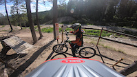
Video: Sampling Scandinavian Riding with Finn Iles
Jul 4, 2019 from pinkbike.com
Järvsö provides no shortage of hucks to flat, scrubs, drifts, and cheeky trail gaps.
Sub Regions
-
Bodaberget/Edeberget
- 4
- 11
- 5
-
Färila
- 13
- 23
- 5
- 3
-
Gråberget
- 5
- 18
- 1
-
Harsa
- 13
- 1
-
Järvsö
- 15
- 33
- 17
-
Järvsö Bergscykel Park
- 3
- 12
- 3
- 6
- 1
-
Kläppaåsen
- 6
- 8
- 10
-
Kolsvedja
- 1
- 12
-
Los
- 1
- 16
- 4
-
Tallåsen
- 1
- 1
- 1
-
Västra Ljusdal
- 6
- 9
- 1
- 1
-
Vikaråsen - Helgerosberget - Ygsklacken
- 1
- 5
-
Yg
- 7
- 2
Popular Ljusdal Mountain Biking Trails
• 90 ★ 4.8 • 1 mile • 75 ft • 1,172 •
Den här leden är precis vad Järvsö Bergscykel Park står för – cykling för alla. Det finns stora velodromkurvor, sköna hopp sugande nedförsbackar och spännande utmaningar. I Barbro trivs alla sorters cyklister, allt ifrån...
• 100 ★ 4.2 • 879 ft • 0 ft • 1,143 •
Döpt efter Lill-Babs första platta. En blå led som passar som fortsättning på Barbro/Manolito/Älskade Ängel eller om du känner för en lite enklare avslutning efter En Tuff Brud eller Lite för Liten.
• 75 ★ 3.9 • 466 ft • 0 ft • 1,120 •
Nyöppnade Teenie Weenie är mer flowig och lättkörd än tidigare.
• 65 ★ 4.7 • 1,404 ft • 0 ft • 1,115 •
Man-built downhill track. Narrow with lots of twists and turns. Easy to ride, difficult to ride fast.
• 95 ★ 4.9 • 961 ft • 6 ft • 1,099 •
Highly rated popular red difficulty singletrack. This mountain bike primary trail can be used downhill only and has a easy overall physical rating. It features rock face. Trail visibility is always easy to follow. On average it takes 1 minutes to complete this trail.
• 75 ★ 4.1 • 659 ft • 0 ft • 1,096 •
En avstickare från Tuff brud eller fortsättning på Manolito. Leden är en smal singeltrack.
• 85 ★ 4.0 • 633 ft • 16 ft • 1,086 •
Highly rated popular blue difficulty singletrack. This mountain bike primary trail can be used downhill only and has a easy overall physical rating. It features bridge and rock face. On average it takes minutes to complete this trail.
Ljusdal Mountain Bike Routes
★ 4.0 • 6 miles • 653 ft • 9 • Loop •
Leden går på både grusväg, smala stigar och maskingrävd del. Bitvis gott om sten. En fantastisk...
5 miles • 427 ft • 9 •
Ljusdals kommuns röda mtb-led. Delar vissa partier med blåa leden men är bra mycket jobbigare på de...
3 miles • 159 ft • 4 • Loop •
Ljusdals kommun har satt upp sträckningen för denna stig. Man utgår från Ljusdals Skidstadion. Leden...
9 miles • 113 ft • 10 • Point to Point •
Very beautiful trail that follows the river Ljusnan. There are some creek crossings that require you to...
66 miles • 2,145 ft • 17 • Point to Point •
Överlångt distanspass med klubbsamvaro
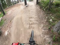
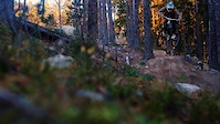
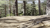
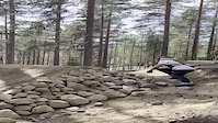
Photos of Ljusdal Mountain Bike
Videos of Ljusdal Mountain Bike

Current Trail Warnings
| status | trail | date | condition | user | info |
|---|---|---|---|---|---|
| Malin Nedre | Sep 25, 2026 @ 11:43am (Europe/Mariehamn) Sep 25, 2026 | Very Dry | mcharza |
Recent Trail Reports
Activity Feed
| username | action | type | title | date |
|---|---|---|---|---|
| PiloS | add | report | activity #105990550 and 16 more | Oct 16, 2026 @ 8:44am Oct 16, 2026 |
| OIv7cy | vote | trail | activity #105111497 | Oct 3, 2026 @ 8:23am Oct 3, 2026 |
| Pramborg | vote | trail | activity #104844741 | Sep 29, 2026 @ 8:43am Sep 29, 2026 |
| mcharza | add | report | activity #104554873 and 12 more | Sep 25, 2026 @ 8:07am Sep 25, 2026 |
| Pramborg | add | report | activity #103980381 | Sep 17, 2026 @ 7:03am Sep 17, 2026 |
Recent Comments
| username | type | title | comment | date |
|---|---|---|---|---|
| trail | 0/10 poäng | Jul 23, 2024 @ 3:24pm Jul 23, 2024 | ||
| trail | Åk inte hit för att köra MTB | Jul 23, 2024 @ 3:24pm Jul 23, 2024 | ||
| trail | Du menar 114 meter till första stigkorsningen? | Sep 26, 2022 @ 7:21am Sep 26, 2022 | ||
| trail | Första 225 meter på "Trappan" är... | Sep 26, 2022 @ 12:46am Sep 26, 2022 | ||
| trail | Stänger den så får vi se hur det utvecklar sig. | Jul 11, 2022 @ 12:24pm Jul 11, 2022 |
Local Badges
-

Completionist0 awarded -
Completionist0 awarded -
Completionist44 awarded -
Completionist0 awarded -
Completionist0 awarded -
Completionist0 awarded
Bike & Skill Parks
| name | type | city | rating |
|---|---|---|---|
| Järvsö Bergscykel Park | bike park | Ljusdal | |
| Järvsö Skillspark | skill park | Ljusdal | |
| Teknikområde | skill park | Ljusdal |
Activity Type Stats
| activitytype | trails | distance | descent | descent distance | total vertical | rating | global rank | state rank | photos | reports | routes | activity logs |
|---|---|---|---|---|---|---|---|---|---|---|---|---|
| Mountain Bike | 392 | 264 miles | 31,122 ft | 113 miles | 1,302 ft | #134 | #8 | 123 | 1,262 | 5 | 12,955 | |
| E-Bike | 19 | 15 miles | 846 ft | 8 miles | 1,093 ft | #3,027 | #68 | 1,174 | 479 | |||
| Gravel Bike | 133 | 94 miles | 7,766 ft | 41 miles | 1,148 ft | #441 | #32 | 14 | 18 | |||
| Adaptive Bike | 64 | 46 miles | 5,023 ft | 21 miles | 1,148 ft | #1,053 | #40 | 42 | ||||
| Winter Fat Bike | 51 | 59 miles | 6,138 ft | 28 miles | 1,247 ft | #424 | #30 | 23 | ||||
| Horse | 80 | 58 miles | 6,047 ft | 28 miles | 1,089 ft | #394 | #29 | 230 | 1 | |||
| Hike | 347 | 253 miles | 24,715 ft | 106 miles | 1,302 ft | #514 | #37 | 1 | 1,219 | 1 | 169 | |
| Trail Running | 349 | 254 miles | 24,747 ft | 106 miles | 1,302 ft | #369 | #38 | 1,219 | 1 | 468 | ||
| Dirtbike/Moto | 3 | 1 mile | 72 ft | 3,228 ft | 79 ft | 225 | ||||||
| Snowmobile | 10 | 11 miles | 692 ft | 6 miles | 879 ft | #77 | #6 | 1 | 1 | |||
| Snowshoe | 1 | 5 miles | 118 ft | 4 miles | 105 ft | 1 | ||||||
| Nordic Ski | 55 | 65 miles | 4,032 ft | 25 miles | 1,247 ft | #169 | #19 | 1,040 |
Frequently Asked Questions
▼
What are the best places to ride in Ljusdal?
Ljusdal has 13 areas to explore for mountain biking. The top rated areas are:
▼
What are the highest rated mountain biking trails in Ljusdal?
The highest rated mountain biking trails in Ljusdal are:
- Till Mina Vänner (4.6/5)
- Barbro (4.6/5)
- Kristin (4.6/5)
- Manolito (4.5/5)
- Itzy Bitzy (4.5/5)
▼
Where can I park to ride in Ljusdal?
▼
What is the longest trail in Ljusdal?
The longest trail in Ljusdal is Harsa Lätta Milen at 5.6 miles. View all trails sorted by distance.
▼
What are the best & highest rated hiking trails in Ljusdal?
The best hiking trails in Ljusdal are: View all hiking trails sorted by popularity score.
▼
What are the best & highest rated trail running trails in Ljusdal?
The best trail running trails in Ljusdal are:
- Ljusnanleden Vallåsen - Skalsvägen
- Gruvbergsleden Vinter
- Milspåret Ulvstabäcken
- Järvzoo Koppling
- Stigningen
▼
How many trails are in Ljusdal?
Ljusdal has a total of 410 trails. Of those, 392 are designated for mountain biking. Browse top mountain biking trails in Ljusdal to find detailed information including difficulty ratings, distances, and trail conditions.
▼
Which trail has the most elevation gain in Ljusdal?
The trail with the most elevation gain in Ljusdal is Blacksåsrudan with 370 ft of elevation gain. View all trails sorted by elevation gain.
▼
Which trail has the most elevation descent in Ljusdal?
The trail with the most elevation descent in Ljusdal is Gruvberget with 664 ft of elevation descent. View all trails sorted by elevation descent.
▼
What activities are most popular in Ljusdal?
Ljusdal supports the following activities: Mountain Biking, E-Biking, Gravel Biking, Adaptive Biking, Winter Fat Biking, Horseback, Hiking, Trail Running, Snowmobiling, Nordic Skiing.
▼
What are the steepest mountain biking trails in Ljusdal?
The steepest mountain biking trail in Ljusdal is Sorgmon with an average grade of 9.7%. View all trails sorted by grade.
▼
Are there any trails with scenic viewpoints in Ljusdal?
Yes, there are 6 scenic viewpoints marked along trails in Ljusdal. Some popular viewpoints include: Explore more points of interest to find trails with the best views.
▼
What trails have the biggest jumps in Ljusdal?
The trails with the biggest jumps in Ljusdal are: Browse all mountain bike trails to find trails with jumps and technical features.
▼
Are the trails open in Ljusdal?
Out of 145 trails:
- Clear / Green: 128
- Minor Issue / Yellow: 11
- Significant Issue / Amber: 4
- Closed: 2
▼
What are the trail conditions in Ljusdal?
Based on trail reports from the past week in Ljusdal:
- Ideal: 14 trails
- Very Dry: 1 trail
- Prevalent Mud: 1 trail
▼
Can I ride an ebike in Ljusdal?
Yes, Ljusdal supports e-bike riding. There are 10 trails in Ljusdal that allow e-bikes. Check the e-bike trails listing for specific trail access details and any local regulations.
▼
What are the most popular mountain biking routes in Ljusdal?
The most popular mountain biking routes in Ljusdal are: View all mountain biking routes in Ljusdal.
▼
What is the highest summit in Ljusdal?
The highest summit in Ljusdal is Stora Korpmägg at 2,241 ft elevation.
▼
What are the most popular Strava Segments in Ljusdal?
The most popular Strava segments in Ljusdal are:
- En Tuff Manolito (4,547 athletes)
- Tuff Brud 2020 (3,721 athletes)
- Oh Mary - Ekki Ekki (3,654 athletes)
▼
What are some popular technical trail features in Ljusdal?
There are 2 technical trail features (TTFs) in Ljusdal. Some popular features include: View all technical trail features in Ljusdal.
▼
What trails are closed in Ljusdal?
There are currently 2 closed trails in Ljusdal. The breakdown of all trail statuses is:
- Clear / Green: 128
- Minor Issue / Yellow: 11
- Significant Issue / Amber: 4
- Closed: 2
▼
Are there accessible or adaptive trails in Ljusdal?
Yes, there are 64 accessible/adaptive trails in Ljusdal. View all adaptive trails in Ljusdal for specific accessibility information.
▼
What are the most popular mountain biking trails in Ljusdal?
The most popular mountain biking trails in Ljusdal are: View all mountain biking trails sorted by popularity.
▼
What are the best beginner ride trails in Ljusdal?
The best beginner mountain biking trails in Ljusdal are:
- Badtjärns Gröna Ned (5/5)
- Badtjärns Gröna Upp (5/5)
- Skjutbanan (4.5/5)
Activities
Trails
- By ollesvenskonthetrail
 TRAILFORKS & contributors
- Admins: ollesvenskonthetrail, JALLE, OrjanX, martinlindstr, Hygabacka
- #14082 - 5,675 views
- ljusdal activity log | embed map of Ljusdal mountain bike trails | ljusdal mountain biking points of interest
Downloading of trail gps tracks in kml & gpx formats is enabled for Ljusdal.
You must login to download files.
