close
-
Layers w
- Weather Layers
- Pro
- Pro
- Pro
- Pro
- Pro
- Pro
- More Layers
- Pro
- Pro
- Pro
- Pro
-
Upgrade to

3D
Trail Conditions
- Unknown
- Snow Groomed
- Snow Packed
- Snow Covered
- Snow Cover Partial
- Freeze/thaw Cycle
- Icy
- Prevalent Mud
- Wet
- Variable
- Ideal
- Dry
- Very Dry
Trail Flow (Ridden Direction)
Trailforks scans users ridelogs to determine the most popular direction each trail is ridden. A good flowing trail network will have most trails flowing in a single direction according to their intension.
The colour categories are based on what percentage of riders are riding a trail in its intended direction.
The colour categories are based on what percentage of riders are riding a trail in its intended direction.
- > 96%
- > 90%
- > 80%
- > 70%
- > 50%
- < 50%
- bi-directional trail
- no data
Trail Last Ridden
Trailforks scans ridelogs to determine the last time a trail was ridden.
- < 2 days
- < 1 week
- < 2 weeks
- < 1 month
- < 6 months
- > 6 months
Trail Ridden Direction
The intended direction a trail should be ridden.
- Downhill Only
- Downhill Primary
- Both Directions
- Uphill Primary
- Uphill Only
- One Direction
Contribute Details
Colors indicate trail is missing specified detail.
- Description
- Photos
- Description & Photos
- Videos
Trail Popularity ?
Trailforks scans ridelogs to determine which trails are ridden the most in the last 9 months.
Trails are compared with nearby trails in the same city region with a possible 25 colour shades.
Think of this as a heatmap, more rides = more kinetic energy = warmer colors.
- most popular
- popular
- less popular
- not popular
ATV/ORV/OHV Filter
Max Vehicle Width
inches
US Cell Coverage
Legend

Radar Time
Activity Recordings
Trailforks uses anonymized public activity data.
?
Activity Recordings
Trailforks uses anonymized public activity data.
?
Personal Heatmap
▶
Activity Types
all
/
none
▶
Options
2
Date range
month
–
Winter Trails
Warning
A routing network for winter maps does not exist. Selecting trails using the winter trails layer has been disabled.
Missing Trails
Most Popular
Least Popular
Trails are colored based on popularity. The more popular a trail is, the more red. Less popular trails trend towards green.
Jump Magnitude Heatmap
Heatmap of where riders jump on trails. Zoom in to see individual jumps, click circles to view jump details.
BC Backroad Status
![map legend]()
Service Road Atlas is a free to use, community-driven service for viewing and creating reports on the numerous back-country service roads around B.C. and Alberta.

Slope Aspect
Direction the slope faces
Trails Deemphasized
Trails are shown in grey.
Only show trails with no bike usage.
Suggested Layers
Based on selected activity type
Save the current map location and zoom level as your default home location whenever this page is loaded.
Save
No description for Morrison has been added yet!
Login or register to submit one.
Activities Click to view
- Mountain Bike
31 trails
- E-Bike
30 trails
- Gravel Bike
0 trails
- Adaptive Bike
0 trails
- Hike
39 trails
- Trail Running
39 trails
Region Details
- 1
- 1
- 7
- 9
- 10
Region Status
Open as of Jun 7, 2026Stats
- Avg Trail Rating
- Trails (view details)
- 32
- Trails Mountain Bike
- 32
- Trails E-Bike
- 30
- Trails Hike
- 39
- Trails Trail Running
- 39
- Total Distance
- 25 miles
- Total Descent
- 4,488 ft
- Total Vertical
- 1,925 ft
- Highest Trailhead
- 7,844 ft
- Reports
- 797
- Photos
- 121
- Ridden Counter
- 25,662
Sub Regions
-
Matthews Winters Park
- 1
- 3
- 5
- 5
-
Mount Falcon Park
- 4
- 4
- 4
-
Red Rock Park
Popular Morrison Mountain Biking Trails
• 90 ★ 3.9 • 3,403 ft • 71 ft • 1,408 •
Popular green difficulty singletrack. This multi-use trail can be used both directions and has a easy overall physical rating with a 71 ft green climb. On average it takes 3 minutes to complete this trail.
• 100 ★ 4.0 • 3 miles • 1,472 ft • 1,270 •
Hikers and equestrians at Mount Falcon Park have 1.7-mile all to themselves. The remaining 11 park miles are multi-use. The 2,000-foot elevation gain of the Trail, a steep climb from the east, provides a vigorous workout. Historic sites...
• 75 ★ 4.4 • 2 miles • 365 ft • 1,240 •
One of the most technical trails in Jefferson County and in the Front Range in general. Expect large, angular, slabby rock that is poised to grab your front wheel and launch you off your bike. If starting this trail from the north and...
• 80 ★ 3.6 • 2 miles • 382 ft • 1,170 •
Popular blue difficulty singletrack. This multi-use trail can be used uphill primary and has a moderate overall physical rating with a 382 ft blue climb. On average it takes 28 minutes to complete this trail.
• 100 ★ 3.6 • 1 mile • 282 ft • 1,053 •
Popular green difficulty dirt/gravel road. This multi-use trail can be used both directions and has a easy overall physical rating with a 282 ft green climb. On average it takes 12 minutes to complete this trail.
• 90 ★ 4.4 • 2,614 ft • 73 ft • 1,009 •
A technical and rocky ride. As to be expected of any of the trails in the area, expect rocks, chunk, drops, jumps, and other "bike optimized" features. The trail to the west makes for a great escape if you're in over your head on this...
• 50 ★ 3.9 • 2,544 ft • 56 ft • 999 •
This trail sometimes assimilated into the trail, though it skips the most fun sections of . Despite that, it offers some challenging slick rock descents/climbs, loose dust and gravel, and tight corners. The trail is a less extreme...
Morrison Mountain Bike Routes
8 miles • 1,360 ft • 2 •
Blue/black, everything's rollable if you aren't sure. Lots of hikers typically on the . If you can climb...
7 miles • 1,188 ft • 8 • Loop •
Loop starting and ending at the Park lower north lot. Can be done in both directions. Technical in some...
11 miles • 1,377 ft • 8 • Loop •
10.7 mile loop with some a few challenging spots.
17 miles • 3,265 ft • 3 •
Start at the base of Mt Falcon, end at the eastern-most parking lot of Lair of the Bear.
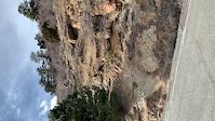
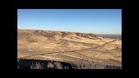
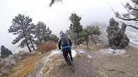
Photos of Morrison Mountain Bike
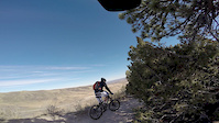
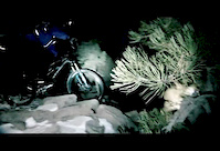
Videos of Morrison Mountain Bike
trail: Dakota Ridge
0:11 |
|
Apr 17, 2020

trail: Dakota Ridge
0:25 |
151 |
Sep 7, 2018

trail: Dakota Ridge
2:29 |
1487 |
Nov 20, 2017
trail: Red Rocks Trail
2:07 |
104 |
Feb 18, 2017
trail: Dakota Ridge
0:49 |
21 |
May 26, 2015
trail: Red Rocks Trail
0:57 |
67 |
May 17, 2015
trail: Dakota Ridge
0:37 |
614 |
Feb 22, 2015

trail: Castle
0:07 |
193 |
May 19, 2014
Recent Trail Reports
| status | trail | date | condition | info | user |
|---|---|---|---|---|---|
| Morrison Natural History Museum | Jun 7, 2026 @ 10:38am (America/Denver) Jun 7, 2026 | Dry | tshralper | ||
| Parmalee | Jun 7, 2026 @ 10:38am (America/Denver) Jun 7, 2026 | Dry | tshralper | ||
| Tower | Jun 7, 2026 @ 10:38am (America/Denver) Jun 7, 2026 | Dry | tshralper | ||
| Castle (Upper) | Jun 7, 2026 @ 10:38am (America/Denver) Jun 7, 2026 | Dry | tshralper | ||
| Castle | Jun 7, 2026 @ 10:38am (America/Denver) Jun 7, 2026 | Dry | tshralper | ||
| Village Walk | May 16, 2026 @ 7:05am (America/Denver) May 16, 2026 | Dry | Caro7Rd1cB | ||
| Red Rocks Alt | May 16, 2026 @ 7:05am (America/Denver) May 16, 2026 | Dry | Caro7Rd1cB | ||
| Red Rocks Trail | May 16, 2026 @ 7:05am (America/Denver) May 16, 2026 | Dry | Caro7Rd1cB | ||
| Red Rocks Trail | May 16, 2026 @ 7:05am (America/Denver) May 16, 2026 | Dry | Caro7Rd1cB | ||
| Morrison Slide | May 12, 2026 @ 6:38am (America/Denver) May 12, 2026 | Dry | ZgY29H |
Activity Feed
| username | action | type | title | date |
|---|---|---|---|---|
| cokrafter | wishlist | route | activity #97160104 | Jun 16, 2026 @ 8:35pm 2 days |
| Rideteacher | wishlist | route | activity #97034288 | Jun 15, 2026 @ 5:24am Jun 15, 2026 |
| TomHolds20 | ridden | trail | activity #96771107 | Jun 11, 2026 @ 5:13pm Jun 11, 2026 |
| tshralper | add | report | activity #96536621 and 4 more | Jun 8, 2026 @ 6:57am Jun 8, 2026 |
| Germanptsekm | wishlist | trail | activity #95994279 | May 31, 2026 @ 7:05pm May 31, 2026 |
Recent Comments
| username | type | title | comment | date |
|---|---|---|---|---|
| trail | Very impressive build! So chunky yet all... | May 16, 2026 @ 8:59pm May 16, 2026 | ||
| trail | I love this trail. Steep technical rock... | Jan 30, 2026 @ 5:59pm Jan 30, 2026 | ||
| trail | Great trail with a short technical high speed... | Jan 4, 2026 @ 12:31pm Jan 4, 2026 | ||
| trail | Punchy uphill with a lil bit of tech. Leads to... | Sep 10, 2025 @ 4:53pm Sep 10, 2025 | ||
| trail | It’s a brutal and very slow going trail.... | Sep 5, 2025 @ 8:42pm Sep 5, 2025 |
Local Badges
-

Epic Ride Climb 2k283 awarded -

Climbing 10k Badge240 awarded -

Climbing 100k Badge7 awarded -

Epic Ride Descent 2k285 awarded -

Descent 10k Badge245 awarded -

Descent 100k Badge7 awarded
Activity Type Stats
| activitytype | trails | distance | descent | descent distance | total vertical | rating | global rank | state rank | photos | reports | routes | ridelogs |
|---|---|---|---|---|---|---|---|---|---|---|---|---|
| Mountain Bike | 31 | 21 miles | 3,927 ft | 9 miles | 1,837 ft | #1,663 | #621 | 135 | 801 | 10 | 24,903 | |
| E-Bike | 30 | 21 miles | 3,753 ft | 9 miles | 1,837 ft | #4,186 | #1,377 | 2 | 799 | 892 | ||
| Hike | 39 | 24 miles | 4,383 ft | 10 miles | 1,926 ft | #2,664 | #1,024 | 15 | 797 | 4,215 | ||
| Trail Running | 39 | 24 miles | 4,383 ft | 10 miles | 1,926 ft | #5,049 | #1,582 | 797 | 1 | 1,460 |
Frequently Asked Questions About Morrison
▼
What are the best places to ride in Morrison?
Morrison has 3 areas to explore for mountain biking. The top rated areas are:
▼
What are the highest rated mountain biking trails in Morrison?
The highest rated mountain biking trails in Morrison are:
- Dakota Ridge (4.3/5)
- Dakota Ridge Trail (4.2/5)
- Zorro (4.2/5)
- Red Rocks Trail (4.1/5)
- Red Rocks Connector (4.1/5)
▼
What is the best time of the year to ride in Morrison?
Based on ride log data, the most popular months to ride in Morrison are:
- July (159 activities)
- May (115 activities)
- June (115 activities)
▼
Where can I park to ride in Morrison?
Activities
Trails
- By canadaka
 Trailforks & contributors
 - Admins: apply
- #4920 - 8,370 views
- morrison activity log | embed map of Morrison mountain bike trails | morrison mountain biking points of interest
Downloading of trail gps tracks in kml & gpx formats is enabled for Morrison.
You must login to download files.