
close
3D
Trail Conditions
- Unknown
- Snow Groomed
- Snow Packed
- Snow Covered
- Snow Cover Partial
- Freeze/thaw Cycle
- Icy
- Prevalent Mud
- Wet
- Variable
- Ideal
- Dry
- Very Dry
Trail Flow (Ridden Direction)
Trailforks scans users activity logs to determine the most popular direction each trail is ridden. A good flowing trail network will have most trails flowing in a single direction according to their intension.
The colour categories are based on what percentage of users are riding a trail in its intended direction.
The colour categories are based on what percentage of users are riding a trail in its intended direction.
- > 96%
- > 90%
- > 80%
- > 70%
- > 50%
- < 50%
- bi-directional trail
- no data
Trail Last Used
Trailforks scans activity logs to determine the last time a trail was ridden.
- < 2 days
- < 1 week
- < 2 weeks
- < 1 month
- < 6 months
- > 6 months
Trail Ridden Direction
The intended direction a trail should be ridden.
- Downhill Only
- Downhill Primary
- Both Directions
- Uphill Primary
- Uphill Only
- One Direction
Contribute Details
Colors indicate trail is missing specified detail.
- Description
- Photos
- Description & Photos
- Videos
Trail Popularity ?
Trailforks scans activity logs to determine which trails are ridden the most in the last 9 months.
Trails are compared with nearby trails in the same city region with a possible 25 colour shades.
Think of this as a heatmap, more activities = more kinetic energy = warmer colors.
- most popular
- popular
- less popular
- not popular
ATV/ORV/OHV Filter
Max Vehicle Width
inches
US Cell Coverage
Legend

Radar Time
Activity Recordings
Trailforks uses anonymized public activity data.
?
Activity Recordings
Trailforks uses anonymized public activity data.
?
Winter Trails
Warning
A routing network for winter maps does not exist. Selecting trails using the winter trails layer has been disabled.
Missing Trails
Most Popular
Least Popular
Trails are colored based on popularity. The more popular a trail is, the more red. Less popular trails trend towards green.
Jump Magnitude Heatmap
Heatmap of where users jump on trails. Zoom in to see individual jumps, click circles to view jump details.
BC Backroad Status
![map legend]()
Service Road Atlas is a free to use, community-driven service for viewing and creating reports on the numerous back-country service roads around B.C. and Alberta.

Slope Aspect
Direction the slope faces
Trails Deemphasized
Trails are shown in grey.
Only show trails with no bike usage.
Suggested Layers
Based on selected activity type
Save the current map location and zoom level as your default home location whenever this page is loaded.
SaveBike Park Closed for Season. Opens on June 11
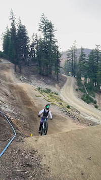
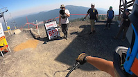
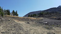
Mt. Bachelor Bike Park is a lift-served downhill mountain bike destination set on the volcanic slopes of Mt. Bachelor, about 22 miles southwest of Bend in Central Oregon. Built into a high-alpine landscape of lava rock, pumice soils, and open ponderosa pine forest, the park combines machine-built flow trails, jump lines, and rugged technical singletrack with expansive Cascade Mountain views. Unlike larger destination bike parks, Mt. Bachelor offers a more compact but varied network that emphasizes progression—beginners can start on mellow learning terrain while advanced riders will find steep volcanic rock gardens, technical descents, and freeride-style features. The riding character is distinctly Central Oregon: loose, dry, dusty in summer, and often fast, with volcanic terrain adding both challenge and uniqueness.
The park features more than a dozen miles of gravity-served trails accessed primarily by the Pine Marten lift, with the Little Pine beginner area offering an approachable introduction to downhill riding. Trail styles range from beginner-friendly flow routes and confidence-building jump features to advanced technical lines such as rock-heavy descents and steep black-diamond terrain. Intermediate riders will find the strongest selection, with trails blending berms, rollers, jumps, and natural volcanic features into long descending runs. Because of its smaller size, many riders combine a bike park day with Bend’s extensive surrounding cross-country and enduro trail systems, making Mt. Bachelor an ideal component of a broader Central Oregon mountain biking trip.
The park features more than a dozen miles of gravity-served trails accessed primarily by the Pine Marten lift, with the Little Pine beginner area offering an approachable introduction to downhill riding. Trail styles range from beginner-friendly flow routes and confidence-building jump features to advanced technical lines such as rock-heavy descents and steep black-diamond terrain. Intermediate riders will find the strongest selection, with trails blending berms, rollers, jumps, and natural volcanic features into long descending runs. Because of its smaller size, many riders combine a bike park day with Bend’s extensive surrounding cross-country and enduro trail systems, making Mt. Bachelor an ideal component of a broader Central Oregon mountain biking trip.
source: Mt. Bachelor Ski Resort
Primary Trail Type: All-Mountain & Downhill
Land Status: Ski Resort
 google parking directions plan a road trip here
Access Info:
Bike park access is through the West Village base area at Mt. Bachelor Ski Resort, where riders will find day parking, ticketing, rentals, and rider services. The park is typically reached via the Cascade Lakes Scenic Byway from Bend, with driving time generally around 30 minutes from downtown. Riders can also connect to regional trail systems in the area, although most visitors access the park directly by vehicle. Base facilities include lift access, skills areas, and progression zones for newer riders before moving onto the upper mountain trail network.
Disclaimer:
Mt. Bachelor Bike Park is a paid, lift-served facility requiring a bike park ticket or season pass for chairlift access. Riders are expected to follow resort trail ratings, directional signage, and mountain safety rules. Approved mountain bikes and protective equipment are strongly encouraged, particularly due to the sharp volcanic rock and high-speed terrain. Operating dates are seasonal and dependent on snowpack and trail conditions, generally running during the summer and early fall months after snowmelt. Riders should always check current lift and trail status before traveling, as weather and maintenance can affect operations.
Trail info last updated
Activities Click to view
- Mountain Bike
25 trails
- Hike
10 trails
- Trail Running
10 trails
Bike Park Details

- 2
- 14
- 6
- 1
- 2
Region Status
Open as of Oct 1, 2026- Day Ticket
- $69 USD
- Uplift Type
- Chair Lift
- Season start
- Jun 11
- Season end
- Oct 2

Stats
- Avg Trail Rating
- Trails (view details)
- 33
- Trails Mountain Bike
- 25
- Trails E-Bike
- 1
- Trails Gravel Bike
- 3
- Trails Adaptive Bike
- 3
- Trails Horse
- 1
- Trails Hike
- 10
- Trails Trail Running
- 10
- Trails Snowshoe
- 1
- Trails Backcountry Ski
- 2
- Total Distance
- 33 miles
- Total Descent
- 8,472 ft
- Total Vertical
- 4,432 ft
- Highest Trailhead
- 9,053 ft
- Reports
- 576
- Photos
- 166
- Completed Counter
- 24,998
Articles

Video: All the Style & All the Speed at Mt Bachelor Bike Park
Sep 25, 2021 from pinkbike.com
Secret lines, flow and all the good stuff.

Video: Cam McCaul & Dusty Wygle Have A Blast on Mt. Bachelor's Flagship Jump Trail
Sep 2, 2020 from pinkbike.com
Kyle Jameson built this masterpiece called 'Redline'.
Popular Mt. Bachelor Bike Park Mountain Biking Trails
• 100 ★ 3.6 • 2 miles • 0 ft • 1,874 •
The upper section of Lava Flow is a machine-built doubletrack flow trail with a mix of wood, brick and dirt birms along with jumps and rollers strategically placed. Riders should expect to encounter loose soil and lava rock in places.
• 95 ★ 4.1 • 3,478 ft • 0 ft • 1,751 •
The lower section of Lava Flow can be accessed from either middle/upper Lava Flow or via the Lava Connect trail from the top of the Sunshine Accelerator lift. A flow trail with rolling terrain, dirt & brick berms and optional jumps,...
• 80 ★ 4.1 • 1 mile • 0 ft • 1,408 •
The middle section of Lava Flow trail is similar to the upper section in that it's a flow trail that features dirt birms, jumps and rollers. This portion of the trail descends out of the lava fields and more into dirt as you descend...
• 90 ★ 3.5 • 1 mile • 3 ft • 1,370 •
This flow trail doesn't have a huge vertical drop but you'll find numerous wood features on this trail, adding variety and character to the route. Cone Run starts as a wider machine-built trail but as it crosses the Cinder Cone, it...
• 75 ★ 3.7 • 2,182 ft • 0 ft • 1,283 •
Blade Runner is a more difficult singletrack trail with some technical features. It is a narrower trail than Cone Run or Lava Flow. Low end riders who feel comfortable on FTL and lower Lava Flow can try Blade Runner from the top of the...
• 70 ★ 4.0 • 3,547 ft • 0 ft • 1,280 •
This final section of Last Chance is not as technically challenging as the preceding middle and upper sections. Traveling along the dark and shady north side of the Cinder Cone, this trail will make you feel like you're in the middle of...
• 65 ★ 3.7 • 3,586 ft • 0 ft • 1,079 •
Way Out is a machine-built trail that widens as it descends below the narrow, singletrack Cone Run trail where it traverses the steep Cinder Cone face. With the increased width on the lower section, it will allow for increased speed....
• 85 ★ 3.9 • 1 mile • 0 ft • 1,058 •
Rattlesnake is one of the most difficult trails on the mountain. It's narrow and flowing with several sharp drops and rises as it snakes through a natural canyon. Brick and dirt berms are sharply banked and the trees are tight in a...
Mt. Bachelor Bike Park Mountain Bike Routes
★ 5.0 • 22 miles • 1,057 ft • 6 • Shuttled •
One ride hitting some of the best trails in town. Start on Flagline from the Dutchman Flats Sno-Park...
★ 4.0 • 30 miles • 1,997 ft • 13 •
Here in Bend the Whole Chimichanga offers a unique and unparalleled downhill experience of Central Oregon,...
26 miles • 1,472 ft • 9 • Shuttled •
Use Cog Wild or multiple vehicles to shuttle this route with some of the best downhill trails in Bend...
25 miles • 1,067 ft • 18 • Shuttled •
Overview A well-developed shuttle system takes the sting out of the climbing and lets you focus on the...
25 miles • 1,264 ft • 6 •
Downhill shuttler going from bachelor to skylienrs snow park
28 miles • 1,716 ft • 7 • Shuttled •
Optional shuttle ride from Dutchman Sno Park. Start with a beautiful backcountry traverse on...
Photos of Mt. Bachelor Bike Park Mountain Bike
Videos of Mt. Bachelor Bike Park Mountain Bike




Recent Trail Reports
| status | trail | date | condition | info | user |
|---|---|---|---|---|---|
| Evergreen | Oct 1, 2026 @ 12:42pm (America/Los_Angeles) Oct 1, 2026 | Very Dry | crbondurant | ||
| Cone Run | Oct 1, 2026 @ 12:42pm (America/Los_Angeles) Oct 1, 2026 | Dry | crbondurant | ||
| Lava Flow (lower) | Oct 1, 2026 @ 12:42pm (America/Los_Angeles) Oct 1, 2026 | Dry | crbondurant | ||
| Lava Flow (Middle) | Oct 1, 2026 @ 12:42pm (America/Los_Angeles) Oct 1, 2026 | Dry | crbondurant | ||
| DSM | Oct 1, 2026 @ 12:42pm (America/Los_Angeles) Oct 1, 2026 | Dry | crbondurant | ||
| Rockfall | Oct 1, 2026 @ 12:42pm (America/Los_Angeles) Oct 1, 2026 | Dry | crbondurant | ||
| Big Wood | Oct 1, 2026 @ 12:42pm (America/Los_Angeles) Oct 1, 2026 | Ideal | crbondurant | ||
| Lava Flow (Upper) | Oct 1, 2026 @ 12:42pm (America/Los_Angeles) Oct 1, 2026 | Dry | crbondurant | ||
| Hot Dust | Oct 1, 2026 @ 12:42pm (America/Los_Angeles) Oct 1, 2026 | Very Dry | crbondurant | ||
| Redline | Oct 1, 2026 @ 12:42pm (America/Los_Angeles) Oct 1, 2026 | Ideal | crbondurant |
National Scenic Trails & Official Routes
-
Metolius Windigo Trail
- Mountain Bike
- E-Bike
- Horse
- Hike
- Trail Running
Activity Feed
| username | action | type | title | date |
|---|---|---|---|---|
| benfahy2009 | wishlist | route | activity #106436882 | Oct 23, 2026 @ 8:40am 2 days |
| Iluvdust | wishlist | trail | activity #106307518 | Oct 20, 2026 @ 8:14pm Oct 20, 2026 |
| Iluvdust | ridden | trail | activity #106307445 and 11 more | Oct 20, 2026 @ 8:11pm Oct 20, 2026 |
| dzaback | wishlist | route | activity #105875497 | Oct 14, 2026 @ 9:52am Oct 14, 2026 |
| 338LM | add | photo | activity #105853141 | Oct 14, 2026 @ 12:35am Oct 14, 2026 |
Recent Comments
| username | type | title | comment | date |
|---|---|---|---|---|
| trail | Please consider labeling the Evergreen as a... | Sep 27, 2026 @ 2:06pm Sep 27, 2026 | ||
| trail | This is a well graded trail that offers offers... | Sep 27, 2026 @ 2:01pm Sep 27, 2026 | ||
| trail | My 9 year old's favorite, right up the with... | Sep 27, 2025 @ 2:57pm Sep 27, 2025 | ||
| trail | This trail is downhill only for bikes but up... | Aug 2, 2025 @ 7:51pm Aug 2, 2025 | ||
| trail | Fun little flow trail for after-dinner while... | Jul 6, 2025 @ 7:05pm Jul 6, 2025 |
Nearby Areas
| name | distance | ||||
|---|---|---|---|---|---|
| Mt. Bachelor Parking Lot | 7 | 1.6 km | |||
| Swampy Sno-Park | 3 | 7 | 5.7 km | ||
| Edison Butte | 1 | 2 | 6 km | ||
| Wanoga | 5 | 14 | 7 | 7.4 km | |
| Wango Sno-Park | 3 | 1 | 7.8 km |
Local Badges
-

Completionist1 awarded
Bike & Skill Parks
| name | type | city | rating |
|---|---|---|---|
| Mt. Bachelor Skills Park | skill park | Bend |




Local Products
Activity Type Stats
| activitytype | trails | distance | descent | descent distance | total vertical | rating | global rank | state rank | photos | reports | routes | activity logs |
|---|---|---|---|---|---|---|---|---|---|---|---|---|
| Mountain Bike | 25 | 25 miles | 8,051 ft | 17 miles | 1,739 ft | #975 | #13 | 165 | 572 | 35 | 10,897 | |
| E-Bike | 1 | 764 ft | 82 ft | 623 ft | 82 ft | 364 | 96 | |||||
| Gravel Bike | 3 | 2 miles | 702 ft | 2 miles | 568 ft | #466 | #234 | 88 | 2 | 13 | ||
| Adaptive Bike | 3 | 2 miles | 702 ft | 2 miles | 568 ft | #468 | #235 | 88 | ||||
| Horse | 1 | 2 miles | 404 ft | 2 miles | 404 ft | #413 | #278 | 55 | ||||
| Hike | 10 | 13 miles | 423 ft | 2 miles | 4,432 ft | #5,308 | #72 | 1 | 432 | 850 | ||
| Trail Running | 10 | 13 miles | 423 ft | 2 miles | 4,432 ft | #5,180 | #60 | 432 | 130 | |||
| Snowshoe | 1 | 2 miles | 1,417 ft | 4 | 31 | |||||||
| Backcountry Ski | 2 | 3 miles | 1,417 ft | 4 | 1,833 |
Frequently Asked Questions
▼
What are the highest rated mountain biking trails in Mt. Bachelor Bike Park?
▼
What is the best time of the year to ride in Mt. Bachelor Bike Park?
Based on activity log data, the most popular months to ride in Mt. Bachelor Bike Park are:
- August (324 activities)
- July (275 activities)
- September (186 activities)
▼
Where can I park to ride in Mt. Bachelor Bike Park?
There are 1 parking locations listed in Mt. Bachelor Bike Park. The most popular parking spots are:
▼
What is the longest trail in Mt. Bachelor Bike Park?
The longest trail in Mt. Bachelor Bike Park is Evergreen at 4.4 miles. View all trails sorted by distance.
▼
What are the best & highest rated hiking trails in Mt. Bachelor Bike Park?
The best hiking trails in Mt. Bachelor Bike Park are: View all hiking trails sorted by popularity score.
▼
What are the best & highest rated trail running trails in Mt. Bachelor Bike Park?
The best trail running trails in Mt. Bachelor Bike Park are: View all trail running trails sorted by popularity score.
▼
How many trails are in Mt. Bachelor Bike Park?
Mt. Bachelor Bike Park has a total of 33 trails. Of those, 25 are designated for mountain biking. Browse top mountain biking trails in Mt. Bachelor Bike Park to find detailed information including difficulty ratings, distances, and trail conditions.
▼
Which trail has the most elevation gain in Mt. Bachelor Bike Park?
The trail with the most elevation gain in Mt. Bachelor Bike Park is Evergreen with 1,354 ft of elevation gain. View all trails sorted by elevation gain.
▼
Which trail has the most elevation descent in Mt. Bachelor Bike Park?
The trail with the most elevation descent in Mt. Bachelor Bike Park is Redline with 971 ft of elevation descent. View all trails sorted by elevation descent.
▼
What activities are most popular in Mt. Bachelor Bike Park?
Mt. Bachelor Bike Park supports the following activities: Mountain Biking, Hiking, Trail Running.
▼
What bike services are there in Mt. Bachelor Bike Park?
The following bike services are available in Mt. Bachelor Bike Park:
- Trail Association (1)
- Land Managers (1)
▼
What are the steepest mountain biking trails in Mt. Bachelor Bike Park?
The steepest mountain biking trail in Mt. Bachelor Bike Park is Evergreen with an average grade of 5.8%. View all trails sorted by grade.
▼
Are there any trails with scenic viewpoints in Mt. Bachelor Bike Park?
Yes, there are 1 scenic viewpoints marked along trails in Mt. Bachelor Bike Park. Some popular viewpoints include: Explore more points of interest to find trails with the best views.
▼
Are the trails open in Mt. Bachelor Bike Park?
The overall region status for Mt. Bachelor Bike Park is Clear / Green. Out of 28 trails:
- Clear / Green: 27
- Minor Issue / Yellow: 1
▼
Can I ride an ebike in Mt. Bachelor Bike Park?
There are 1 trails in Mt. Bachelor Bike Park that allow e-bikes. Check the e-bike trails listing for specific trail access details and any local regulations.
▼
What are the most popular mountain biking routes in Mt. Bachelor Bike Park?
The most popular mountain biking routes in Mt. Bachelor Bike Park are: View all mountain biking routes in Mt. Bachelor Bike Park.
▼
What type of bike is most common in Mt. Bachelor Bike Park?
Based on activity log data, the most common bike types used in Mt. Bachelor Bike Park are:
- AM (85 activities)
- DH (4 activities)
- CX (2 activities)
- RD (1 activities)
- Gravel (1 activities)
▼
What are the most popular Strava Segments in Mt. Bachelor Bike Park?
The most popular Strava segments in Mt. Bachelor Bike Park are:
- Cone Run from Lava Flow (3,768 athletes)
- Last Chance Proper (3,624 athletes)
- Redline, 1st Road Crossing to 2nd Road Crossing (1,729 athletes)
▼
Are there local clubs or events in Mt. Bachelor Bike Park?
There are 1 local clubs or associations listed in the Mt. Bachelor Bike Park directory. Browse the local directory for details.
▼
What are the most popular mountain biking trails in Mt. Bachelor Bike Park?
The most popular mountain biking trails in Mt. Bachelor Bike Park are: View all mountain biking trails sorted by popularity.
▼
What are the best beginner ride trails in Mt. Bachelor Bike Park?
The best beginner mountain biking trails in Mt. Bachelor Bike Park are:
- Lava Flow (lower) (4.1/5)
- FTL (First Timer Line) (3.7/5)
Activities
Trails
- Hard trails in Mt. Bachelor Bike Park
- Easy trails in Mt. Bachelor Bike Park
- Favorite trails in Mt. Bachelor Bike Park
- Most ridden trails in Mt. Bachelor Bike Park
- Singletrack in Mt. Bachelor Bike Park
- Viewpoint trails in Mt. Bachelor Bike Park
- Trails with technical features in Mt. Bachelor Bike Park
- Race routes in Mt. Bachelor Bike Park
Points of Interest
- By fletcherd
 & contributors
- Admins: COTA, MBBP, COTA
- #4466 - 25,881 views
- mt. bachelor bike park activity log | embed map of Mt. Bachelor Bike Park mountain bike trails | mt. bachelor bike park mountain biking points of interest
Downloading of trail gps tracks in kml & gpx formats is enabled for Mt. Bachelor Bike Park.
You must login to download files.
