
more stats
3,478 ft
Distance
-199 ft
Descent
00:03:27
Avg time
-201 ft
Altitude change
6,373 ft
Altitude min
6,574 ft
Altitude max
6,574 ft
Altitude start
6,375 ft
Altitude end
-5.8%
Grade
-19.7%
Grade max
-1.8%
Grade min
3,478 ft
Distance down
00:03:27
Avg time

Lava Flow (lower) Details

  • Activities
    • Mountain Bike
    • Gravel Bike
    • Adaptive Bike
  • Riding Area
    Mt. Bachelor Bike Park
    Bend, Oregon
  • Difficulty Rating
  • Local Popularity
    95 in Mountain Biking [+]
    • 5 in Adaptive Biking
    • 100 in Gravel Biking
  • Global Ranking
    #49129 in Mountain Biking
  • Trail Type
    Doubletrack
  • Bike Type
    DH, AM, Adaptive MTB, Gravel
  • Direction
    Downhill Only
    Popular Direction Shown
  • Physical Rating
    Easy
  • Season
    July-October
  • Dogs Allowed
    Yes
  • TTFs on Trail
    Jump
  • Year Opened
    2014
  • Land Owner

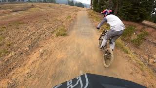
The lower section of Lava Flow can be accessed from either middle/upper Lava Flow or via the Lava Connect trail from the top of the Sunshine Accelerator lift. A flow trail with rolling terrain, dirt & brick berms and optional jumps, lower Lava Flow, when access from the Sunshine lift, is the next step in progression after the FTL trail. For intermediate and advanced riders, lower Lava Flow is a fun way to end the 4.5 mile top-to-bottom descent.

Trail Supporters

  • USFS
    Land Manager

Bike Park

Local Trail Association
  • trail association logo
  • Please consider joining or donating to the local trail association to support
    trail development & maintenance.

Recent Activity on Trail

Past Week
  • 6 rides
  • 19 miles average
6 Months
  • 140 rides
  • 18 miles avg distance
All
  • 819 rides
  • Last: Sep 18, 2026
c1c2c3c4
January
February
March
April
May
June
July
August
September
October
November
December
update trails status or condition

Lava Flow (lower) Trail Reports

Status:
on Aug 1, 2026
Very Dry
Avg: 4.06 (9 votes)
Your vote: 0

view (7,631)
close
      Directions to lava-flow-lower trailhead (43.997230, -121.673020)

      Photos

      2 more »
      mtb
      73 |
      Jan 21, 2025 @ 10:29am
      Jan 21, 2025
      mtb
      62 |
      Jan 21, 2025 @ 10:29am
      Jan 21, 2025

      Videos

      3 more »
      Swizzle Stick, Lava Flow  Mt. Bachelor Bike Park
      mtb
      3:37 | 124 | Jan 21, 2025 , Bend
      Beginner Downhill Mountain Biking - Mt...
      mtb
      11:25 | 406 | Aug 10, 2021 , Bend
      Mt Bachelor || Lava Flow: Nearly 4 Miles of Flow!
      mtb
      6:37 | 444 | Jul 18, 2019 , Bend

      Routes with this trail

      2 miles 19 Point to Point
      Built by Dirt Mechanics, professional downhill mountain biker Kyle Jameson, and the dedicated Mt. Bachelor...

      Trail Products

      4.1
      9 Ratings
      5 22%
      4 67%
      3 11%
      2
      1

      2 Reviews & Comments

      Ryanhester1446 Ryanhester1446
      I wouldn't say it's a green on a dry day becuase it gets very dust and it's hard to keep speed and keep from slipping out.
      bgrattan bgrattan
      This trail can get VERY sandy and dusty making it hard for young riders. If someone thinks it will be an easy ride just because it is green, they will be disappointed.

      We hope you've been enjoying Trailforks!

      Create a FREE account to view all trail reviews and much more.

      • By MtBachelor MBBP & contributors
      • #30050 - 2,268 views

      Frequently Asked Questions

      Where is Lava Flow (lower) located?
      Lava Flow (lower) is located in Mt. Bachelor Bike Park, Bend, Oregon, United States. It is part of the Mt. Bachelor Bike Park trail network. The trailhead is located at coordinates 43.99723, -121.67302.
      How hard is Lava Flow (lower)?
      Lava Flow (lower) is rated as Green difficulty. The physical rating is Easy. The average grade is 5.8%.
      What is the elevation gain for Lava Flow (lower)?
      The trail has 199 ft of elevation descent. The elevation ranges from 6,373 ft to 6,574 ft.
      Is Lava Flow (lower) a point to point trail?
      Yes, Lava Flow (lower) is a point to point trail. The direction is Downhill Only. The trail type is doubletrack.
      How long is Lava Flow (lower)?
      Lava Flow (lower) is 3,478 ft long. The trail type is doubletrack.
      Are dogs allowed on Lava Flow (lower)?
      Yes, dogs are allowed on Lava Flow (lower). Please keep dogs on a leash where required and clean up after them.
      When is the best time of year to ride Lava Flow (lower)?
      Based on activity log data, the most popular months to ride Lava Flow (lower) are:
      • July (163 activities)
      • August (150 activities)
      • September (71 activities)
      Check the reports page for current trail conditions.
      How do I access Lava Flow (lower)? Where is the closest parking trailhead?
      The closest parking and trailhead locations to Lava Flow (lower) are: View all parking locations in the area.
      How long does it take to ride Lava Flow (lower)?
      Based on recorded activities, it takes an average of 3 minutes to ride Lava Flow (lower). The trail is 3,478 ft long. Actual times will vary based on fitness level, conditions, and pace. View recent activity logs for more details.
      How busy is Lava Flow (lower)?
      Lava Flow (lower) is a very popular trail. There have been 5,306 recorded activities on this trail. The trail has received 7,631 check-ins. View recent activity on this trail.

      Hit the Trail

      Open in App

      Get this trail on your phone instantly.

      open trail in app

      Download Trail

      Save to wishlist, Garmin & download.
      save the trail

      Find Related Routes

      Find routes and users activities that include this trail.
      find routes for this trail

      You must enter a description before submitting.