close
-
Layers w
- Weather Layers
- Pro
- Pro
- Pro
- Pro
- Pro
- Pro
- More Layers
- Pro
- Pro
- Pro
- Pro
-
Upgrade to

3D
Trail Conditions
- Unknown
- Snow Groomed
- Snow Packed
- Snow Covered
- Snow Cover Partial
- Freeze/thaw Cycle
- Icy
- Prevalent Mud
- Wet
- Variable
- Ideal
- Dry
- Very Dry
Trail Flow (Ridden Direction)
Trailforks scans users ridelogs to determine the most popular direction each trail is ridden. A good flowing trail network will have most trails flowing in a single direction according to their intension.
The colour categories are based on what percentage of riders are riding a trail in its intended direction.
The colour categories are based on what percentage of riders are riding a trail in its intended direction.
- > 96%
- > 90%
- > 80%
- > 70%
- > 50%
- < 50%
- bi-directional trail
- no data
Trail Last Ridden
Trailforks scans ridelogs to determine the last time a trail was ridden.
- < 2 days
- < 1 week
- < 2 weeks
- < 1 month
- < 6 months
- > 6 months
Trail Ridden Direction
The intended direction a trail should be ridden.
- Downhill Only
- Downhill Primary
- Both Directions
- Uphill Primary
- Uphill Only
- One Direction
Contribute Details
Colors indicate trail is missing specified detail.
- Description
- Photos
- Description & Photos
- Videos
Trail Popularity ?
Trailforks scans ridelogs to determine which trails are ridden the most in the last 9 months.
Trails are compared with nearby trails in the same city region with a possible 25 colour shades.
Think of this as a heatmap, more rides = more kinetic energy = warmer colors.
- most popular
- popular
- less popular
- not popular
ATV/ORV/OHV Filter
Max Vehicle Width
inches
US Cell Coverage
Legend

Radar Time
Activity Recordings
Trailforks uses anonymized public activity data.
?
Activity Recordings
Trailforks uses anonymized public activity data.
?
Personal Heatmap
▶
Activity Types
all
/
none
▶
Options
2
Date range
month
–
Winter Trails
Warning
A routing network for winter maps does not exist. Selecting trails using the winter trails layer has been disabled.
Missing Trails
Most Popular
Least Popular
Trails are colored based on popularity. The more popular a trail is, the more red. Less popular trails trend towards green.
Jump Magnitude Heatmap
Heatmap of where riders jump on trails. Zoom in to see individual jumps, click circles to view jump details.
BC Backroad Status
![map legend]()
Service Road Atlas is a free to use, community-driven service for viewing and creating reports on the numerous back-country service roads around B.C. and Alberta.

Slope Aspect
Direction the slope faces
Trails Deemphasized
Trails are shown in grey.
Only show trails with no bike usage.
Suggested Layers
Based on selected activity type
Save the current map location and zoom level as your default home location whenever this page is loaded.
SaveThe Paskapoo Slopes [a.k.a. Eastlands] area is east [] of Canada Olympic Park, south of the Trans-Canada Highway, west of Sarcee Trail and north of Cougar Ridge. The trails have been roughed-in and updated over the last couple of decades, and have been the site of many racing events. It's one of the hidden gems of Calgary, lots of twisting singletrack that is surprisingly buff.
Primary Trail Type: Cross-Country
AKA: Eastlands
Land Status: City Managed
 google parking directions
 Access Info:
The main access point is a new parking lot on the west end (below The Scottish Shop gate). There is also good acess from the community of Cougar Ridge, if you don't mind finishing on a climb. Three is also a bike / pedestrian tunnel under Sarcee at the east end at the bottom of the hill.
Region Supporters & Maintainers
Activities Click to view
- Mountain Bike
82 trails
- E-Bike
62 trails
- Hike
81 trails
- Trail Running
81 trails
Region Details
- 4
- 3
- 30
- 37
- 3
Region Status
Open as of May 29, 2026Stats
- Avg Trail Rating
- Trails (view details)
- 77
- Trails Mountain Bike
- 82
- Trails E-Bike
- 62
- Trails Hike
- 81
- Trails Trail Running
- 81
- Total Distance
- 16 miles
- Total Descent
- 3,079 ft
- Total Vertical
- 483 ft
- Highest Trailhead
- 4,059 ft
- Reports
- 1,447
- Photos
- 148
- Ridden Counter
- 34,693
Popular Paskapoo Slopes Mountain Biking Trails
• 100 ★ 4.4 • 1,312 ft • 8 ft • 967 •
An easy green trail with no real elevation change. The main access to Grunty.
• 100 ★ 4.0 • 407 ft • 31 ft • 912 •
A somewhat narrow windy connector from to Beaver Fever. An easier climb than up the east end of Beaver Fever.
• 100 ★ 4.4 • 1,598 ft • 84 ft • 878 •
A generally easy green trail at the bottom of Paskapoo Slopes. Minimal elevation change, but a few roots.
• 95 ★ 3.8 • 3,691 ft • 197 ft • 878 •
This is one of the main east - trails cutting across Paskapoo slopes. It is an overgrown road turned wide bike track that climbs fairly steadlily but gently from west to east. When starting from the west end, this is a very good option...
• 100 ★ 3.7 • 758 ft • 63 ft • 856 •
This trail can be used to access the west end of or as an alternative start to . There are a few punchy climbs when heading east. An easy flow heading west.
• 100 ★ 4.0 • 791 ft • 41 ft • 831 •
Narrow single track with a bit of elevation change but not any roots to speak of. An easier access to than .
Paskapoo Slopes Mountain Bike Routes
3 miles • 529 ft • 6 • Loop •
Paskapoo loop using to Downlow to with a fun return on . There is an unofficial trail off downlow that...
6 miles • 813 ft • 25 • Loop •
A way to tie in most of the best trails on Paskapoo Slopes in under an hour. Recommended to follow the...
★ 3.0 • 2 miles • 244 ft • 7 • Loop •
This is a great short loop for kids with generally easy climbing and still some fun downhill portions....
★ 1.0 • 6 miles • 732 ft • 13 • Loop •
Want some solitude and break from the city life without leaving the city?! Try this loop! This loop weaves...
6 miles • 729 ft • 13 • Loop •
Want some solitude and break from the city life without leaving the city?! Try this loop! This loop weaves...
6 miles • 963 ft • 21 • Loop •
This has become my usual route through Paskapoo Slopes. Using short repeats of sections of , , and Lemon...
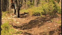
Photos of Paskapoo Slopes Mountain Bike
Videos of Paskapoo Slopes Mountain Bike
trail: High Roller
0:34 |
9 |
Oct 27, 2024

trail: Traverse
0:59 |
457 |
Nov 5, 2014

trail: Grunty
3:09 |
1393 |
Sep 4, 2013

trail: Jawbone
4:23 |
361 |
Aug 9, 2013
trail: Shrubbery
0:14 |
634 |
Oct 20, 2012
trail: Shorty
0:24 |
282 |
Jun 19, 2012

trail: Lemon Orchard
17:08 |
67 |
Jul 16, 2025 , Calgary

trail: Lemon Orchard
10:02 |
53 |
Jul 16, 2025 , Calgary
Current Trail Warnings
| status | trail | date | condition | user | info |
|---|---|---|---|---|---|
| Coulee Lane | May 11, 2026 @ 7:43pm (America/Edmonton) May 11, 2026 | Unknown | bguscott | Private property |
Recent Trail Reports
| status | trail | date | condition | info | user |
|---|---|---|---|---|---|
| 77th St to 85th St | May 29, 2026 @ 6:54pm (America/Creston) May 29, 2026 | Ideal | StoshIam | ||
| Grunty | May 9, 2026 @ 1:57pm (America/Creston) May 9, 2026 | Dry | unregistered19 | ||
| Traverse | May 9, 2026 @ 1:57pm (America/Creston) May 9, 2026 | Ideal | unregistered19 | ||
| Down in the Jungle | May 9, 2026 @ 1:57pm (America/Creston) May 9, 2026 | Ideal | unregistered19 | ||
| Jungle Run | May 9, 2026 @ 1:57pm (America/Creston) May 9, 2026 | Ideal | unregistered19 | ||
| Hookup | May 9, 2026 @ 1:57pm (America/Creston) May 9, 2026 | Ideal | unregistered19 | ||
| Homestead | May 9, 2026 @ 1:57pm (America/Creston) May 9, 2026 | Ideal | unregistered19 | ||
| The Otter Way | May 9, 2026 @ 1:57pm (America/Creston) May 9, 2026 | Ideal | unregistered19 | ||
| Beaver Fever | May 9, 2026 @ 1:57pm (America/Creston) May 9, 2026 | Ideal | unregistered19 | ||
| Down Right | May 9, 2026 @ 1:57pm (America/Creston) May 9, 2026 | Dry | unregistered19 |
Activity Feed
| username | action | type | title | date |
|---|---|---|---|---|
| privas752 | wishlist | region | activity #96203204 | Jun 3, 2026 @ 8:14pm 1 day |
| StoshIam | add | report | activity #95824095 | May 29, 2026 @ 10:24pm May 29, 2026 |
| JSarro | wishlist | region | activity #94620272 | May 13, 2026 @ 5:26am May 13, 2026 |
| unregistered19 | add | report | activity #94387510 and 16 more | May 9, 2026 @ 4:37pm May 9, 2026 |
| JSarro | wishlist | route | activity #94261625 | May 7, 2026 @ 8:00pm May 7, 2026 |
Recent Comments
| username | type | title | comment | date |
|---|---|---|---|---|
| trail | Believe it or not there are moose in the area... | Nov 7, 2025 @ 7:08pm Nov 7, 2025 | ||
| trail | Seems to be closed. Private property sign up... | May 15, 2025 @ 5:58pm May 15, 2025 | ||
| report | Recluse is an older route that had become very... | Sep 19, 2024 @ 7:28pm Sep 19, 2024 | ||
| trail | The best stand-alone downhill trail at Paskapoo. | Aug 26, 2024 @ 3:31pm Aug 26, 2024 | ||
| trail | An angry wasp nest underneath the bridge right... | Jul 29, 2024 @ 3:35pm Jul 29, 2024 |
Nearby Areas
| name | distance | ||||
|---|---|---|---|---|---|
| Winsport Bike Park | 8 | 16 | 5 | 0.8 km | |
| Bowmont Park | 29 | 6 | 1.5 km | ||
| Edworthy Park | 20 | 25 | 9 | 2.1 km | |
| Valley Ridge | 2 | 5 | 2 | 2.2 km | |
| 12 Mile Coulee | 10 | 12 | 2 | 3.1 km |
Local Badges
-

Completionist6 awarded
Activity Type Stats
| activitytype | trails | distance | descent | descent distance | total vertical | rating | global rank | state rank | photos | reports | routes | ridelogs |
|---|---|---|---|---|---|---|---|---|---|---|---|---|
| Mountain Bike | 82 | 16 miles | 3,081 ft | 8 miles | 482 ft | #565 | #13 | 146 | 1,447 | 13 | 20,089 | |
| E-Bike | 62 | 11 miles | 2,316 ft | 6 miles | 482 ft | #3,191 | #25 | 1,411 | 3 | 792 | ||
| Hike | 81 | 16 miles | 3,061 ft | 8 miles | 482 ft | #5,107 | #37 | 2 | 1,437 | 552 | ||
| Trail Running | 81 | 16 miles | 3,061 ft | 8 miles | 482 ft | #3,318 | #25 | 1,437 | 1,642 |
Frequently Asked Questions About Paskapoo Slopes
▼
What are the highest rated mountain biking trails in Paskapoo Slopes?
The highest rated mountain biking trails in Paskapoo Slopes are:
- Low-Walk (4.4/5)
- Hawkeye (4.4/5)
- Narrows of the Forest (4.3/5)
- Judo Fish (4.2/5)
- The Pat Down (4.2/5)
▼
What is the best time of the year to ride in Paskapoo Slopes?
Based on ride log data, the most popular months to ride in Paskapoo Slopes are:
- July (317 activities)
- May (264 activities)
- August (246 activities)
▼
Where can I park to ride in Paskapoo Slopes?
▼
What is the longest trail in Paskapoo Slopes?
The longest trail in Paskapoo Slopes is Ridge Run at 4,698 ft. View all trails sorted by distance.
Activities
Trails
Points of Interest
- By pinkrobe & contributors
- Admins: CMBA, DonYx, ryancartiers, CMBA
- #6541 - 46,292 views
- paskapoo slopes activity log | embed map of Paskapoo Slopes mountain bike trails | paskapoo slopes mountain biking points of interest
Downloading of trail gps tracks in kml & gpx formats is enabled for Paskapoo Slopes.
You must login to download files.