close
-
Layers w
- Weather Layers
- Pro
- Pro
- Pro
- Pro
- Pro
- Pro
- More Layers
- Pro
- Pro
- Pro
- Pro
-
Upgrade to

3D
Trail Conditions
- Unknown
- Snow Groomed
- Snow Packed
- Snow Covered
- Snow Cover Partial
- Freeze/thaw Cycle
- Icy
- Prevalent Mud
- Wet
- Variable
- Ideal
- Dry
- Very Dry
Trail Flow (Ridden Direction)
Trailforks scans users activity logs to determine the most popular direction each trail is ridden. A good flowing trail network will have most trails flowing in a single direction according to their intension.
The colour categories are based on what percentage of users are riding a trail in its intended direction.
The colour categories are based on what percentage of users are riding a trail in its intended direction.
- > 96%
- > 90%
- > 80%
- > 70%
- > 50%
- < 50%
- bi-directional trail
- no data
Trail Last Ridden
Trailforks scans activity logs to determine the last time a trail was ridden.
- < 2 days
- < 1 week
- < 2 weeks
- < 1 month
- < 6 months
- > 6 months
Trail Ridden Direction
The intended direction a trail should be ridden.
- Downhill Only
- Downhill Primary
- Both Directions
- Uphill Primary
- Uphill Only
- One Direction
Contribute Details
Colors indicate trail is missing specified detail.
- Description
- Photos
- Description & Photos
- Videos
Trail Popularity ?
Trailforks scans activity logs to determine which trails are ridden the most in the last 9 months.
Trails are compared with nearby trails in the same city region with a possible 25 colour shades.
Think of this as a heatmap, more activities = more kinetic energy = warmer colors.
- most popular
- popular
- less popular
- not popular
ATV/ORV/OHV Filter
Max Vehicle Width
inches
US Cell Coverage
Legend

Radar Time
Activity Recordings
Trailforks uses anonymized public activity data.
?
Activity Recordings
Trailforks uses anonymized public activity data.
?
Personal Heatmap
▶
Activity Types
all
/
none
▶
Options
2
Date range
month
–
Winter Trails
Warning
A routing network for winter maps does not exist. Selecting trails using the winter trails layer has been disabled.
Missing Trails
Most Popular
Least Popular
Trails are colored based on popularity. The more popular a trail is, the more red. Less popular trails trend towards green.
Jump Magnitude Heatmap
Heatmap of where users jump on trails. Zoom in to see individual jumps, click circles to view jump details.
BC Backroad Status
![map legend]()
Service Road Atlas is a free to use, community-driven service for viewing and creating reports on the numerous back-country service roads around B.C. and Alberta.

Slope Aspect
Direction the slope faces
Trails Deemphasized
Trails are shown in grey.
Only show trails with no bike usage.
Suggested Layers
Based on selected activity type
Save the current map location and zoom level as your default home location whenever this page is loaded.
SaveCalgary riding areas include 12 Mile Coulee, Bowmont, Eastlands and Nose Hill in the NW, Fish Creek Park in the SE/SW and a smattering of singletrack elsewhere in the city. Lift accessed riding is available at Canada Olympic Park.
Trail maintenance in 12 Mile Coulee, Bowmont Park, and Fish Creek Park is handled by the Calgary Mountain Bike Alliance together with volunteers and the permission of the City of Calgary and Alberta Parks.
Outside of Calgary, the Kananaskis Country area has hundreds of km of trails.
Trail maintenance in 12 Mile Coulee, Bowmont Park, and Fish Creek Park is handled by the Calgary Mountain Bike Alliance together with volunteers and the permission of the City of Calgary and Alberta Parks.
Outside of Calgary, the Kananaskis Country area has hundreds of km of trails.
eBikes Allowed:
Yes
AKA: Cowtown
Activities Click to view
- Mountain Bike
1,331 trails
- E-Bike
686 trails
- Gravel Bike
72 trails
- Adaptive Bike
0 trails
- Winter Fat Bike
22 trails
- Horse
7 trails
- Hike
1,262 trails
- Trail Running
1,246 trails
- Dirtbike/Moto
17 trails
- Snowshoe
68 trails
- Downhill Ski
15 trails
- Backcountry Ski
18 trails
- Nordic Ski
55 trails
Region Details
- 339
- 56
- 536
- 351
- 41
- 3
Region Status
Open as of 1 hoursStats
- Avg Trail Rating
- Trails (view details)
- 1,345
- Trails Mountain Bike
- 1,331
- Trails E-Bike
- 686
- Trails Gravel Bike
- 72
- Trails Winter Fat Bike
- 22
- Trails Horse
- 7
- Trails Hike
- 1,262
- Trails Trail Running
- 1,246
- Trails Dirtbike/Moto
- 17
- Trails ATV/ORV/OHV
- 1
- Trails Snowmobile
- 1
- Trails Snowshoe
- 68
- Trails Downhill Ski
- 15
- Trails Backcountry Ski
- 18
- Trails Nordic Ski
- 55
- Total Distance
- 620 miles
- Total Descent
- 43,170 ft
- Total Vertical
- 1,065 ft
- Highest Trailhead
- 4,300 ft
- Reports
- 14,741
- Photos
- 2,812
- Completed Counter
- 319,518
Articles

Winner announced for Calgary Cycle X Devinci Giveaway 2019
Oct 17, 2019 from pinkbike.com
Sub Regions
-
12 Mile Coulee
- 10
- 12
- 2
-
Bearspaw
- 2
-
Bottomlands
- 5
- 17
- 3
-
Bowmont Park
- 1
- 29
- 6
-
Bridgeland
- 12
- 17
- 6
-
Cigarette Slopes
- 2
- 3
-
Cranholes
- 18
- 4
-
Edgemont
- 6
- 9
- 3
-
Edworthy Park
- 20
- 25
- 9
-
Elbow Park
- 1
- 9
- 8
- 1
-
Fish Creek Provincial Park
- 1
- 56
- 66
- 12
-
Glenmore Park & Weaselhead Flats
- 11
- 1
-
Griffith Woods Park
- 1
- 1
- 3
- 1
-
McHugh Bluff
- 4
- 16
- 6
- 1
-
Nose Creek Park
- 26
- 1
- 1
-
Nose Hill Park
- 131
- 104
- 1
-
Paskapoo Slopes
- 3
- 30
- 37
- 3
-
Rocky Ridge Ranch Royal Oak
- 1
-
Scotman (Down) Hill Shorts
- 2
- 3
- 2
-
SE Calgary River Trails and East FCP
- 14
- 11
- 1
-
Shaganappi Nordic Operations Club (SNO)
- 2
- 1
-
Valley Ridge
- 1
- 2
- 5
- 2
-
Winsport Bike Park
- 8
- 16
- 5
Popular Calgary Mountain Biking Trails
• 100 ★ 4.1 • 2,484 ft • 0 ft • 1,435 •
Singletrack begins as a fork off to the left . Fast descent, watch for walkers.
• 100 ★ 4.3 • 2,329 ft • 18 ft • 1,403 •
Popular green difficulty singletrack. This mountain bike primary trail can be used both directions and has a easy overall physical rating with a 18 ft green climb. On average it takes 3 minutes to complete this trail.
• 100 ★ 3.8 • 2,753 ft • 3 ft • 1,392 •
Green singletrack has a few roots and rocks, but nothing major. Connects Votier's Flats and Bridge 7.
• 100 ★ 4.0 • 971 ft • 0 ft • 1,219 •
Popular green difficulty singletrack. This mountain bike primary trail. On average it takes 1 minutes to complete this trail.
• 95 ★ 4.1 • 4,347 ft • 63 ft • 1,115 •
Begins with a trail alongside the cliff-face of Bowmont park, then into a short tree section, onto the cliffs again, and finishes through trees to a pathway in the middle of Bowmont park. If you don't like exposure, this is not the...
• 100 ★ 4.0 • 961 ft • 0 ft • 1,090 •
Good epilogue to your cycling day if you're parked at the huge Glennfield parking lot. Short fast little ride whipping between small trees and shrubs. John Glenn's pioneer home was a short distance from this trail (stones throw from...
Calgary Mountain Bike Routes
★ 5.0 • 10 miles • 792 ft • 12 • Loop •
The Tour De Creek is an XC / Trail bike friendly loop that rides the best trails on the west side of Fish...
★ 5.0 • 7 miles • 718 ft • 9 •
Great mix of technical single track and pathway. I prefer to do this trail as an out and back starting at...
3 miles • 529 ft • 6 • Loop •
Paskapoo loop using to Downlow to with a fun return on . There is an unofficial trail off downlow that...
★ 2.4 • 8 miles • 606 ft • 11 • Loop •
2021 #RideCMBA Nosehill Medium Loop. Showcases more of Nosehills trails, with some of the better fast and...
★ 3.0 • 17 miles • 1,836 ft • 21 • Loop •
After riding pretty much all of Nose Hill, I would consider this one of best long loops you could do at...
6 miles • 813 ft • 25 • Loop •
A way to tie in most of the best trails on Paskapoo Slopes in under an hour. Recommended to follow the...
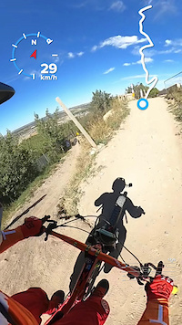
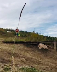
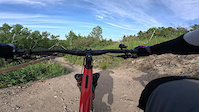
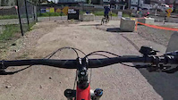
Photos of Calgary Mountain Bike
Videos of Calgary Mountain Bike
trail: Haircut Rabbit
0:45 |
93 |
Jun 4, 2025
trail: Canyonero
0:07 |
71 |
May 7, 2025
trail: High Roller
0:34 |
10 |
Oct 27, 2024
trail: Haircut Rabbit
0:42 |
|
Sep 9, 2024
trail: Safari
0:19 |
|
Sep 9, 2024
trail: Lazer Fade
3:04 |
90 |
Aug 11, 2024
trail: Haircut Rabbit
0:19 |
101 |
Jul 9, 2024
trail: Haircut Rabbit
4:26 |
31 |
Jul 9, 2024
Current Trail Warnings
| status | trail | date | condition | user | info |
|---|---|---|---|---|---|
| North Beaverdang | Jul 16, 2026 @ 11:19am (America/Edmonton) Jul 16, 2026 | Ideal | cptkirk63 | New logs washed into the mini fjord and... | |
| Columbus UFO | Jul 19, 2026 @ 9:08am (America/Edmonton) Jul 19, 2026 | Dry | breadedcod SHORE CORPS | Severely undercut and collapsed into the... | |
| Fuzzy Groover | Jul 18, 2026 @ 9:56am (America/Creston) Jul 18, 2026 | Unknown | Shiver2009 | E-Bike |
Recent Trail Reports
| status | trail | date | condition | info | user |
|---|---|---|---|---|---|
| Crescent | Jul 30, 2026 @ 2:12pm (America/Edmonton) 1 hours | Unknown | DuncanIOvhEj | ||
| Lazer Fade | Jul 30, 2026 @ 7:53am (America/Edmonton) 7 hours | Dry | marlon-d | ||
| Regional Pathway - Parkridge Dr to Bonaventure Dr | Jul 28, 2026 @ 6:58pm (America/Edmonton) 2 days | Ideal | MickSomerwil | ||
| Macleod to Glennfield | Jul 28, 2026 @ 6:58pm (America/Edmonton) 2 days | Ideal | MickSomerwil | ||
| Glennfield Valley Gravel | Jul 28, 2026 @ 6:58pm (America/Edmonton) 2 days | Ideal | MickSomerwil | ||
| Stream Changes Loop | Jul 28, 2026 @ 6:58pm (America/Edmonton) 2 days | Ideal | MickSomerwil | ||
| Parkland Hill | Jul 28, 2026 @ 6:58pm (America/Edmonton) 2 days | Ideal | MickSomerwil | ||
| Regional Pathway - West Sikome | Jul 28, 2026 @ 6:58pm (America/Edmonton) 2 days | Ideal | MickSomerwil | ||
| Shawnee to Cantrell | Jul 28, 2026 @ 6:58pm (America/Edmonton) 2 days | Ideal | MickSomerwil | ||
| Regional Pathway - Bow Ranche to Sikome | Jul 28, 2026 @ 6:58pm (America/Edmonton) 2 days | Ideal | MickSomerwil |
Activity Feed
| username | action | type | title | date |
|---|---|---|---|---|
| DuncanIOvhEj | add | report | activity #100364880 | Jul 30, 2026 @ 1:12pm 1 hours |
| marlon-d | add | report | activity #100339902 | Jul 30, 2026 @ 6:53am 7 hours |
| MickSomerwil | add | report | activity #100280235 and 6 more | Jul 29, 2026 @ 9:48am 1 day |
| MickSomerwil | add | report | activity #100280233 and 2 more | Jul 29, 2026 @ 9:48am 1 day |
| sroux | ridden | trail | activity #100262511 | Jul 29, 2026 @ 4:42am 1 day |
Recent Comments
| username | type | title | comment | date |
|---|---|---|---|---|
| trail | steep single tracks with little dropdown at... | Jul 24, 2026 @ 8:00pm Jul 24, 2026 | ||
| report | LOL you tried to ride a bike park trail while... | Jul 7, 2026 @ 12:05pm Jul 7, 2026 | ||
| trail | same here almost wiped out mid way through | Jun 28, 2026 @ 8:25pm Jun 28, 2026 | ||
| trail | Pretty lame we buy a pass and can't use it?... | Jun 22, 2026 @ 1:24pm Jun 22, 2026 | ||
| trail | Incredible trail, super flowy downhill line.... | May 9, 2026 @ 3:25pm May 9, 2026 |
Local Badges
-

Completionist3 awarded -
Completionist0 awarded -
Completionist0 awarded -
Completionist0 awarded -
Completionist6 awarded -
Completionist2 awarded
Bike & Skill Parks
| name | type | city | rating |
|---|---|---|---|
| Winsport Bike Park | bike park | Calgary | |
| Montgomery Mountain Bike Park | skill park | Calgary | |
| COP Skills Park | skill park | Calgary | |
| Griffith Woods Dirt Jump Bike Park | skill park | Calgary | |
| Fairview Bike Park | skill park | Calgary |
Activity Type Stats
| activitytype | trails | distance | descent | descent distance | total vertical | rating | global rank | state rank | photos | reports | routes | activity logs |
|---|---|---|---|---|---|---|---|---|---|---|---|---|
| Mountain Bike | 1,331 | 607 miles | 42,123 ft | 238 miles | 971 ft | #16 | #2 | 2,698 | 14,734 | 61 | 352,695 | |
| E-Bike | 686 | 361 miles | 24,944 ft | 147 miles | 958 ft | #46 | #6 | 3 | 13,923 | 6 | 12,580 | |
| Gravel Bike | 72 | 49 miles | 3,809 ft | 23 miles | 761 ft | #22 | #15 | 4 | 1,658 | 7 | 2,110 | |
| Winter Fat Bike | 22 | #9 | #10 | 18 | 10 | 2 | 224 | |||||
| Horse | 7 | 3 miles | 108 ft | 4,642 ft | 935 ft | #219 | #7 | 2,074 | 18 | |||
| Hike | 1,262 | 596 miles | 39,610 ft | 232 miles | 1,066 ft | #38 | #2 | 27 | 14,640 | 8 | 8,020 | |
| Trail Running | 1,246 | 589 miles | 39,242 ft | 229 miles | 1,066 ft | #17 | #1 | 9 | 14,641 | 18 | 57,117 | |
| Dirtbike/Moto | 17 | 5 miles | 489 ft | 2 miles | 679 ft | #169 | #5 | 2,072 | 62 | |||
| ATV/ORV/OHV | 1 | 1 mile | 56 ft | 2,848 ft | 33 ft | 2,072 | 17 | |||||
| Snowmobile | 1 | 1 mile | 56 ft | 2,848 ft | 33 ft | |||||||
| Snowshoe | 68 | 13 miles | 1,670 ft | 5 miles | 935 ft | #72 | #4 | 14 | 4 | 180 | ||
| Downhill Ski | 15 | 5 miles | 299 ft | 2 miles | 679 ft | #249 | #5 | 1,029 | ||||
| Backcountry Ski | 18 | 6 miles | 299 ft | 2 miles | 679 ft | #143 | #4 | 2 | 240 | |||
| Nordic Ski | 55 | 9 miles | 515 ft | 3 miles | 935 ft | #60 | #4 | 32 | 6 | 5,569 |
Frequently Asked Questions About Calgary
▼
What are the best places to ride in Calgary?
Calgary has 26 areas to explore for mountain biking. The top rated areas are:
▼
What are the highest rated mountain biking trails in Calgary?
The highest rated mountain biking trails in Calgary are:
- Canyonero (4.6/5)
- Sunset Meadow (4.5/5)
- Low-Walk (4.4/5)
- Hawkeye (4.4/5)
- Berm Blaster (4.3/5)
▼
What is the best time of the year to ride in Calgary?
Based on activity log data, the most popular months to ride in Calgary are:
- July (2,962 activities)
- May (2,287 activities)
- August (2,133 activities)
▼
Where can I park to ride in Calgary?
There are 44 parking locations listed in Calgary. The most popular parking spots are: View all parking and trailhead locations on the map to plan your visit.
Activities
- Calgary Mountain Biking Trails
- Calgary E-Biking Trails
- Calgary Gravel Biking Trails
- Calgary Winter Fat Biking Trails
- Calgary Horseback Trails
- Calgary Hiking Trails
- Calgary Trail Running Trails
- Calgary Dirtbiking Trails
- Calgary Snowshoeing Trails
- Calgary Skiing Trails
- Calgary Backcountry Skiing Trails
- Calgary Nordic Skiing Trails
Trails
Points of Interest
- Entrance to Skyline and Nordic Ski Learning Area Information
- 8th Avenue Entrance Information
- Multi-use entrance at lower parking lot Information
- 26th Street Entrance Information
- Quarry Road Entrance Information
- Main parking lot Clubhouse entrance Information
- Owl Park Other
- Astral Prophets Intergalactic South Bow Crossing Pedestrian Bridge
- Shelter Cabin
- Shelter Cabin
- Top Hill (4,229 ft)
- By radek
 Trailforks SDBA & contributors
 - Admins: AEF, Canadmos, warrenmacdonald, CMBA, DonYx, ryancartiers
- #3091 - 174,561 views
- calgary activity log | embed map of Calgary mountain bike trails | calgary mountain biking points of interest polygons
Downloading of trail gps tracks in kml & gpx formats is enabled for Calgary.
You must login to download files.