close
-
Layers w
- Weather Layers
- Pro
- Pro
- Pro
- Pro
- Pro
- Pro
- More Layers
- Pro
- Pro
- Pro
- Pro
-
Upgrade to

3D
Trail Conditions
- Unknown
- Snow Groomed
- Snow Packed
- Snow Covered
- Snow Cover Partial
- Freeze/thaw Cycle
- Icy
- Prevalent Mud
- Wet
- Variable
- Ideal
- Dry
- Very Dry
Trail Flow (Ridden Direction)
Trailforks scans users ridelogs to determine the most popular direction each trail is ridden. A good flowing trail network will have most trails flowing in a single direction according to their intension.
The colour categories are based on what percentage of riders are riding a trail in its intended direction.
The colour categories are based on what percentage of riders are riding a trail in its intended direction.
- > 96%
- > 90%
- > 80%
- > 70%
- > 50%
- < 50%
- bi-directional trail
- no data
Trail Last Ridden
Trailforks scans ridelogs to determine the last time a trail was ridden.
- < 2 days
- < 1 week
- < 2 weeks
- < 1 month
- < 6 months
- > 6 months
Trail Ridden Direction
The intended direction a trail should be ridden.
- Downhill Only
- Downhill Primary
- Both Directions
- Uphill Primary
- Uphill Only
- One Direction
Contribute Details
Colors indicate trail is missing specified detail.
- Description
- Photos
- Description & Photos
- Videos
Trail Popularity ?
Trailforks scans ridelogs to determine which trails are ridden the most in the last 9 months.
Trails are compared with nearby trails in the same city region with a possible 25 colour shades.
Think of this as a heatmap, more rides = more kinetic energy = warmer colors.
- most popular
- popular
- less popular
- not popular
ATV/ORV/OHV Filter
Max Vehicle Width
inches
US Cell Coverage
Legend

Radar Time
Activity Recordings
Trailforks uses anonymized public activity data.
?
Activity Recordings
Trailforks uses anonymized public activity data.
?
Personal Heatmap
▶
Activity Types
all
/
none
▶
Options
2
Date range
month
–
Winter Trails
Warning
A routing network for winter maps does not exist. Selecting trails using the winter trails layer has been disabled.
Missing Trails
Most Popular
Least Popular
Trails are colored based on popularity. The more popular a trail is, the more red. Less popular trails trend towards green.
Jump Magnitude Heatmap
Heatmap of where riders jump on trails. Zoom in to see individual jumps, click circles to view jump details.
BC Backroad Status
![map legend]()
Service Road Atlas is a free to use, community-driven service for viewing and creating reports on the numerous back-country service roads around B.C. and Alberta.

Slope Aspect
Direction the slope faces
Trails Deemphasized
Trails are shown in grey.
Only show trails with no bike usage.
Suggested Layers
Based on selected activity type
Save the current map location and zoom level as your default home location whenever this page is loaded.
Save
No description for Payson has been added yet!
Login or register to submit one.
Links
Region Supporters & Maintainers
![Payson City Utah]()
Payson City UtahMaintainer
Activities Click to view
- Mountain Bike
133 trails
- E-Bike
54 trails
- Gravel Bike
10 trails
- Adaptive Bike
7 trails
- Winter Fat Bike
28 trails
- Horse
56 trails
- Hike
151 trails
- Trail Running
148 trails
- Dirtbike/Moto
18 trails
- ATV/ORV/OHV
2 trails
- Snowmobile
2 trails
- Snowshoe
28 trails
Region Details
- 8
- 2
- 29
- 52
- 35
- 7
Region Status
Caution as of Jun 17, 2026Stats
- Avg Trail Rating
- Trails (view details)
- 153
- Trails Mountain Bike
- 133
- Trails E-Bike
- 54
- Trails Gravel Bike
- 10
- Trails Adaptive Bike
- 7
- Trails Winter Fat Bike
- 28
- Trails Horse
- 56
- Trails Hike
- 151
- Trails Trail Running
- 148
- Trails Dirtbike/Moto
- 18
- Trails ATV/ORV/OHV
- 2
- Trails Snowmobile
- 2
- Trails Snowshoe
- 28
- Trails Backcountry Ski
- 2
- Total Distance
- 205 miles
- Total Descent
- 51,963 ft
- Total Vertical
- 7,241 ft
- Highest Trailhead
- 11,909 ft
- Reports
- 4,551
- Photos
- 516
- Ridden Counter
- 18,185
Sub Regions
-
Forebay
- 1
- 13
- 16
- 4
- 1
-
Mt. Nebo
- 7
- 15
- 19
- 2
-
Payson Canyon
- 6
- 13
- 6
- 3
Popular Payson Mountain Biking Trails
• 100 ★ 3.5 • 2,999 ft • 160 ft • 417 •
The lower section of Trotters is heavily wooded with tight turns in shady basin. There is a few spring crossings along with a section of exposed trail and great views of Payson canyon as you climb to the junction.
• 95 ★ 3.9 • 2,408 ft • 68 ft • 414 •
is one of the OG Forebay trails. It doesn't have to be your , but it's ours. Easy trail with a nice flow through the oak and maple trees. it's a nice place to catch your breath after climbing up from the main forebay parking lot.
• 100 ★ 3.2 • 2 miles • 266 ft • 386 •
Short climbs and some tight turns. Expect spectacular views in the spring, fall and winter. In 2025 a new bridge and several berms were constructed to help with flow. A center shortcut was also added to allow to be ridden in a figure 8.
• 95 ★ 3.4 • 3,127 ft • 42 ft • 344 •
Raygun has several tight corners with limited visibility. Moderate grade for descending and climbing. Great for beginners that are ready to advance to intermediate trails.
• 90 ★ 3.0 • 1,903 ft • 36 ft • 324 •
Great views and home to Rusty the chair, who has been watching over Forebay for several decades.
Payson Mountain Bike Routes
4 miles • 618 ft • 5 • Out & Back •
Climb , , one loop on . Down Raygun, , Jax to . Sprint up . Repeat Raygun, , Jax and sprints up .
★ 5.0 • 6 miles • 400 ft • 1 •
Longer pedal way of getting to the top of bennie creek from above (jones ranch/blackhawk area)
2 miles • 468 ft • 5 • Out & Back •
Climb , Trotters and to the Pond. to Jax, down Jax to . Sprint up , Mez. Repeat to Jax, down Jax to ....
13 miles • 1,994 ft • 2 • Loop •
Pete Parking lot, Take Pete Road to Sheephearders Trail, Ride up Sheepnhearders to Kunz Flats, Take Kunz...
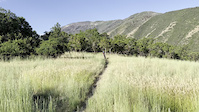
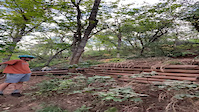
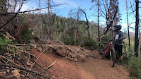
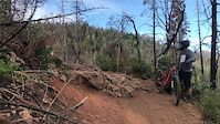
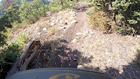
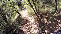
Photos of Payson Mountain Bike
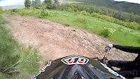
Videos of Payson Mountain Bike
trail: Wakara
0:08 |
|
Oct 27, 2022
trail: Bennie Creek Trail
0:06 |
|
Aug 12, 2022
trail: Bennie Creek Trail
0:08 |
110 |
Nov 9, 2021

trail: Bennie Creek Trail
0:09 |
|
Nov 9, 2021
trail: Bennie Creek Trail
0:09 |
|
Nov 9, 2021
trail: Bennie Creek Trail
0:43 |
187 |
Nov 10, 2017
trail: Bennie Creek Trail
2:13 |
199 |
Aug 15, 2015
trail: Pine Forest Trail
3:16 |
119 |
Jun 4, 2015
Current Trail Warnings
| status | trail | date | condition | user | info |
|---|---|---|---|---|---|
| Sawmill-Nebo Creek Trail | Jun 17, 2026 @ 3:59pm (America/Denver) Jun 17, 2026 | Ideal | jeffsyn | Lots of trees down across trail on the... | |
| Vaquero | Jun 7, 2026 @ 8:34pm (America/Denver) Jun 7, 2026 | Unknown | Fabotti | Large burnt trees down across trail,... |
Recent Trail Reports
| status | trail | date | condition | info | user |
|---|---|---|---|---|---|
| Wakara Cutoff | Jun 14, 2026 @ 8:36am (America/Denver) Jun 14, 2026 | Dry | mtstewart74 Forebay | ||
| Wakara | Jun 14, 2026 @ 8:36am (America/Denver) Jun 14, 2026 | Dry | mtstewart74 Forebay | ||
| Uncle Rico | Jun 14, 2026 @ 8:36am (America/Denver) Jun 14, 2026 | Dry | mtstewart74 Forebay | ||
| Trotter | Jun 14, 2026 @ 8:36am (America/Denver) Jun 14, 2026 | Dry | mtstewart74 Forebay | ||
| Tithing Mountain | Jun 14, 2026 @ 8:36am (America/Denver) Jun 14, 2026 | Dry | mtstewart74 Forebay | ||
| TECH LINE | Jun 14, 2026 @ 8:36am (America/Denver) Jun 14, 2026 | Dry | mtstewart74 Forebay | ||
| Taze | Jun 14, 2026 @ 8:36am (America/Denver) Jun 14, 2026 | Dry | mtstewart74 Forebay | ||
| Round Top | Jun 14, 2026 @ 8:36am (America/Denver) Jun 14, 2026 | Dry | mtstewart74 Forebay | ||
| Ray Gun | Jun 14, 2026 @ 8:36am (America/Denver) Jun 14, 2026 | Dry | mtstewart74 Forebay | ||
| Pipeline Alt | Jun 14, 2026 @ 8:36am (America/Denver) Jun 14, 2026 | Dry | mtstewart74 Forebay |
National Scenic Trails & Official Routes
-
Bonneville Shoreline Trail
- Mountain Bike
- E-Bike
- Horse
- Hike
- Trail Running
- Snowshoe
- Nordic Ski

Activity Feed
| username | action | type | title | date |
|---|---|---|---|---|
| Reggimann | vote | trail | activity #97396246 and 1 more | Jun 20, 2026 @ 8:05am Jun 20, 2026 |
| Reggimann | add | photo | activity #97396235 | Jun 20, 2026 @ 8:05am Jun 20, 2026 |
| Reggimann | comment | trail | activity #97396155 | Jun 20, 2026 @ 8:04am Jun 20, 2026 |
| Reggimann | ridden | trail | activity #97395919 and 5 more | Jun 20, 2026 @ 8:01am Jun 20, 2026 |
| jeffsyn | add | report | activity #97211578 | Jun 17, 2026 @ 3:07pm Jun 17, 2026 |
Recent Comments
| username | type | title | comment | date |
|---|---|---|---|---|
| trail | Not a black going down. Nice flow, couple... | Jun 20, 2026 @ 8:04am Jun 20, 2026 | ||
| trail | Good time, prepare for a few rock drops and... | Jun 17, 2026 @ 2:32pm Jun 17, 2026 | ||
| report | Any pictures you can share of the trail &... | Jun 9, 2026 @ 8:02pm Jun 9, 2026 | ||
| trail | Does this trail legally have equestrian use? I... | Mar 31, 2026 @ 11:55am Mar 31, 2026 | ||
| trail | Nothing advanced about this trail. Honestly... | Mar 18, 2026 @ 7:37am Mar 18, 2026 |
Local Badges
-

Completionist0 awarded -

Big Ride 30k1,179 awarded -

Epic Ride 50k517 awarded -

Top 10 Trails0 awarded -
Completionist0 awarded -

10 Green Trails99 awarded
Activity Type Stats
| activitytype | trails | distance | descent | descent distance | total vertical | rating | global rank | state rank | photos | reports | routes | ridelogs |
|---|---|---|---|---|---|---|---|---|---|---|---|---|
| Mountain Bike | 133 | 161 miles | 39,948 ft | 83 miles | 5,305 ft | #792 | #307 | 440 | 4,544 | 34 | 13,884 | |
| E-Bike | 54 | 74 miles | 16,115 ft | 39 miles | 5,305 ft | #2,108 | #940 | 1 | 2,425 | 1 | 1,565 | |
| Gravel Bike | 10 | 17 miles | 1,982 ft | 7 miles | 2,982 ft | #442 | #1,023 | 176 | ||||
| Adaptive Bike | 7 | 18 miles | 2,280 ft | 7 miles | 4,085 ft | #374 | #1,719 | 147 | 1 | |||
| Winter Fat Bike | 28 | 21 miles | 3,757 ft | 9 miles | 4,767 ft | #253 | #1,033 | 1,336 | 1 | |||
| Horse | 56 | 144 miles | 39,741 ft | 70 miles | 7,054 ft | #60 | #342 | 14 | 3,630 | 1 | 91 | |
| Hike | 151 | 205 miles | 51,932 ft | 98 miles | 7,241 ft | #361 | #172 | 47 | 4,549 | 25 | 1,563 | |
| Trail Running | 148 | 193 miles | 50,495 ft | 95 miles | 7,205 ft | #486 | #191 | 11 | 4,549 | 25 | 1,661 | |
| Dirtbike/Moto | 18 | 40 miles | 7,343 ft | 18 miles | 4,770 ft | #158 | #96 | 3 | 1,055 | 1 | 122 | |
| ATV/ORV/OHV | 2 | 7 miles | 823 ft | 2 miles | 3,114 ft | #778 | #336 | 1,016 | 1 | 12 | ||
| Snowmobile | 2 | 2 miles | 387 ft | 4,833 ft | 1,798 ft | #273 | #142 | 5 | 1 | |||
| Snowshoe | 28 | 15 miles | 1,824 ft | 5 miles | 3,576 ft | #740 | #329 | 2,412 | 12 | 114 | ||
| Backcountry Ski | 2 | 2 miles | 194 ft | 3,517 ft | 2,431 ft | 6 | 1 | 31 |
Frequently Asked Questions About Payson
▼
What are the best places to ride in Payson?
Payson has 3 areas to explore for mountain biking. The top rated areas are:
▼
What are the highest rated mountain biking trails in Payson?
The highest rated mountain biking trails in Payson are:
- Bennie Creek Trail (4.5/5)
- Kuntz Flat (4.4/5)
- Maple Lake (4.2/5)
- Grotto Jump Line (4.2/5)
- Summit Trail (4.2/5)
▼
What is the best time of the year to ride in Payson?
Based on ride log data, the most popular months to ride in Payson are:
- July (315 activities)
- June (230 activities)
- September (202 activities)
▼
Where can I park to ride in Payson?
There are 35 parking locations listed in Payson. The most popular parking spots are: View all parking and trailhead locations on the map to plan your visit.
Activities
Trails
- By canadaka
 Trailforks & contributors
 - Admins: jkwilliamz, UtahJohn, jpmcghee, jasonmalczyk, URMB, UVTA
- #4733 - 11,806 views
- payson activity log | embed map of Payson mountain bike trails | payson mountain biking points of interest
Downloading of trail gps tracks in kml & gpx formats is enabled for Payson.
You must login to download files.