
close
3D
Trail Conditions
- Unknown
- Snow Groomed
- Snow Packed
- Snow Covered
- Snow Cover Partial
- Freeze/thaw Cycle
- Icy
- Prevalent Mud
- Wet
- Variable
- Ideal
- Dry
- Very Dry
Trail Flow (Ridden Direction)
Trailforks scans users activity logs to determine the most popular direction each trail is ridden. A good flowing trail network will have most trails flowing in a single direction according to their intension.
The colour categories are based on what percentage of users are riding a trail in its intended direction.
The colour categories are based on what percentage of users are riding a trail in its intended direction.
- > 96%
- > 90%
- > 80%
- > 70%
- > 50%
- < 50%
- bi-directional trail
- no data
Trail Last Used
Trailforks scans activity logs to determine the last time a trail was ridden.
- < 2 days
- < 1 week
- < 2 weeks
- < 1 month
- < 6 months
- > 6 months
Trail Ridden Direction
The intended direction a trail should be ridden.
- Downhill Only
- Downhill Primary
- Both Directions
- Uphill Primary
- Uphill Only
- One Direction
Contribute Details
Colors indicate trail is missing specified detail.
- Description
- Photos
- Description & Photos
- Videos
Trail Popularity ?
Trailforks scans activity logs to determine which trails are ridden the most in the last 9 months.
Trails are compared with nearby trails in the same city region with a possible 25 colour shades.
Think of this as a heatmap, more activities = more kinetic energy = warmer colors.
- most popular
- popular
- less popular
- not popular
ATV/ORV/OHV Filter
Max Vehicle Width
inches
US Cell Coverage
Legend

Radar Time
Activity Recordings
Trailforks uses anonymized public activity data.
?
Activity Recordings
Trailforks uses anonymized public activity data.
?
Winter Trails
Warning
A routing network for winter maps does not exist. Selecting trails using the winter trails layer has been disabled.
Missing Trails
Most Popular
Least Popular
Trails are colored based on popularity. The more popular a trail is, the more red. Less popular trails trend towards green.
Jump Magnitude Heatmap
Heatmap of where users jump on trails. Zoom in to see individual jumps, click circles to view jump details.
BC Backroad Status
![map legend]()
Service Road Atlas is a free to use, community-driven service for viewing and creating reports on the numerous back-country service roads around B.C. and Alberta.

Slope Aspect
Direction the slope faces
Trails Deemphasized
Trails are shown in grey.
Only show trails with no bike usage.
Suggested Layers
Based on selected activity type
Save the current map location and zoom level as your default home location whenever this page is loaded.
SaveThis generally intermediate XC trail network on mainly flat bench land is coupled with forest single track and short downhill sections. There are opportunities for beginners in the more open and logging road access areas, the forested sections having more challenging and some rooty terrain. There are mostly optional or easily walk-able intermediate features throughout the area with some more advanced toward the eastern section in French Creek valley area which can also be accessed from the Morningstar drainage area and via the French Creek Bridge underpass on Highway 19. Morningstar trails are frequented by horse riders and are more beginner and intermediate oriented.
Mountain biking is more prevalent to the southeast and southwest side, dog walkers generally enter near the Golf Course off Qualicum and View Roads of the area near Rupert Road.
Some local horse access near Rupert and Bennett Roads and from horse farm areas in the Morningstar area.
Trail character changes to steeper grades on the slope down to French Creek (south side of the Hydo lines).
Mountain biking is more prevalent to the southeast and southwest side, dog walkers generally enter near the Golf Course off Qualicum and View Roads of the area near Rupert Road.
Some local horse access near Rupert and Bennett Roads and from horse farm areas in the Morningstar area.
Trail character changes to steeper grades on the slope down to French Creek (south side of the Hydo lines).
Primary Trail Type: Cross-Country
Land Status: Private Managed Forest
Land Manager: Mosaic
 google parking directions plan a road trip here
Access Info:
Qualicum Rd at Pheasant Glen Golf Course
Qualicum Beach Firehall
Hwy 4 pullout near the powerline crossing and the Welcome to QB pullout
Access and some parking on the northwest end of View Road
Bike (& very limited parking) access off Bennett Road by the mailboxes and past the airport, connecting also to the airport access trails
Highway 19 access after the French Creek bridge northbound by the yellow gate, minimal parking
Qualicum Beach Firehall
Hwy 4 pullout near the powerline crossing and the Welcome to QB pullout
Access and some parking on the northwest end of View Road
Bike (& very limited parking) access off Bennett Road by the mailboxes and past the airport, connecting also to the airport access trails
Highway 19 access after the French Creek bridge northbound by the yellow gate, minimal parking
Trail info last updated
Region Supporters & Maintainers
trail builderSponsor
Activities Click to view
- Mountain Bike
128 trails
- E-Bike
128 trails
- Horse
45 trails
- Hike
120 trails
- Trail Running
120 trails
- Snowshoe
126 trails
- Nordic Ski
2 trails
Region Details
- 28
- 6
- 29
- 57
- 8
Region Status
Open as of Nov 15, 2026
Stats
- Avg Trail Rating
- Trails (view details)
- 128
- Trails Mountain Bike
- 128
- Trails E-Bike
- 128
- Trails Gravel Bike
- 70
- Trails Adaptive Bike
- 15
- Trails Winter Fat Bike
- 8
- Trails Horse
- 45
- Trails Hike
- 120
- Trails Trail Running
- 120
- Trails Dirtbike/Moto
- 1
- Trails ATV/ORV/OHV
- 1
- Trails Snowshoe
- 126
- Trails Nordic Ski
- 2
- Total Distance
- 34 miles
- Total Descent
- 3,116 ft
- Total Vertical
- 278 ft
- Highest Trailhead
- 378 ft
- Reports
- 2,098
- Photos
- 778
- Completed Counter
- 4,776
Popular Pheasant Glen Mountain Biking Trails
• 75 ★ 4.7 • 1,296 ft • 0 ft • 110 •
Popular blue difficulty singletrack. This mountain bike primary trail can be used both directions and has a easy overall physical rating with a 0 ft green climb. On average it takes 2 minutes to complete this trail.
• 80 ★ 4.0 • 751 ft • 22 ft • 105 •
Look for the big spike sticking in a stump found while trail building. Close to the bridge
• 80 ★ 4.5 • 2,920 ft • 57 ft • 104 •
Popular blue difficulty singletrack. This mountain bike primary trail can be used both directions and has a moderate overall physical rating with a 57 ft green climb. On average it takes 6 minutes to complete this trail.
• 85 ★ 4.4 • 617 ft • 6 ft • 102 •
Sweet little downhill trail that is still offers a good climb back up to the powerline roads.
• 60 ★ 4.8 • 1,263 ft • 33 ft • 82 •
A-Side is a section of the resurrected old trail along the Highway 4 combined with a new trail using the remaining tree stands after logging and starts just past the orange access gate to the area across from the Hydro facility. It...
• 75 ★ 3.7 • 679 ft • 46 ft • 78 •
Connects Entrails to Slipstream. Makes it so one can ride through without hike-a-biking
Pheasant Glen Mountain Bike Routes
9 miles • 618 ft • 27 • Loop •
A good introduction to all things Pheasant Glen. Trails are mainly Blue rated but some of the newer trails...
6 miles • 420 ft • 23 • Loop •
This mountain bike (or hiking route) captures most of the southeastern section of Pheasant Glen, avoiding...
6 miles • 480 ft • 23 • Loop •
Introduction to Pheasant Glen riding area - Intermediate Rider Makes use of the southeastern section of...
★ 2.7 • 23 miles • 1,039 ft • 1 • Loop •
This route encompasses gravel logging roads (Qualicum Beach to Whiskey Creek. It passes through Little...
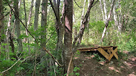
Photos of Pheasant Glen Mountain Bike
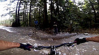
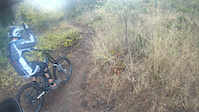
Videos of Pheasant Glen Mountain Bike

Current Trail Warnings
| status | trail | date | condition | user | info |
|---|---|---|---|---|---|
| PG1 | Nov 7, 2026 @ 10:44am (America/Vancouver) Nov 7, 2026 | Ideal | rapid-roy TrailsBC | Large pine across trail near the short... |
Recent Trail Reports
Activity Feed
| username | action | type | title | date |
|---|---|---|---|---|
| rapid-roy | add | report | activity #107890671 and 13 more | Nov 16, 2026 @ 8:51am 2 days |
| rapid-roy | update | trail | activity #107889388 | Nov 16, 2026 @ 8:23am 2 days |
| rapid-roy | add | report | activity #107732636 | Nov 13, 2026 @ 4:35pm Nov 13, 2026 |
| Kus | update | trail | activity #107675127 and 1 more | Nov 12, 2026 @ 2:07pm Nov 12, 2026 |
| rapid-roy | add | report | activity #107372357 and 8 more | Nov 7, 2026 @ 12:37pm Nov 7, 2026 |
Recent Comments
| username | type | title | comment | date |
|---|---|---|---|---|
| trail | Hitman got a haircut on Oct 28. Some bridge... | Oct 30, 2026 @ 10:17am Oct 30, 2026 | ||
| trail | Well it is safe to say that after crossing the... | Oct 27, 2026 @ 3:53pm Oct 27, 2026 | ||
| report | Cleared branches & mowed, log is... | Oct 5, 2026 @ 5:25pm Oct 5, 2026 | ||
| trail | This is a really fun loamy trail. Thank you... | Sep 30, 2026 @ 6:09pm Sep 30, 2026 | ||
| report | NICE work!! I rode it the other day and vowed... | Sep 28, 2026 @ 2:35pm Sep 28, 2026 |
Nearby Areas
| name | distance | ||||
|---|---|---|---|---|---|
| Laburnum Road | 21 | 24 | 3.1 km | ||
| Little Mountain | 4 | 16 | 2 | 2 | 4.7 km |
| HammerFest | 11 | 63 | 25 | 5 | 6.2 km |
| Top Bridge/Englishman River Regional Park | 8 | 6 | 1 | 6.9 km | |
| Upper Little Qualicum River Woodlands | 1 | 1 | 1 | 8.3 km |
Local Badges
-

Completionist0 awarded

Activity Type Stats
| activitytype | trails | distance | descent | descent distance | total vertical | rating | global rank | state rank | photos | reports | routes | activity logs |
|---|---|---|---|---|---|---|---|---|---|---|---|---|
| Mountain Bike | 128 | 34 miles | 3,117 ft | 12 miles | 279 ft | #2,517 | #137 | 747 | 2,098 | 4 | 2,391 | |
| E-Bike | 128 | 34 miles | 3,117 ft | 12 miles | 279 ft | #1,490 | #78 | 12 | 1,942 | 129 | ||
| Gravel Bike | 71 | 20 miles | 1,319 ft | 7 miles | 262 ft | #3,620 | #209 | 2 | 51 | 2 | 32 | |
| Adaptive Bike | 15 | 5 miles | 440 ft | 2 miles | 262 ft | #3,631 | #209 | 85 | ||||
| Winter Fat Bike | 8 | 2 miles | 177 ft | 5,026 ft | 167 ft | #3,620 | #209 | 49 | ||||
| Horse | 45 | 13 miles | 892 ft | 5 miles | 262 ft | #1,502 | #49 | 66 | 1 | |||
| Hike | 120 | 33 miles | 2,657 ft | 11 miles | 279 ft | #4,529 | #203 | 10 | 2,041 | 1 | 436 | |
| Trail Running | 120 | 33 miles | 2,657 ft | 11 miles | 279 ft | #3,575 | #115 | 4 | 2,030 | 344 | ||
| Dirtbike/Moto | 1 | 3,071 ft | 56 ft | 2,129 ft | 52 ft | 53 | 13 | |||||
| ATV/ORV/OHV | 1 | 3,071 ft | 56 ft | 2,129 ft | 52 ft | 46 | 3 | |||||
| Snowshoe | 126 | 33 miles | 3,051 ft | 12 miles | 279 ft | #316 | #22 | 92 | 1 | |||
| Nordic Ski | 2 | 2,096 ft | 23 ft | 912 ft | 36 ft | #2,643 | #87 | 2 | 8 | 5 |
Frequently Asked Questions
▼
What are the highest rated mountain biking trails in Pheasant Glen?
The highest rated mountain biking trails in Pheasant Glen are:
- PG1 (4.3/5)
- A - Side (4.3/5)
- Jimbo (4.2/5)
- Jellyfish (4.2/5)
- Backdoor Climb - 8 Ball Connector (4.2/5)
▼
Where can I park to ride in Pheasant Glen?
There are 5 parking locations listed in Pheasant Glen. The most popular parking spots are:
- Limited Parking (2-3)
- Parking, Qualicum Road and Golf Club Entrance
- Parking
- Roadside Barriers; Limited Parking
- PG Park 2
▼
What is the longest trail in Pheasant Glen?
The longest trail in Pheasant Glen is Back Door at 2.1 miles. View all trails sorted by distance.
▼
What are the best & highest rated hiking trails in Pheasant Glen?
The best hiking trails in Pheasant Glen are: View all hiking trails sorted by popularity score.
▼
What are the best & highest rated trail running trails in Pheasant Glen?
The best trail running trails in Pheasant Glen are: View all trail running trails sorted by popularity score.
▼
How many trails are in Pheasant Glen?
Pheasant Glen has a total of 128 trails. Browse top mountain biking trails in Pheasant Glen to find detailed information including difficulty ratings, distances, and trail conditions.
▼
Which trail has the most elevation gain in Pheasant Glen?
The trail with the most elevation gain in Pheasant Glen is Velvet Grind with 221 ft of elevation gain. View all trails sorted by elevation gain.
▼
Which trail has the most elevation descent in Pheasant Glen?
The trail with the most elevation descent in Pheasant Glen is Back Door with 264 ft of elevation descent. View all trails sorted by elevation descent.
▼
What activities are most popular in Pheasant Glen?
Pheasant Glen supports the following activities: Mountain Biking, E-Biking, Horseback, Hiking, Trail Running, Snowshoeing, Nordic Skiing.
▼
What are the steepest mountain biking trails in Pheasant Glen?
The steepest mountain biking trail in Pheasant Glen is Backdoor Climb - 8 Ball Connector with an average grade of 23.2%. View all trails sorted by grade.
▼
Are there any trails with scenic viewpoints in Pheasant Glen?
Yes, there are 5 scenic viewpoints marked along trails in Pheasant Glen. Some popular viewpoints include:
- Jellyfish Viewpoint of Mt Arrowsmith and French Creek Valley
- Scenic viewpoint - French Creek
- Eagle View Lookout
- Three Cedars Lookout
- Morning Star Sandy Beach Settling Pond
▼
Are the trails open in Pheasant Glen?
The overall region status for Pheasant Glen is Clear / Green. Out of 113 trails:
- Clear / Green: 102
- Minor Issue / Yellow: 9
- Significant Issue / Amber: 2
▼
What are the trail conditions in Pheasant Glen?
Based on trail reports from the past week in Pheasant Glen:
- Wet: 10 trails
- Ideal: 4 trails
▼
Can I ride an ebike in Pheasant Glen?
Yes, Pheasant Glen supports e-bike riding. There are 130 trails in Pheasant Glen that allow e-bikes. Check the e-bike trails listing for specific trail access details and any local regulations.
▼
What are the most popular mountain biking routes in Pheasant Glen?
The most popular mountain biking routes in Pheasant Glen are: View all mountain biking routes in Pheasant Glen.
▼
What are the top sights to see in Pheasant Glen?
There are 3 notable sights in Pheasant Glen. Some of the top sights include: Explore all points of interest in Pheasant Glen.
▼
What are the most popular Strava Segments in Pheasant Glen?
The most popular Strava segments in Pheasant Glen are:
- Gravel Sprint (56 athletes)
- Back Door (32 athletes)
- Hitman Cometh (19 athletes)
▼
What are some popular technical trail features in Pheasant Glen?
There are 64 technical trail features (TTFs) in Pheasant Glen. Some popular features include:
- 8B - D04 Drop, Rollable, Medium to High, 38" (Drop)
- 8B - D01 Drop, Medium High (Drop)
- 8B - AF01 A-Frame, Medium (A-Frame)
- 8B - D03 Drop, Small Medium, 22" (Drop)
- UF - B01 Bridge, Medium (Bridge)
▼
What are the most popular mountain biking trails in Pheasant Glen?
The most popular mountain biking trails in Pheasant Glen are: View all mountain biking trails sorted by popularity.
▼
What are the best beginner ride trails in Pheasant Glen?
The best beginner mountain biking trails in Pheasant Glen are: View all beginner mountain biking trails in Pheasant Glen.
Activities
Trails
Points of Interest

- pheasant glen activity log | embed map of Pheasant Glen mountain bike trails | pheasant glen mountain biking points of interest
Downloading of trail gps tracks in kml & gpx formats is enabled for Pheasant Glen.
You must login to download files.
