close
-
Layers w
- Map Content
- More Layers
- Pro
- Pro
- Pro
- Pro
- Pro
- Pro
- Pro
- Pro
-
Upgrade to

3D
Trail Conditions
- Unknown
- Snow Groomed
- Snow Packed
- Snow Covered
- Snow Cover Partial
- Freeze/thaw Cycle
- Icy
- Prevalent Mud
- Wet
- Variable
- Ideal
- Dry
- Very Dry
Trail Flow (Ridden Direction)
Trailforks scans users ridelogs to determine the most popular direction each trail is ridden. A good flowing trail network will have most trails flowing in a single direction according to their intension.
The colour categories are based on what percentage of riders are riding a trail in its intended direction.
The colour categories are based on what percentage of riders are riding a trail in its intended direction.
- > 96%
- > 90%
- > 80%
- > 70%
- > 50%
- < 50%
- bi-directional trail
- no data
Trail Last Ridden
Trailforks scans ridelogs to determine the last time a trail was ridden.
- < 2 days
- < 1 week
- < 2 weeks
- < 1 month
- < 6 months
- > 6 months
Trail Ridden Direction
The intended direction a trail should be ridden.
- Downhill Only
- Downhill Primary
- Both Directions
- Uphill Primary
- Uphill Only
- One Direction
Contribute Details
Colors indicate trail is missing specified detail.
- Description
- Photos
- Description & Photos
- Videos
Trail Popularity ?
Trailforks scans ridelogs to determine which trails are ridden the most in the last 9 months.
Trails are compared with nearby trails in the same city region with a possible 25 colour shades.
Think of this as a heatmap, more rides = more kinetic energy = warmer colors.
- most popular
- popular
- less popular
- not popular
ATV/ORV/OHV Filter
Max Vehicle Width
inches
US Cell Coverage
Legend

Radar Time
x
Activity Recordings
Trailforks users anonymized public ridelogs from the past 6 months.
- mountain biking recent
- mountain biking (>6 month)
- hiking (1 year)
- moto (1 year)
Activity Recordings
Trailforks users anonymized public skilogs from the past 12 months.
- Downhill Ski
- Backcountry Ski
- Nordic Ski
- Snowmobile
Winter Trails
Warning
A routing network for winter maps does not exist. Selecting trails using the winter trails layer has been disabled.
x
Missing Trails
Most Popular
Least Popular
Trails are colored based on popularity. The more popular a trail is, the more red. Less popular trails trend towards green.
Jump Magnitude Heatmap
Heatmap of where riders jump on trails. Zoom in to see individual jumps, click circles to view jump details.
Trails Deemphasized
Trails are shown in grey.
Only show trails with NO bikes.
Save the current map location and zoom level as your default home location whenever this page is loaded.
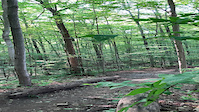
SaveLocated near Cambridge, Ontario, there are more than 25 km of off-road mountain biking trails to explore. In addition, to those trails, there are several walking trails.
It is a popular place for bikers, hikers, horseback riders, joggers, and dog walkers. In the winter, it also becomes a popular place for cross country skiing and ice fishing.
Easy Fatbike/MTB loops marked with Yellow Tape. Follow the single yellow tape to get around the property. Double yellow tape marks a longer route.
Primary Trail Type: Cross-Country
 google parking directions
 Access Info:
Wellington Road 32 (Just South of the 401 Bridge) Cambridge, ON
Files
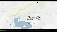
- hand-drawn-map.jpg (199 KB)
Activities Click to view
- Mountain Bike
43 trails
- Hike
43 trails
- Trail Running
42 trails
Region Details
- 10
- 1
- 18
- 6
- 7
- 1
Region Status
Open as of May 14, 2024Stats
- Avg Trail Rating
- Trails (view details)
- 43
- Trails Mountain Bike
- 43
- Trails Hike
- 43
- Trails Trail Running
- 42
- Trails Snowshoe
- 42
- Total Distance
- 19 miles
- Total Descent
- 1,191 ft
- Total Vertical
- 108 ft
- Highest Trailhead
- 1,112 ft
- Reports
- 2,180
- Photos
- 206
- Ridden Counter
- 31,570
Popular Puslinch Tract / Twin Ponds Trails
Mountain Bike Routes
| title | rating | distance |
|---|---|---|
| Twin Ponds Full Loop (Old 2018) | 11 miles | |
| Puslinch Full Loop 2019 | 11 miles | |
| Easy Puslinch Loop | 9 miles | |
| Puslinch Light 13km | 8 miles | |
| Twin Ponds no Hardwoods | 7 miles | |
| 16 mile Puslinch Tract / Twin Ponds Cross-country Ride | popular ridelog | 16 miles |
| 21 mile Puslinch Tract / Twin Ponds Ride | popular ridelog | 21 miles |
| 18 mile Puslinch Tract / Twin Ponds Cyclo-cross Ride | popular ridelog | 18 miles |
| 12 mile Puslinch Tract / Twin Ponds Ride | popular ridelog | 12 miles |
| 9 mile Puslinch Tract / Twin Ponds Ride | popular ridelog | 9 miles |
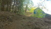
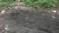
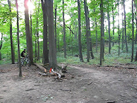
Photos of Puslinch Tract / Twin Ponds Mountain Bike
trail: Screaming Goat
8 |
May 4, 2024 @ 3:24pm
May 4, 2024
trail: No Spandex Allowed
30 |
Mar 31, 2024 @ 1:13pm
Mar 31, 2024
trail: No Spandex Allowed
31 |
Mar 31, 2024 @ 1:13pm
Mar 31, 2024
trail: Shag Me
43 |
Feb 11, 2024 @ 2:05pm
Feb 11, 2024
trail: Shag Me
22 |
Feb 11, 2024 @ 2:05pm
Feb 11, 2024
trail: Hobo Camp
45 |
Jul 30, 2023 @ 6:19pm
Jul 30, 2023
trail: Hotwheels
22 |
Jul 9, 2023 @ 1:31pm
Jul 9, 2023
trail: Shag Me
99 |
Nov 16, 2022 @ 12:21pm
Nov 16, 2022Videos of Puslinch Tract / Twin Ponds Mountain Bike
trail: Hotwheels
|
Jul 2, 2021
trail: 401
3:20 |
67 |
Oct 24, 2018
trail: Hotwheels
0:03 |
342 |
Oct 20, 2018
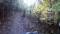
trail: Riser Bar
6:41 |
213 |
Oct 9, 2018

trail: Neil's Hill
4:20 |
270 |
Oct 9, 2018
trail: Neil's Hill
0:22 |
1136 |
Oct 28, 2014
trail: Air BnB
0:19 |
232 |
May 22, 2013
trail: Neil's Hill
0:07 |
652 |
Oct 15, 2011
Recent Trail Reports
| status | trail | date | condition | info | user |
|---|---|---|---|---|---|
| Hobo Camp | May 14, 2024 @ 11:15am May 14, 2024 | Variable | AppleNick | ||
| Air BnB | May 14, 2024 @ 11:15am May 14, 2024 | Ideal | AppleNick | ||
| Rocky Road | May 14, 2024 @ 11:15am May 14, 2024 | Ideal | AppleNick | ||
| Screaming Goat | May 14, 2024 @ 11:15am May 14, 2024 | Ideal | AppleNick | ||
| Parabola | May 14, 2024 @ 11:15am May 14, 2024 | Ideal | AppleNick | ||
| Commuter | May 14, 2024 @ 11:15am May 14, 2024 | Ideal | AppleNick | ||
| The Exit Run | May 2, 2024 @ 10:31am May 2, 2024 | Ideal | Joel123456 KWTA | ||
| Flow | May 2, 2024 @ 10:31am May 2, 2024 | Ideal | Joel123456 KWTA | ||
| Shag Me | May 2, 2024 @ 10:31am May 2, 2024 | Variable | Joel123456 KWTA | ||
| The Pine Loop | May 2, 2024 @ 10:31am May 2, 2024 | Variable | Joel123456 KWTA |
Activity Feed
| username | action | type | title | date |
|---|---|---|---|---|
| AppleNick | vote | trail | activity #52658850 and 5 more | May 15, 2024 @ 5:46pm 2 days |
| Rider2009 | wishlist | trail | activity #52649389 and 3 more | May 15, 2024 @ 1:54pm 2 days |
| Rider2009 | ridden | trail | activity #52647832 | May 15, 2024 @ 1:17pm 2 days |
| AppleNick | add | report | activity #52618360 and 5 more | May 14, 2024 @ 8:10pm May 14, 2024 |
| aidanobbema | wishlist | trail | activity #52392238 | May 10, 2024 @ 7:13pm May 10, 2024 |
Recent Comments
| username | type | title | comment | date |
|---|---|---|---|---|
| trail | “ | Apr 6, 2024 @ 4:12pm Apr 6, 2024 | ||
| trail | . | Apr 6, 2024 @ 4:10pm Apr 6, 2024 | ||
| trail | This trail is super fun. Big thanks to the... | May 28, 2023 @ 9:54am May 28, 2023 | ||
| trail | Sweet Trail. Shoutout to the people that... | May 28, 2023 @ 9:52am May 28, 2023 | ||
| report | hh | Apr 2, 2023 @ 9:06am Apr 2, 2023 |
Nearby Areas
| name | distance | ||||
|---|---|---|---|---|---|
| Little Tract | 1.1 km | ||||
| Shade's Mills | 2 | 3.8 km | |||
| Hanlon Creek | 13 | 10 | 5.5 km | ||
| Hyde Tract | 14 | 3 | 8.5 km | ||
| Chicopee Ski Hill | 2 | 5 | 2 | 8.6 km |
Local Badges
-

Completionist22 awarded
Activity Type Stats
| activitytype | trails | distance | descent | descent distance | total vertical | rating | global rank | state rank | photos | reports | routes | ridelogs |
|---|---|---|---|---|---|---|---|---|---|---|---|---|
| Mountain Bike | 43 | 19 miles | 1,191 ft | 6 miles | 108 ft | #139 | #10 | 108 | 2,180 | 5 | 16,274 | |
| Hike | 43 | 19 miles | 1,191 ft | 6 miles | 108 ft | #90 | #9 | 98 | 2,180 | 108 | ||
| Trail Running | 42 | 19 miles | 1,168 ft | 6 miles | 108 ft | #89 | #9 | 2,180 | 59 | |||
| Snowshoe | 42 | 19 miles | 1,191 ft | 6 miles | 108 ft | 13 | 4 |
- By brenthillier
 NSMBA TRAILFORKS & contributors
 - Admins: tschinkel
- #3299 - 60,941 views
- puslinch tract / twin ponds activity log | embed map of Puslinch Tract / Twin Ponds mountain bike trails | puslinch tract / twin ponds mountain biking points of interest
Downloading of trail gps tracks in kml & gpx formats is enabled for Puslinch Tract / Twin Ponds.
You must login to download files.