close
-
Layers w
- Weather Layers
- Pro
- Pro
- Pro
- Pro
- Pro
- Pro
- More Layers
- Pro
- Pro
- Pro
- Pro
-
Upgrade to

3D
Trail Conditions
- Unknown
- Snow Groomed
- Snow Packed
- Snow Covered
- Snow Cover Partial
- Freeze/thaw Cycle
- Icy
- Prevalent Mud
- Wet
- Variable
- Ideal
- Dry
- Very Dry
Trail Flow (Ridden Direction)
Trailforks scans users activity logs to determine the most popular direction each trail is ridden. A good flowing trail network will have most trails flowing in a single direction according to their intension.
The colour categories are based on what percentage of users are riding a trail in its intended direction.
The colour categories are based on what percentage of users are riding a trail in its intended direction.
- > 96%
- > 90%
- > 80%
- > 70%
- > 50%
- < 50%
- bi-directional trail
- no data
Trail Last Ridden
Trailforks scans activity logs to determine the last time a trail was ridden.
- < 2 days
- < 1 week
- < 2 weeks
- < 1 month
- < 6 months
- > 6 months
Trail Ridden Direction
The intended direction a trail should be ridden.
- Downhill Only
- Downhill Primary
- Both Directions
- Uphill Primary
- Uphill Only
- One Direction
Contribute Details
Colors indicate trail is missing specified detail.
- Description
- Photos
- Description & Photos
- Videos
Trail Popularity ?
Trailforks scans activity logs to determine which trails are ridden the most in the last 9 months.
Trails are compared with nearby trails in the same city region with a possible 25 colour shades.
Think of this as a heatmap, more activities = more kinetic energy = warmer colors.
- most popular
- popular
- less popular
- not popular
ATV/ORV/OHV Filter
Max Vehicle Width
inches
US Cell Coverage
Legend

Radar Time
Activity Recordings
Trailforks uses anonymized public activity data.
?
Activity Recordings
Trailforks uses anonymized public activity data.
?
Personal Heatmap
▶
Activity Types
all
/
none
▶
Options
2
Date range
month
–
Winter Trails
Warning
A routing network for winter maps does not exist. Selecting trails using the winter trails layer has been disabled.
Missing Trails
Most Popular
Least Popular
Trails are colored based on popularity. The more popular a trail is, the more red. Less popular trails trend towards green.
Jump Magnitude Heatmap
Heatmap of where users jump on trails. Zoom in to see individual jumps, click circles to view jump details.
BC Backroad Status
![map legend]()
Service Road Atlas is a free to use, community-driven service for viewing and creating reports on the numerous back-country service roads around B.C. and Alberta.

Slope Aspect
Direction the slope faces
Trails Deemphasized
Trails are shown in grey.
Only show trails with no bike usage.
Suggested Layers
Based on selected activity type
Save the current map location and zoom level as your default home location whenever this page is loaded.
Save
No description for Rosebery has been added yet!
Login or register to submit one.
 google parking directions
Primary Trail Type: Cross-Country
Shuttleable: YES
google parking directions Activities Click to view
- Mountain Bike
19 trails
- E-Bike
6 trails
- Hike
18 trails
- Trail Running
18 trails
Region Details
- 3
- 3
- 7
- 1
Region Status
Open as of Jul 11, 2026Stats
- Avg Trail Rating
- Trails (view details)
- 16
- Trails Mountain Bike
- 19
- Trails E-Bike
- 6
- Trails Hike
- 18
- Trails Trail Running
- 18
- Total Distance
- 26 miles
- Total Descent
- 8,324 ft
- Total Vertical
- 3,455 ft
- Highest Trailhead
- 5,320 ft
- Reports
- 214
- Photos
- 107
- Completed Counter
- 4,184
Popular Rosebery Mountain Biking Trails
• 100 ★ 4.2 • 3 miles • 143 ft • 743 •
Somewhat flowy hand-made trail mostly through large treed interior forest. Some steeper bits, some avoidable stunts. For the uphill biker, follow the newly built that climbs to the Butter trailhead.
• 100 ★ 4.2 • 2 miles • 92 ft • 726 •
Hand built single track flow trail. Fun and beautiful for all abilities with great views to Valhalla Provincial Park. Taking some abuse as it becomes more popular. You can shuttle it or bike up the logging road for a good 2 to 3 hour...
• 75 ★ 3.9 • 2 miles • 69 ft • 455 •
Purpose built adaptive MTB trail for paraplegic riders. Used by able riders too.
• 85 ★ 2.0 • 1,217 ft • 2 ft • 250 •
Popular green difficulty singletrack. This mountain bike primary trail can be used downhill primary and has a easy overall physical rating. On average it takes 1 minutes to complete this trail.
• 60 ★ 3.7 • 2 miles • 482 ft • 206 •
Extends riding to the north of the through alder tunnels and more mature forest, with a great lookout over Hills.
• 85 ★ 4.0 • 4 miles • 240 ft • 205 •
is newly completed in October 2023. It is both a challenging climbing trail to reach the Butter trailhead away from the FSR and a downhill built to inclusive-adaptive trail standards. It is a fun and flowy machine built trail with...
• 80 ★ 4.0 • 4,537 ft • 94 ft • 128 •
This trail follows a decommissioned logging road out to the viewpoint pavilion and . It has gentle grade fluctuations, no features and amazing views. There are a couple of optional climbs and descents on the uphill side but the main...
• 80 ★ 0.0 • 1,119 ft • 3 ft • 59 •
Short, fun inclusive-adaptive trail that links the Butter Trailhead and the .
Rosebery Mountain Bike Routes
29 miles • 4,583 ft • 7 •
14 miles • 3,061 ft • 4 • Race •
Stage 5 half pint of Singletrack 6 in 2024
• 15 miles • 3,935 ft • 7 •
• 14 miles • 3,277 ft • 7 •
• 3 miles • 529 ft • 2 •
• 8 miles • 575 ft • 5 •
Photos of Rosebery Mountain Bike
Videos of Rosebery Mountain Bike
trail: Spine Trail
4:56 |
1120 |
Jul 14, 2017

trail: Spine Trail
12:33 |
252 |
Nov 10, 2021 , New Denver
youtuber
![Upper Butter - New Denver, BC]()

trail: Butter (upper)
9:05 |
1145 |
May 15, 2020 , New Denver
youtuber
![Lower Butter - New Denver, BC]()
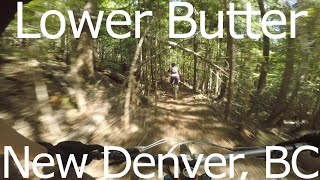
trail: Butter (lower)
10:59 |
1039 |
May 15, 2020 , New Denver
youtuber
![Spine - New Denver, BC]()
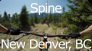
trail: Spine Trail
9:00 |
850 |
May 3, 2020 , New Denver
Recent Trail Reports
| status | trail | date | condition | info | user |
|---|---|---|---|---|---|
| Rolling Thunder | Jul 11, 2026 @ 12:36pm (America/Creston) Jul 11, 2026 | Ideal | smikep | ||
| Butter (lower) | Jun 11, 2026 @ 10:01am (America/Creston) Jun 11, 2026 | Unknown | Bridgesglenn | ||
| Spine Trail | May 17, 2026 @ 3:38pm (America/Creston) May 17, 2026 | Dry | kmsports NABS | ||
| Spine Access | May 17, 2026 @ 3:38pm (America/Creston) May 17, 2026 | Ideal | kmsports NABS | ||
| Butter (upper) | Aug 10, 2025 @ 11:42am Aug 10, 2025 | Ideal | darklord | ||
| Sneaky Weasel | Aug 10, 2025 @ 11:42am Aug 10, 2025 | Ideal | darklord | ||
| Butter Me Up | Aug 10, 2025 @ 11:42am Aug 10, 2025 | Ideal | darklord | ||
| Logging Road Connector | Jun 15, 2025 @ 9:31am Jun 15, 2025 | Ideal | Bridgesglenn | ||
| BMU Upper Connector | Jun 15, 2025 @ 9:31am Jun 15, 2025 | Ideal | Bridgesglenn | ||
| Telegraph Trail | May 7, 2025 @ 10:25pm May 7, 2025 | Ideal | priscillapink |
Activity Feed
| username | action | type | title | date |
|---|---|---|---|---|
| syvc | ridden | trail | activity #99647483 and 2 more | Jul 20, 2026 @ 6:18pm 2 days |
| smikep | add | report | activity #98978479 | Jul 11, 2026 @ 4:29pm Jul 11, 2026 |
| karenmcnab | wishlist | region | activity #98728791 | Jul 8, 2026 @ 11:49am Jul 8, 2026 |
| katiesmolik | ridden | trail | activity #98108666 and 3 more | Jun 29, 2026 @ 10:08pm Jun 29, 2026 |
| tomstochmal | wishlist | trail | activity #98104925 | Jun 29, 2026 @ 7:58pm Jun 29, 2026 |
Recent Comments
| username | type | title | comment | date |
|---|---|---|---|---|
| trail | Great ride! A couple newer berms in the middle... | Jul 13, 2025 @ 8:30pm Jul 13, 2025 | ||
| trail | Should be renamed to Roots2. Pretty knarley.... | Jun 27, 2025 @ 7:59pm Jun 27, 2025 | ||
| report | Trail Builders!!! I'm sure there are more... | Aug 18, 2024 @ 11:06am Aug 18, 2024 | ||
| report | New tree down between second and third cedar... | Jul 22, 2024 @ 3:59pm Jul 22, 2024 | ||
| trail | The Telegraph Trail is open for the season!... | May 2, 2023 @ 10:19pm May 2, 2023 |
Nearby Areas
| name | distance | ||||
|---|---|---|---|---|---|
| Dennis Creek Basin Recreation Site | 1 | 4.7 km | |||
| Idaho Peak | 6 | 4 | 2 | 7.5 km | |
| Shannon Lake Recreation Site | 1 | 7.9 km | |||
| Retallack | 3 | 10 | 1 | 11.6 km | |
| Box Lake | 1 | 3 | 3 | 18.1 km |
Activity Type Stats
| activitytype | trails | distance | descent | descent distance | total vertical | rating | global rank | state rank | photos | reports | routes | activity logs |
|---|---|---|---|---|---|---|---|---|---|---|---|---|
| Mountain Bike | 19 | 25 miles | 8,045 ft | 12 miles | 3,455 ft | #5,524 | #235 | 105 | 213 | 2 | 1,361 | |
| E-Bike | 6 | 4 miles | 2,067 ft | 3 miles | 1,827 ft | #7,284 | #277 | 2 | 147 | 124 | ||
| Hike | 18 | 23 miles | 6,617 ft | 11 miles | 3,455 ft | #7,055 | #283 | 195 | 100 | |||
| Trail Running | 18 | 23 miles | 6,617 ft | 11 miles | 3,455 ft | #6,430 | #237 | 195 | 14 |
Frequently Asked Questions About Rosebery
▼
What are the highest rated mountain biking trails in Rosebery?
The highest rated mountain biking trails in Rosebery are:
- Butter (upper) (4.2/5)
- Butter (lower) (4.1/5)
- Butter Me Up (4/5)
- BMU Upper Connector (4/5)
- Spine Trail (3.9/5)
▼
What is the best time of the year to ride in Rosebery?
Based on ride log data, the most popular months to ride in Rosebery are:
- July (48 activities)
- August (47 activities)
- June (34 activities)
▼
Where can I park to ride in Rosebery?
There are 3 parking locations listed in Rosebery. The most popular parking spots are: View all parking and trailhead locations on the map to plan your visit.
▼
What is the longest trail in Rosebery?
The longest trail in Rosebery is Butter Me Up at 6.8 km. View all trails sorted by distance.
Activities
- By barry-mclane
 & contributors
 - Admins: NSTS, KCTS
- #5765 - 11,657 views
- rosebery activity log | embed map of Rosebery mountain bike trails | rosebery mountain biking points of interest
Downloading of trail gps tracks in kml & gpx formats is enabled for Rosebery.
You must login to download files.