
close
3D
Trail Conditions
- Unknown
- Snow Groomed
- Snow Packed
- Snow Covered
- Snow Cover Partial
- Freeze/thaw Cycle
- Icy
- Prevalent Mud
- Wet
- Variable
- Ideal
- Dry
- Very Dry
Trail Flow (Ridden Direction)
Trailforks scans users activity logs to determine the most popular direction each trail is ridden. A good flowing trail network will have most trails flowing in a single direction according to their intension.
The colour categories are based on what percentage of users are riding a trail in its intended direction.
The colour categories are based on what percentage of users are riding a trail in its intended direction.
- > 96%
- > 90%
- > 80%
- > 70%
- > 50%
- < 50%
- bi-directional trail
- no data
Trail Last Used
Trailforks scans activity logs to determine the last time a trail was ridden.
- < 2 days
- < 1 week
- < 2 weeks
- < 1 month
- < 6 months
- > 6 months
Trail Ridden Direction
The intended direction a trail should be ridden.
- Downhill Only
- Downhill Primary
- Both Directions
- Uphill Primary
- Uphill Only
- One Direction
Contribute Details
Colors indicate trail is missing specified detail.
- Description
- Photos
- Description & Photos
- Videos
Trail Popularity ?
Trailforks scans activity logs to determine which trails are ridden the most in the last 9 months.
Trails are compared with nearby trails in the same city region with a possible 25 colour shades.
Think of this as a heatmap, more activities = more kinetic energy = warmer colors.
- most popular
- popular
- less popular
- not popular
ATV/ORV/OHV Filter
Max Vehicle Width
inches
US Cell Coverage
Legend

Radar Time
Activity Recordings
Trailforks uses anonymized public activity data.
?
Activity Recordings
Trailforks uses anonymized public activity data.
?
Winter Trails
Warning
A routing network for winter maps does not exist. Selecting trails using the winter trails layer has been disabled.
Missing Trails
Most Popular
Least Popular
Trails are colored based on popularity. The more popular a trail is, the more red. Less popular trails trend towards green.
Jump Magnitude Heatmap
Heatmap of where users jump on trails. Zoom in to see individual jumps, click circles to view jump details.
BC Backroad Status
![map legend]()
Service Road Atlas is a free to use, community-driven service for viewing and creating reports on the numerous back-country service roads around B.C. and Alberta.

Slope Aspect
Direction the slope faces
Trails Deemphasized
Trails are shown in grey.
Only show trails with no bike usage.
Suggested Layers
Based on selected activity type
Save the current map location and zoom level as your default home location whenever this page is loaded.
SaveOmrådet rymmer många stigar där ryttare och hästar förkommer. Använd din röst för att uppmärksamma både häst och ryttare att du kommer på cykeln. Tänk på att ringklockan och skrikiga bromsar kan skrämma hästen.
Primary Trail Type: Cross-Country
Land Status: Regional Recreation Area
This region uses the Uk/Euro style trail grading system.
Trail info last updated
Activities Click to view
- Mountain Bike
64 trails
- Horse
13 trails
- Hike
58 trails
- Trail Running
62 trails
Region Details
- 7
- 16
- 30
- 10
- 1
Region Status
Caution as of Sep 22, 2026Stats
- Avg Trail Rating
- Trails (view details)
- 69
- Trails Mountain Bike
- 64
- Trails Gravel Bike
- 15
- Trails Horse
- 13
- Trails Hike
- 58
- Trails Trail Running
- 62
- Total Distance
- 21 miles
- Total Descent Distance
- 11 miles
- Total Descent
- 3,249 ft
- Total Vertical
- 318 ft
- Highest Trailhead
- 365 ft
- Reports
- 35
- Photos
- 21
- Completed Counter
- 655
Popular Säve Mountain Biking Trails
• 45 ★ 0.0 • 3,015 ft • 21 ft • 13 •
Moderately popular green difficulty singletrack. This multi-use trail can be used both directions and has a moderate overall physical rating with a 21 ft blue climb. Trail visibility is always easy to follow. On average it takes 8 minutes to complete this trail.
• 40 ★ 0.0 • 3,002 ft • 6 ft • 13 •
Moderately popular blue difficulty singletrack. This mountain bike primary trail can be used both directions and has a moderate overall physical rating with a 6 ft green climb. Trail visibility is always easy to follow. On average it takes 8 minutes to complete this trail.
• 30 ★ 0.0 • 548 ft • 0 ft • 12 •
En flowig skön bana med lagom stora hopp och drop som gör den riktigt trevlig. Den enda utav banorna som blir jobbig vid blöta dagar, gegga och halt.
• 5 ★ 4.5 • 505 ft • 0 ft • 12 •
Ingen nybörjarbana utan värm upp och öva på de mindre hoppen först. Ingen svår bana tekniskt. En bana som bygger upp fart och har flera hopp och drops i ganska stora modeller där flygturen blir långa,sköna och mjuka.
• 30 ★ 0.0 • 492 ft • 40 ft • 12 •
Accessstigen från ridspåret upp till höjden med startstigarna och kullen där banorna börjar. Stigen funkar utmärkt som nedfart/bana oxå, starta på kullen och ta första hoppet och fortsätt ner med roliga svängar och avsluta...
• 35 ★ 0.0 • 2,949 ft • 25 ft • 12 •
Less popular blue difficulty singletrack. This mountain bike primary trail can be used both directions and has a moderate overall physical rating with a 25 ft blue climb. Trail visibility is always easy to follow. On average it takes 11 minutes to complete this trail.
Säve Mountain Bike Routes
14 miles • 981 ft • 0 •
Beskrivning Elevation Gain: 235 m Elevation Loss: 236 m Min Elevation: 72 m Max Elevation: 142 m Fakta 1...
8 miles • 904 ft • 0 • Loop •
12 km fin fin trail genom olika terränger. Obs ha koll på ridvägarna, inga mtb är tillåtet där.
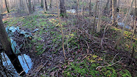
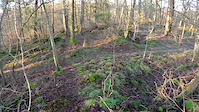
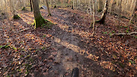
Photos of Säve Mountain Bike
Videos of Säve Mountain Bike
Recent Trail Reports
| status | trail | date | condition | info | user |
|---|---|---|---|---|---|
| Stockflight | Sep 22, 2026 @ 7:49pm (Europe/Stockholm) Sep 22, 2026 | Unknown | ArtiosSwe29 | ||
| Droppstigen | Aug 28, 2026 @ 1:55pm (Europe/Stockholm) Aug 28, 2026 | Very Dry | packbox | ||
| Nordslättsåsen | Nov 7, 2025 @ 10:15am (Europe/Stockholm) Nov 7, 2025 | Unknown | Trampe | ||
| Numera Dödsriket | Nov 7, 2025 @ 10:15am (Europe/Stockholm) Nov 7, 2025 | Unknown | Trampe | ||
| Sluta Slåss Mannen | Nov 7, 2025 @ 10:15am (Europe/Stockholm) Nov 7, 2025 | Unknown | Trampe | ||
| Tobbes Walk Of Shame | Nov 7, 2025 @ 10:15am (Europe/Stockholm) Nov 7, 2025 | Unknown | Trampe | ||
| Stenrännan | Nov 16, 2023 @ 5:46am Nov 16, 2023 | Dry | Trampe | ||
| Näckrosen Nordväst | Nov 16, 2023 @ 5:44am Nov 16, 2023 | Dry | Trampe | ||
| Brandenburg Uber Alles 1 | Nov 16, 2023 @ 5:43am Nov 16, 2023 | Dry | Trampe | ||
| Trampes Stig | Oct 30, 2023 @ 7:31am Oct 30, 2023 | Wet | Trampe |
Activity Feed
| username | action | type | title | date |
|---|---|---|---|---|
| Ez1xKO | wishlist | route | activity #106481426 | Oct 24, 2026 @ 5:18am 2 days |
| Haraldoking | ridden | trail | activity #105133607 | Oct 3, 2026 @ 11:51am Oct 3, 2026 |
| ArtiosSwe29 | add | report | activity #104364494 | Sep 22, 2026 @ 10:49am Sep 22, 2026 |
| packbox | add | report | activity #102506389 | Aug 28, 2026 @ 4:57am Aug 28, 2026 |
| ForsmanFredrik | comment | route | activity #101244997 | Aug 11, 2026 @ 9:29am Aug 11, 2026 |
Recent Comments
| username | type | title | comment | date |
|---|---|---|---|---|
| trail | Gör gärna en stigrapport (Trail Report)... | Oct 26, 2023 @ 10:41am Oct 26, 2023 | ||
| trail | Gör gärna en stigrapport (Trail Report)... | Oct 26, 2023 @ 10:40am Oct 26, 2023 | ||
| trail | Gör gärna en stigrapport (Trail Report)... | Oct 26, 2023 @ 10:40am Oct 26, 2023 | ||
| trail | 26 okt Fast och fint, inga problem. Mkt svamp. | Oct 26, 2023 @ 10:24am Oct 26, 2023 | ||
| trail | 26 okt Blött men farbart. Några djupa pölar... | Oct 26, 2023 @ 10:23am Oct 26, 2023 |
Nearby Areas
| name | distance | ||||
|---|---|---|---|---|---|
| Enekullen | 12 | 30 | 2 km | ||
| Rödbo | 4 | 8 | 2.6 km | ||
| Backa med omnejd | 20 | 13 | 4.2 km | ||
| Angered | 13 | 18 | 4.2 km | ||
| Guddehjälm | 7 | 6 | 4.7 km |
Local Badges
-

Completionist0 awarded




Activity Type Stats
| activitytype | trails | distance | descent | descent distance | total vertical | rating | global rank | state rank | photos | reports | routes | activity logs |
|---|---|---|---|---|---|---|---|---|---|---|---|---|
| Mountain Bike | 64 | 19 miles | 3,064 ft | 10 miles | 318 ft | #6,516 | #229 | 21 | 35 | 3 | 1,432 | |
| Gravel Bike | 15 | 5 miles | 420 ft | 2 miles | 276 ft | #8,094 | #389 | 3 | ||||
| Horse | 13 | 5 miles | 525 ft | 2 miles | 230 ft | #1,534 | #83 | 4 | ||||
| Hike | 58 | 17 miles | 2,598 ft | 9 miles | 312 ft | #7,264 | #334 | 30 | 40 | |||
| Trail Running | 62 | 19 miles | 2,795 ft | 10 miles | 312 ft | #6,009 | #303 | 32 | 44 |
Frequently Asked Questions
▼
What are the highest rated mountain biking trails in Säve?
The highest rated mountain biking trails in Säve are:
- Stockflight (4.1/5)
- Fartgupp (4.1/5)
- Psykologen (4/5)
- Trollbranten (3.8/5)
- Studsbollen (3.8/5)
▼
What is the best time of the year to ride in Säve?
Based on activity log data, the most popular months to ride in Säve are:
- August (12 activities)
- July (5 activities)
- May (5 activities)
▼
Where can I park to ride in Säve?
Check the Säve trail map for trailhead and parking information. Community members regularly update access and parking details for trails in the area.
▼
What is the longest trail in Säve?
The longest trail in Säve is Vitsippans Rike at 5,151 ft. View all trails sorted by distance.
▼
What are the best & highest rated hiking trails in Säve?
The best hiking trails in Säve are: View all hiking trails sorted by popularity score.
▼
What are the best & highest rated trail running trails in Säve?
The best trail running trails in Säve are: View all trail running trails sorted by popularity score.
▼
How many trails are in Säve?
Säve has a total of 69 trails. Of those, 64 are designated for mountain biking. Browse top mountain biking trails in Säve to find detailed information including difficulty ratings, distances, and trail conditions.
▼
Which trail has the most elevation gain in Säve?
The trail with the most elevation gain in Säve is Ytterligheten with 208 ft of elevation gain. View all trails sorted by elevation gain.
▼
Which trail has the most elevation descent in Säve?
The trail with the most elevation descent in Säve is Vägen Ner with 232 ft of elevation descent. View all trails sorted by elevation descent.
▼
What activities are most popular in Säve?
Säve supports the following activities: Mountain Biking, Horseback, Hiking, Trail Running.
▼
What are the steepest mountain biking trails in Säve?
The steepest mountain biking trail in Säve is Stigen Upp Till Höjden with an average grade of 8.1%. View all trails sorted by grade.
▼
Are the trails open in Säve?
The overall region status for Säve is Minor Issue / Yellow. Out of 24 trails:
- Clear / Green: 15
- Minor Issue / Yellow: 3
- Significant Issue / Amber: 5
- Closed: 1
▼
What are the most popular mountain biking routes in Säve?
The most popular mountain biking routes in Säve are: View all mountain biking routes in Säve.
▼
What type of bike is most common in Säve?
Based on activity log data, the most common bike types used in Säve are:
- AM (5 activities)
▼
What are the most popular Strava Segments in Säve?
The most popular Strava segments in Säve are:
- Lättrullat Till Skålvisered (287 athletes)
- Happy ending (99 athletes)
- Brandenburg Blaupunkt DH (42 athletes)
▼
What trails are closed in Säve?
There are currently 1 closed trails in Säve. The breakdown of all trail statuses is:
- Clear / Green: 15
- Minor Issue / Yellow: 3
- Significant Issue / Amber: 5
- Closed: 1
▼
What are the most popular mountain biking trails in Säve?
The most popular mountain biking trails in Säve are: View all mountain biking trails sorted by popularity.
▼
What are the best beginner ride trails in Säve?
The best beginner mountain biking trails in Säve are:
- Näckrosen - Fjället (0/5)
- Promenaden (0/5)
- Grankottsflow (0/5)
- By Mellrob & contributors
- Admins: GSC, TyroneSlothrop, edvin-m, JBohden, nivis, Marleey, wikisara, JBohden
- #19895 - 3,149 views
- säve activity log | embed map of Säve mountain bike trails |
Downloading of trail gps tracks in kml & gpx formats is enabled for Säve.
You must login to download files.
