
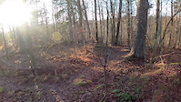
more stats
548 ft
Distance
-54 ft
Descent
00:04:53
Avg time
-56 ft
Altitude change
115 ft
Altitude min
171 ft
Altitude max
171 ft
Altitude start
115 ft
Altitude end
-10.2%
Grade
-15.7%
Grade max
-1.1%
Grade min
512 ft
Distance down
36 ft
Distance flat
00:04:53
Avg time

Pollyflow Details

  • Activities
    • Mountain Bike
    • Hike
    • Trail Running
  • Riding Area
    Säve
    Göteborg
  • Difficulty Rating
  • Local Popularity
    30 in Mountain Biking [+]
    • 5 in Trail Running
    • 5 in Hiking
  • Global Ranking
    #331815 in Mountain Biking [+]
    • #306277 in Trail Running
    • #367456 in Hiking
  • National Ranking
    #24,333 in Mountain Biking · Sweden [+]
    • #25,648 in Trail Running
    • #25,787 in Hiking
  • Hiking SAC Scale
    T1 Hiking
  • Trail Type
    Singletrack
  • Bike Type
    DH, AM
  • Direction
    Downhill Only
  • Physical Rating
    Moderate
  • Trail Visibility
    Always easy to follow
  • Dogs Allowed
    Yes
  • TTFs on Trail
    Berm, Drop, Jump, Gap Jump

En flowig skön bana med lagom stora hopp och drop som gör den riktigt trevlig. Den enda utav banorna som blir jobbig vid blöta dagar, gegga och halt.

Access Info

Startar bäst ifrån startkullen ovan T-korsningen så man får gratis fart direkt.

Disclaimer

Hästar kan använda området som accessväg ner till ridvägen. Även vi använder ridvägen en liten bit för att komma tillbaka till banorna.

Tags
BermsDropsJumps

Recent Activity on Trail

Past Week
  • 0 rides
  •  
6 Months
  • 1 rides
  • 4 miles avg distance
All
  • 6 rides
  • Last: Sep 22, 2026
c1c2c3c4
January
February
March
April
May
June
July
August
September
October
November
December
update trails status or condition

Pollyflow Trail Reports

statusdatedescription
Apr 20, 2021 @ 11:19pm
Apr 20, 2021
Apr 27, 2020 @ 11:47pm
Apr 27, 2020
Lite småblöt efter sista hoppet, men inga problem.
more »
Status:
on Apr 20, 2021
Ideal
no votes yet
Your vote: 0

view (267)
close
      Directions to pollyflow trailhead (57.801850, 11.988900)

      Photos

      No photos have been added for Pollyflow yet, add a photo.

      Videos

      1 more »
      Pollyflow demo
      mtb
      0:37 | 99 | Jan 22, 2020 , Göteborg

      Reviews / Comments

      No reviews yet, be the first to write a review or ask a question.
      Use trail reports to comment on trail conditions.


      We hope you've been enjoying Trailforks!

      Create a FREE account to view all trail reviews and much more.

      • By Stucke70TF Pro & contributors
      • #245254 - 553 views

      Frequently Asked Questions

      ▼ Where is Pollyflow located?
      Pollyflow is located in Säve, Göteborg, Sweden. It is part of the Säve trail network. The trailhead is located at coordinates 57.80185, 11.9889.
      ▼ How hard is Pollyflow?
      Pollyflow is rated as Blue difficulty. The physical rating is Moderate. The average grade is 10.2%.
      ▼ What is the elevation gain for Pollyflow?
      The trail has 54 ft of elevation descent. The elevation ranges from 115 ft to 171 ft.
      ▼ Is Pollyflow a point to point trail?
      Yes, Pollyflow is a point to point trail. The direction is Downhill Only. The trail type is singletrack.
      ▼ How long is Pollyflow?
      Pollyflow is 548 ft long. The trail type is singletrack.
      ▼ Are dogs allowed on Pollyflow?
      Yes, dogs are allowed on Pollyflow. Please keep dogs on a leash where required and clean up after them.
      ▼ How do I access Pollyflow? Where is the closest parking trailhead?
      The closest parking and trailhead locations to Pollyflow are: View all parking locations in the area.
      ▼ How long does it take to ride Pollyflow?
      Based on recorded activities, it takes an average of 5 minutes to ride Pollyflow. The trail is 548 ft long. Actual times will vary based on fitness level, conditions, and pace. View recent activity logs for more details.
      ▼ How busy is Pollyflow?
      Pollyflow is a less popular trail with lighter traffic. There have been 41 recorded activities on this trail. The trail has received 267 check-ins. View recent activity on this trail.

      Hit the Trail

      Open in App

      Get this trail on your phone instantly.

      open trail in app

      Download Trail

      Save to wishlist, Garmin & download.
      save the trail

      Find Related Routes

      Find routes and users activities that include this trail.
      find routes for this trail

      You must enter a description before submitting.

